from 94 reviews
No Limit
Daily Tour
Unlimited
English, Hindi, Pahari


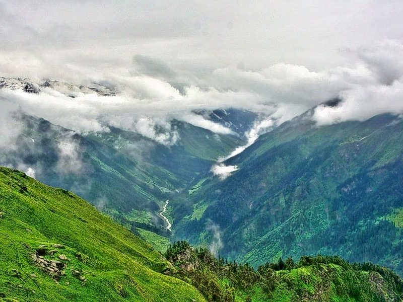
Uttarakhand is home to some of the beautiful and enchanting natural lakes in India attracts a large number of tourists. Crystal clear water lakes both small and big are dotted throughout Uttarakhand with lavish surroundings. Uttarakhand concludes a priceless treasure of lakes glittering in eyes of the tourists.
Some of the lakes are so beautiful added by surrounding natural charm that they should be captured as a photographic memory ever. These sapphire-hued lakes perfectly complement the scenic landscape of verdant hills, floral meadows, and snow-clad Himalayan peaks. At higher elevations, glacial lakes are a common sight for trekkers and mountaineers.
Here are top 19 of the most enchanting lakes of Uttarakhand – while a few of them daring treks fit for adventurers, other are relaxing getaways, perfect for a lazy weekend escape.
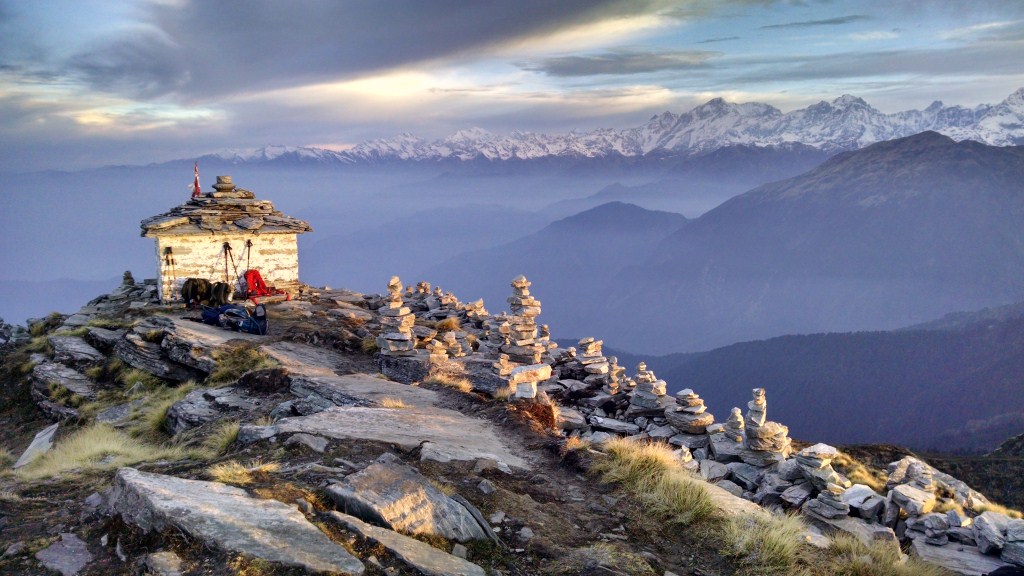
Roopkund Lake :
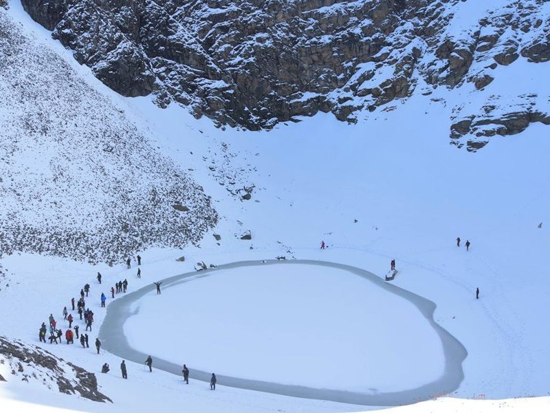
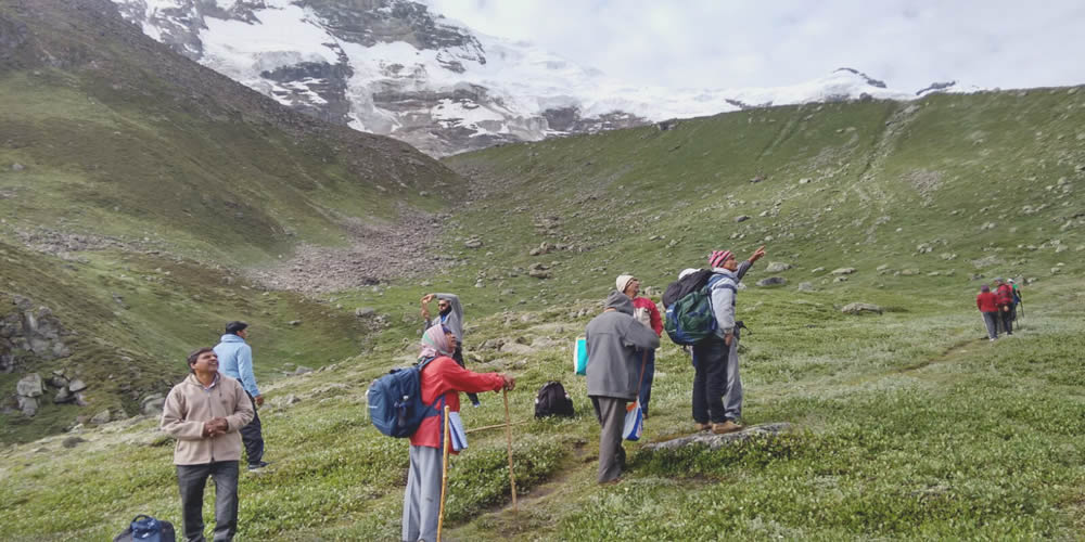
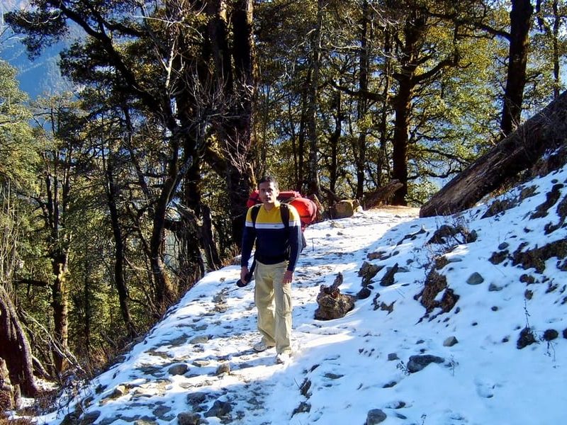
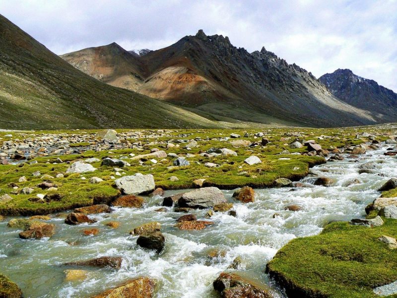
Roopkund (locally known as Mystery Lake or Skeleton Lake) is a high altitude glacial lake in the Uttarakhand state of India. It lies in the lap of Trishul massif. Located in the Himalayas, the area around the lake is uninhabited and is roughly at an altitude of 5,020 metres (16,470 ft), surrounded by rock-strewn glaciers and snow-clad mountains. Roopkund is a popular trekking destination.The size of the lake varies substantially, but it is seldom more than 40 metres in diameter (1000 to 1500 square metres in area), and is frozen in the winter.
With a depth of about 3 metres, Roopkund is widely known for the hundreds of ancient human skeletons found at the edge of the lake.[4] The human skeletal remains are visible at its bottom when the snow melts.[5] Initial investigations led some to believe they were the remains of a semi-legendary event when a single group was killed in a sudden and violent hailstorm in the 9th century,[6] but scientific research has subsequently shown that the remains belong to three distinct groups who died in two independent events.[7] Because of the human remains, the lake has been called Skeleton Lake in recent times
Roopkund is a picturesque tourist destination and one of the important places for trekking in Chamoli District, Himalayas, near the base of two Himalayan peaks: Trisul (7,120 m) and Nanda Ghunti (6,310 m).[19] The Lake is flanked by a rock face named Junargali to the North and a peak named Chandania Kot to the East. A religious festival is held at the alpine meadow of Bedni Bugyal every autumn with nearby villages participating. A larger celebration, the Nanda Devi Raj Jat, takes place once every twelve years at Roopkund, during which Goddess Nanda is worshipped.[19] The lake is covered with ice for most of the year, with the best time to trek being in autumn (mid-September to October)
For years it has enthralled travellers all across the globe to see the infamous skeleton lake with their naked eyes. Yes! You may be wondering why skeleton lake. It is believed that during the occurrence of a catastrophic event, ancients humans from 1000 years ago have perished there and ever since then the remains of the skeletons are still visible when the snow melts. There are plenty of articles on the internet about this lake and how it has been a fascination to the rest of the world. Quite the chills!
Roopkund lake also known as the mystery lake is situated in the Chamoli district of Uttarakhand in India. It is a glacial lake with an altitude of 5072 metres.
This location provides an outstanding panoramic view amidst the lap of mountains and paddocks. Over the years, Roopkund has evolved to become an excellent renowned trekking destination in Uttarakhand, attracting hundreds of visitors every year. This is undoubtedly a true natural delight that is worth every penny and time. The exquisite ginormous alpine meadows, the varieties in the terrains, picturesque skies, snow-clad mountains and a lot more will cleanse your mind and soul with its purgatorial effects. It’s true as they say, there is nothing comparable with the mighty Himalayan elegance.
In this article, we have briefly answered some of the most asked questions related to this trek thereby to make it an ultimate hassle-free experience for the trekkers.
What can you see in the Roopkund Trek?
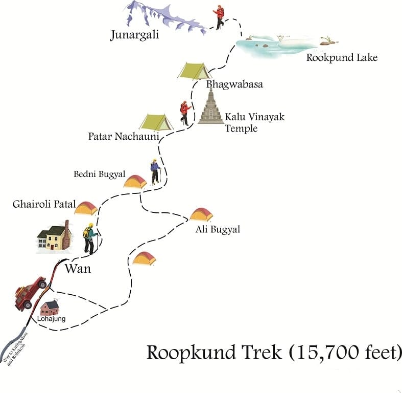
Note:Below descriptions are laid in the order of the trekking route towards the Roopkund lake.
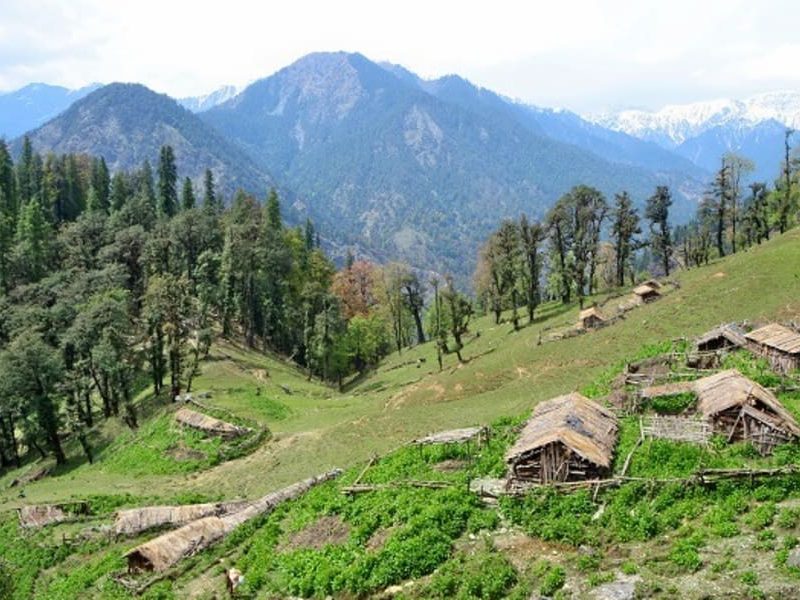
Lohajung (beginning point of the trek) – Lohajung offers a breathtaking view of the Didina Valley, you also get the sight of Mt. Nanda Ghunti which lies on the outer rim of Nanda Devi Sanctuary. Add to that the peaks of Trishul, Ronti, Chaukhamba and more.
Wan to Ghairoli Patal – Wan is a small village situated at an hour’s drive from Lohajung. Initially, it has become the stoppage point for many trekking groups. You can witness the locals engaged in their daily shenanigans like farming and animal grazing. The oak trees here are one of the densest in India.
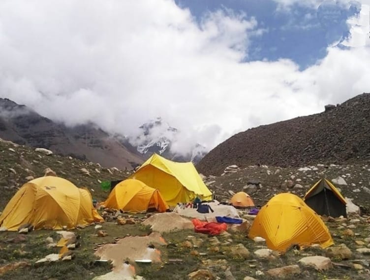
From wan, a 3-hour trek will lead you to Ghiaroli Patal which consists of dense commendable forests and water streams. It is also an ideal location for campsites.
Ali Bugyal to Bedni Bugyal – As you descend from the forests of Ghairoli Patal, the next trail opens up to a huge lush green meadow, this is Ali Bugyal. Miles and miles of beautiful pastureland is truly a bolt out of the blue.
From this point, it takes about an hour and a half to reach Bedni Bugyal. You will halt to camp at the Bedni campsite which has a spectacular bird’s eye view of the entire mountain range. These two twin grasslands are the largest high altitude meadows in India.
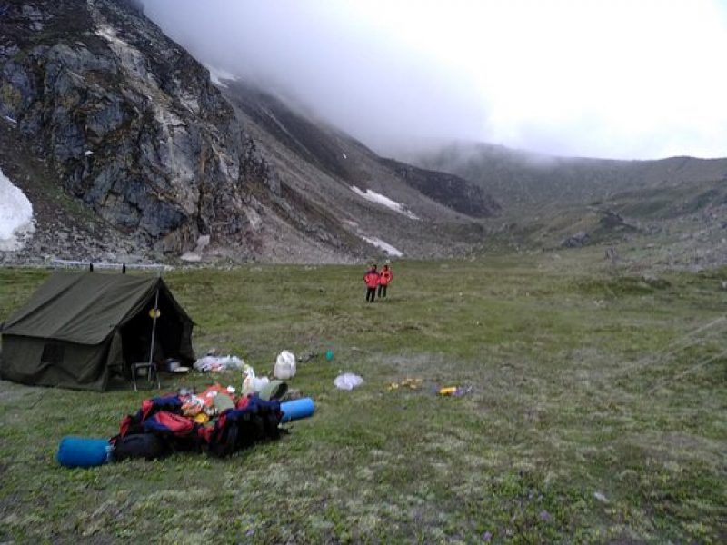
Patar Nachauni to Bhagwabhasa – Patar Nachauni also means ‘dancing girls’ in the local language. This trail makes a way out of the Bedni campsite. You will also notice the meadows of Ghora Lotani, with bewitching horses all around. The next path follows to a steep ascent to Kalu Vinayak and a gentle slope downwards to Bhagwabasa.
Roopkund – From Bhagwabhasa it takes 3 hours to trek to Roopkund. Bed of snow-covered mountains will leave you awestruck. These moments will certainly leave you wondering how giving mother nature is!
You finally get to see the infamous mystery lake of Roopkund. The bones of the skeletons add to the spooky vibe which makes it an unforgettable experience for a lifetime.
Best Time to visit Roopkund Lake Trek
Due to the climatic changes, Roopkund is accessible for only 3 to 4 months a year.
It depends totally on one’s personal preference, whether you’d want to trek in the thick white blanket of snow or clear vibrant fields.
Should you choose to trek in the snow, you must go there between mid-May to the end of June.
Regardlessly, the best time for trekking would be in autumn which is in mid-September until October, simply because of the magnificent crystal clear view and lesser crowds in the trails. You must also not forget that this is the time when the snow melts and you witness the skeletons near the lake. Nevertheless, it depends upon one’s comfort zone. You should also avoid trekking during the monsoons.
What is the temperature in Roopkund?
In the month of May to June, the temperature at your campsites during the day will be somewhere between 5°C to -1°C and 3° to -4° C at night time.
In September to October, the temperature at your campsites in the day will be somewhere around 6° to 1° C and 4° to -4°C at night respectively.
How to reach Roopkund?
You will usually be asked to assemble at Kathgodam or Lohajung which is considered as the starting point of the trek.
You can further take a train, bus or car from Dehradun to reach Kathgodam.
And as mentioned earlier, buses, shared taxis, and private cars are readily available if you are beginning the journey from Dehradun.
Note
If your base camp is at Lohajung you can take a bus, shared taxi or private car directly from Kathgodam. The distance is 218 km which should be covered in approximately 7 hours 30 minutes.
Is Roopkund trek for you?
The difficulty level of this trek is moderate. You may run short of breath very frequently given that there are quite a several steep climbs and zig-zag rocky paths.
If you aren’t used to walking for long hours without panting or gasping for breath or isn’t leading any active lifestyle at the present you may want to switch to other easier trek options.
But if Roopkund trek is the only thing you’d want, then you should start working out at least 3 to 4 months prior.
Every trekker needs to do the trekking on an average of 5 to 6 hours, prevailing weather conditions.
Nevertheless, this trek is safe and doable for a beginner, with a basic fit physique.
You should also not have any issues related to the heart and lungs. A healthy physical condition is an absolute necessity for a smooth trekking experience
Every trek to Roopkund takes about 7 to 8 days.
I hope that answers most of your questions regarding the Roopkund Trek.
Trekking is magical and if you are an avid mountain person we definitely suggest you to attempt this thrilling adventure at least once in your lifetime.
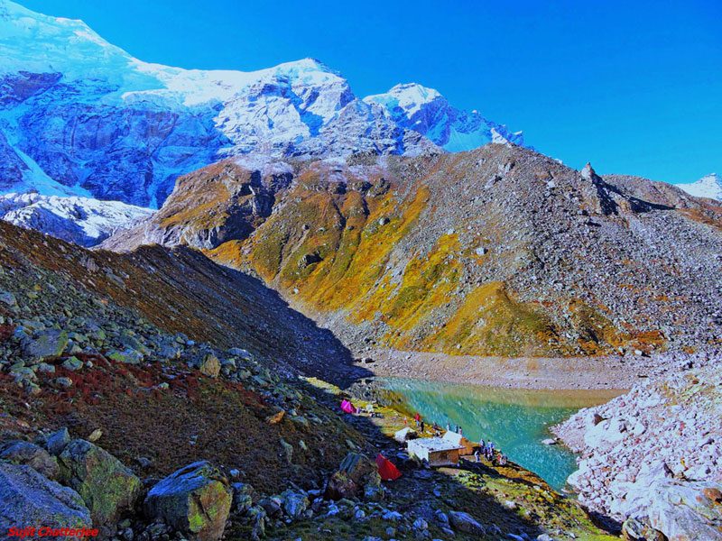
Kedar Tal Lake :

Kedartal (also known as Shiva’s lake) is a glacial lake situated at an altitude of 4,750 metres (15,580 ft) in the Garhwal region of the Himalayas in India. The lake is fed by the snowfall over Thalay Sagar (6,904 m), Meru (6,672 m), Bhrigupanth (6,772 m) and other surrounding peaks, and is the source of Kedar Ganga, which in Hindu mythology is considered to be Shiva’s contribution to Bhagirathi (a source-stream of the Ganges
Kedartal, at a distance of 17 km from Gangotri, is a popular trekking destination. Starting from Gangotri the route involves a steep rocky climb along the narrow Kedar Ganga gorge en route to Bhojkharak, 8 km away. From there it is 4 km to the next available camping site of Kedarkharak, and a further 5 km to Kedartal. The route passes through scenic Himalayan birch forests, but is made hazardous in places by falling rocks, high altitude and segments of steep ascent.
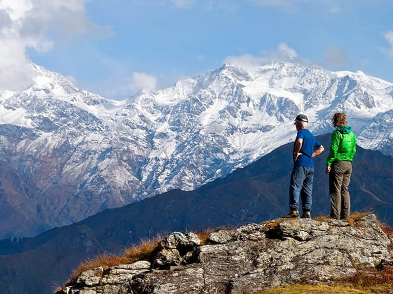
Kedartal is one of the most sought-after destinations in Uttarakhand. The beauteous lush green valleys, dream-inducing meadows, cascading waterfalls, wooded birch forests, gushing rivers, define the sublime beauty of this trek. Kedartal is a beautiful, crystal clear, emerald lake.Kedartal, High Altitude Lake of ShivaKedartal, a glacial lake, is a heavenly abode seated at an altitude of 4750 meters above sea level, in the Uttarkashi district (1158m) of Uttarakhand. It is nestled in the Garhwal region of the mighty Himalayas.Kedartal Lake is also termed as “Shiva’s Lake” and is considered to be one of the high altitude lakes of Uttarakhand.The Kedartal Lake, at an elevation of 15485 ft, is located at the foot of the Thalaysagar and Brigupanth Peaks. This scenic lake gets draped in the melting snow of Brigupanth Peak and Thalaysagar Peak, making it all the more gorgeous and alluring.According to Indian Hindu Mythology, the Kedartal Lake is Lord Shiva’s contribution to the Bhagirathi River. This Lake has originated from the melting away of the Kedar glacier.It then threads its way to the Kedar Ganga River which is also an important tributary of the river Bhagirathi.The trek to this angelic lake provides a sneak-peek view of the famous snow-clad peaks like Mount Manda, Bhagirathi, Mount Meru, Mount Jogin, Mount Gangotri, and Thalaysagar. This location is extremely diverse with ravishing landscapes, pious rivers, and panoramic views of the arduous mountain ranges.
Activities in and around Kedartal
Exploring the hidden gems of Kedartal Uttarakhand makes the trekking experience an unforgettable one. There are some interesting activities which can be done during your visit to Kedartal.
Kedartal Trek
The trek to Kedartal is a 17 KM long trek, starting from Gangotri with Kedar Ganga River flowing along the sides.
This stellar trek is a proud witness to the unparalleled rugged beauty of nature which is extremely refreshing and welcoming. This trek alone is privy to the magnificent beauty of the reflections of Thalaysagar Peak.
This trek takes you through the most surreal valley of Gods, thick birch forests, resplendent rhododendrons, a divine high-altitude river, and the flora and fauna invite you to delve deep into its otherworldly beauty and thereby garner a life-altering experience.
The trekking trail of Kedartal Uttarakhand is meant for seasoned trekkers and calls for experience and sheer patience. The idyllic beauty of this trek is beyond articulation as the zigzag paths lead one through aspiring meadows and alpine forests.
The sight from Kedartal Lake is absolutely awe-inspiring and rejuvenating. Through the Kedartal trek, one can view the mesmerizing beauty of the Gangotri glacier at its haunting best.
Do we need Permit for Kedartal trek?
During the Kedartal trek, you need to fetch a permit to start the journey. You have to be kitted with authorized permission from the official authority to undertake a smooth and hassle-free journey. You can get your Kedartal trek permit from Gangotri after you fill in all your details.
You can also fax the authority all your details before-hand and collect the Kedartal trek permit as soon as you reach Gangotri. You are also required to carry your ID proof always.
Why Kedartal trek is a difficult one?
The Kedartal trek difficulty level is rated as Strenuous(quite a difficult one) and is meant for experienced trekkers only. The Kedartal trek difficulty level is mainly due to its high altitude. It requires proper acclimatization and adaptation to the high height and unpredictable climatic changes so that you can take guard against the high altitude sickness in the mountains.
As you climb higher the oxygen level in the air becomes thinner making the trek more and more exhausting. It can also lead to hypoxia if the proper methods are not followed.
The snow patches along the trekking path to Kedartal also make navigation difficult. The trek trail is full of perils and unpredictability. The path is steep, filled with boulders and slippery rocky surfaces on all sides.
To reach the summit, the trekkers need to cross dense pine and birch forests, sliding zones, and high elevated pastures. The infamous spider walls on the trekking path to Kedartal Uttarakhand are quite challenging to traverse through.
These are the things that the trekkers must take guard against while on the trek. One must be sure-footed and alert while negotiating the steep drops and tricky terrains. However this journey, despite being somewhat dangerous is extremely thrilling and challenging for all the trekkers and adventure buffs. The par excellence view upon reaching the destination is absolutely worth the risk.
Best time to visit Kedartal
Kedartal in summer
Kedartal in May is very invigorating and thirst-quenching. You will find the lake frozen all around with the snowy mountains in the backdrop.
The fine rays of sunlight on the hard crust of the frozen lake glisten up the surrounding, providing an exceptionally shiny picture.
During this season, the presence of the leftover snow on the trek trails is a major attraction. The snow-topped mountains, brightening up in the summer sun is just heavenly to feast your eyes on.
Kedartal in summer (mid-May to end June) is the perfect time to undertake this trek. Kedartal in May remains quite warm during the day with a 20 degrees Celsius temperature. The evenings are quite chilly and the temperatures at night plummet down quite often. Winter clothes and woolens should be a constant companion.
Kedartal in autumn
After the monsoons, Kedartal becomes squeaky clean and exudes fresh earthly smell all around. Kedartal in September offers the trekkers unhindered and the clearest views of the majestic snow-filled mountain tops. The Kedartal Lake gets decked up in the shade of emerald green or blue depending on the weather conditions. This season blesses the trekkers with the perfect reflection of Mount Thalaysagar in its waters.
Another major attraction during the autumn season is the snow plumes. With heavy gusts of wind blowing sans cesse at the mountain tops, the snow gets blown away into the air forming the shape of the plume on hats.
During this season, the silver birch trees put on a golden yellow color with their trunks shining brightly in the autumn sun. In this season, you can also spot the mountain goats – Bharal. Kedartal in autumn (mid-September to end-October) is quite cooler than summers. During the day the temperatures hover between 13 degrees Celsius to 15 degrees Celsius and at night it falls drastically. From the end of October, the snowfall begins at the higher campsites of Kedartal.

DAY 1
Reach Gangotri from Dehradun
Drive distance: 242 km | Drive Duration: 8 hours
Transport will be arranged from Hotel Grand Legacy Dehradun at 6.00 am. Cab cost per vehicle will be Rs.8,000(5-6 seater). This is to be shared among trekkers and paid directly to the driver.
DAY 2
Acclimatization day around Gangotri (10,052 ft)
Take a short trek up one of the trails around Gangotri and then return to base.
DAY 3
Trek from Gangotri (10,052 ft) to Bhoj Kharak (13,219 ft)
Trek distance: 9 km | Trek Duration: 5-6 hours
Moderate-difficult. Steep ascent all the way. The terrain is rocky in many parts.
DAY 4
Bhoj Kharak (13,219 ft) to Kedar Kharak (14,239 ft)
Trek distance: 4.25 km | Trek Duration: 3 hours
Moderate-difficult. 1 km of steep ascent followed by 3 km of moderate ascents and descents.
DAY 5
Kedar Kharak (14,239 ft) to Kedartal (15,485 ft) and back to Kedar Kharak (14,239 ft)
Trek distance: 5.40 km | Trek Duration: 8 hours
Difficult. Continuously ascending trail over a rocky terrain.
DAY 6
Kedar Kharak (14,239 ft) to Gangotri (10,052 ft)
Trek distance: 8.50 km | Trek Duration: 8 hours
Moderate. Continuously descending trail over a rocky terrain
DAY 7
Gangotri to Dehradun
Drive distance: 242 km | Drive Duration: 8 hours
Cab cost per vehicle will be Rs.8,000 (5-6 seater). You will reach Dehradun between 6.00 PM and 7.00 PM.
IMPORTANT POINTS
Please note:
Twin sharing tents may not be available in May, June, July and August. This is because raw materials for making tents are sourced from different countries. But their export has been affected due to international unrest. This has led to a global shortage of tents. Having said that, you’ll still have comfortable space as these tents have been designed to accommodate three trekkers.
Kedartal Trek FAQs
1.What is the best time to do Kedartal trek?
The best time to plan the Kedartal Trek is in the months of May to mid-June and then September to October are considered to be the best months to go for this Kedartal trek.
2.Will the transfers from Delhi be inclusive in Kedartal trek cost?
Yes, the transfer from Delhi is inclusive in the Kedartal trek cost as the package is complete for the customer which includes the transfers, accommodation, meals and many other things which allow the customer to enjoy a hassle-free trip throughout the journey.
3.What type of clothes do I have to carry for Kedartal trek?
The clothes which you are required to carry along with you for this Kedartal trek are as follows:-
– Heavy woolen clothes can keep you warm throughout the trek.
– Woolen socks.
– Gloves.
– Hats or caps.
– Jackets and sweaters.
4.Will non-vegetarian meals be also available on Kedartal trek?
No, non-vegetarian meals are not available on the Kedartal trek. The trekkers will only be provided with the vegetarian meals throughout the trek.
5.What is the difficulty level of Kedartal trek?
The Kedartal Trek offers a moderate level of difficulty. Since you will be trekking towards one of the most scenic glacial lakes in the world, a lot of technique and proper physique will be required from you. Not only physical, but you need to be mentally fit too to complete this trek and cover a distance of around six days.
6.What will be the route of Kedartal trek?
The trek to Kedartal starts right from the Gangotri. You will be picked from Delhi – Dehradun – Uttarkashi – Gangotri which is a long drive of 258 KM from Dehradun which takes around 10 hours to reach the Gangotri. From Gangotri, the trek is 18 KM. In the first phase of the trek on the second day, you will start the trekking from Gangotri to Bhoj Kharak which is an 8 KM trek.
Then on the 3rd day, you will start the trek from Bhoj Kharak – Kedar Kharak which is a 5 KM trek. Then on the fourth day, you will trek from Kedar Kharak – Kedar Tal – Jogin ABC – Kedar Tal which is a 10 KM long trek. Then on the fifth day, you will be trekking to the last point of the trek from Kedar Tal – Gangotri trek which is 18 KM long trek.
7.Can kids do Kedartal trek?
No, Kids are not allowed to go for the Kedartal trek. Anyone below the age of 18 cannot avail this trek as it is considered to be moderately difficult.
8.What is the permit process for Kedartal trek Tapovan?
The process to get the permit for the Kedartal trek Tapovan is like it can be obtained from either the District Forest Officer in Uttarkashi or at the forest office in Gangotri. There is a daily limit of 150 permits per day and it is issued on a first come first-served basis.
9.What is the cellular network connectivity for this trek?
BSNL and Airtel have a good connectivity in this region. Network is available at Gangotri. No network can be expected beyond this point.
10.Is it a group tour?
Yes, it is a group tour which provides you all sorts of trekking adventures to your whole group .
Satopanth Lake :
Satopanth Tal is a lake in Uttarakhand, India, located in the midst of snow-capped peaks at an altitude of 4,600 metres (15,100 ft) above sea-level. The lake is considered to be of religious significance to the local people; residents of Mana village throw the ashes of the dead in the lake Many people believe that the Trimoortis, viz, Brahma, Vishnu and Mahesh, bathe in the lake in an auspicious day. Also some types of birds are found here, which pick up the pollutants of the lake and thus keep the lake clean. These birds are not found anywhere.[clarification needed] The local belief is that they are the Gandharvas disguised, who guard the lake against evils
An untouched Glacier Lake, Satopanth Tal is a triangle-shaped hidden treasure amidst the magnificent Garhwal region. The destination happens to be an impeccable religious site for the locals and is believed that the three supreme deities of Hinduism, Brahma, Vishnu, and Maheshwara meditated on the three different corners. Nestled at a huge elevation of 4600 meters above sea level, this crystal clear green water lake is beautifully bedecked amid the snow-shrouded peaks.
This renowned trekking trail in Uttarakhand holds immense significance in Hinduism and attracts thousands of travelers from all across the globe. A massive crowd of devotees treks to this lake on solar and lunar fortnights to take bath into it as this is considered very auspicious. This gorgeous site also offers a great opportunity to have glimpses of the Himalayas.
Along with enjoying the thrilling trekking experience, one can also witness the surreal beauty of the scenic vistas and the glory of the gorgeous Vasudhara Falls. In addition, the traveler also gets an opportunity to capture the awe-inspiring views of Himalayan gigantic such as Chaukhamba, Neelkanth, and Swargarohini.
Note- Be informed that you are not going to find any permanent establishments for an overnight halt on the Satopanth Tal Trek expedition. Hence, you are strictly advised to carry food, raw materials, tents, and sleeping gear along with you.
Also Check Out: Detailed Itinerary for Mt. Satopanth Peak Expedition
Brief Details about the Trek
01 Duration of the trek- 6 days
02 Difficulty level- moderate
03 Distance covered- around 50 km
04 Start and end point- the journey continues from Rishikesh to Badrinath
05 Base Camp- Mana Village
06 Nearest Airport- Jolly Grant Airport in Dehradun
07 Nearest Railhead- Rishikesh
08 Best time- between May-June and then September-October
Trekking Tour Highlights
The Legend of Satopanth Tal
If we go by the traditional Sanskrit then the word ‘Sat-o’ means ‘of truth’ and ‘Panth’ means ‘Pathway’. Hence, Satopanth altogether means a pathway leading to ultimate truth. Several myths are existing about the lake that has passed on from one generation to another and is spread among locals and tourists as folklore.
There is a belief that some unique bird species often come to the shores of this lake, which are Gandharvas from heaven. It is believed that they come here to pick the garbage, dirt, and pollution to keep the lake clean and hygienic.
When you roam around the village, you will get to hear several stories related to the origin of this revered site.
Best Time to Trek along the Satopanth Tal Trek
This high-altitude trekking trail however overflows with beauty all around the year and is best to be undertaken either during monsoon months or the summer season.
Covering This Trek during the Summer Months
Summer month in Uttarakhand starts in May and the clear skies offer clear views of the snow-peaked Mt. Neelkanth, Swargarohini, and Mt. Chaukhamba. The starry sky looks so enchanting, especially on the full moon day. Adventure lovers can enjoy the eye-treating views of the nature during summer months with colorful and scented flowers blooming all around.
The trails pass through the dense forest areas, lush meadows, and bluish-green water enhances the glory of this pristine glacial lake. The average temperature of the site ranges between 12 degrees Celsius during the daytime and during the night, the temperature hovers between 7 Degree Celsius and -5 degrees Celsius.
Also Check Out: Detailed Itinerary for Satopanth Base Camp Trek
Covering this Trek Post Monsoon
Another ideal time to trek along Satopanth Lake is the post-monsoon season. September and October reveal another aspect of the scenic vista of this region. This is the most ideal time to witness the beauty of River Alaknanda at its utmost level. In October, the region starts receiving snowfall covering the landscape in a light cover of white.
Winter months are not recommended to plan your Satopanth Tal Trek due to extreme climatic conditions and during the monsoon months, the region becomes quite prone to landslides making routes inaccessible. When you reach the top of this high altitude, it is quite common to find a lot of snow in the winter months.
How to Reach Satopanth Tal Trek
The trek commences at Mana in Uttarakhand, the last village established on the Indo-Tibetan border. Located only 4 km away from the main town of Badrinath, the destination is well connected with several major cities of the country.
By Air- Jolly Grant Airport in Dehradun is the nearest airport and is only 317 km away from Badrinath. The airport is well connected to various big cities with several direct and connecting flights available on regular basis. One can also opt for the helicopter services available from the Sahastradhara helipad in the city.
On reaching the airport, one can easily find a taxi or a cab to reach the desired destination.
By Rail– Unfortunately, there is no railway station in Badrinath and the nearest railhead to the pilgrimage is Haridwar Railway Station which is nicely connected to the different parts of the country.
By Road– Badrinath is very well connected to its surrounding states via NH-58 and this makes it easily accessible by roadways. You don’t need to worry about safety as the roads are well maintained and very safe to travel. We would recommend you to take a bus rather than driving your own to reach the place as it would be very arduous and hectic for you.
If you are coming from Delhi then you can easily catch a bus from ISBT Kashmere Gate. Once you arrive in Badrinath then take a bus or taxi to reach Mana Village which is only 3-4 km from here.
Satopanth Tal Trek Itinerary
To have a clear understanding of the journey you are planning to cover, you must check out this meticulously designed itinerary.
Day 1- Rishikesh- Badrinath- Drive for almost 300 km
You will be covering a total of 11 hours long road journey to reach Badrinath from Rishikesh. We would recommend you to start your day a little early in the morning so that you can reach the site on time and can save your energy for the next day’s schedule. You will be left with a little time in the evening when you can visit the pilgrimage. After darshan and completing the puja rituals return to the hotel for a night meal which is then followed by a relaxing overnight stay.
Day 2- Badrinath- Lakshmi Van- 5 hours long trekking
Kickstart your second day of the trip with a relishing morning meal and then get ready to move towards Mana Village. You can either think of covering the distance between Badrinath and Mana Village by walking or can hire a taxi or cab. After you have completed 3-4 hours of the distance you get to see the mesmerizing beauty of the gorgeous Vasudhara Falls.
After crossing the waterfalls area, keep on moving towards Lakshmi Van campsite elevated at 11,900 feet where you will go for an overnight stay in the tent.
Day 3- Lakshmi Van- Chakratirtha – 4 hours long trekking
On the 3rd day of your journey, you will be walking along the green grasslands along with the rocky areas of Dhano Glacier. This is going to be a very exciting journey where you will be enjoying glimpses of Bhagirathi peaks and the patches of colorful wildflowers. Start trekking towards Sahastradhara from where you get to enjoy the awe-inspiring views of the majestic Neelkanth Peak on a very clear day.
Go for an hour-long trek to reach the Chakratirtha Campsite from here.
Day 4- Chakratirtha to Satopanth Lake and back- 8 hours long trekking
This is the day when you start trekking towards Satopanth Lake from where you get the first glimpse of the pristine glacial lake. Enjoy the scintillating views of a lifetime with Swargarohini on the left, Neelkanth behind you, Balakun on the right, and Chaukhamba straight ahead. Climb up to Chakrateerth once you are done with clicking pictures.
Day 5- Chakrateerth to Badrinath via Mana- 6 hours long trekking
Climb down to Mana Village by following the same route which takes almost 6 hours. Take a direct jeep or cab to reach Badrinath if you feel too exhausted which you definitely would be.
Day 6- Badrinath- Rishikesh
On the last day of your journey, you will be taking a cab or bus to Rishikesh for your onward journey towards home. Take out some time to shop out your heart’s contents or souvenirs from either Rishikesh or Badrinath before you leave the state.
How Arduous is Satopanth Tal Trek
Although the trekking trail to reach the pristine glacial lake in Uttarakhand is of moderate level yet there are some challenges you are surely going to face.
Attitude Gain
01 One of the most challenging things on a trek is steep attitude gain as when you climb up the hills, oxygen level in the atmosphere goes down. Our heart and the respiratory organs are bound to function more heavily and this is how acute breathing problems might also occur to someone.
Steep Climb on the 3rd Day
02 You will be gaining an altitude of more than 2500 feet in altitude, so be ready for some heavy legwork. Do not forget to keep a water bottle with you to stay hydrated and also carry extra snacks in your bag so that you feel energized throughout the day.
Climate and Temperature
03 One needs to stay updated with the weather forecast and be prepared for a sudden drop in the temperature, especially during the night. You will be acclimatizing for a day so that your body gets adapted to the cold climate of the region. The temperature often goes down to a sub-zero level and ranges between -5 and -7 degrees Celsius.
Mountain Sickness
04 Altitude Motion Sickness is one of the most common challenges faced by the trekkers as there is a bit of rising in the altitude while climbing up to Satopanth Tal Lake. Altitude Motion Sickness is similar to motion sickness that causes headaches and nausea to the traveler. However, it is not a very serious problem but if ignored initially then it can become very dangerous.
Physical Fitness
05 One needs to be physically very fit and should have great strength or else trekking to the height of 2000- 2500 feet is not possible. The entire terrain is covered with loose rocks, moraines, and boulders making the walk pretty stressful for the ankles and knees.
Snow
06 The entire valley from Chakratirtha to Satopanth Lake is bedecked with thick sheets of snow throughout the year. One needs to be very smart and attentive while packing their trekking bags as your backpacks must include UV protected sunglasses to deal with the snow blindness, good pair of trekking shoes to comfortably walk on the moraines, and a good pair of gloves to keep your hands warm and help with snow handling.
Frequently Asked Questions about Satopanth Tal Trek
It is quite obvious for a traveler to have his/her mind filled with plenty of questions when they plan for this trekking trail. We have enlisted a few of the most commonly asked questions of the trekkers about this thrilling adventure.
Q: How High is Satopanth
Ans- This crystal clear green water lake is nestled beautifully at an altitude of 4600 meters above sea level.
Q: How Do you Reach There?
Ans– Badrinath is the starting point of this adventurous trail and then from there, one move to Mana Village. From this place, you will be crossing two campsites, first at Lakshmi Van and the other one is at Chakratirtha.
Q: Where is This Gorgeous Lake Located?
Ans- This glimmering lake is located in the Chamoli district of Uttarakhand. Satopanth Lake is located closer to Badrinath Dham and is easily accessible from Mana Village.
Q: What is the Itinerary of the Satopanth Tal Trek?
Ans- The itinerary for this thrilling experience goes as follows-
Day 1- Rishikesh to Badrinath
Day 2- Badrinath to Lakshmi Van
Day 3- Lakshmi Van to Chakratirtha
Day 4- Chakratirtha to Satopanth and then return to Chakratirtha
Day 5- Chakratirtha to Mana and then to Badrinath
Day 6- Badrinath to Rishikesh
Q: How Difficult is Satopanth Trek
Ans- The trek is of moderate to difficult level and you need to have prior trekking experience and a high fitness level to cover this trekking trail.
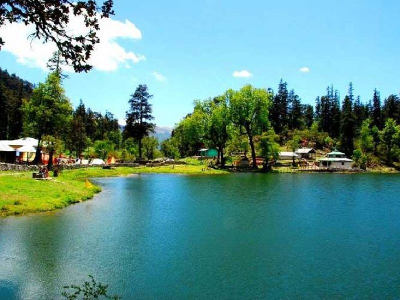
Dodital taal:
Dodital is a freshwater lake in uttarkashi district, Uttarakhand, India, situated at a height of 3,024 metres (9,921 ft). The Assi Ganga river emerges from Dodital and joins Bhagirathi at the confluence in Gangori, near Uttarkashi.
Dodital Lake is a beautiful lake situated in Uttarkashi District of Uttarakhand India. It is famous natural beauty and awesome surroundings.
The lake is situated approx 3000 metres above sea level and is surrounded by huge Oak woods, Pine, and Rhododendron forests. It is also home to the famous Himalayan Golden Mahseer fish.
The Dodital trek provides beautiful views of the mighty Bandarpunch mountain ranges. It is also a bird watchers paradise. We can enroute see a lot of Himalayan birds during the trek. The lake too is full of fishes and it is a delight watching and feeding the fishes like the Himalayan Golden Trout.
The month of July and August during the monsoon is the right time to trek and the sight of the blooming flowers make it truly a heaven on earth.
Dodital in Uttarakhand is a part of Garhwal tourism, and the local languages spoken are Gadhwali and Hindi. The best time to visit Dodital would be from July and February.
Dodital Trek is a group trekking tour. The Trek is low altitude trek reaching an elevation of 3000m above sea level. Sangamchatti is the base camp for the trek.
The Dodital trek is a moderate grade trek and a total distance of approx 40 km is covered during the trek.
Dodital – Trek Itinerary – 5 Nights – 5 Days
Day 01: Rishikesh – Sangamchatti ( 160kms / 8hr )
Early morning, drive to Sangamchatti via Chamba and Uttarkashi. Arrival at Sangamchatti by evening, check into the hotel. Enroute visit Lord Vishwanath temple in Uttarkashi.
Dinner & overnight stay.
Day 02: Uttarkashi to Bevra (2,400m) ( 5 kms trek / 5hrs )
Today we trek to Bevra village. The trek is a gradual ascent alongside the river AsinGanga. We trek our way through small villages and also enjoy the natural scenery of Uttarakhand.
On reaching Bevra we rest in camps and tents. Dinner & overnight stay.
Day 03: Bevra to Dodital (3,310m) ( 16 kms / 7hrs )
Today we trek to Dodital from Bevra village. The trek is a easy trek with a beautiful background of lush green forests and huge mountain peaks. We trek our way through small villages and also enjoy the natural scenery of Uttarakhand.
We take a small rest break at Manjhi. Dodital is around 2kms from Manjhi.
On reaching Dodital we rest in camps and tents. Dinner & overnight stay.
Day 04: Dodital – Agoda (2250 mts/7380 ft) (17 kms/4-5 hrs)
Today we start early and we trek down till Agoda. It is a 17 Kms Trek, gradual descent and relatively easy trek.
On reaching Agoda we rest in camps and tents. Dinner & overnight stay.
Day 05: Agoda – Rishikesh (4 kms trek + 140 kms Drive)
We start early today and complete the down hill trek from Agoda to Sangamchatti of around 04 Kms in 2hrs. On reaching Sangamchatti we drive down to Rishikesh. Evening free at leisure.
Dinner and overnight stay at the hotel.
Tour Ends.
Transportation during the Tour
Transport depends on the client requirement and feasibility. Some of the basically used transport during the tour package are:-
| 2 – 4 Pax | 4 – 6 Pax | 7 – 10 Pax | 10 + Pax |
| Indigo – Dzire | Innova – Xylo | Travera – Bolero | Tempo Traveller – Bus |
Trek Essentials
Trek Inclusion
Tents will be provided on sharing basis.
Trek Package Exclusions
By Air
The nearest Airport is Jolly Grant Airport in Dehradun, which is about 200 km from Uttarkashi HQ. Taxi and bus services are available from Dehradun airport to Uttarkashi HQ.
By Train
Rishikesh, Haridwar & Dehradun all have Railway Stations. Nearest rail-head from Uttarkashi is Rishikesh and Derhadun (200 km approx). From Rishikesh/Dehradun one can take a bus/Taxi to reach Uttarkashi.
By Road
State transport buses play regularly between Uttarkashi and Rishikesh/Dehradun. Local Transport Union Buses and State Transport buses operate between Uttarkashi and Dehradun (200 km), Haridwar (250 km). Gangotri is 100 km from Uttarkashi headquarter . Dodital is 19 km form uttarkashi and 24 km trek after that.
Hemkund Lake:
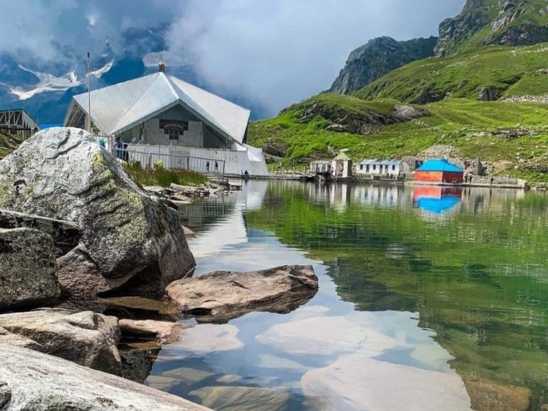
Hemkund Sahib (also spelled Hemkunt), formally known as Gurudwara Shri Hemkund Sahib Ji, is a Sikh place of worship and pilgrimage site in Chamoli district, Uttarakhand, India. It is devoted to Guru Gobind Singh Ji (1666–1708), the tenth Sikh Guru, and finds mention in Dasam Granth. With its setting of a glacial lake surrounded by seven mountain peaks, each adorned by a Nishan Sahib on its cliff, it is according to the Survey of India located in the Garhwal Himalaya at an elevation of 4,160 meters (13,650 feet).[1] It is approached from Govindghat on the Rishikesh-Badrinath highway. The main town near Gobindghat is Joshimath. The altitude of the lake at Hemkund is approximately 13,650 feet.
Hemkund is inaccessible from October through April because of snowbound paths and glaciers. Sikh pilgrims arrive in May and set to work to repair the damage to the path over the winter, which tradition is called kar seva (“selfless service”), a concept which forms an important tenet of the Sikh faith.
The take-off point for Hemkund Sahib is the town of Govindghat, about 275 kilometres (171 mi) from Rishikesh. The 9 kilometres (5.6 mi) trek is along a reasonably well-maintained path to the village of Ghangaria (also called Govinddham). This path can be covered either by walk or by pony and a Gurudwara here gives shelter to pilgrims. In addition, there are a few hotels and a campground with tents and mattresses. A 1,100-metre (3,600 ft)climb on a 6-kilometre (3.7 mi) of stone paved path leads to Hemkund. Overnight stay is not allowed at Hemkund Sahib, so it is necessary to leave by 2 PM to make it back to Govindghat by dusk.
Gurudwara Shri Hemkund Sahib is a most sacred pilgrimage site for Sikhs in Chamoli district, Uttarakhand, India which is visited by large numbers of pilgrims every summer from all over the world. This divine place lies in the higher Himalayas at an elevation of 4632 Meters (more than 15,210 feet) with a setting of a glacial lake surrounded by seven mountain peaks and each peak is adorned by a Nishan Sahib on its cliff. It is situated nearly 29 kms from Joshimath via Govindghat, is set in one of the famous beauty spots of the central Himalayas and has a lake of crystal clear water located in beautiful surrounding. The glaciers from Hathi Parvat and Sapt shring peaks feed the lake and a small stream called Himganga flows out of the lakes.
Shri Hemkund Sahib is famous for the Sikh Worship Place, known as Shri Hemkunt Sahib Ji, devoted to the tenth and penultimate guru of the Sikhs Shri Guru Gobind Singh Ji. It’s the only Gurudwara in the world to have a pentagonal structure in its design. A very distinct feature considering the prominence of domes in all the Gurudwaras, Shri Hemkunt Sahib is a place of almost unbelievable beauty and peace. Seven peaks – known as the Sapt Sring – surround the shrine, looming over lush green pastures. The lake’s rocky shores are covered with snow through most of the year, but when the snows melt, the almost mythical yellow-green flower known as the Brahma Kamal, the “Lotus of the Gods“, blooms amidst the rocks. It’s a place of a rather wild and untamed beauty- and one of Sikhism’s most important shrines.
Etymology:
Hemkunt is a Sanskrit name derived from Hem (“Snow”) and Kund (“bowl”). Dasam Granth says this is the place where Pandu Raja practiced Yoga. In addition, the Dasam Granth says God ordered Sikh Guru Gobind Singh to take birth while he was in deep meditation at the mount of Hemkunt.
History of Shri Hemkund Sahib:
Sri Hemkunt Sahib is mentioned in the life history of Guru Gobind Singh Ji who meditated at Hemkunt Sahib for years, finally leaving his earthly form and uniting with the Almighty. In spite of this, the place remained unknown and undiscovered for more than 2 centuries.
Bhai Santokh Singh Ji was a Sikh poet and historian who used imagination and descriptions in the relics to identify this place. This helped reach the correct spot in finding.
Achitira Natak is an autobiographical account of incarnated life of Shri Guru Gobind Singh Ji as a powerful youth who was called into existence during Sat Yug, the ‘age of truth’ (the first of four ages according to Hindu mythology) to do battle with fierce demons that terrorized mortals and gods including Hindu deities and gods. When they had been destroyed, the youth, known as Dusht Daman, the ‘destroyer of evil‘, was instructed to go to Hemkunt Sapat sring to meditate until he was called upon by God. Guru Gobind Singh’s own account in Bachitra Natak completes this story. After realizing his oneness with God through meditation and austere discipline, he was reborn in Kal Yug, the ‘age of darkness‘, as the son of the ninth Guru and his wife. Later, after his father’s martyrdom, he became the tenth and final living Guru of the Sikhs.
[[ਅਬ ਮੈ ਅਪਨੀ ਕਥਾ ਬਖਾਨੋ ॥ ਤਪ ਸਾਧਤ ਜਿਹ ਬਿਧਿ ਮੁਹਿ ਆਨੋ ॥ अब मै अपनी कथा बखानो ॥ तप साधत जिह बिधि मुहि आनो ॥ – Now I relate my own story as to how I was brought here, while I was absorbed in deep meditation.
ਹੇਮ ਕੁੰਟ ਪਰਬਤ ਹੈ ਜਹਾਂ ॥ ਸਪਤ ਸ੍ਰਿੰਗ ਸੋਭਿਤ ਹੈ ਤਹਾਂ ॥੧॥ हेम कुंट परबत है जहां ॥ सपत स्रिंग सोभित है तहां ॥१॥ – The site was the mountain named Hemkunt, with seven peaks and looks there very impressive.
It is also believed that Lakshman, the younger brother of Ram, meditated by the lake and regained his health after being severely wounded by Meghnath, son of the demon Ravana, during battle.
Nestled high in the lap of Himalayas, the high altitude lake of Hemkund/Lokpal perches at an astounding elevation of 4329 mts above the sea level, upon reaching this lake, travellers are completely immersed in another world. The lake is entirely surrounded through heavenly
Mythologies of Hemkund Sahib:
It is believed that Guru Gobind Singh meditated here for a long time. According to Hindu mythology, Rishi Medhasa of the Markandeya Purana and Lord Ram’s younger brother, Lakshmana, performed penance at this site.
Importance:
This gurudwara is the world’s highest gurudwara. It is visited by Sikhs as well as Hindus.
Sikhs consider this as a scared region. A Hindu shrine dedicated to mythological hero Lakshmana is attractive for Hindu Pilgrims. This temple is built on the banks of Hemkund.
Natural Beauty of Hemkund Lake:
The Gurudwara is build beside a beautiful lake known as Hemkund. Glaciers from majestic peaks known as Hathi Parvat and Saptrishi peaks feed the lake. A small stream known as Himganga originates from the lake. Hemkunt Sahib is nestled amidst seven snow capped peaks and marvelous snowy glaciers. These amazing things make this place a great option for quiet and spiritual vacations.
How To Reach
BY AIR: Air passengers can book their flights till the Jolly Grant Airport at Dehradun. The roads are accessible till Govind Ghat as a trek of 19kms commences from here till Hemkund Sahib. The airport links Dehradun with major Indian cities.
BY RAIL: Rishikesh is the closest railway station to the town of Hemkund Sahib and is situated at around 273 kms before the town of Govindghat on the NH58 route. The town is well linked with railway networks with major Indian destinations.
BY ROAD: The town is linked up with motorable roads that are connected till the beautiful town of Govind Ghat. Govind Ghat is situated in NH58 and can easily be reached through major destinations of the state of Uttarakhand.
Travel:
Hemkund is inaccessible from October through April because of snow bound paths and glaciers. Sikh pilgrims arrive in May and set to work to repair the damage to the path over the winter, which tradition is called kar seva (“work service”), a concept which forms an important tenet of the Sikh faith
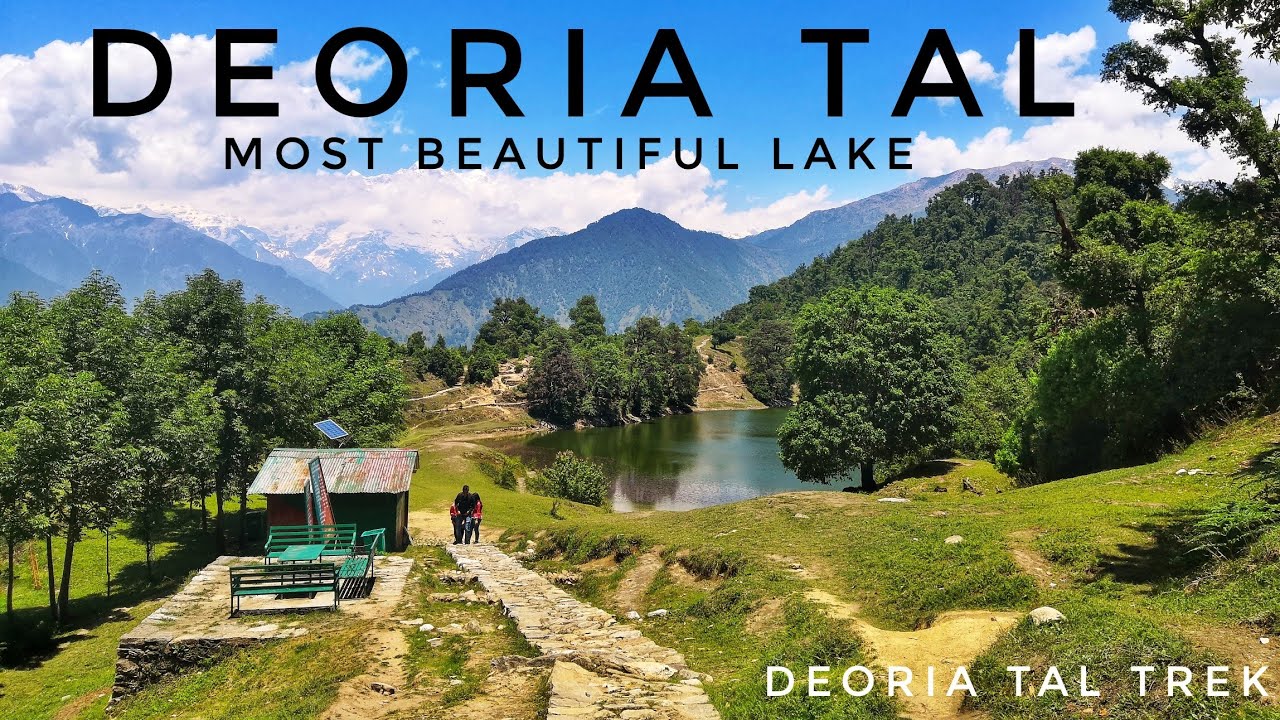
Deoria Tal:
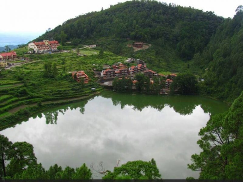
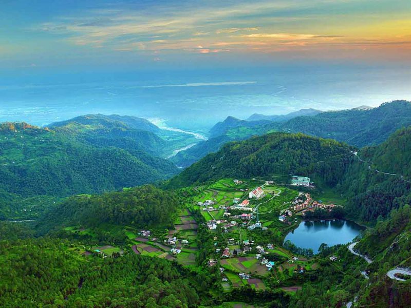
(also Devaria or Deoriya) is a lake about 3 km (1.9 mi) from the villages of Mastura and Sari on the Ukhimath-Chopta road in the state of Uttarakhand in India. Situated at an altitude of 2,438 metres (7,999 ft) in the Garhwal Himalayas, it has heavily wooded, lush green surroundings with snow-covered mountains (Chaukhamba being one of them) in the backdrop. It is considered sacred by Hindus.
Hindu faith states that the Devas bathed in this lake, hence the name. The lake is also believed to be the “Indra Sarovar” referred to in the Puranas by wandering Hindu mendicants, Sadhus. It is also believed that it was the place from where the mighty Pandavas were asked queries by Yaksha. According to the locals it was also said that this lake was built by Bheem, who was strongest among the Pandavas, to appease his thirst, and Yudhister, who was the wisest, suggested Bheem to build his own lake
Deoriatal Travel Guide
A dreamlike lake that is surrounded by the snow-clad mountains in the district of Rudraprayag in Garhwal Region, Deoriatal is amongst the most popular camping & trekking places in Uttarakhand Himalayas. �Situated some 3 km on an uphill trek from Mastura and Sari villages on the Ukhimath-Chopta road, the lake allures visitors with the stunning reflection of Chaukhamba Peaks on its crystal clear water. According to beliefs, the nature sightseeing place in Uttarakhand, which sits at an elevation of 2438 m is considered as the place where Gods used to take bath. Thus, this offbeat lake destination holds a special significance to Hindu devotees. It is also reckoned to be the famed ‘Indra Sarovar’ which has its reference in the Puranas. It is believed that it was this travel place where the Pandavas were asked questions by Yaksha. The legend has it that this lake was created by Bheem who was the strongest among the Pandavas in order to appease his thirst.The lake can only be reached through a 3 km trekking trail from Sari village. The charm and the beauty of the nature of this popular place in Uttarakhand allures a large number of trekkers and nature aficionados throughout the year.
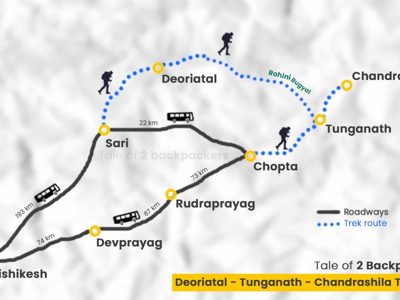
Snow-capped mountains of Himalayas like Chaukhamba, Nilkantha, Bandarpunch, Kedar Range, and Kalanag make the backdrop quite surreal at Deoriatal and one can savour a 300� panoramic view. The astounding green forest is the major attraction on the trekking route of Deoriatal. Bird watching along with the exhilarating trek are the two major draws which make it an ideal place to visit. Camping and village tourism are also the must-do things in here. Apart from savouring an experience of a lifetime in Deoriatal, one has a number of places to visit situated at a short distance from the surreal lake like the popular tourist destinations of Chopta and Tungnath (the highest Shiva Temple in the world). Those seeking more adventure in Rudraprayag, can also attempt a 4 km trek to Chandrashila from Chopta via the Tungnath Temple.
Our Deoriatal travel guide is filled with information on best places to visit and things to do, which makes it quite essential for the travellers looking for an best Deoriatal holiday experience. Also, handcrafted for you are the varied travel packages by Tour My India that ensure a vacation unlike any other.
Where to Stay in Deoriatal?
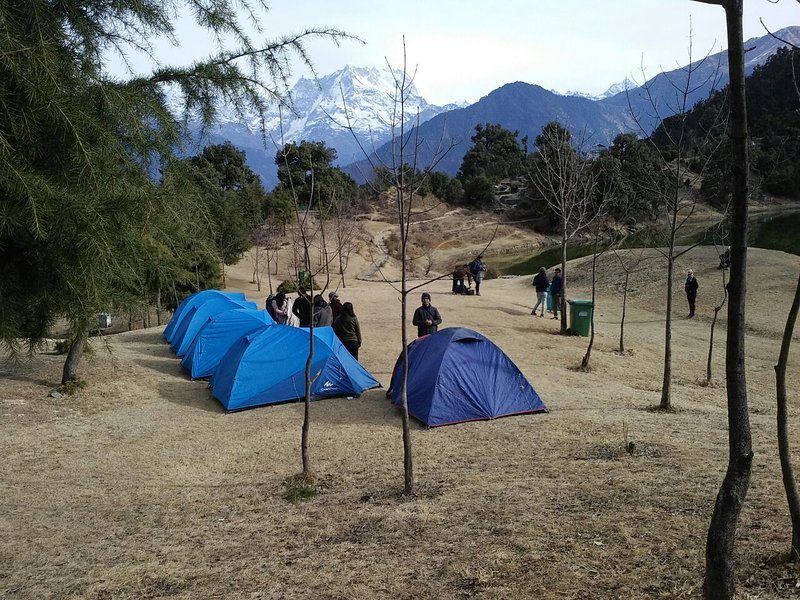
Being a beautiful lake, DeoriaTal offers some unblemished nature to savour. It also gives tourists an opportunity of camping under the supervision of forest officials. Along with that, a Forest Rest House is also available for booking as a staying place in Deoriatal. In order to find any other accommodation options, one has to trek down to Sari Village to find some budget places to stay that offer decent services.
Places Near By | Deoria Tal
Chandrashila :
Chandrashila summit is a standout amongst the most loved goals of trekking fans in India. Trekkers outside of India too come to Chandrashila for trekking extraordinarily amid the late spring months. Just 1.5Km from Tungnath. Chandrashila is the slope lodging Tungnath sanctuary. Chandrashila crest, 4000 meters above ocean level, offers extensive variety of touring chance to the trekkers.
Tungnath Temple:
Tungnath sanctuary, one among the five of Panch Kedar journeys and the most astounding elevation sanctuary devoted to Lord Shiva, is arranged on the lap of Chandrashila crest in Chamoli area of Dev Bhoomi Uttarakhand 3,680 meters over the ocean level. Bearing the religious centrality, Tungnath sanctuary is a standout amongst the most went by journeys of India. Arm of master Shiva is loved in Tungnath sanctuary. Legend of Panch Kedar states about its beginning.
Chopta :
Chopta is a little district of knolls and evergreen timberland territory which is a piece of kedarnath natural life asylum situated in Uttarakhand state, India and a base for trekking to Tungnath, third sanctuary of Panch Kedar, which lies 3.5 kilometers (2.2 mi) away. Situated at a separation of 1.5 kilometers (0.93 mi) from Tungnath is Chandrashila, an ascending to more than 4,000 meters (13,000 ft).
Best Time to Visit Deoriatal
Despite the fact that Deoriatal is accessible throughout the year, however, summer and winter are the ideal seasons to visit the place. During these seasons, the lake is at its best to enjoy the serene beauty and enjoy night camping as well.
From April to June are the months of summer here. During this time, one can enjoy the rich ambiance of the lake and can have really good time here. The temperature during this time varies between 15 and 25�C during summer and the weather remains quite cold because of high elevation.
The season of monsoon is not meant for the excursion to Deoria Tal. From July to September the place witnesses heavy rainfall and this makes the trekking and other activities difficult here. Chances of landslides and roadblocks also increase during the monsoon season in the state of Uttarakhand.
The month of October is the commencement of winter season in Deoriatal and it lasts till March. Moreover, the temperature during these months remains in between 0�C and 10�C. Winters in Deoriatal are extremely cold with fair chance of frequent snowfall. It is advisable to take heavy woollen clothes.
Best Time To Visit In Deoria Tal
Deoria or Devoria Tal is a best place to visit if you go Devoria tal you feel seren beauty and mesmerizing more things. All Visitor uasually go to Devoria tal March till mid june. In that months night are cold all round the year.Monsoon season should be drop beacause untimely landslide on the rout and blockage of road.
Things To Do In Deoria Tal
1 : One of the first things you can enjoy walking on mountain peaks, with lush green woods and mesmerize seren beauty of Deoria Tal.
2 : In Devria Tal there is the night camping and star night photography is must to do things. October to Jun is the best time for night photography as well as weather is clear in night during these month.
3 : If you plane your trip for 2-3 days more to mesmerize the seren beauty and adventure of valley then Devariya Tal to Tungnath/Chandrashila trek via Rohini Bugyal / Bhrujgali is another breathtaking things to do from Devariya lake.
Deoria Tal Trek | How to reach?
Reaching Deoria Tal is not difficult. Jolly Grant in Dehradun is the nearest airport and Haridwar Junction is the nearest railway station from the place. Sari Village which is the beginning point of the trek of Chopta is well-connected through road as well. One has to first reach the village by bus/cab and then from there need to trek 3 km uphill.
Jolly Grant Airport in Dehradun is the nearest airport from Deoriatal which is around 209 km away from the place. After reaching the airport, you need to carry on your rest of the journey by road. At the airport, you can board a taxi or cab to Sari Village and thereafter a 3 km trek to reach Deoriatal.
The nearest railway station from Deoriatal is Haridwar Railway Station which is located at a distance of approximately 218 km from the place. Once you land at Haridwar, you can hire a taxi from there to Sari village. From Sari village, you need to cover the distance of 3 km trek to reach your destination.
The place is very well-connected with other northern states of India through motorable roads. One can hire a taxi or can drive itself to Sari Village in order to reach here. Once you reach Sari Village, there is a 3 km trek to reach Deoria Tal. Buses from ISBT Anand Vihar, Delhi to Rudraprayag are also easily available. In order to reach the place, one can cover the distance from Rudraprayag to Sari village by local transport or by hiring a cab and thereafter trek to Deoriatal.
FAQ for Deotia tal
01: Is the per person camping cost in Deoria tal?
INR 2000/- to INR3000/- Per person per night for camp & food for 01 person.
02: Is it safe to stay in deoria tal?
Yes many people stay in deria tal. But winter time is risky due to snow fall. Also dont move out side your camp at night. Some time wild animal walk around near by like tiger, bear can.
03: what is the best time to visit Deoria tal?
12 month is the best time to visit Deoria Tal.
04: What can see near by Deoria tal?
03 famous point you can cover with Deoria tal like Chopta Chandrashila Trekking.
Stay
Meal
Activity
Other Inclusions
Transport
Things To Carry
Advisory
Tour Type
Cancellation Policy
Refund Policy
Booking Confirmation Policy
find any other accommodation options, one has to trek down to Sari Village to find some budget places to stay that offer decent services.
Khurpatal :
lake located 12 kilometers (39,000 ft) ahead of the famous tourist destination Nainital in the state of Uttarakhand, India. Khurpatal was named Khurpatal because its shape resembles that of a khur (sole of a horse).In November 2016, the Uttarakhand High Court ordered several lakes to be declared eco-sensitive zones, prohibiting felling of trees and new construction within a 2–5 km radius. Khurpatal is one of these lakes.
Allure Lake Front Best Hotels to Stay in Khurpatal, Nainital
Khurpatal is a new destination near Nainital that the tourists are now looking to explore. Most people have travelled to Nainital many times and the growing crowds in Nainital is pushing people to look for places that are peaceful and serene. Khurpatal is an excellent choice if you want to stay away from the crowd in Nainital and want to enjoy a relaxed and peaceful holiday in the Kumaon Hills. If you still want to explore cafes and eateries in Nainital, it’s only a short drive from Khurpatal.
Since we can be easily discovered on Google Maps, you will be able to arrive at Allure Lakefront Suites without any hassle. The winding Nainital-Khurpatal road is absolutely fantastic and the views are breathtaking. If you’re coming from Nainital to Khurpatal, stop near the temple and take a look of the lake from the lake-view Point. Its incredibly beautiful!
Food in Khurpatal
The food at Allure Lakefront Suites is simply magical! Our chef was trained in Indian cuisine in India’s Food Capital – Delhi and that’s why we call our kitchen Delhi-cious. When you’re staying at Allure Lakefront, our kitchen team will ensure that you savour the best quality food in Nainital.
The Chef is also trained in the local Kumaon Food. While you’re at Allure Lakefront Suites, do give it a try. We can vouch for his Pahaadi Chicken which is mind-blowing! Some vegetarian dishes like Aloo ke Gutke, Bhaang Chutney and Bhaat ki Churkani are absolutely delish! Ask our team for a local Kumaoni food menu and they will be more that happy to serve you some amazing Kumaoni Food in Khurpatal.
The evenings at Allure are popular for our Mughlai Bar-be-Que Grill. We serve delicious veg and non-veg Mughlai bbq starters in the evening that will make your stay in Khurpatal so much more memorable.
Khurpatal Sightseeing
During your stay at Allure Lakefront Suites, there are some very good sightseeing points. While there are many places to see in Khurpatal and nearby, the most famous spot is Nainital. Located only at a distance of 10 kms and easily accessible by road, Nainital is situated at a height of 6500 ft above the sea level. Go for boating and enjoy Nainital Mall Road’s street food or chill at a cafe, Nainital has lots to offer.
Bhimtal and Naukuchiatal are twin lake towns in Nainital district and popular among tourists. Bhimtal can be easily accessed by road from Khurpatal and the distance is only 35 kms. A drive to Bhimtal will take approximately 1 hour. Bhimtal is known for its small island in the middle of the lake which makes it quite popular among tourists. Naukuchiatal which is only 4 kms from Bhimtal is known as the untouched beauty of the region. Please ask our staff to arrange a cab to Nainital or Bhimtal.
Corbett National Park, known for the Royal Bengal Tigers and named after the English conservationist, Jim Corbett is only 50 kms from Khurpatal. You can go for a day-long trip and jungle safari in Jim Corbett National Park from Khurpatal.
Weather in Khurpatal
Since Khurpatal is located at a height of 5500 feet above the sea level, the weather in Khurpatal is pleasant throughout the year. The best part about the weather is its neither too hot in the summers, nor its too cold in the winters.
Khurpatal enjoys a beautiful weather as compared to other hill stations. The best time to visit Khurpatal is March. April, October and November. During these months the sun shines at its best during the day and the evenings are pleasant.
May & June are also good months to visit Khurpatal its little warm during the day. Expect a high of about 28-30 degree Celsius during these months and about 18-20 degree low.
Khurpatal receives its share of monsoon during the months of July and August and this is the time when everything turns green in the hills. The clouds engulf the region and there are times when the lake completely disappears in the cloud cover.
If you want to enjoy snow, then your best bet is December and January. While it does not snow in Khurpatal, you can always take a short drive to Nainital to witness snowfall.
Khurpatal is actually a 12 month destination in terms of its weather. Tourists come round the year to Khurpatal to enjoy their most favourite season on the hills.
Delhi to Khurpatal
Delhi to Khurpatal by road is only a six hours drive. Khurpatal is located at a distance of only 275 kms from Delhi and the road is quite good. Please take the Kalladungi route from Delhi while coming to Khurpatal. This is a shorter route as compared to the Haldwani-Nainital route.
The train connectivity between Delhi – Khurpatal is also great. The closest railway station is Haldwani which is only 45 kms from Khurpatal. There are daily trains from Delhi to Haldwani and back.
Thee closest airport from Khurpatal is the Delhi International Airport. If you’re coming from other States, Delhi is the capital and well connected by Air with all major city airports. Let us know and we will arrange a pick up facility for you.
Nainital to Khurpatal Distance And Route
A scenic drive of about 8-10 kms from Nainital will bring you to Allure Lake Front Residences. If you’re looking for a hotel near Nainital, then our hotel in Khurpatal is only a short 20 minutes drive from the Nainital Mall Road.
Nainital to Khurpatal Route: Nainital Mall Road — Cave Garden — Lover’s Point — Himalayan Botanical Garden — Mountain Magic — Woodland Waterfall — Vaishno Devi Temple — Lingadhar — Khurpatal
Once you reach Lingadhar, you’ll see the Moss Garden signage on your left. From that point, take the road going left and you’ll be able to come straight to Khurpatal. We are located by the lake and next to the AWHO Colony.
How to reach Khurpatal Lake, Uttarakhand
By Air:
Pantnagar Airpot is located in Udham Singh Nagar district and the nearest airport to Khurpatal which is around 78 Km away by road.
By Train:
Kathgodam railway station which is near Haldwani is the nearest railway station to Khurpatal which is around 34 km away by road.
By Car:
The road is well connected to Khurpatal one can easily travel by car or motorcycle. Khurpatal is around 362 km away from Dehradun, the capital of Uttarakhand, and also around 362 km away from Delhi, the capital of India.
By Bus:
One can travel to Khurpatal by Government Buses from Dehradun or Delhi directly. As buses are available directly from respective bus stations.
Bhimtal:
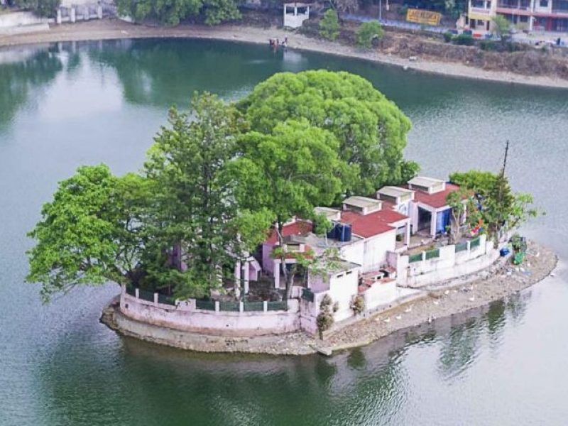
Bhimtal is a lake in the town of Bhimtal, in Kumaon division, Uttarakhand, with a masonry dam built in 1883 creating the storage facility. It’s the 2nd largest lake by surface area in Uttarakhand.
It is the largest lake of Kumaon region, largest lake of Nainital district, which is known as the “Lake district of India The lake provides drinking water supply and supports aquaculture with variety of fish species. There is an island at the center of the lake which has been developed as a tourist attraction and has an aquarium
Bhimtal is one of the famous lake cities in Kumaon region. Older than Nainital city, Bhimtal is named after the majestic character of Mahabharata, Bhima. Situated at a height of 1370 meters above sea level, Bhimtal offers a majestic scenic beauty to its visitors.
The major attraction of this place is a small island located in the middle of the lake, which also has a large aquarium on it. Bhimtal beholds exceptional views and vistas of the mother nature and is a paradise for nature lovers. The pristine blue lake and several temples across the mountains make it one of the choicest destinations for people who wish to relax, away from the hustle and bustle of the city yet stay closer to it.
Bhimtal Aquarium
The aquarium located at the center of the lake is a great tourist attraction and create a magical spell on everyone who visits it. The aquarium was previously a restaurant which is now converted into an aquarium to preserve the natural aqua-marine vegetation of this place. The aquarium can be accessed by riding a boat on the lake, which is the only way to reach it.
Things to do at Bhimtal
Bhimtal offers a wide range of activities and sightseeing around it.
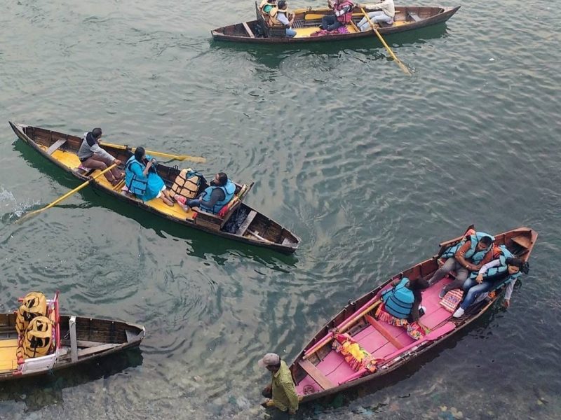
Boating and fishing
One of the primary activities that attract a large number of tourists is boating and fishing. Bhimtal is home to three beautiful lakes- Bhimtal Lake, Sattal Lake, and Naukuchiatal Lake. The most magical experience is offered by Bhimtal lake wherein you can visit the island located in the middle of the lake. The scene is quite picturesque and offers a vivid experience to its visitors.
You can do fishing and angling at these lakes and take your fish back home for a yummy meal.
Stargazing and Camping
This one is especially for people who live in Delhi or other metro cities, loaded with pollution, and have not seen a clear sky in ages. The camp set amidst the lush green forests of Bhimtal’s mountain range offers an exceptional experience to tourists and campers. You can indulge in the gazing the star-studded sky and get refreshed in the natural fresh air that this place offers.
Picnic with family and friends
Unwind yourself by enjoying a picnic with your family or friends at the banks of the three lakes Bhimtal beholds. The lakes are a famous picnic spot amongst both locals and tourists. Get your food packed and enjoy a soothing day at the lakeside with your loved ones.
Sightseeing
Bhimtal is home to various temples apart from lakes. Some of the sightseeing places are Victoria dam just 1.9 km away, Hidimba Parvat 5 km away, Bhimeshwar Mahadev Temple 3.7 km away, Hanuman Garhi temple 22 km away, Nag temple 3.7 km away, and Folk Culture Museum which is nearby.
Shopping at the street market
Shop around the local street market of Bhimtal and look for Garhwali paintings, carpets, statues, organic products, and handmade candles. Also, do not miss the local food of this area which is an exceptional experience.
If you are an adventure enthusiast, Bhimtal does not disappoint you. Several adventure activities are conducted around Bhimtal at regular intervals. Following are some of the activities which attract plenty of tourists at Bhimtal;
Trekking and Hiking
Bhimtal is surrounded by dense lush green forests on all sides, which offers a great spot for trekking and hiking. There are both long and short trails across the mountains of Bhimtal.
While trekking you can also come across various migratory and resident birds on these mountains.
Dirt Biking and Paragliding
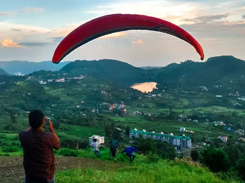
If you want to experience a bird’s eye view of the valley, fly high above the mountains and forests of Bhimtal while you paraglide. Naukuchiatal is a famous spot for activities like Paragliding and Dirt Biking, which is just 4 km away from Bhimtal.
If you want to experience your adrenaline rushing through your veins, dirt Biking is your game. Witness the beautiful yet adventurous mountains from a whole new angle and check one of these adventure sports off your list.
Festivities in Bhimtal
July is the go-to month if you want to be a part of the festival and carnival at Bhimtal. Hareli festival is celebrated here in the month of July which is a celebration of the good harvest. Fairs, cultural performances, bike and car events in death well are some of the festival activities.
The festival highlights the cultural and historical significance of Bhimtal and brings you a lot closer to the life locals live.
Historical significance of Bhimtal
After the Anglo-Nepalese war, also known as Gorkha War of 1814-1816, Bhimtal came under the British rule. There are still the then used pedestrian routes connecting Kathgodam and other Kumaoni regions. These routes also lead to Tibet and Nepal and are speculated to be the part of the ancient silk route.
The famous Shiva temple alongside the Bhimtal lake is believed to be built by Baz Bahadur, the king of Kumaon and ruler of Chand Dynasty in 17th century AD.
Mythological significance of Bhimtal
Bhimtal was earlier known as “Bheemsarovar Lake” after the famous Mahabharata character Bheem. According to legend, Bhimtal was the stomping ground of Pandavas which they used to visit during their time of exile. The lake is the result of Bheem’s blow on the ground by his ‘Gada’ in order to develop a source of water to quench their thirst. The Bhimeshwar Mahadev temple was hence erected here as a tribute to Bheema.
Interesting facts about Bhimtal
From the Gagar Village in Nainital district, is the Garg Parvat from which originates the Gargi river, close to Bhimeshwar Mahadev temple.
How to reach Bhimtal
Bhimtal is just 22 km away from Nainital city. You can drive yourself to Bhimtal or hire a taxi cab. There is a regular bus service from Bhimtal to Nainital and vice versa.
Bhimtal does not have its own dedicated railway station or Airport. If you are traveling by train, Kathgodam Railway Station is the nearest one which is 30 km away from Nainital. You can hire a private or shared taxi from the station to reach Bhimtal. There are also buses running from the railway station to Bhimtal.
If you are traveling by air, Pantnagar airport is the nearest airport which is 56 km away. You can travel to Bhimtal via NH 109 by a private or shared taxi from the airport.
Best time to visit Bhimtal
Bhimtal welcomes its tourists at almost all times of the year. The months of March, April, May, October, November, and December are the best ones to enjoy Bhimtal, fully bloomed during the first three and covered with snow during the later three.
Traveler tips while visiting Bhimtal
There is easy availability of ATMs, petrol pumps, restaurants, cafes and hotels in Bhimtal due to its close proximity to Nainital city. Yet, it is advisable that you carry some cash all the time.
If you are planning budget travel, try visiting during the off-season as during the peak months, Bhimtal can dig a hole in your pockets.
Always pack some woolens while traveling to Bhimtal and other nearby places.
________________________________________
You can always club Bhimtal along with Nainital trip. We at Nainital Tourism, a division of Holidays DNA offer Nainital Tour packages that offer a tour to the popular sightseeing places of Nainital. For travelling within and around Nainital, you can also book a private cab from top car rental companies in Nainital. Please fill the Contact Us form for more details about the various packages.
Bhullatal:
Bhullatal, an artificial manmade lake dedicated to the Garhwali youth of The Garhwal Rifles who helped in construction of the lake, located at just 1 km from the Lansdowne, India.Bhulla in Garhwali language means younger brother. Bhullatal is also known as Bhulla Lake.
Bhulla Tal in Lansdowne
Bhulla Tal – Picnic Spot in Lansdowne Located at near to the Lansdowne city , Bhulla Lake is best place for kids , couples and old ones . Bhulla Lake has very neat and clean environment at the lap of nature . Tourists likes it as it is equally entertaining and peaceful with tranquil atmosphere . Still not much populated , Bhulla Lake is a man – made artificial lake . ‘ Bhulla ‘ in local garhwali language means ‘ Young Brother . Bhulla Lake is dedicated to the young Garhwali youth of Garhwal Rifles who helped in construction of the lake . Bhulla Lake has ample boating facilities with few ducks as well in the lake water . Beautiful duck shapped boats are available for paddling on the lake at very cheap rates . An amusement and children situated near the lake for the kids fun . One can also find small souvenir shop , a cafe , herbal plants nursery , enclosure for rabbits near the Bhulla Lake . A small over bridge on the lake attracts visitors for a best lake view . Stands are there to sit besides the lake . A bamboo machan and fountains are also constructed near the lake for more entertainment .
How To Reach Bhulla Tal
Lansdowne Bhulla Lake is located at just 1 km from Lansdowne city and can be reached easily by walk on well made path . Nearesr rail connectivity is at Kotdwara railway station ( 42 kms ) and airport at Jolly Grant Airport , Dehradun ( 150 kms ) .
Location of Bhulla Tal
Bhulla Tal is located in In Lansdowne ( Set amidst thick Oak and Banj forest , Bhulla tal is a small lake where you can enjoy boating with your family . Lake is in the cantt area of Lansdowne . ) .
What is Bhulla Tal famous for ?
Bhulla Tal is popular place for following activities / interests – Boating , Kids & family spots , Lakes .
About Bhulla Tal
A small , well maintained and serene lake known as Bhulla Lake or Bhulla Tal is located at just 1 km walk from Lansdowne city centre . Made and maintained by Indian Army , Bhulla Lake is also known as Bhulla Tal among locals . A perfect picnic spot and entertaining day out in Lansdowne , Bhulla Lake is a famous place in Lansdowne .
In Lansdowne Set amidst thick Oak and Banj forest , Bhulla tal is a small lake where you can enjoy boating with your family . Lake is in the cantt area of Lansdowne . | |
Dist./ Travel Time |
2.1 kms From Gandh Park , Lansdowne Market |
Entry Type | Free Entry Although walking around lake is free but for boating you have to spend @ 50 |
Opening Time | 10:00 am |
Closing Time | 5:00 pm |
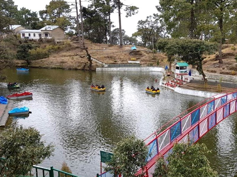
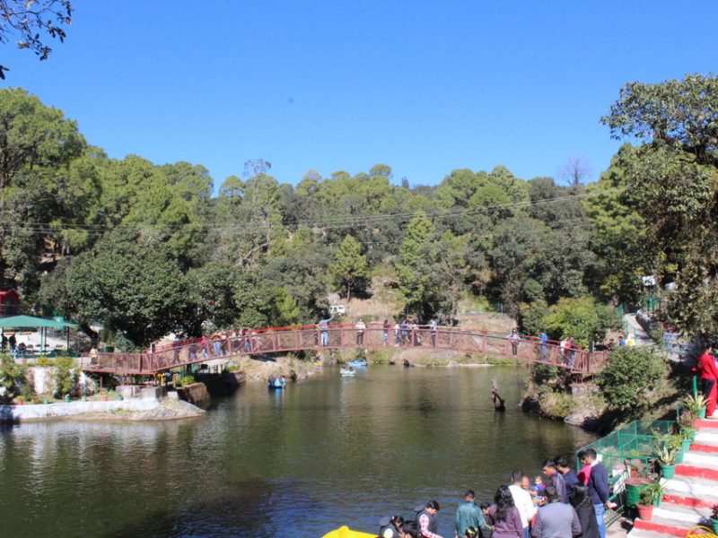
Sat Tal :
(Hindi for “seven lakes”) is an interconnected group of seven freshwater lakes situated in the Lower Himalayan Range near Bhimtal, a town of the Nainital district in Uttarakhand, India. During the British Raj, the area had a tea plantation, one of four in the Kumaon area at that time. The lakes sit at an altitude of 1370 metres below lush orchards in the Mehragaon valley.Set amongst dense forests of oak and pine trees, Sattal is one of the few unspoiled and unpolluted freshwater biomes in India. These lakes are a paradise for migratory birds. It is home to a few camps being operated mostly by local people catering to tourists looking for outdoor vacations.
Sattal of Seven Lakes located close to each other is at a distance of 20 KM from Nainital and it will take one hour via Bowali. On the main road connecting Haldwani to Almore at MehrGaon you have to take a right turn and Sattal is 7 KM from here.
There is a view point before descending to Sattal lake level and from here you can see two lakes side by side Hanuman-tal and Bharat-tal . These two lakes receive less water and almost remain dry like in summer months. The main Lake consist of three lakes Ram-tal, Lakshman-tal and Sita-tal joined together by narrow passages clearly visible in dry seasons when less water is available. These lakes are heaven for migratory birds. All the busy market and tourist activites of Sattal is located around these three lakes only. Here is the list of seven lakes known as Sattal
Hanuman Tal and Bharat Tal ( less water , located side by side )
Ramtal, Lakshman-tal, Sita-tal ( Main three lakes )
Garud Tal
NalDamayanti Tal ( almost dry in summer months)
There is a busy tourist market and playground near the lakes. This is mostly treated as lunch point for tourist visiting from Nainital and other places. Good number of restaurants are available here. Here the famous food is Kadi Chawal. In place Dal you will get Kadi a juicy recipe with diluted curd in it to mix with rice.
Main Highlight of Sattal lake Nainital Uttarakhand :
Seven Lakes comprising Sattal are:
Location
Sattal is located in the Lower Himalayan Range and is the effect of tectonic activities and the elevating of deposits amid the Tibetan and the Indo-Gangetic plains. The rocks are mainly sedimentary and quartzite. The area can be divided into lower Himalayas and terraces.
History of Sattal
The British used to liken the enthralling splendor of Sattal with the Westmorland of England. In fact, the British loved the area so much that during the colonial era, Sattal had a tea plantation area which was among the four tea plantation estates of the Kumaon region.
History of Sattal Uttarakhand
Sattal is located in the lower Himalayan range and the result of tectonic activities. Sattal is known for birding paradise and migratory birdlife.
How to reach Sattal Lake:
By AIR: Pantnagar Airport is the nearest airport which is in Udham singh nagar district is located 50.7 km away and the estimated timing is 1 hour 20 minutes by four-wheeler.
By train: The nearest railway station is Kathgodam railway station which is 29.5 km approximately 45 minutes ride by a four-wheeler for Sattal.
By Bus: How to Reach: By Bus, Car, motorcycle. Kathgodam roadways bus station and Haldwani roadways bus station these two stations are the nearest bus station for reaching out sattal and there will be bus between every 1 to 2 hour timing.
Sattal has many best place to visit for extreme adventure and birdlife.
Butterfly Museum: This butterfly museum has over 2500 species of butterfly and 1100 species of insects.
The sattal Christian ashram: This ashram is located in the banks of sattal lake and made by E Stanley Jones.
Subhash dhara: A Natural fresh water fall which leads to Bharat tal (near sattal) is a whole new and extreme experience for tourist.
Bhemtal: Bhemtal a town located 13.9 km away from sattal is also known for one of the seven freshwater lakes in nainital district and this small town settled around bhemtal lake.
Naukuchia tal: naukuchia tal is also a freshwater lake located 17km away from sattal and 8.24km from Bhemtal.
Bhowali: Bhowali another small town 8 km from sattal is known for its cold weather and snow fall.
Top Best Hotels and Cafes in Sattal
Things To Do In Sattal
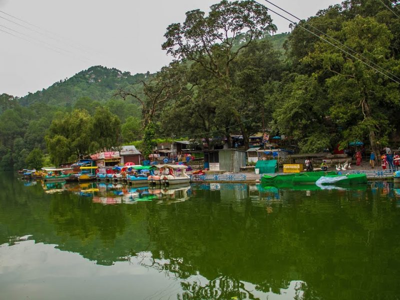
Trekking: located in the middle of dense oak and pin forest there are many trekking and hiking spots for adventure.
Rock climbing: Rock climbing is a great idea for getting fun in the sattal valley.
Night Trekking: Those who loves to go out at night for a walk or a group walk Night Trekking is the best choice for them in Sattal.
Boating: Having a 3km lake and boats in front of you then no one can resist
Kayaking: Kayaking is a great activity for solo fun. Exploring the whole lake on your own.
Rafting: Being in a group always excites you then rafting is a great idea for a group to have fun together in Sattal.
Mountain Biking: For bike lover or riders it is a chance to test your skills on mountain and have fun doing mountain biking
Angling: Sitting in the bank of sattal watching the lake having an angle on the hand is a dream location for fishing lovers.
Best Time To Visit Sattal
Winter: October to June is the best time to visit sattal. This time of session the upper Himalayan Birds migrates to sattal. And you can experience snow fall in December to March.
Bedni Kund:
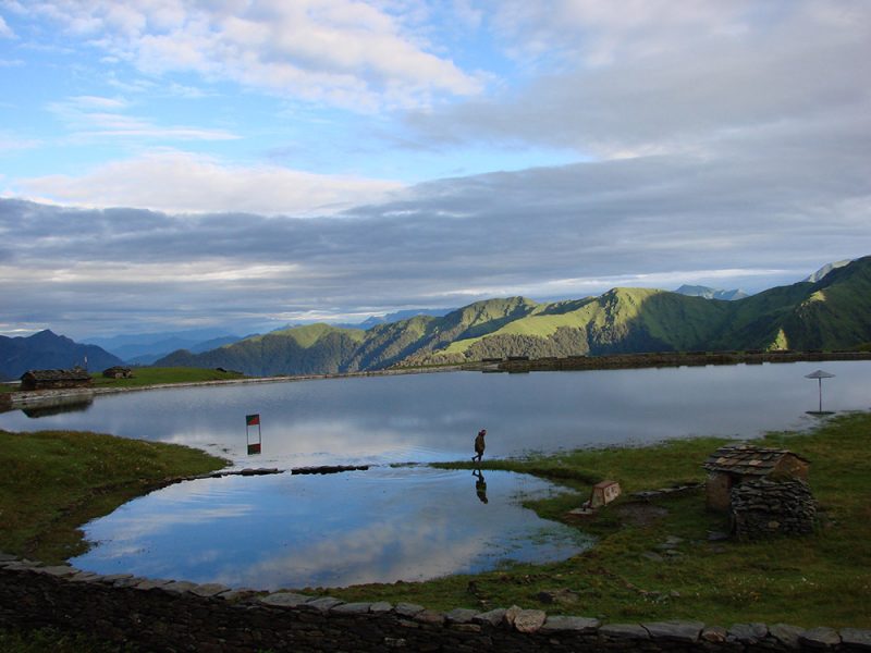
Planning to visit Bedni Kund? Check out Bedni Kund Image Gallery, with some of the most beautiful and latest Bedni Kund Pictures. These travel photos of Bedni Kund will help you plan your Bedni Kund tour.
About Bedni Kund
Bedni Kund is a part of the alpine meadows of Bedni Bugyal , which sprawls over 20 square km in the Chamoli district of Uttarakhand . This glacial lake is situated at an astounding elevation of 3,354 metres about 11,004 feet above sea level . The lake is adjacent to Ali Bugyal and is considered as one of the largest grasslands in Asia . The nearby cities are Nainisain , Kandara , Khatyari , Simli and Kausani .
Location & How to Reach Bedni Kund
Bedni Kund can be easily accessible from Lohajang Pass , which is well connected by motorable roads . The trek to Bedni Bugyal will pass through the verdant forests and tiny hamlets . From Lohajang Pass , the trek will descend for 7 km and further ascend for 4 km , finally reaching the Wan village . The hikers will have to cover a moderate trek of 9 km , which will pass through luscious rhododendron and beguiling oak forests.
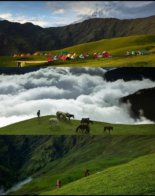
Check how to reach Bedni Bugyal
Read How to Reach guide for All Bedni Bugyal.
What is Bedni Kund famous for ?
Bedni Kund is popular place for following activities / interests – Adventure , Lakes
Bedni Kund in Ali Bedni Bugyal
Religious Importance of Bedni Kund Lake
Bedni Kund is a popular pilgrim site for the Hindus . it serves as a sacred pilgrim place where Ma Nanda and Shiva are worshipped by the devotees . The pilgrims carry the palanquin of Ma Nanda from Bedni Kund to Roopkund during the famous Nanda Devi Raj Jaat which happens once in twelve years
The famous Bedni Bugyal trek :
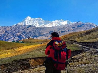
Bedni Bugyal , which is an enchanting meadow , is a popular trek among the adventure enthusiasts . Bedni Bugyal is en route to Roopend and falls near a quaint hamlet called Wan nestled in the Garhwal Himalayas . One can relish the majestic views of the Trishul and Nanda Ghunti Peaks which are clearly visible from here . The area around the lake is blessed with nature’s abundance , Brahma Kamal or ” Sauseurea Obyollata can be seen here . Location & How to Reach Bedni Kund
The Only Meadow Trek With Stunning Mountain Views
Out of the other meadow treks in our country — Dayara Bugyal, Gidara Bugyal, and Bhrigu Lake trek — Ali Bedni has the grandest of mountain views. That’s because of one thing — the sight of Mt. Trishul and Mt. Nanda Ghunti jutting right out of the meadows.
Jutting out doesn’t mean you see the tops of these mountains, you see the entire face — almost 6000-7000 feet of it — rising right in front of you.
The spring season is about to end on the Ali-Bedni Bugyal trek. Soon, green meadows will start peeping out from under the snow.
By summer, you see meadows carpeted with fresh grass.
The surprise of finding yourself in Ali Bugyal after trekking through dense forests is unbeatable. The moment you get out of the shades of the forest cover, you see acres and acres of green carpet sprawled out in front of you. Mt Trishul, stands tall against the blue skies, making for a formidable backdrop. Horses and their foals tear themselves across the turf in an uninhibited abandon while the cattle graze lazily on this bounty.
The walk to Bedni Bugyal from here is exhilarating! It is a walk that tempts you to take off your shoes and feel this carpet for yourselves. The Bedni Bugyal is another stop in this meadow country – a strip of vibrant green, overlooking the western valley. Popping right out of this meadow-like sentient, silent guards are the mountains of Trishul and Nanda Ghunti. If you climb the Bedni Top, other high risers of the imposing Chaukhamba range open up before you. These incredible settings make these twin meadows a must-do on the trekker’s bucket list.
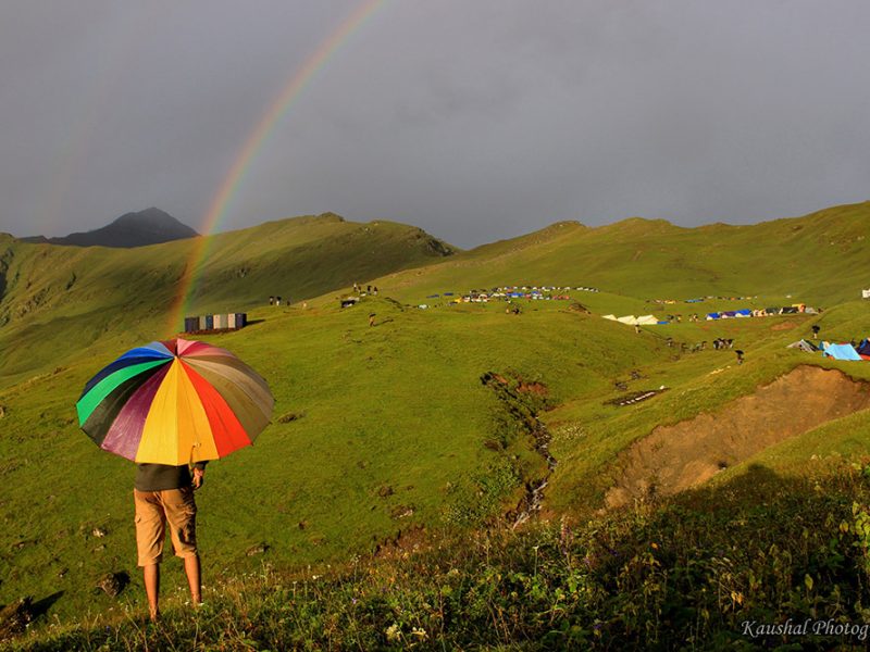
DAY 1
Reach Lohajung (7,624 ft)
Drive distance: 260 km | Drive Duration: 10-11 hours
Reach Lohajung; 10-11 hours drive from Rishikesh. Transport will be arranged from Live Free Hostel, Rishikesh at 5.00 am.
The cost of a cab – Is rs 7,000/- per vehicle and the cost of a Tempo Traveller is Rs 10,500, which is to be paid by trekkers directly to the driver.
DAY 2
Trek from Lohajung (7,624 ft) to Didna (8,045 ft)
Trek Distance: 8 km | Trek Duration: 5 hours
Trek gradient is moderate-difficult. A steep descent from Lohajung and a steep ascent for most of the trail that levels out only in the last 100 meters. Carry sufficient water. You will cross streams intermittently where you can refill your water bottles.
DAY 3
Didna (8,045 ft) to Abin Kharak (11,417 ft) via Ali Bugyal (11,640 ft)
Trek Distance: 9.3 km | Trek Duration: 6 hours
Easy to moderate. Gradual ascent for almost 3 km and a level walk on an undulating meadow, followed by a short descent to the campsite. Carry sufficient water. You will cross streams intermittently where you can refill your water bottles.
DAY 4
Abin Kharak (11,417 ft) to Gehroli Patal (10,479 ft) via Bedni Bugyal (12,550 ft)
Trek Distance: 5.60 km | Trek Duration: 4 hours
Easy. Rolling meadows followed by a slightly steep ascent to Bedni Top and gradual descent to Gehroli Patal. Carry sufficient water. No water sources are on the way.
DAY 5
Gehroli Patal (10,479 ft) to Wan (8,412 ft). Drive from Wan to Lohajung (7,624 ft)
Trek Distance: 6.30 km | Trek Duration: 5 hours
Moderate. This day is full of descent for almost 2,500 ft. Carry sufficient water. You will cross streams intermittently where you can refill your water bottles.
DAY 6
Drive from Lohajung (7,624 ft) to Rishikesh
Drive distance: 260 km | Drive Duration: 10-11 hours
Reach Rishikesh; 10-11 hours drive from Lohajung. Transport will be organized by Indiahikes. Cab cost – Rs.7,000 per vehicle, for an SUV and Rs.10,500 per vehicle, for a Tempo Traveller which is to be paid by trekkers directly to the driver.
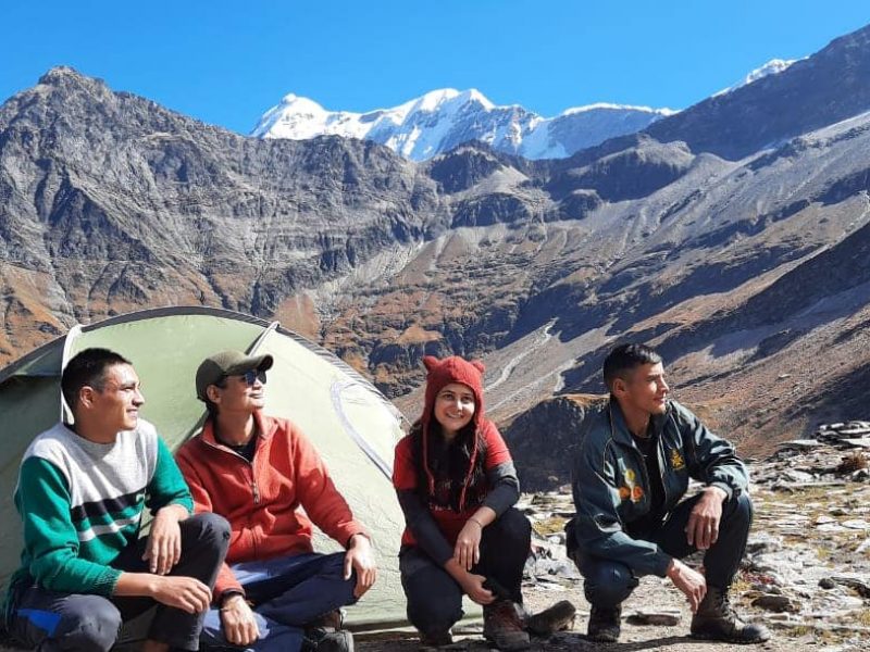
IMPORTANT POINTS
Please note: Twin sharing tents may not be available in May, June, July and August. This is because raw materials for making tents are sourced from different countries. But their export has been affected due to international unrest. This has led to a global shortage of tents. Having said that, you’ll still have comfortable space as these tents have been designed to accommodate three trekkers.
Bisurital :
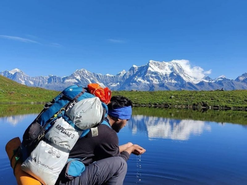
Adventure Camps in Bisurital Lake housed in the beautiful North Indian state, Uttarakhand offers a huge platform for its guests. Visitors can experience adventure and relaxing activities in the place. The destination also offers beautiful scenic landscapes of nature. In the lap of Mother Nature, travelers have the refreshing opportunity to feel the pleasant surroundings of nature. Far away from the polluted city life, this adventure camp in Bisudital Lake provides an amazing opportunity for the travelers to enjoy the beauty of nature more closely. Individuals visiting these adventure camps in Bisudital Lake can pass through the dense forests. Also, visitors can interact with the nature elements like rivers, waterfalls, streams and more. Bisurital trek camp is situated in center bit of Mandakini valley on Alpine locale. All out trek is of 60 km climbing and plunging the two sides. Most elevated rise point on this trek is Bisuri Dhar (located at about 4100m altitude) which is encompassed by high glades and snow clad mountains.
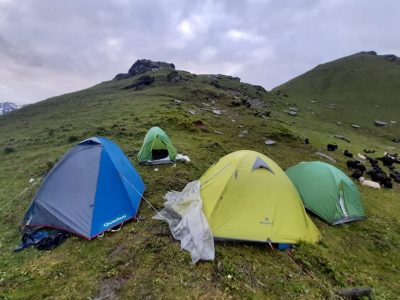
Bisurital adventure camp is as yet immaculate and disagreeable trekking goal, climate here remains completely clear, more often than not temperature is delicate with the exception of snowfall season. It’s on notoriety furnishes high likelihood to get to know uncommon and imperiled types of Himalayan natural life. Being a rarely popularized outing destination, it provides a gentle climate which makes the place more catchy and attractive for the tourists. The trek passes crossing thick backwoods, waterways, rivulets, streams, cascades, high glades and uncommon natural life and so forth. Gangotri more prominent Himalayan reaches seems just close by separation from Bisurital. If you want to experience unforgettable moments of your life, then best time to visit Bisurital Lake is from walk to december. This high voltage adventure trekking begins from Chopta and the trek goes through Kedarnath Wildlife Sanctuary.
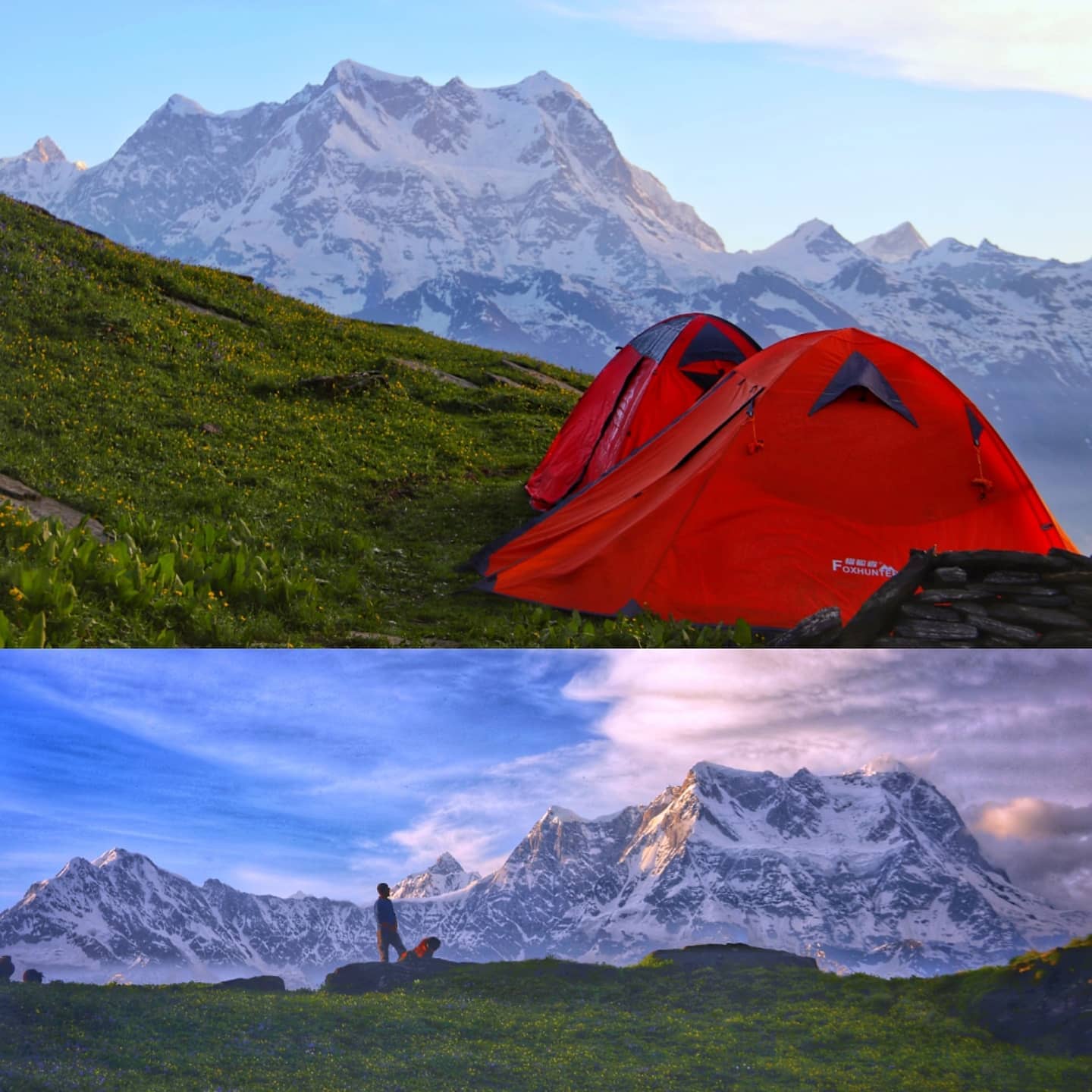
The Bisurital adventure camp allows you to live a new world close to nature’s touch in the lap of Mother Nature. So, pack your bags and lit up your enthusiasm to explore this nature’s beauty with pleasant surroundings.
Bisurital trek is located in middle portion of Mandakini valley on Alpine region. Total trek is of 60 kilometre ascending and descending both sides. Highest elevation point on this trek is Bisuri Dhar (4100 metre ) which is surrounded by alpine meadows and snow clad mountains.Bisurital is still untouched and unpopular trekking destination, weather here remains crystal clear, most of the time temperature is gentle except snowfall season. Its on popularity provides high probability to get acquainted with rare and endangered species of himalayan wildlife. The trek passes crossing dense forests, rivers, rivulets, streams, waterfalls, alpine meadows and rare wildlife etc. Gangotri greater Himalayan ranges appears just in hand distance from Bisurital.best time to visit Bisurital is from march to december. Trekking starts from Chopta and the trek passes through Kedarnath Wildlife Sanctuary.
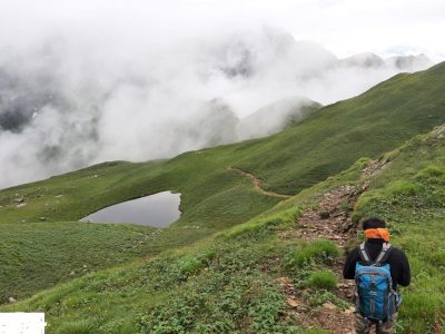
Suggested Bisurital trek Itinerary
Day 1 : Rishikesh to Chopta ( 190km drive )
Day 2 : Chopta to Chitra Gufa ( Chitray Gumpha ) ( 15 km trek )
Day 3 : Chitra Gufa to Bisurital ( 15 km trek )
Day 4 : Bisurital to River Akash Gamini ( 15 km trek )
Day 5 : Akash Gamini to Chopta ( 15 km trek )
Day 6 : Chopta to Rishikesh ( 190km drive )
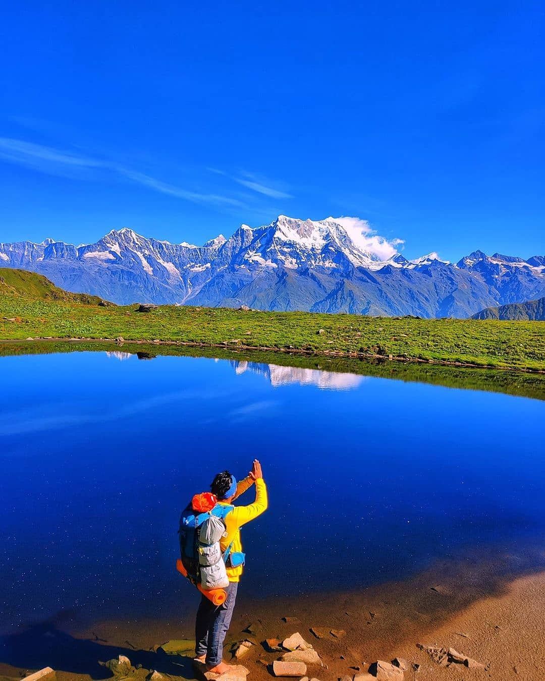
Note : The trek also starts from Sari Village as well , covering both Deoriatal and Rohini Buygal as well . On on return , you come down to Chopta . If you have one more day , you can also visit Tungnath and Chandrashila as well.
Deo Tal :
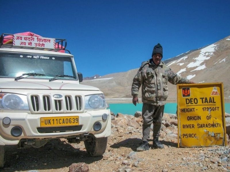
The Origin of Sarasvati River Deo Tal is a sacred lake atop Mana Pass, it is considered very holy since this lake is believed to be the origin of the Mythical Saraswati River. You can also see Rajas Tal and Nag Tal before Deo Tal on either side of the road. Deo Tal is just 3 kms before Mana Pass Zero Point,This lake is surrounded by icy peaks and remains frozen all year round except for the month of September. In Sanskrit, the lake stands as ‘Lake of The Gods’
About Deo Tal Mana Pass
Deo Tal is alternatively known as “Dev Tal” or “Lake of Lords” is a pious and mesmerizing lake in Mana Pass that is located on the India-China border. Mana-pass is the highest motorable pass in the world. Deo Tal Mana Pass is a sacred place as there is a belief that the Saraswati River is originated from here. Deo Tal Lake remains frozen the entire year except for September month.
History
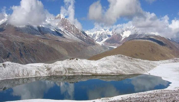
In previous times Mana Pass was a trade route between Uttarakhand &Tibet. This trade route was closed by the Chinese in 1951. The route was later used by pilgrims and travelers under the agreement between India and China.
Overview of Deo Tal Mana Pass
Altitude-5,632 m
Location- Chamoli, Garhwal (India-China Border)
Longitude -79.4147°E
Latitude -31.0696°N
Mountain Range-Himalayas
Best Time to visit Deo Tal Mana Pass
The best time to visit Deo Tal Mana Pass is the months of August & September.
How to reach Deo Tal Mana Pass
To reach Deo Tal Mana Pass, one has to start the journey from Badrinath Dham. Once you get to Mana village you have to fulfill some basic formalities and verify the permits to begin your journey. The roads are not in perfect condition therefore driving motorcycles and vehicles having superior ground clearance is advisable.
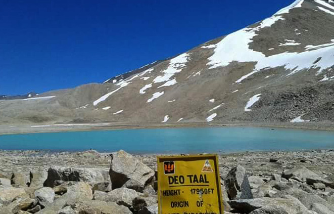
Route- Badrinath-Mana Village-Gastoli-Rattakona-Jagraon-Deo Tal Mana Pass
Travel Tips for Deo Tal Mana Pass
Travel tips for Deo Tal Mana Pass are very useful for a smooth, safe, and enjoyable journey.
Tourist attraction in Deo Tal Mana Pass
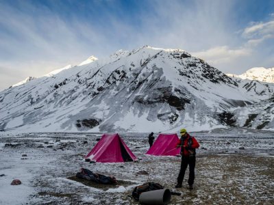
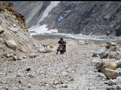
.
Gandhi Sarovar Taal :
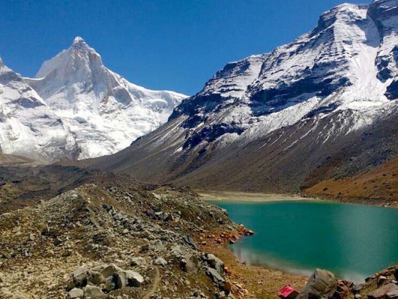
is also known as Chorabari Tal/Lake because it emerges from Chorabari Bamak Glacier which is situated on the lapse of Kedarnath temple. The Gandhi Sarovar is situated at a height of 3900m (12,800ft) above the sea level. Earlier this lake was named as kanti Sarovar, but in 1948 the Ashes of Mahatma Gandhi was found in the lake which resulted in changing the name of the lake to Gandhi Sarovar.Due to this many devotees taking interest in coming to this beautiful lake.Gandhi Sarovar is also famous for it’s kathas like in early time Lord Shiva uses to give Yoga lessons to Saptarishis in this lake. Now a days travelers coming to kedarnath dham usually go to gandhi sarovar also as it is sitauted in the middle of the beautiful himalayas and in the route to the lake you will also find a beautiful waterfall which is named as Madhu Ganga Waterfall. Gandhi sarovar is the same glacial lake which causes the tragedy in kedarnath temple on 2013, the heavy rainfall and the breakage of the glacier rises the water level by 7m (23ft) which breaks the dam and due to which this tragedy happened,Gandhi Sarovar is situated on the lapse of kedarnath temple,Trek distance from Kedarnath temple to Gandhi sarovar is around 3kms long but if you are coming directly from Gaurikund than the trek distance increases by 19kms.Gandhi Sarovar trek started from the Iron bridge of Kedarnath which comes before the kedarnath temple and takes you directly to the gandhi sarovar,Morning is the best time to visit gandhi sarovar because wheather changes here frequently.
Summers is the best time to explore the Gandhi Sarovar.
Chorabari Tal, Kedarnath
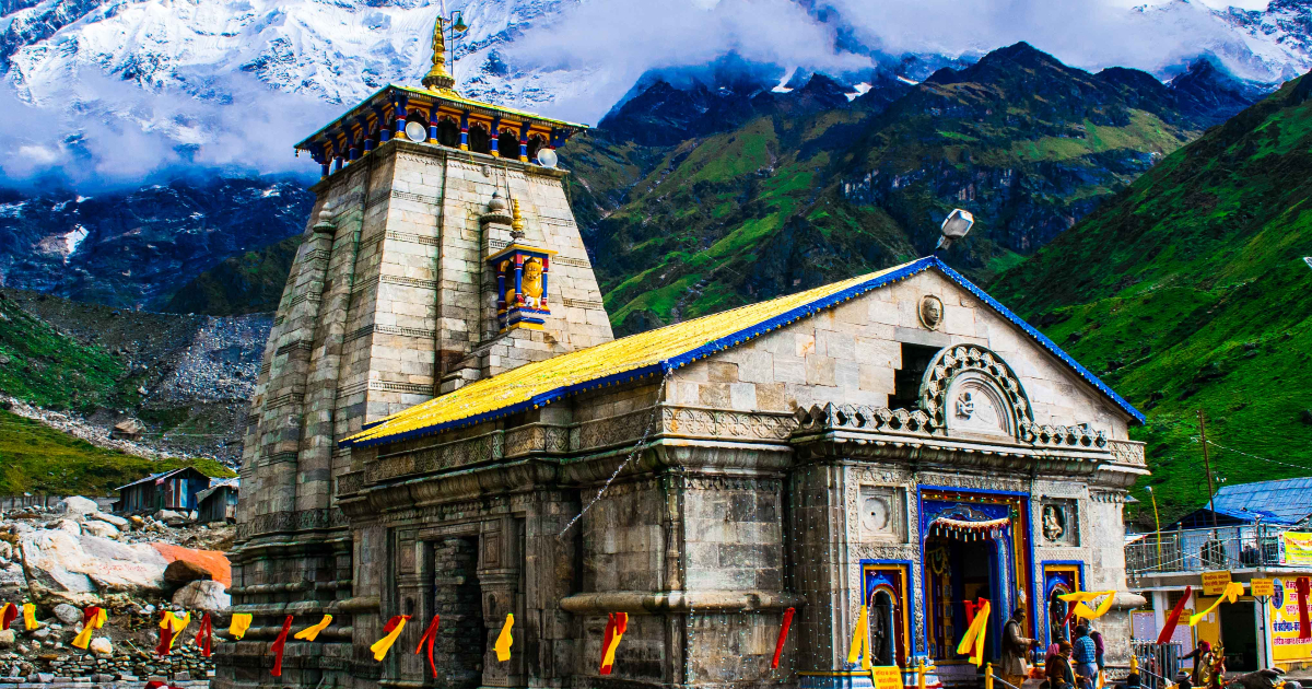
Visitor Information
Chorabari Tal
is a scenic wonder situated at a nearby distance from kedarnath It is a snout of Chorabari Glacier and is an essential resource for Mandikini River, an offshoot of Alaknanda River. It is quaintly at the opening of Chorabari Barnak glacier and is located amidst the Kedarnath and Kirti Stambh mountain ranges. It is at the height of 3,900 mts above sea level. A trek to this beautiful lake is what enriches one’s journey here and add a relishing endeavor to complement your itinerary with.
Traveler Tips
Things to Do
Availability of Guides
Guides will be available at either Gaurikund or Kedarnath and don’t forget to continue your journey with someone who knows about the place and can assist you in case guides are not accessible to search here
Bhairavnath Devta temple: This temple is located on the way to Gandhi Sarovar and it is famous for it’s unique Culture.
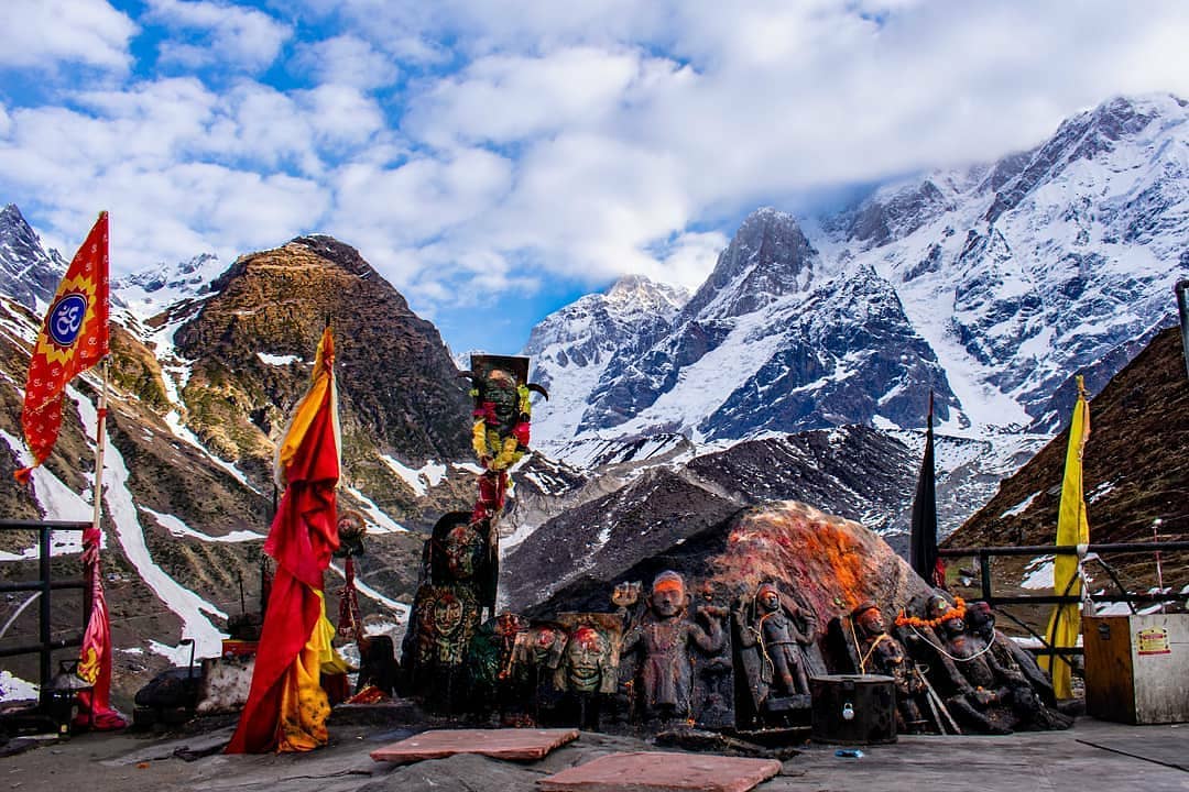
Best Time to Visit
Since, Kedarnath Temple is open from May to October, so try to plan your travels around these months and if you are not in for visiting this temple then Chorabari Tal can be reached all around the year.
By Bus: Nearest bus stand is Rishikesh you will get the direct bus to gaurikund from rishikesh bus stand.
By Train: Nearest Railway station is Rishikesh and dehradun, from here you can book taxi or you can go by bus also to Gaurikund.
By Flight : Nearest airport is Jolly Grant Airport from here you can book the taxi which takes you directly to Gaurikund.
By Helicopter: You can also choose this option as various Government and Private companies started this helicopter services directly to kedarnath temple and than you can go by trek to Gandhi Sarovar.
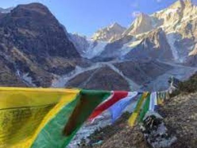
Interesting Facts and Trivia about Chorabari Tal
Nearby Attractions
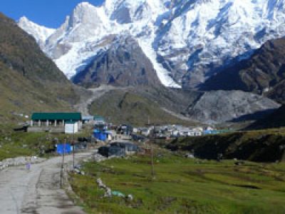
Nearby Restaurants
Since Chorabari Tal is located at a high altitude, there are no eateries or restaurants, so keep food packets and water bottles with yourself on your trek here.
Thus, Chorabari Tal is a wonderful place to enjoy the allure of Himalayas and let yourself be soaked in the gripping aura and spend time with your loved ones here. But, in all this adrenaline rush, make sure that you keep all the required equipments and other things, to turn this trip into a satisfying endeavor. While Chorabari Tal is a must to visit, Kedarnath Temple comes in the way to this lake, and is equally important to feel the divine blessings of this eminent temple. Hence, keep a guide with yourself, along with all essentials, and no matter what you are imagining this lake as; Chorabari Tal will surely leave you in awe during your visit here. You can turn your journey into a picnic at this lake and just soak in the beauty this place boasts itself of!
Kagbhusandi Lake: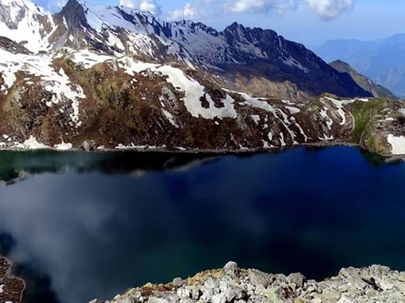
The Kagbhusandi Lake or Khagbhusandi is a small emerald green lake situated at an altitude of 5,230 metres near Kankul Pass (5,230 m) almost a km in length. This lake is cocooned in the Garhwal Himalayas of Uttarakhand state. It is a paradise for the nature lovers as they can admire the beauty of the sublime Neelkanth, Chaukhamba, Thailya Sagar, Brigupanth and Nar-Narayan Peaks during the trek.
Kagbhusandi Tal is a beautiful high altitude oblong lake adorned with emerald green waters and awe striking mountain views. Perched at an elevation of 4730 m, this glacial lake is cradled at the bottom of Hathi Parvat (6730 m), one of the most prominent Himalayan Peak of all the Six Thousanders. It’s water has a striking greenish tint while it’s banks are overrun by flower blooms in various shades- pink, mauve, orange, purples, crimson, ochre, rust and greens. Kankul Khal (Pass), 4630 m above sea level is the gateway for this lake. This sacred lake is 500 m long and 250 m wide.
Due to its remoteness there is a very high possibility of coming across wildlife, especially bears. This trek offers panoramic views of the several Himalayan peaks in the region. One can have a clear view of Neelkanth, Hathi Peak, Chaukhamba, and Nar-Narayan Peaks while moving towards Kagbhushundi Tal. The area comes under the Nanda Devi Biosphere Reserve, a UN world heritage site for natural diversity.
The trail of this amazing trek initiates along the most visited Valley of Flowers, veering off to east of Bhyunder Village. There are so many beautiful meadows in route to Kagbhushundi from Bhyundar. Kargila, Semartoli, Bankbara, Dang Khark, and Raj Khark are the most beautiful campsites in the region. These grasslands are used by the nearby villages for grazing their livestock and used as pasture lands. The route to Kagbhusandi Tal veers through different terrains from dense and colorful forest of pine and maple, to pristine glaciers and gushing streams, making this offbeat trek a fascinating experience for trekkers.
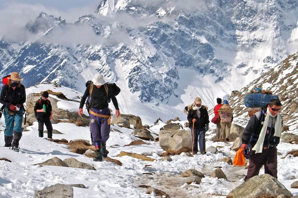
Apart from the splendid lake, the other attraction of the trek are two huge irregular rocks on a spur of Hathi Parvat, often described as crow (Kaga) and an Eagle (Garuda). According to the local folklore, the crow is animatedly conversing with Garuda on the affairs of the universe. Another version has it that a learned Brahmin of Ayodhya once incurred the wrath of the sage Lomas who lived near the lake, and was changed into a crow by the sage. Several such mystic stories make this trek all the more fascinating. As the journey involves walking long distances across glacial moraines and over slippery rocks deep in the Garhwal Himalaya, it is still less explored and is also considered as one of the toughest treks in the Garhwal Himalayan region.
Duration: 7 days
Best Season: May, June, Sep and Oct
Level: Moderate to Difficult
Highest Point: 5230 m
Weather: Nights are cold and day temperature is pleasant during the season.
Temperature: (-2°C to 15°C)
Starting point – Dehradun
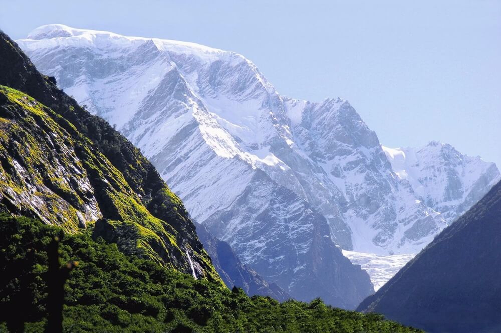
Must Read about Kagbhusandi Lake Trek
Duration: 7 days
Best Season: May, June, Sep and Oct
Level: Moderate to Difficult
Highest Point: 5230 m
Weather: Nights are cold and day temperature is pleasant during the season.
Temperature: (-2°C to 15°C)
Starting point – Dehradun
(7 km)
Day 7 – Govindghat to Dehradun (315 km) (8/9 hours)
On the first day of your trek, you’ll be driving from Rishikesh to Joshimath. The entire journey takes you through the mountain side, with the river Ganges flowing below you. You also get to witness the confluence of rivers Alaknanda and Bhagirathi to form river Ganges.
Govindghat is located in Chamoli district of Uttarakhand. This place is a base for many treks including Kuari Pass, Pangarchula Peak, and Valley of flowers.
Start early and mark your way towards Bhyundar village, the starting point of the trek to Kagbhusandi Lake. Though, there is steep climbing for the first hour of the trek, but it is easier in gradient later on. You will encounter rocky areas, glaciers, shrubs, rivers, etc on the first day of your trek. Enjoy the sounds of gushing water of River Alaknanda, while you move forward. The trail after Bhyundar village passes through dense bear-infested rhododendron forests. It is here that you’ll have a first glimpse of Hathi Parvat while moving towards Roopdhungi. Overnight stay in tents at Roopdhungi.
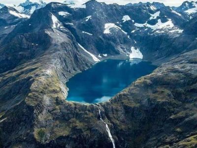
Post breakfast, we move from Roop Dhungi to Simartoli, and later to Raj kharak. The entire trail is beautiful and soothing to eyes. You will be walking on a colorful route with variety of flowers blooming in full blossom and snow-clad Himalayan peaks in the background. Passing through Kargil, Simartoli, Bankbara, and Dang Khark we camp at Raj Khark for the day. These are all beautiful campsites for trekkers. A lot of shepherds from the nearby villages use this area as pastureland to graze their livestock.
This is the most exciting day of our trek as we head to Kagbhusandi Tal from Raj Khark. The initial path to the lake is through green valley and beautiful meadows, later followed by climbing huge boulders and walking on narrow paths. However, the instant thought of the mesmerizing lake will keep you motivated through all the tough routes. On the way, you will witness stunning views of Neelkanth (6596 m.), Hathi Peak (6727 m.), Ghodi Parvat (6590 m.), Chaukhamba and Nar-Narayan Peaks. There is the wide variety of flora and fauna in the valley. You can see Brahma kamal, Myriad, Fen kamal and many more flowers. Once you reach the lake, you will be awestruck by the beauty of nature. Overnight at Kagbhusandi.
After a healthy breakfast, continue your journey to our next campsite. The 8 km route to Gounchha Udiyar is covered by sprawling green meadows, gushing streams, lofty panoramic views, and alpine forest. Do not forget to click some amazing pictures on this route. This is where you can capture the best of what the nature has to offer. Reaching Gouchha Udiyar take a stroll in the area to meet the villagers and get a glimpse of their nomadic and peaceful culture. Take rest after a hectic day at a makeshift tent in Gounchha Udiyar.
Put on your hiking shoes and begin your journey to Painka village, the last day of our on foot excursion of the trek. After reaching Painka, we head towards Govindghat for overnight stay. Painka is a small and beautiful village located in the lap of Garhwal Himalayas. The trek passes through the rocky and narrow paths, along with some dense forest area. You’ll also come across the spring coming from Barmal Peak. The beauty of this place will leave you astonished and you would definitely want to visit here again. The blissful walk ends on reaching Govindghat. Check in at the guest house arranged by us. Enjoy hot dinner and relish the entire evening.
This is the last day of our trip and the sentiment of the trekking experience is unforgettable. We take back some amazing memories and incredible moments to rejoice for the rest of our life. Board our awaiting vehicle and drive back to Rishikesh. Lunch on the way and trip finishes at Rishikesh.
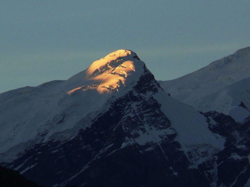
Read More on Kagbhusandi Tal – Kankul Pass Trek
Water Availability
Carry your own water as well during the trek.
Camping/Shelter
Since you are on a trekking trip, you will be carrying your own camping tents.
Food Availability
You will not find any place to eat while on the trek. So make sure to carry your own food with you.
General tips and tricks
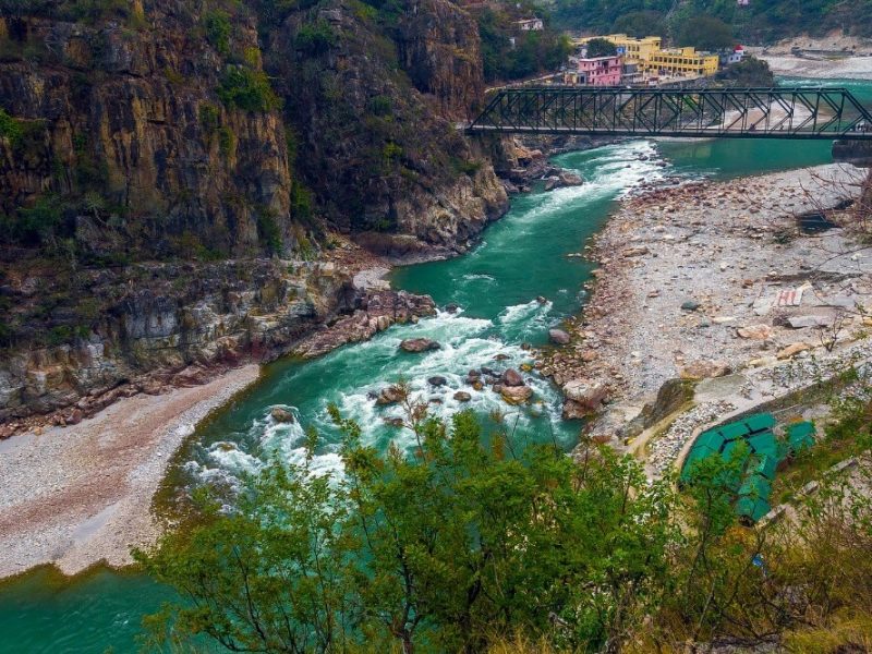
How to reach Kagbhusandi Tal – Kankul Pass Trek
Maheshwari Kund:
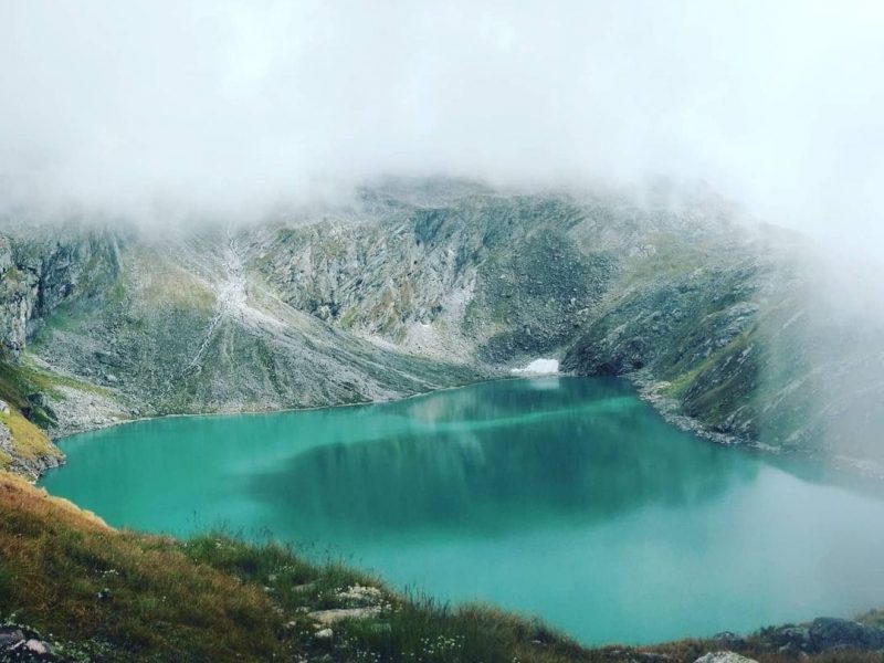
A beautiful place with a very fascinating legend attached to it, Maheshwari Kund is just a few kilometers walk from Munsiyari. Maheshwari Kund, as the name suggests, the lake is surrounded with such jaw-drop surroundings of magnificent and awe inspiring mountain peaks, with such different ieties of Rhododendrons with flowers in exuberant colors. The area itself boasts one of the greatest diversity of Rhododendrons across the world,The place retells many mythological stories where according to the legends the kund was cursed by a Yakshi who use to live in a small lake there, the place faced drought for several years. After the villagers apologized to the Yakshi for not letting him marry the sarpanch daughter and emptying the lake in form of revenge, the ritual is practiced even today. The kund is now is a pond offering nature in its absolutely virgin form where one can have that incredible view of Panchachuli Peak.
Visit Maheshwari Kund
Munsyari is a trekker’s paradise. It offers thrilling adventurous options coupled with amazing sightseeing views. Be it bird-watching, rafting, skiing, camping, wildlife-sighting or just trekking, Munsyari makes for a wonderful holiday option.
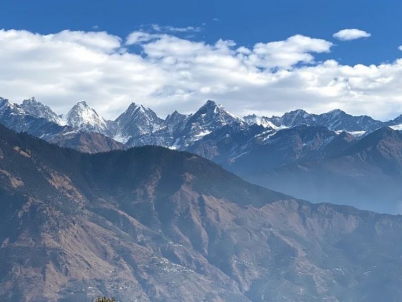
Munsyari is a trekker’s paradise. It offers thrilling adventurous options coupled with amazing sightseeing views. Be it bird-watching, rafting, skiing, camping, wildlife-sighting or just trekking, Munsyari makes for a wonderful holiday option.
The Maheshwari Kund is a charming lake skirted with rhododendrons and huge oak trees. As one walks uphill a couple of yards from the Munsyar Forest Rest House and takes the paved path to the right for nearly a 30-minute walk through a forest to reach a small meadow to the north of which lies this beautiful lake. Legend goes that the lake was the home of Yaksha, a demi-God who fell in love with the Sarpanch’s daughter. In a fit of rage, the villagers dried the lake to teach the demon a lesson. Yaksha cursed the villagers and the village had suffered for a long time from drought. When the villagers apologised to him, the curse got annulled and now stands a beautiful lake amid trees and plantations, to be appreciated by tourists who are left enchanted by its beauty.
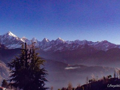
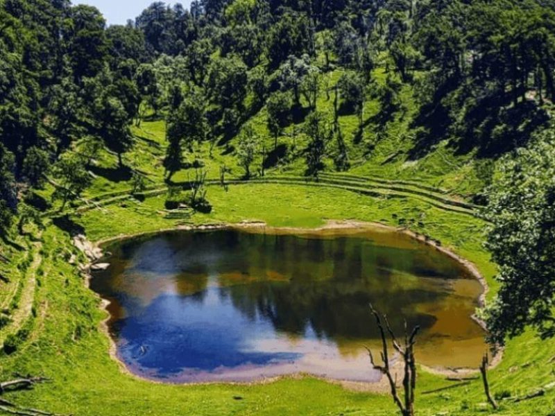
You can easily reach us here.
Airport – The nearest airport is Pantnagar Airport. From here, the distance of Maheshwar Kund is about 310 kilometers. You can quickly go by bus, car, or cab/taxi from here.
Train– Nearest railway station is the Kathgodam railway station. From here the distance of Maheshwar Kund Munsiyari is about 275 kilometers. From here you can easily go by cab/taxi or car easily.
By Road – You can easily book a taxi from Haldwani or Dehradun to Munsiyari.
Nachiketa Taal:
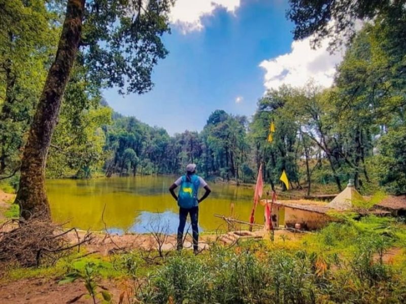
Nachiketa Tal Trek a Pictorial Lake in Uttarkashi
Lying amid dense forests of Oaks and Pines, Nachiketa Tal Trek is a lake on Bhagirathi River’s bank in Uttarkashi district of Uttarakhand at an elevation of 2457 m.
There is a number of fable treks and temples which are tourists’ attraction. This lake is beautiful under the forest
Nachiketa Tal Trek was named after the son of Uddalak
Beside this lake is a temple of Nag Devta and every year during the festival of Nag Panchami villagers visit this divine place. It holds a mythical story that this Lake was named after the son of Uddalak.
Nachiketa found the reality behind life and death at the age of 10.
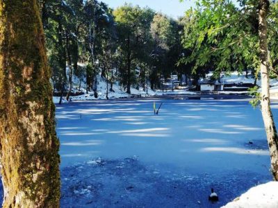
Panoramic views and Trail in Nachiketa Tal Trek
The clear views of Bandarpunch peak and many Himalayas mountain ranges are treated for the eyes and the place offers the great sight of high Himalayan peaks. The trekking distance is not much but the trail is through beautiful dense forests with some streams crossing the way.
Why to choose Nachiketa Tal Trek?
Before heading towards the itinerary, it is really essential to perceive the reason behind choosing Nachiketa Tal Trek.
See firstly, the trekking distance is a total of 06 km which is to be covered into 03 days. Yet, it comes under a moderate level of easy to moderate because of the things that this trek has to offers. These are:
This is easy trek No high altitude mountain sickness due to forthcoming of the forest region
The trail is easy for other treks. So, beginners can And families can easily do this trek.
You got to see so many heavenly bodies at one place like the panoramic view of the Himalayan ranges, meadows, lakes, pine forests, different variety of flora and fauna surpassing through bona fide Garhwali heritage and culture
During the winter season, this fascinating Nachiketa Tal remains covered in snow and the white sheet of snow makes it look like a magical wide snow-land.
And, in summers, the valley turns totally different and amusing because of meadows, wildflowers, and woods blooming in different colors
I think Do spare time in Interaction with our local’s team, and you will get to know about some of the ancient tales of Indian mythology and our local cultures, this is good ideas for trekkers
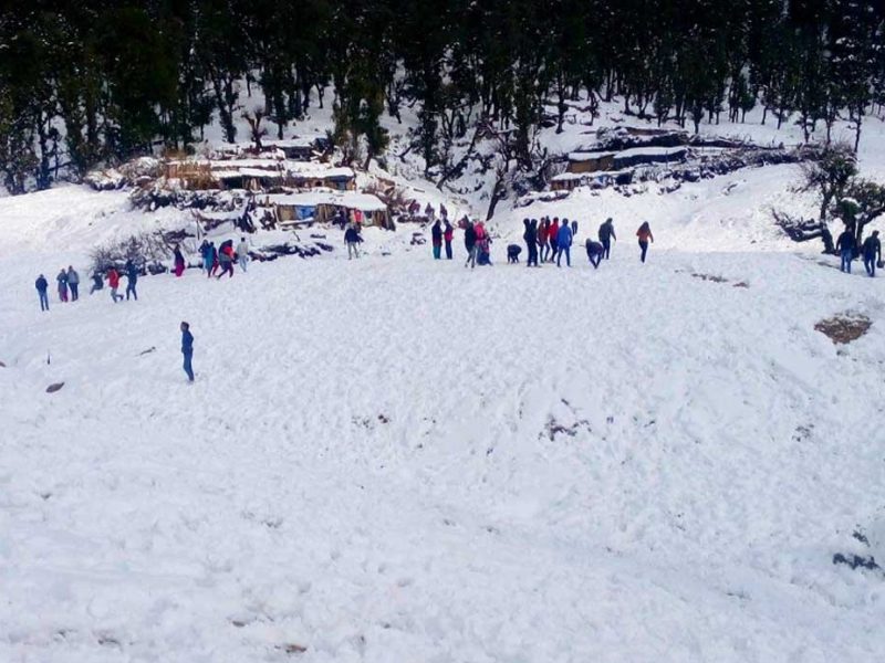
Key Points of Nachiketa Tal Trek
Duration: – 2 Nights 3 Days
Base camp: – Uttarkashi
Summer Temperature: – Day (8°C to 15°C) Night (5° C to 12° C)
Winter Temperature: – Day (2°C to 5° C) Night (-1°C to -3°C)
Nachiketa Tal -Altitude: – 2,443 Meter)
Best Time: – All year
Trek Level: – Easy
Trek distance: – On foot 06 Km – By taxi 344 km
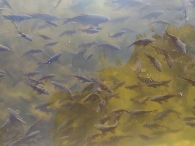
The aquatic ecosystems are extremely important to mankind as they have several uses including drinking water supply, irrigation, navigation, recreation etc. and also serve as sources of organic productivity. Water may be stagnant in the form of lakes, ponds, pools etc. Lakes are naturally formed due to depressions on the earth surface that become filled with water and have diverse geological origin. High altitudes lakes are not exposed so much to pollution sites and are extremely oligotrophic in nature. The ever increasing populations and rapid industrial growth in the present as well as tourist influx are major contributors in influencing the physico-chemical properties of most water bodies. The primary production in high altitude lakes is low due to harsh abiotic conditions.
The land of Uttarakhand comprising the Garhwal and Kumaon regions has many charms to offer. It has abounding mountains, rivers, forests, flora and fauna. The Garhwal Himalayas in addition to a complex network of fluvial ecosystem are blessed with a large number of beautiful lakes. Beside this, many lakes are situated in the lap of the region that adds to the grandeur and scenic beauty of the region.
Garhwal Himalayan lakes occupy a significant place in Hindu culture being of both religious and mythological value. Saints and people from all religions trek long distances to worship such holy lakes. But a drastic change in water quality has been seen recently in these lakes due to increased anthropogenic interference. The water level has also receded rapidly in these lakes. These ecosystems are influenced by the activities outside and by inadequacy of support and participation of local people in their conservation.
The Nachiketa Tal–
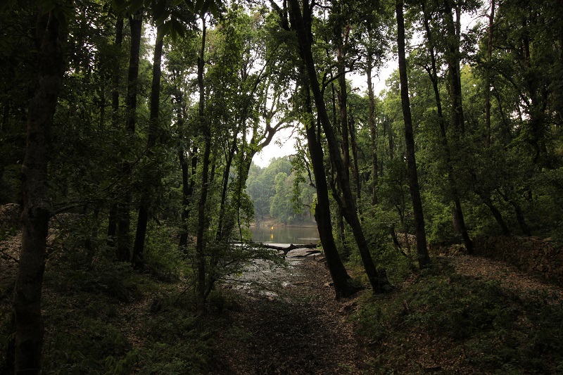
All around it is an aura of peace and purity. The lake has captivating surroundings with forests all around. Here, the unholy are said to become holy and the holy, holier still. The lake is located between latitude N 300 27’ and longitude E 710 72’ with the altitude of 2680m high above sea level to northeast of Uttarkashi district of Uttarakhand and about 200m long and 30 m wide at its broadest points having the depth of 7 m. It is elliptical in shape and medium in size and has no discernible inlet as well as outlet. Natural drains are the only source of water for the lake which are managed by the luxuriant vegetation around the lake. It is quite possible that the lake is a depression in a possible fissured zone which may open into the under water springs feeding the lake continuously.
The lacustrine ecosystem of Nachiketa Tal is an important natural resource and particularly valued for its aesthetic and recreational value. Vegetation cover that provides an enchanting view to the nature lovers; surrounding the lake and dominating species are Quercus leucotrichophora, Q. semicarpifolia, Q. floribunda, Rhododendron arboreum, Myrica esculenta, Lyonia ovalifolia, Taxus baccata, Alnus nepalensis at top canopy while the ground vegetation is dominated with Rubus ellpticus, Berbaris aristata, B. asiatica, B. lyceum with several medicinal herbs viz.Potentila fulgens, Viola betonicifolia, Bergenia ciliata, Rosa brunonii, Ajuga bracteosa, Ocimum gratissimum etc.
Degradation
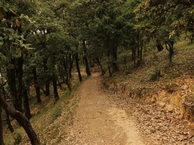
Ecosystem management is an emerging ecological philosophy and approach to solving the problem of environmental degradation. It is a goal driven approach to restore and sustain healthy ecosystems and their functions and values. Steps should be taken to gain better insight into the functioning of such kind of unique ecosystems and conserve them for posterity. Professionals in limnology and water management help to bring understanding and extent to all concerns that water problems focus on both the quality and quantity of freshwater resources. Land degradation is one of the major problems in the management of high Himalayan lakes. During Monsoon when rain strikes, the zonal turbidity increases which is the result of sediments addition from sites. Various forms of environmental perturbations affect quantity and quality of inland water due to increasing run-off, erosion and sedimentation. These are some of the major factors responsible for the degradation of lentic environment of Nachiketa Tal.
Degradation of this aquatic ecosystem is one of the most pressing issues of the environmental concern of the present time. Lack of scientific interest and knowledge has led to the destructive use and faulty management of this ecosystem. It is quite obvious that if a system fails to function, the consequences can often be unpleasant, expensive and irreversible. “Lakes” depending on their spatial position, size and biota, perform a number of ecological functions, and accordingly have different value for human beings. Unlike the lakes of other parts of the world, high altitudes lakes have different kinds of problems. Most of these lakes are acidic and ultra-oligotrophic to oligotrophic in nature. These lakes are very sensitive to the changes caused by anthropogenic activities. The major factors responsible for the degradation of the lacustrine ecosystem of the Nachiketa Tal are as follows:
Tourist interference
![]()
Although the lake does not have any point source of anthropogenic pollution but it is largely affected by the activities of tourists. Every year, the lake is visited by a number of school/college students during autumn and summer breaks. These groups stay at the lake for two to three days. They throw solid waste and plastic bags here and there in the periphery of the lake. Digging of adjacent catchment for installation of tents not only accelerates the soil erosion but also damages the aesthetic beauty of the lake.
Meddling of local people
Problems multiply when local people interfere in the catchment of the lake. Removal of vegetation cover from the catchment area of lakes produces ecological problems such as reduction of allochothonous material available to lakes and loss of a “filter system” for material and suspended particles. Disappearance of forest deprives waterfowl and other wildlife of food and shelter. Thus the function of a “buffer zone” between terrestrial system and lake is impaired. Increased siltation of water is another consequence of deforestation. The front cover of the lake experiences frequent interferences by local people to meet their demands of fuel and fodder. It has severe repercussions; it does not only destroy the old plants but also hampers the growth of young saplings and seedlings at the forest floor.
Religious Assembly
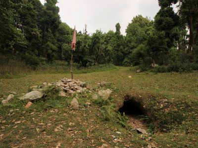
There is large congregation of people around some of the lakes in Garhwal for fulfilling the religious faith. On the day of Baishakhi, thousands of people from Garhwal used to assemble at the bank of Tal (lake) every year and take holy bath in lake water to perform religious rituals.
Scope for management and development
Although the lake does not have any defined source of anthropogenic pollution yet it is largely affected by the tourist activities and interference by the local people in the catchment of the lake. Considering various aspects of degradations following sets of suggestions are recommended for the sustainable management and development of the lake:
Scientific agencies/NGOs should be appointed for regular updating of information on water quality and ecosystem functioning issues.
The information on the values and contribution of lake towards sustainable development should also be collected.
In order to restore ecosystem services, local people should undertake efforts to promote the growth of new vegetation cover, reduce litter and other vegetative material on the floor which ultimately detiorates the rate of humus formation, it decreased the pH of the lake making it more acidic during late summer. Therefore, a comprehensive plan should be developed to bring the catchments of the lake under good perennial vegetative cover.
The inflow of sediments from this zone must be controlled by mulching the zone under a good cover of grass or by some mechanical measures. This will help in maintaining the quality of ecosystem of the lake for a long run.
The region is well known for tourism throughout the country and also abroad for its unexploited natural beauty, religious and mythological values. The Nachiketa Tal, one of the largest lakes of Garhwal Himalaya is most attractive, situated centrally in Garhwal Himalayan zone is under the management of forest department. Scientific management can turn these aquatic ecosystems into a tourist resort for attracting the nature lovers, wildlife –watchers, trekkers and anglers which will ultimately strengthen the state economy.
Short Itinerary of Nachiketa Tal Trek
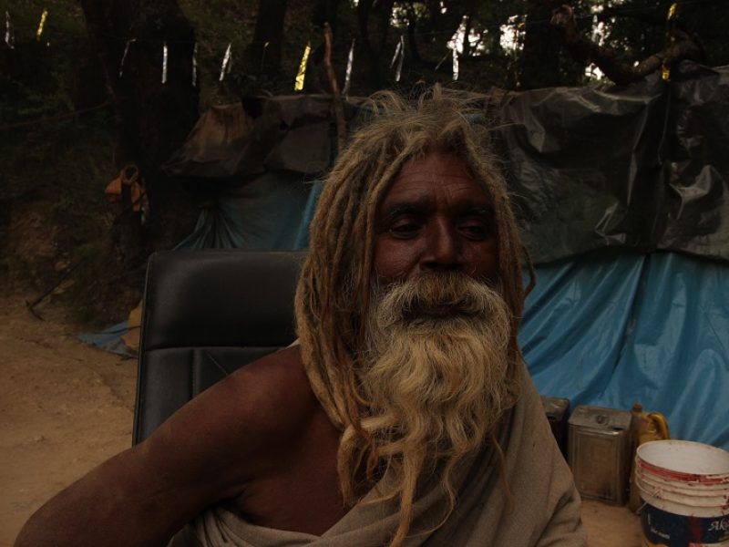
Day 1:-Pickup to you from Dehradun railway station – Drive to Uttarkashi – 150 Km (6/7 Hours) (3,799 feet) overnight stay Hotel
Day 2:–Drive from Uttarkashi Chaurangikhal (22 km) (1/2 Hours) and trek to Nachiketa Tal (2,443 Meter) (3 km) Explore the beauty of Himalayas back to Uttarkashi
Day 3:-Drive from Uttarkashi to Dehradun by taxi (150 km) (6/7 Hours)
Nainital:
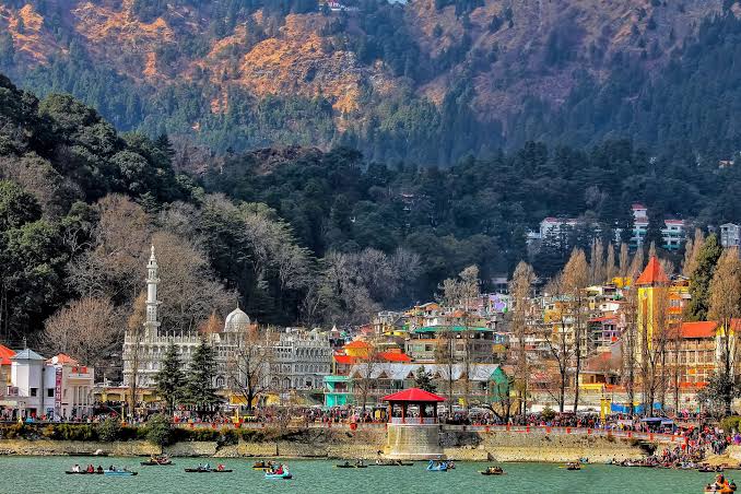
Best time to visit: Through out the year. However hill stations are visited during May to July when it is summer in plains.
Nainital is a popular hill station in North India situated in Kumaon region of Himalayas and is located in the state of Uttarakhand India. Nainital is at a height of 2,084m above sea level is one of the important tourist destination in India. It is also called as lake district of India.
It can be said that Nainital is a paradise for nature lovers. The hills surrounding the lake gives a mesmerising view to the visitors. Nainital is separated into two parts by the lake. The southern side is called as Tallital and the northern part is called as Mallital.
History of Nainital
There are many stories on how Nainital got its name. Nainital is a very old place known from ancient times. The Nainital Lake has a mention in the Skanda purana as tr-irishi sarovar. The story goes here as. Ones three Rishis (sage) named Atri, Pulastya and Pulaha visited Nainital after a pilgrimage. They were very thirsty and searched for water. No water was available in the entire city, hence they dug a hole and diverted the Manasa sarovar water to Nainital. Soon the hole got filled with water which is now the famous Nainital Lake.
Another mythological story related to Nainital is the King Dhaksha was performing Yagna and he did not invite his daughter Parvati and her husband Lord Shiva. Parvati who considered this as an insult to her husband jumped into the Yagna fire and killed herself. Lord Shiva while carrying her dead body to Kailash Sarovar one of her eyes fell at this place and hence it got the name as Nainital. Naini means eye in Hindi.
Nainital was a very famous hill station during British period. In the year 1817 the then British commissioner of Kumaon GW Trail was the first European to visit the place. Due to religious sanctity and to maintain the virgin beauty of the place Traill did not mention about this place to anyone. Later after 20 years P.Baron, a trader from British found the lake while he was finding way out of the hills, he was mesmerised by the beauty of the hill station and decided to stay there.
Best time to visit Nainital, India
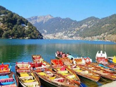
When is the Best Time to Visit Nainital?The climate remains pleasant all year long, which makes it ideal for most tourists. Below is the season wise breakup of the weather in Nainital, to help you plan your family vacation.
Season Avg Min Temp Avg Max Temp
Summer 7°C 27°C
Monsoon 15°C 25°C
Winter 0°C 15°C
Nainital in Summer (March to June):
Summers here stretch from March till June, and this is considered the best time to visit Nainital. Not surprisingly, it is also the peak season for tourists. Nainital’s weather is pleasant during this season, ranging between 7 degree Celsius and 27 degrees Celsius. During the day, the climate remains enjoyable, so you can carry light summer clothes if you plan on staying out in the sun. However, remember that temperatures can drop down to the single digits in the night, and while it may not be freezing cold, carrying a jacket or cardigan can ensure you stay warm and comfortable. Since tourism reaches its peak at this time, the resorts near Nainital get booked out exceptionally quickly. So, if you are making plans to visit this hill station during the summer, finalise your accommodation option as early as possible. You can cover most of the sightseeing attractions such as the Caves Garden, Naini Lake and Land’s End in Nainital during on your summer holiday because Nainital weather is pleasant in the summer season. However, you might want to avoid the harsh afternoon sun.
Nainital in Monsoon (July to September):
These months make up the monsoon season in Nainital. Low temperatures and heavy mists hang over the hills, and turn the lush greenery even greener, making it an ideal season for a romantic getaway. Nainital weather remains humid but cool during the monsoon, and July usually sees heavy showers. Travelling during this season means low airfares and low rates at resorts in and around Nainital, on account of the low footfall. If you like fairs and cultural festivities, take a trip to Nainital during September. You will have the chance to witness the Nandadevi Fair at this time, which includes numerous cultural programs and other exciting things. It serves as a fantastic opportunity to mix with the locals and get a taste of the culture. Along with honeymooners, visiting Nainital in the monsoon is also popular among adventure seekers who can take part in treks and hikes.
Nainital in Winter (October to February):
During the winter months, temperatures in Nainital begin to drop quite low. This is the best time to visit Nainital if you want to enjoy the chilly winter nights and some magical festivals. One of the biggest celebrations in this hill station during this time of the year is Nainital Mahotsav. Taking place in October, this is a celebration of folk art and dance, and it showcases the best of Nainital’s culture. With the onset of November, the winter sets in, and the weather remains chilly until February. You may also experience snowfall during this season, which adds a more romantic aura to this hill station. Snow View Point, Mukteshwar Temple, Naina Peak and the Guano Hills are some of the places you must visit during this season. The days get a little sunshine, but the nights can become rather cold. If you are planning a family vacation during January or February, you will also be able to witness the Vasantosav festival which showcases the traditions of the region.
Geography and Climate of Nainital
Nainital experiences marine or sub tropical climate where summers are not hot and winters are not very cold. Nainital is at an elevation of 6837 ft from the sea level. Winters are usually dry and summers experience some rain.
Summers are mild and the hottest month is July when the maximum temperature goes up to 24oc and the coldest month is January when the minimum temperature hovers around 2oc and maximum temperature hovers around 11oc
The town receives snowfall during December and January. Nainital is known as the shining diamond of Himalayas as it is blessed with three lakes which make the climate to remain moderate during summers.
Important places to visit in Nainital
Nainital lake:
Most important tourist’s attraction of Nainital is the Nainital Lake. Surrounded by 7 hills on all sides of the lake, Nainital Lake is beauty on its own. The 7 hills that bound Nainital lake are Aryapata, Deopata, Handi Bhandi, Alma, Cheena peak, Laria Kanta and Sher ka Dhanda. Also known as Nani Lake it is one of the four lakes of Kumaon hills.
The other three important lakes of this hills are Sattal lake, Bhimtal Lake, Naukuchiyatal Lake. Located at the heart of the city can be reached easily by bus or taxi. The lake receives water mainly from the hill slopes, spring and during monsoon season. Flora and fauna is rich in and around the lake. Boating is done from 6am to 6pm. Boating/ rowing/ paddle boating is one of the famous attractions at the lake.
Naina Devi temple-
It is a scared place in Nainital. It is considered as Shatki peeth is dedicated to God Naina Devi. Located at atop of Hillock near Nainital Lake, it attracts thousands of visitors every year. It is open on all days. Timings to visit temple are from 6am to 10pm. Best time to visit is during Navratras. Naina Devi temple has a history of its own. It is believed that when goddess Parvati killed herself, Lord Shiva was carrying her dead body at that time one of her eye fell at that place hence referred as Naina Devi temple. People of the town consider this temple as very scared.
Nainital zoo-
The zoo is well maintained and is also known as GB Pant high altitude zoo. Nainital zoo is located on Sher Ka Danda hill at an elevation of 2,100m above sea level. It is home for many rare animals. Some of the rare animals to watch are snow leopard, Markhors, Barking deer, Macaque, Himalayan Palm Civet, Goral, Himalayan Yellow throated Martin, Leopard cat, Tibetan wolf and many more. The zoo is covered with grasslands where one can sit and enjoy the beauty of lake and zoo. Zoo is closed on Mondays, Diwali and Holi. Other days zoo is open from 9:30-4:30. The entry fee is very nominal.
Snow view point-
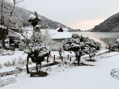
Situated 3Km away from Nainital town it can be reached either by cable car. From here one can see the tips of some of the Himalayan peaks like Nanda Devi, Trishul, Nanda Kot. Large binoculars are established at the view point to have a view of the city from the top. Nainital Lake looks amazing from the top of the hill.
Cave garden-
Cave garden is another important tourist spot in Nainital. It is interconnected seven caves with hanging garden. It is good for people who like to do some simple trekking. Located in Mallital, cave garden gives the tourists a glimpse of ancient civilisation.
The garden is very well organised and mapped for visitors to follow. The caves are given names of different animals like Tiger, Porcupine, Bat, Monkey, Hyena, Flying Fox and Panther caves. It is a fun filled tourist spot and learning spot for children. The best part of this cave is to witness musical fountain in the evening. The timings are 9:30- 5:30pm.
Rope way:
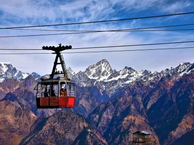
The tour to Nainital would be incomplete with experiencing the aerial rope way. Based on the Swiss technology it is one of the best rope way in India. At a height of 2,270m, it connects snow view point to Mallital. One can get beautiful aerial view of Nainital lake and the snow capped mountains from the rope way. The trolley has a seating capacity up to 12 persons. Timings is from 10am to 5pm.
Tiffin top:
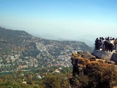
Built by British army officer Mr Kellet in the memory of his wife Dorothy, who was killed in a plane crash along with their children. It is situated in Ayarpatta region in Nainital can be reached only by foot or on horseback. It is located at 4Km from Mall road.
As the name it self suggest tiffin top means packed food, tourists and local people come here with packed foods and spend a quality time with the nature. One can have a beautiful view of Nainital and the Himalayas. It is situated at a height of 2290m. It is open from 8 am in the morning till 5pm in the evening.
Mall road:
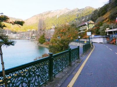
Trip to Nainital would be incomplete without doing some shopping at Mall road. Some of the other famous road for shopping is Bara bazaar and Tibetan market. Mall road is open from 11am to 8.30pm. All of them are located near the lake and Naina Devi temple. Bara bazaar is mainly for food item shopping like Berries, Apples etc. Tibetan market also known as Bhotia market is famous for clothing.
Hanuman garhi:
a famous Hanuman temple located at about 3.5 Km from Tallital at an altitude of 1,830 m. The temple is well connected to motorable roads. One can have a beautiful sight of sunset from here. The temple was built by Neem karoli Baba a local saint in the year 1950.
Kilbury –
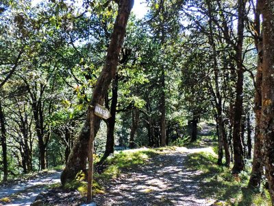
Situated at an height of 2,528m Kilbury is a perfect paradise for bird watchers. Kilbury is located 13 Km from Nainital. One can reach the spot by taxis or local buses. One can see different species of birds here. Some of the rare birds that one can look here are-brown wood Owls, White throated laughing Thrushes, Collared Grosbeaks, Forktails and many more. There is a tourist bungalow here which caters all the needs of the tourist.
Jim Corbett National Park:
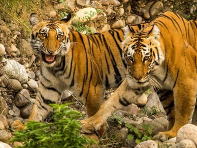
Jim Corbett National Park is just 1.5 hour drive from the Nainital city. It is located at Nainital district and the tourists must not miss to visit Jim Corbett when visiting Nainital. It is the oldest National Park and was established in the year 1936.
The National Park was named after Jim Corbett who was a well known hunter and naturalist. The park was the first one to come under the Project Tiger initiative to save the tigers in India. It is a must visit place and tourists can also stay in the resorts that are available in the National park
If one is lucky then they can see wild animals like tiger, leopard, elephant, chital sloth, Himalayan black bears, barking deer and sambar deer and many more animals along with beautiful Flora all around.
Local Dishes of Nainital
Every city has its own famous food which a tourists should definitely try and enjoy. Even Nainital has some of its famous food. Some of the local dishes of Nainital are
Rass: mild spicy curry eaten with steamed rice.
Bhatt ki Churkani: is a common food during festival season. Made of plain flour and rice paste goes well with Rass.
Baadi: is made with mixture of Dals. This is eaten mainly with rice.
Some other dishes are gulgula, Arsa, roti etc.
How to reach Nainital
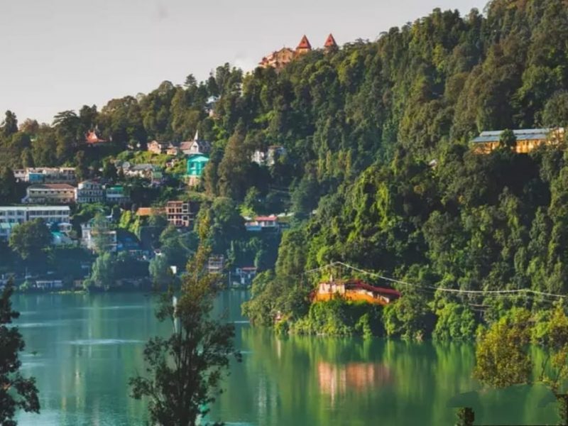
By road: Nainital is well connected to major places in India. From Delhi the distance is around 320 Km which is approximately 9hrs drive. Buses are also available from ISBT Anand Vihar.
By rail: Kathgodam is the nearest railway station. It is 41 Km from Nainital. Some of the trains that pass through Kathgodam are Uttarakhand Samprat kranti, Nainital express, Bagh kranti, Kumaon express and Raniket express.
By air: Pant Nagar airport which is 72 Km from Nainital is the nearest airport for Nainital. Air India operates flights from Delhi to Pant Nagar, which is one hour flight.
Distances of other key places from Nainital:
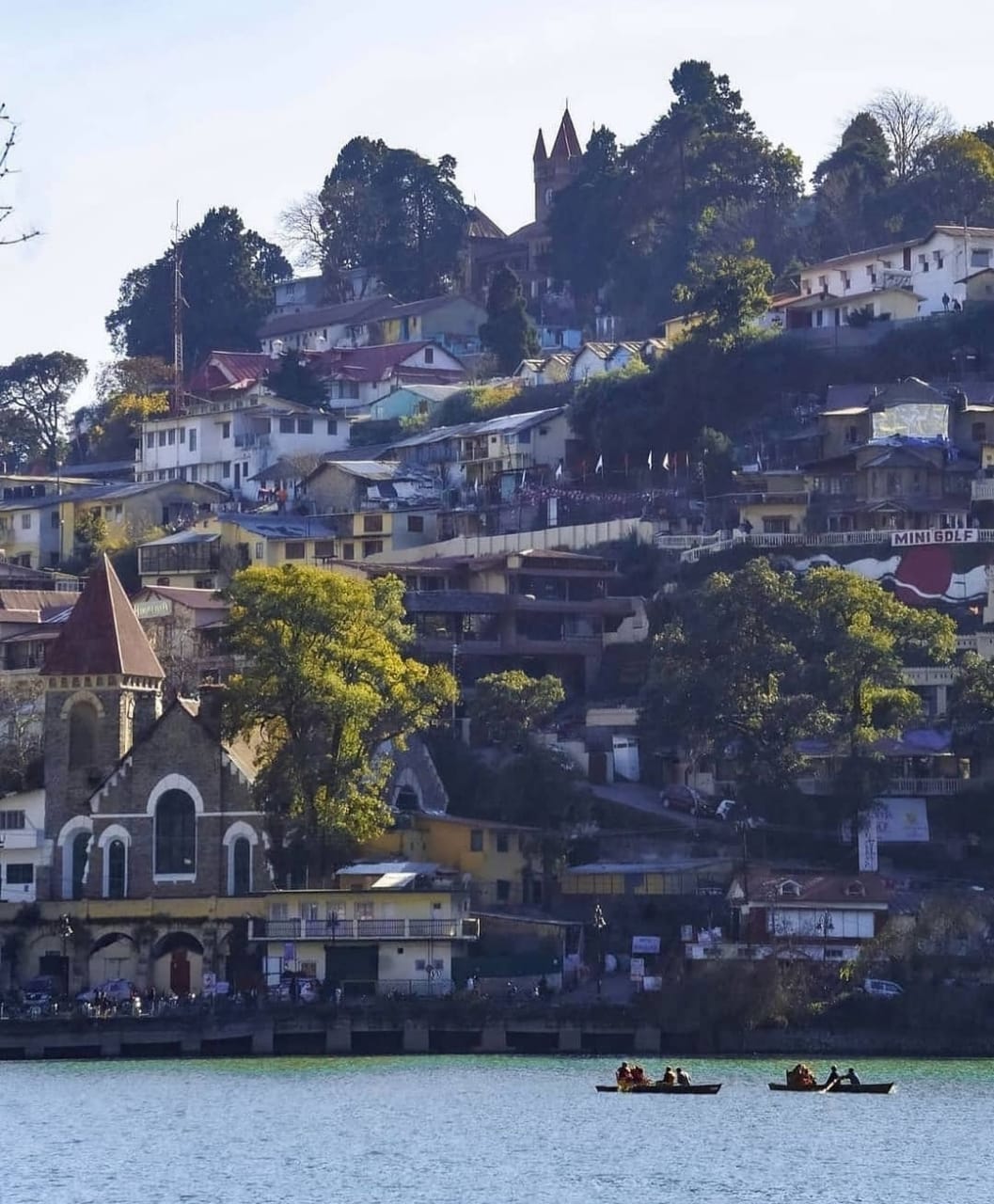
Activities to do in Nainital
Tourists can do lot of activities when they visit Nainital. Other than visiting many tourists places in Nainital, they can also do some activities like
Boating:
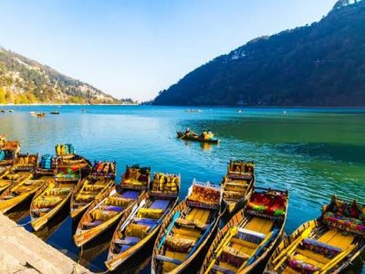
Tourists can do boating in Naini Lake which is the most important tourists place in Nainital. You can hire a yacht or self paddle boat.
Shopping:
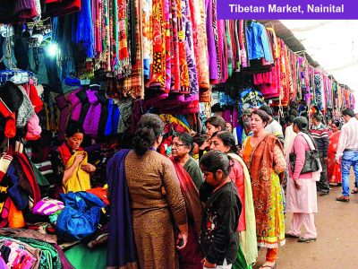
The two main shopping places in Nainital are Mall road and the Barra bazaar. One can look for some good winter clothes like Shawls, sweaters. One can also look for some good wooden handicrafts.
Ropeway:
One can see the magnificent view of Nainital Lake and the surrounding places like China Peak, Tiffin top and Snow view point. The Ropeway connects Nainital city to Snow view point.
Trekking or Hiking:
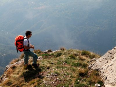
There are several Hiking trails around Nainital which tourists can enjoy the natural beauty of Nainital. Some of the Hiking trails include Nainital- Betalghat trek, Nainital-Binayak trek and Nainital- Kilbury trek.
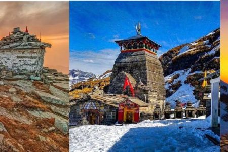
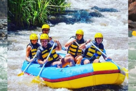
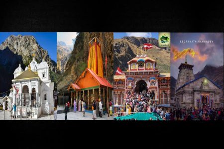
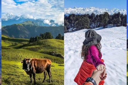
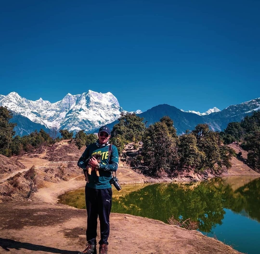
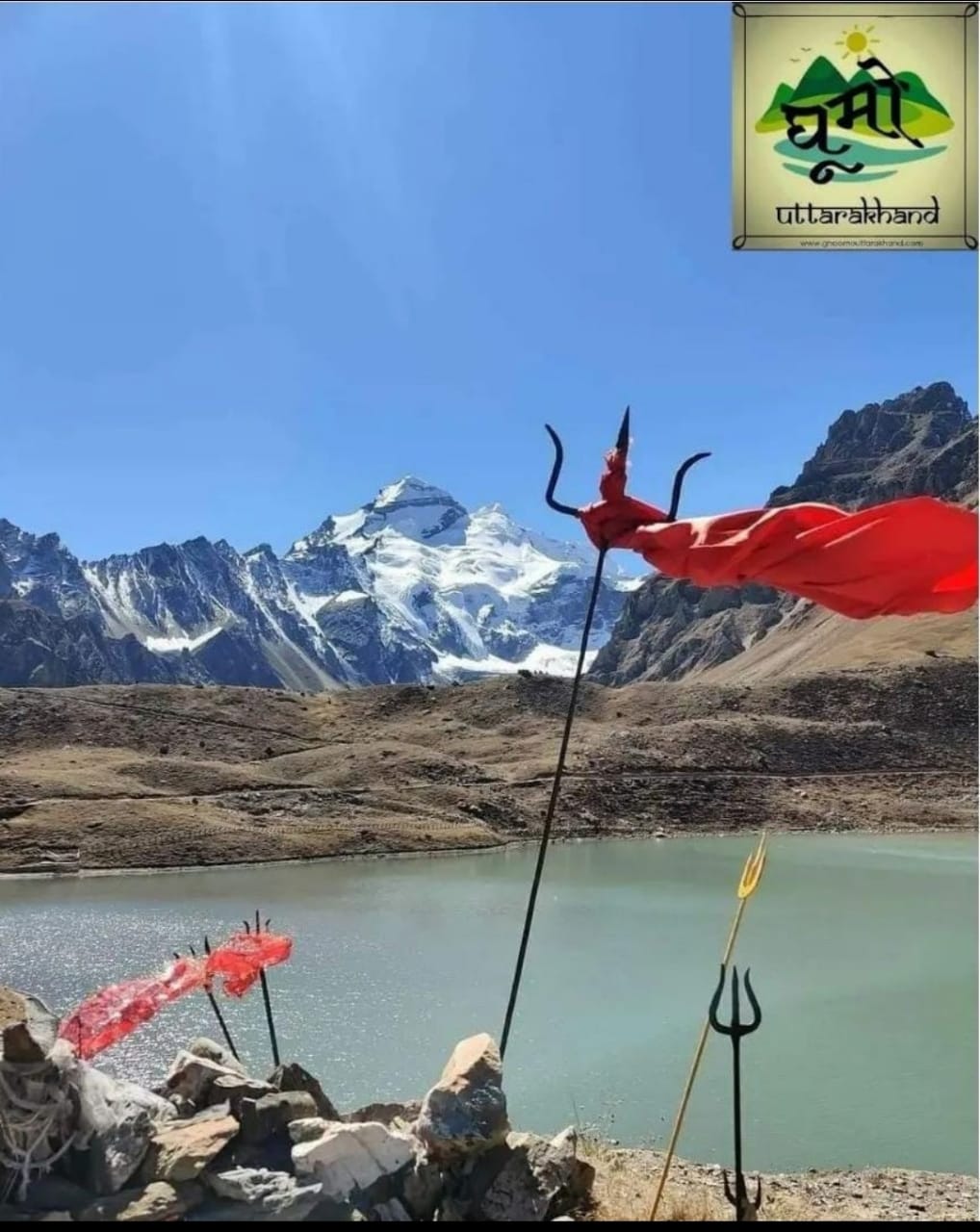
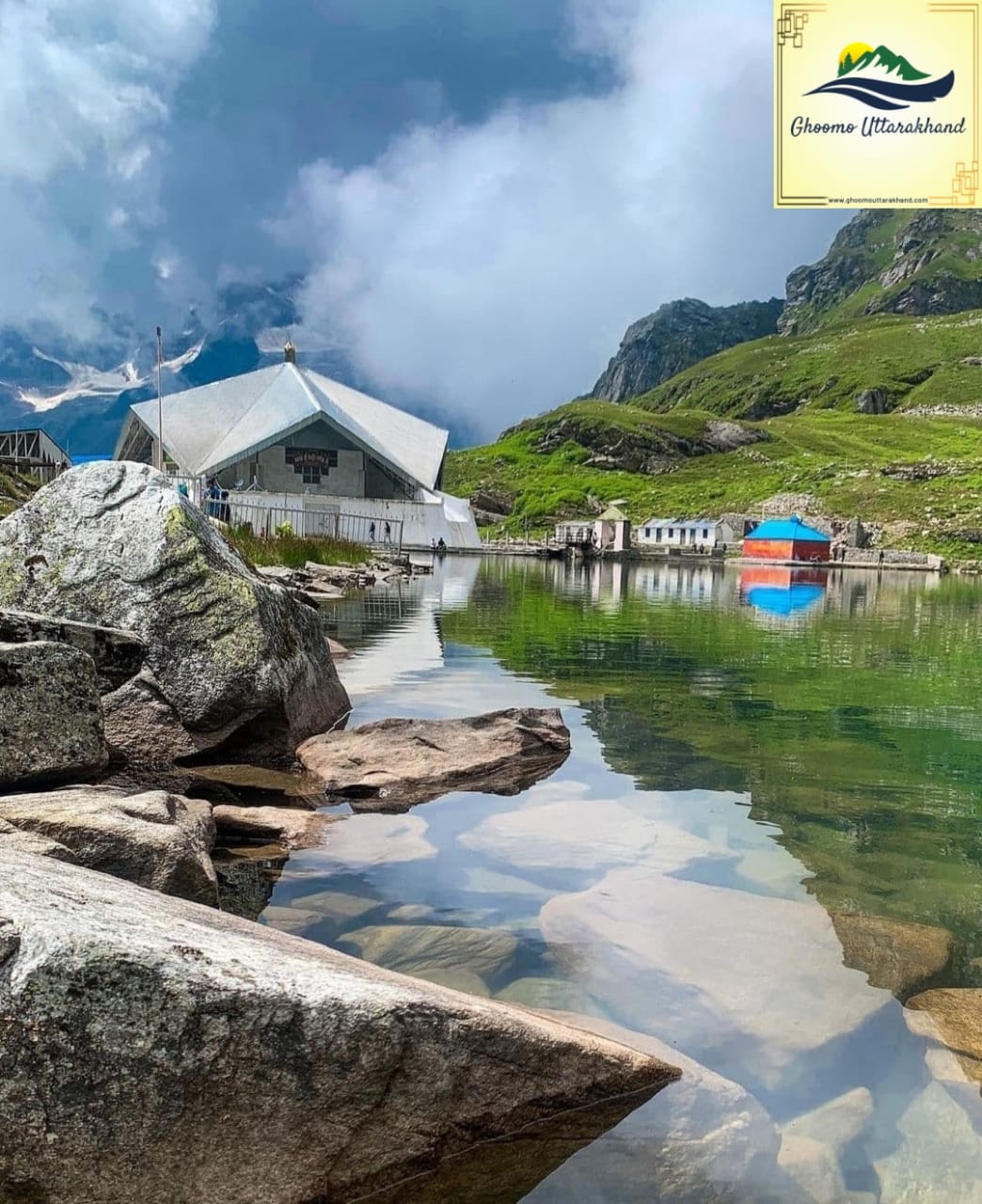
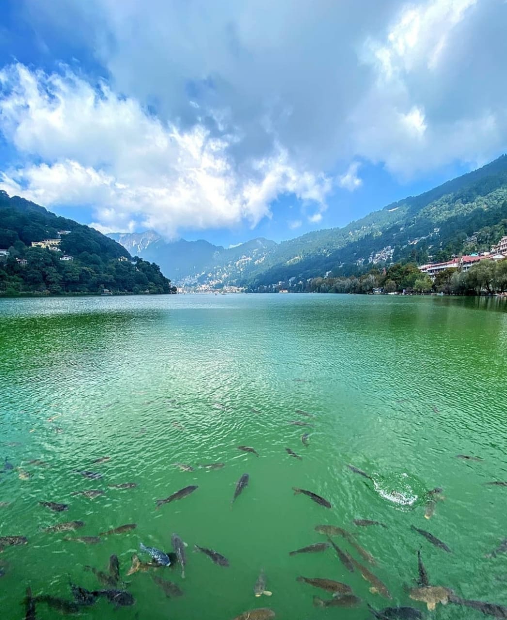
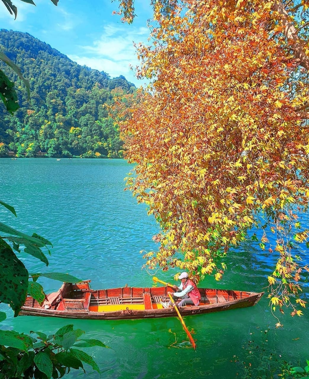
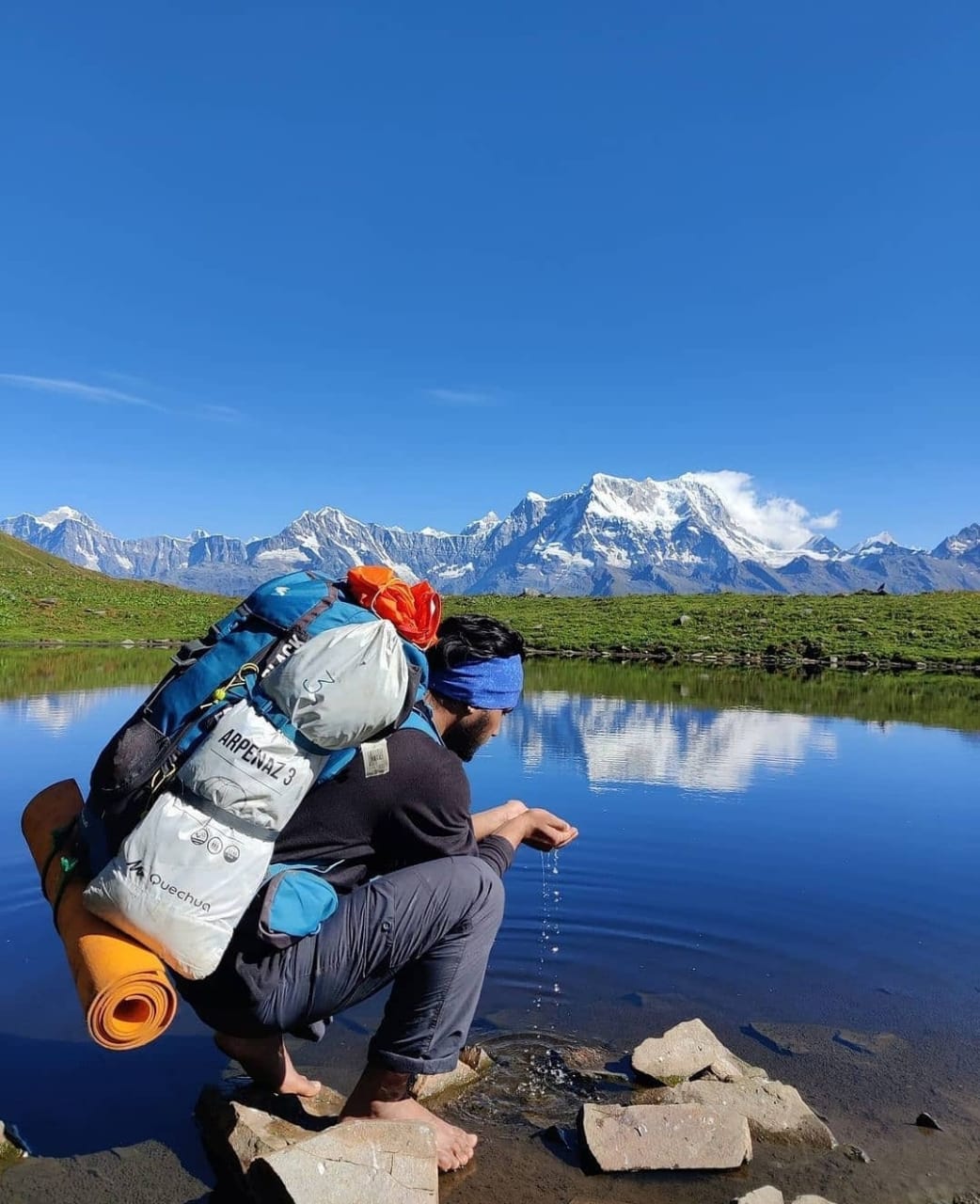
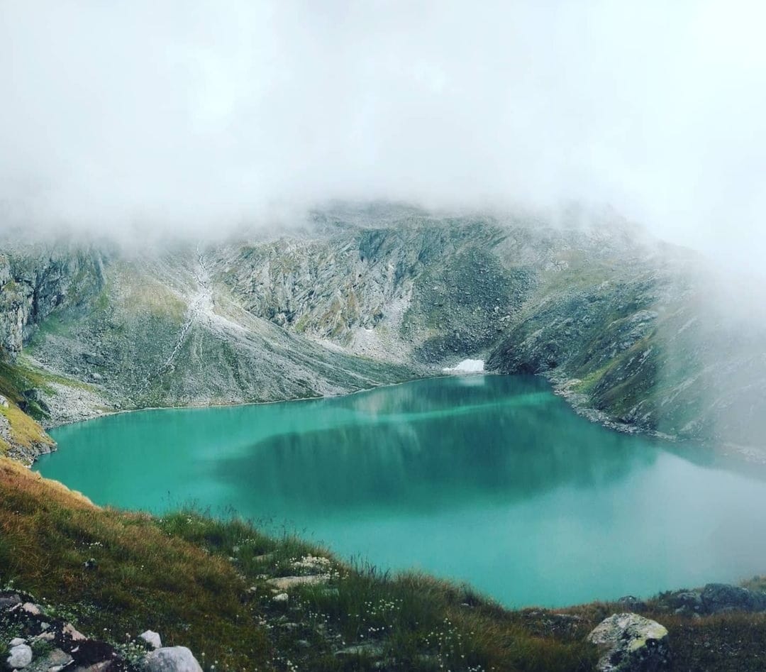
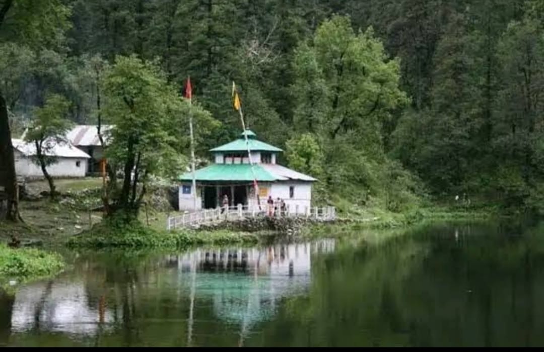
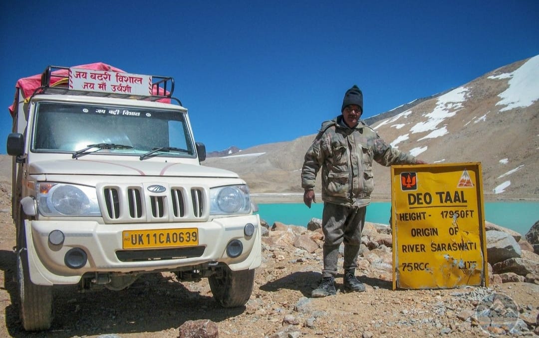
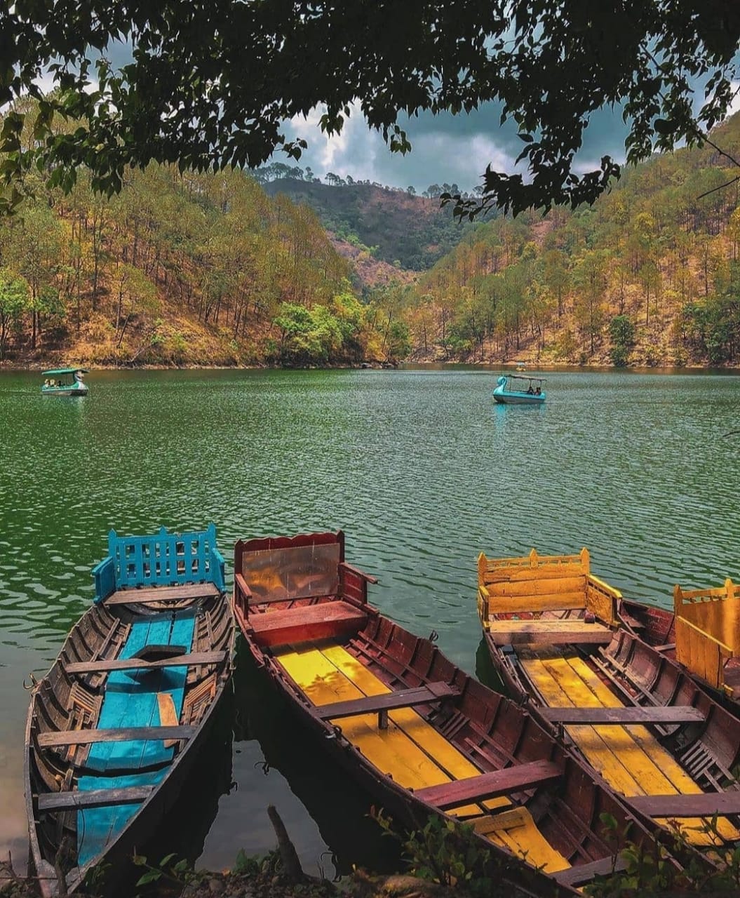
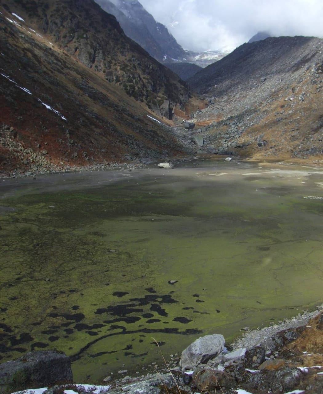
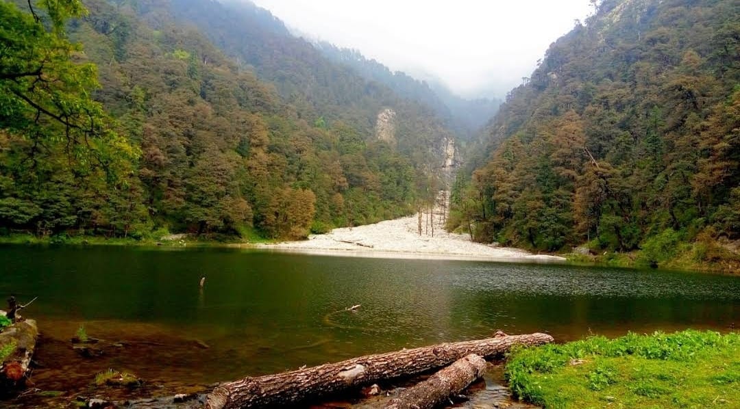
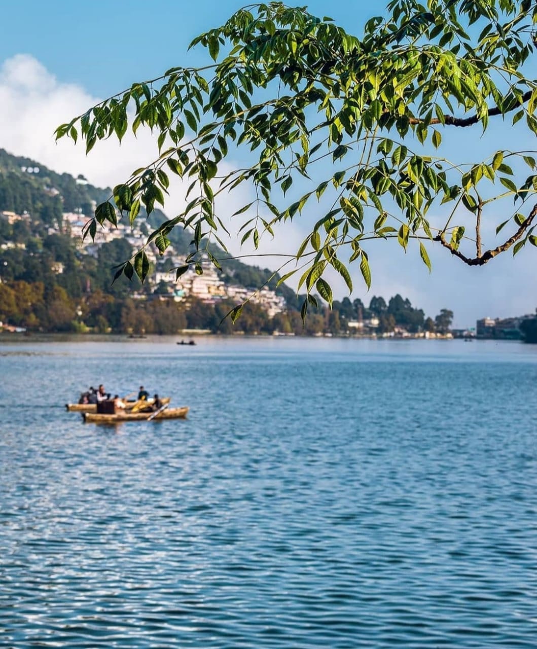
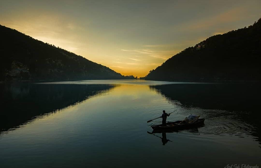
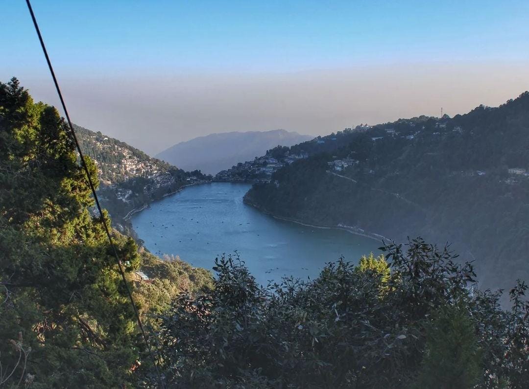
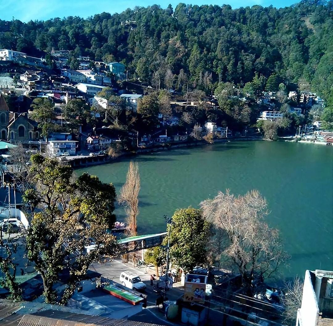
memek
Hello! I could have sworn I’ve been to this blog before but after going through a few of the posts I realized it’s new to me. Nonetheless, I’m definitely pleased I found it and I’ll be book-marking it and checking back regularly! https://trip.tsip.universitasbumigora.ac.id/