from 52 reviews
No Limit
Daily Tour
Unlimited
English, Hindi, Pahari


Char Dham Hotels and Resorts:
While visiting Char Dhams of Uttarakhand, make sure you book your accommodation in advance during peak season. During lean season, you might get accommodation quite easily, at discount prices as well.
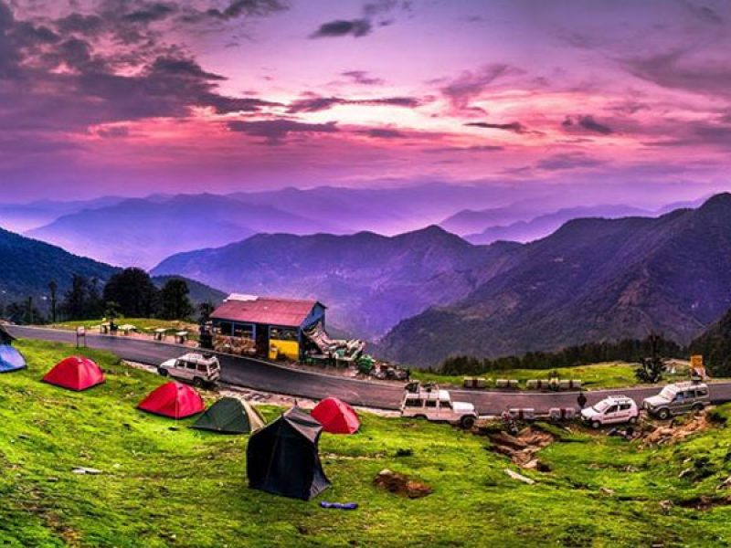
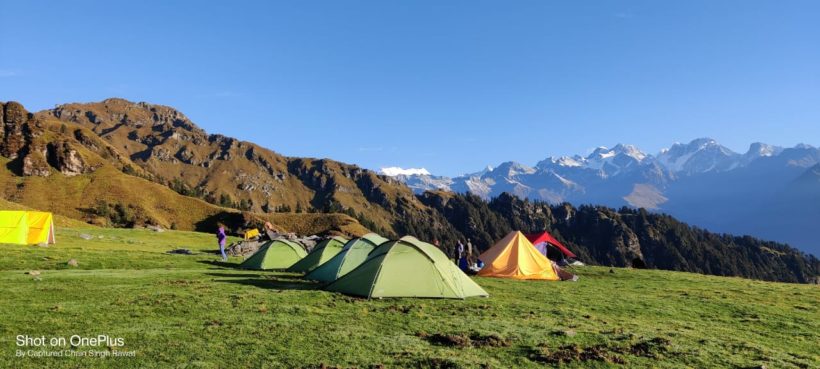
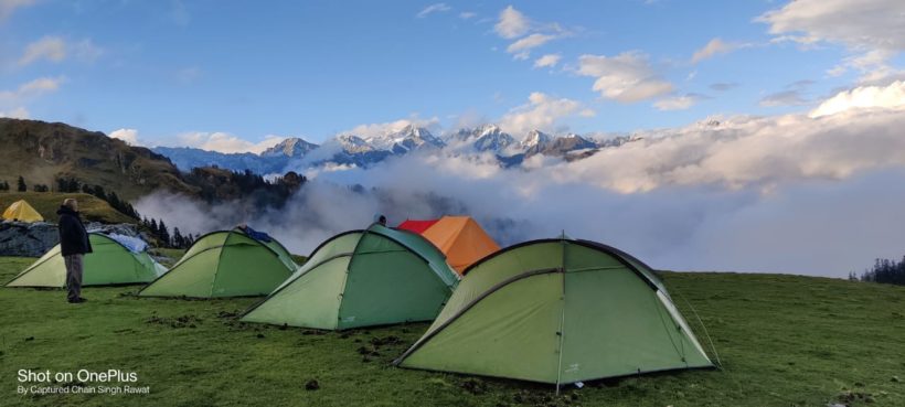
Types of accommodation available in most destinations: Hotels, Resorts, Dharamshala, Lodges, Ashrams, Guesthouses, Tents, Camps, and Homestays
There are number of small and big cities, towns and villages which comes across during entire route of Char Dham Yatra. You can stay at any places which you find good enough as night halt. Make sure the hotels are in good conditions with neat and clean rooms, ventilation, hygenic washrooms and toilets. Some places are remotely located during Char Dham Yatra tour, so be preapred to get average hotels with basic rooms and limited service over there. Also the food options are limited at these destinations.
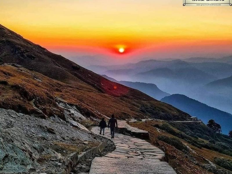
Hill Stations in Uttarakhand
Dotted with long mountain ranges and glittering jewels in the world map, Uttarakhand is well-known for its glorious hill stations having all the ingredients for perfect love-making holidays. Majestic views of surrounding mountains, snow-capped Himalayas, unpolluted natural charm, meandering slopes, and up-down pathways sided by lush greenery.
Panch Kedar
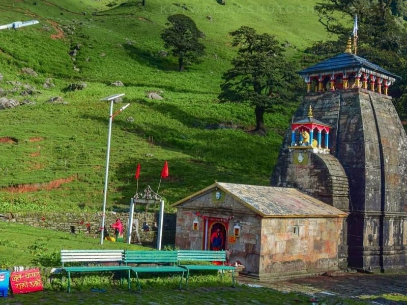
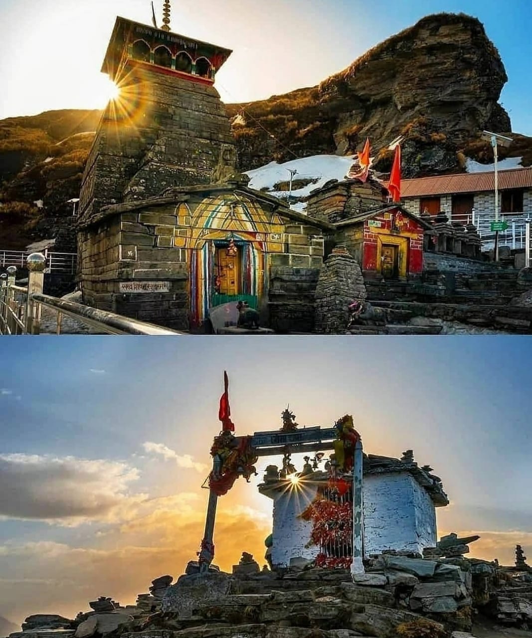
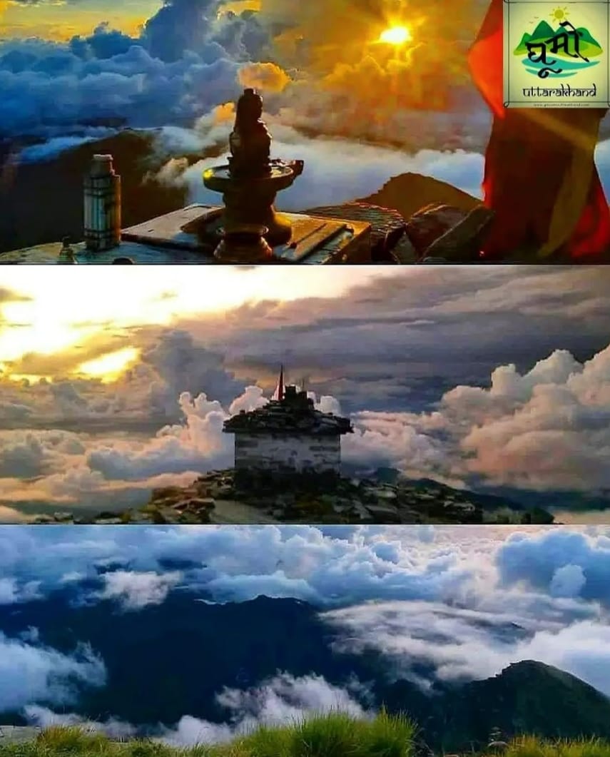
01 Kedarnath 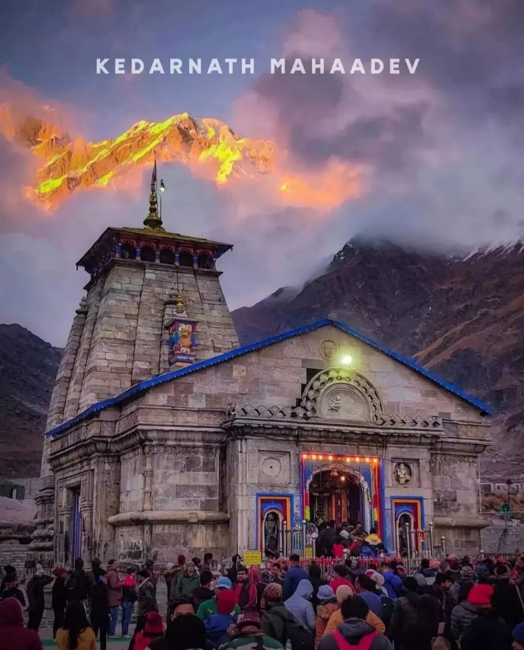
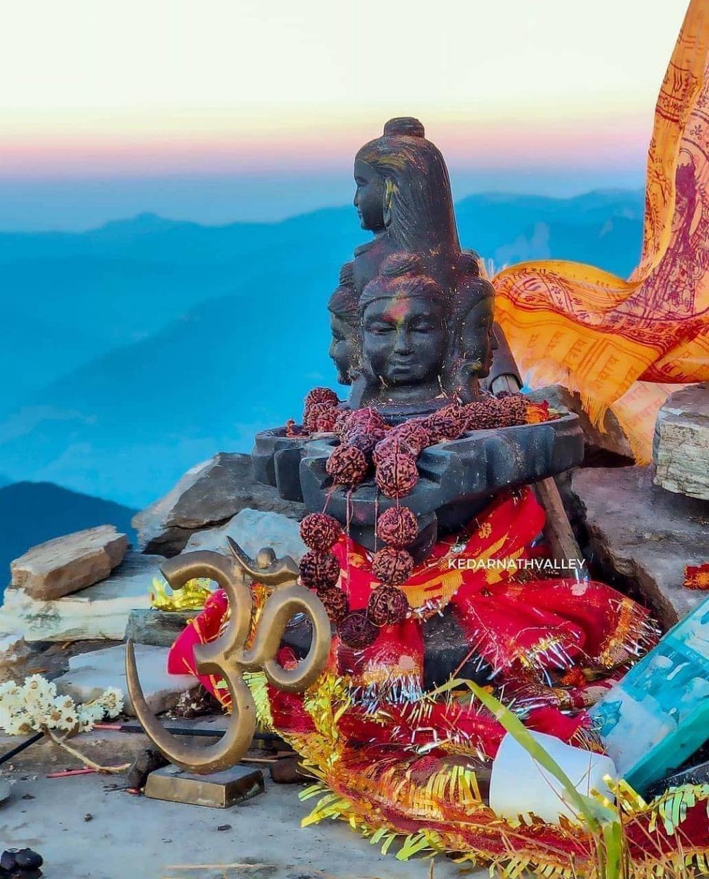
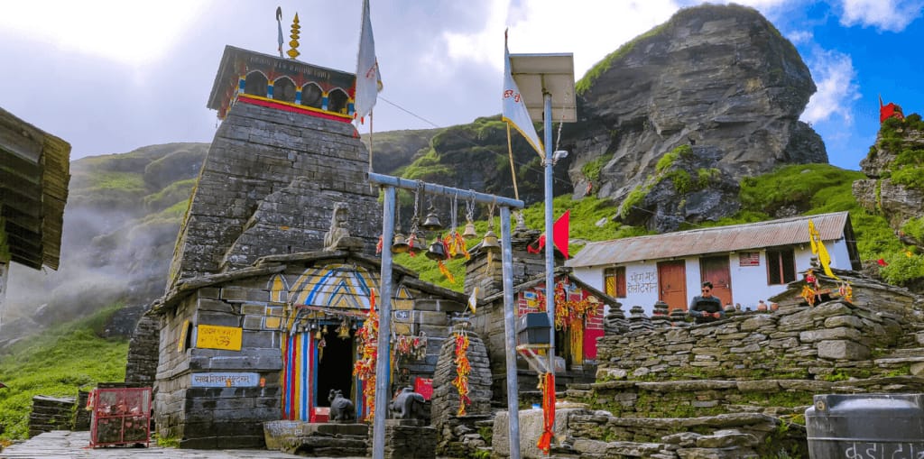
The Kedarnath Mandir (Temple) that nestles at the foothills of the Himalayas is one of the holiest sites of Hinduism. A shrine dedicated to Lord Shiva, the Destroyer of Evil, the temple is one of the 12 Jyotirlingas across India, one of the Char (4) Dhams (Badrinath, Kedarnath, Yamunotri, Gangotri), and one of the 5 Kedars.
Given the treacherous weather in the region, this temple opens to devotees only between the months of April to November each year.
Though there are no inscriptions to go by, it is said that this temple was constructed by a king from the Pandava lineage. His name was Janmajeya. The Shiva Linga here is very ancient.
The temple’s architecture style is said to be the same as most ancient temples of its period – the ashlar style of construction – wherein stone slabs are interlocked into each other without the use of mortar or cement. Each year, thousands of Hindu pilgrims flock to the temple to seek the blessings of Lord Shiva
Kedarnath, a popular Hindu temple, tucked away in the lap of Garhwal Himalayas, some 221 km from Rishikesh in Uttarakhand, is one of the twelve Jyotirlinga temples of Lord Shiva. Lying against the backdrop of the magnificent Kedarnath Mandir Range, at an altitude of 3580 meters, the splendid Kedarnath Dham is where the devotees come seeking the blessings of Lord Shiva. Kedarnath Mandir is said to have been constructed by Adi Shankaracharya in the 8th century A.D. The nearby flowing Mandakini River, mesmerizing vistas and splendid sceneries in the form of the snow-clad mountains, rhododendron forests, and salubrious environment make Kedarnath Dham Yatra, a tranquil and picturesque place to be at.
The devotees experience immense peace of mind while undertaking a Kedanath temple spiritual tour. The temple and nature’s milieu is so divine that it always rekindles human beings’ faith in the Almighty. The temple has survived one of the worst flash floods in 2013 of all time in the state, hence enhancing its sacredness and the mystique in the eyes of the devotees. Devotees flock to Kedarnath pilgrimage tour site every year,as a part of Chardham Yatra circuit. Indeed, Kedarnath in Uttarakhand is one of the most prominent pilgrimages, particularly for the Hindus and spiritual seekers.
Best Time to Visit Kedarnath Temple
Due to its elevation and geographical location, Kedarnath Temple remains open to the pilgrims for a period of six months. The end of April or beginning of the month of May is chosen for the opening of the portals of this high altitude sacred Hindu shrine. The temple closes right after Diwali and its deity is brought to Ukhimath where its worship continues for next six months of winter. Therefore the best time to visit Kedarnath Dham is between April and November with April to mid-June and October to mid-November being ideal most.
Summer
The month of April marks the beginning of summer season in Uttarakhand. It is the time of the year when the ice melts and with the help of the army, the roads are cleared for the commencement of pilgrimage from April end. The average temperature in Kedarnath during summer ranges from 2℃ to 19℃.
Monsoon
Mid-June marks the commencement of monsoon season in Kedarnath. Even though the temperature touches the mark of 19℃, heavy rains keep it a tad difficult for trekking. Though it has to be noted with right gears and guidance, you can still trek to Kedarnath in monsoon season.
Winter
The portals of Kedarnath close in the winter season that begins right after the day of Diwali. The temperature dips to sub zero and the deity from the temple is brought to Ukhimath to be worshipped for next six months.
Kedarnath by Air
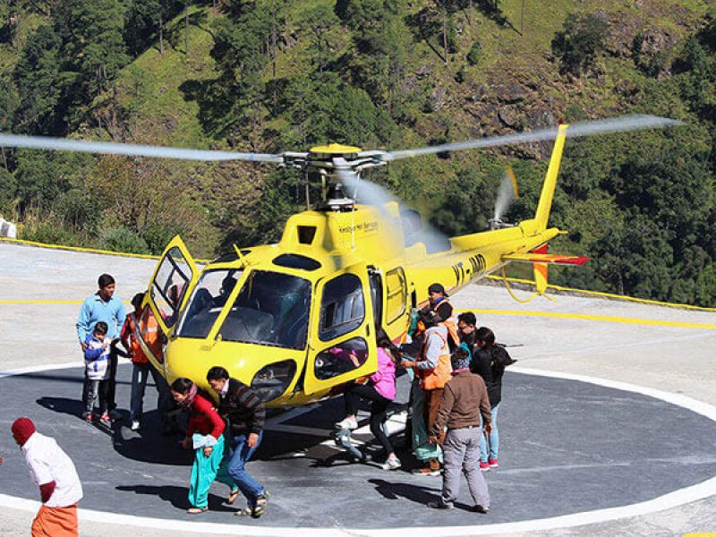
Yes, you can reach Kedarnath by Air also and it is quite comforting too. So, in case you want to skip the tiring trek then you can opt to reach Kedarnath by Air simply by booking a ticket for yourself in a helicopter. Helicopter service is available from Dehradun, Haridwar, and Rishikesh.
From Dehradun: In case you want to take the helicopter service from Dehradun then you have to travel till Shastradhara Helipad in Dehradun and then the helicopter will drop you at your destination in simply 40 minutes.
From Haridwar/ Rishikesh: To take the helicopter service from Haridwar/Rishikesh you need to travel till Phata via taxi and then you can board the helicopter till Kedarnath.
In case you are traveling from other Indian cities, then you need to travel to Jolly Grant airport, Uttarakhand which is the nearest airport to Kedarnath. Booking flights will be comfortable for the longer journeys, especially if you board one from the South of India, and will also help you to save on the travel as many third-party travel sites provide seasonal discounts on flights that you can use. Travel websites like EaseMyTrip provide huge discounts on flight bookings. If you are planning a trip to Kedarnath, you can book it through this travel website. app and save huge money.
Kedarnath is a popular holy destination and it attracts a number of pilgrims to have a holy vocation. So, if you are looking for utter relaxation and serenity, plan your Kedarnath Pilgrimage tour today!
Kedarnath Temple History
The sacred shrine of Kedarnath is said to have been built in the 8th century AD by Adi Shankaracharya at the place adjacent to a spot where the Pandavas of the Mahabharata fame are believed to have constructed a temple. The most popular legend of Kedarnath takes us to the time of Pandavas who after killing their half-brothers, Kauravas in the infamous war were seeking forgiveness from Lord Shiva on the advice of Lord Krishna. It was in Guptkashi that they could spot Lord Shiva who was hiding from them disguised in the form of Nandi, the bull. But one of the Pandavas, Bheema could identify Lord Shiva and chased to only catch him through his tail, while the rest of the body vanished, through a secret cave underneath the ground.
adjacent to a spot where Pandavas of the Mahabharata fame are believed to have constructed a temple. The most popular legend of Kedarnath takes us to the time of Pandavas who after killing their half-brothers, Kauravas in the infamous war were seeking forgiveness from Lord Shiva on the advice of Lord Krishna. It was in Guptkashi that they could spot Lord Shiva who was hiding from them disguised in the form of Nandi, the bull. But one of the Pandavas, Bheema could identify Lord Shiva and chased to only catch him through his tail, while the rest of the body vanished, through a secret cave underneath the ground.
Lord Shiva, who disappeared from Guptkashi reappeared in five different forms namely, hump at Kedarnath, face at Rudranath, arms at Tungnath, navel, and stomach at Madhyamaheshwar and the locks at Kalpeshwar. Another tale about Kedarnath is related to Nar Narayan who went to Badrika Village to worship Parthiva and as a result Lord Shiva appeared before them. Nara-Narayan asked Shiva to remain there in his original form for the welfare of the humanity. Granting their wish, Lord Shiva stayed in that place which is now known as Kedar, thus he is known as Kedareshwara.
Activities around Kedarnath
The surroundings of Kedarnath Temple that imbibe the charm and divine aura of the shrine has spectacular attractions on offer. While sightseeing makes the most part of the activities around Kedarnath, there is a fair chance of paying homage to other sacred temples and relishing adrenaline filled trekking expeditions as well.
A dip at Gaurikund
Witnessing the mesmerizing Gandhi Sarovar
Trekking to the high-altitude Vasuki Tal
Paying respect at the Adi Shankaracharya Samadhi
Chopper/Helicopter Ride around Kedarnath
Visiting the sacred Triyuginarayan and Bhairav temples
Top Places to Visit Around Kedarnath
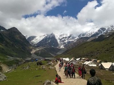
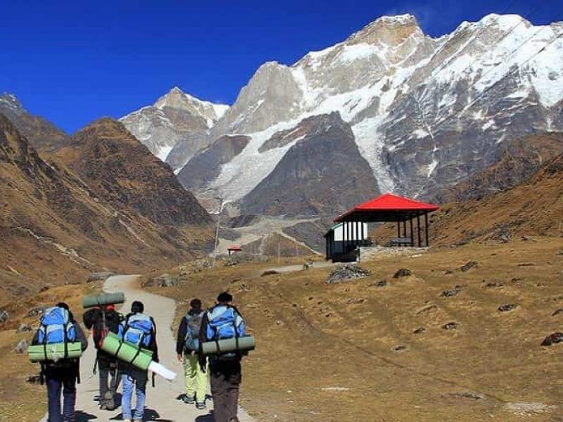
Kedarnath boasts of some picturesque and soul-soothing surroundings which include surreal high altitude lake like Vasuki Tal, the snow-clad mountains, soulful destinations like Ukhimath and Rudraprayag and sacred destinations like Gaurikund. These places come together to weave an aura that must not be missed
Route Locations
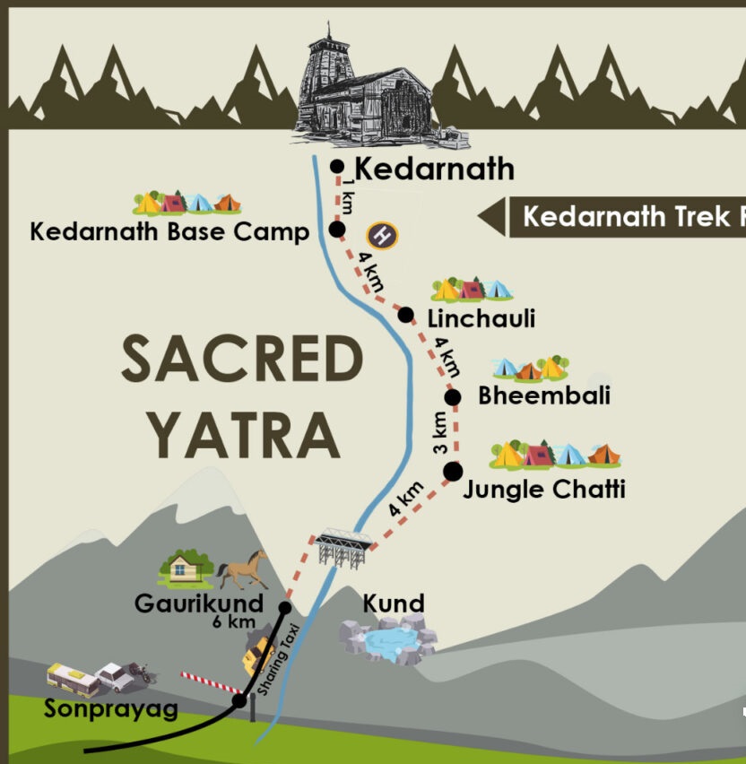
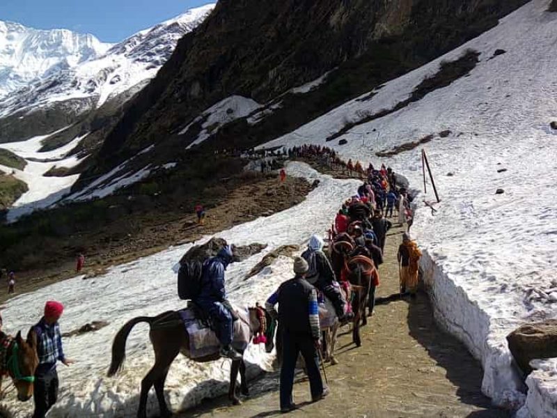
Delhi to Haridwar 206 km –> Haridwar to Rishikesh 24 km –> Rishikesh to Devprayag 74 km –> Devprayag to Srinagar 34 km –> Srinagar to Rudraprayag 33 km –> Rudraprayag to Gaurikund (via Tilwara-Agastmuni-Chandrapuri-Kund-Guptkashi-Phata-Sitapur-SonPrayag) 74 kms –> Gaurikund to Kedarnath (by trek) 14 kms
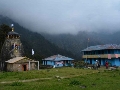
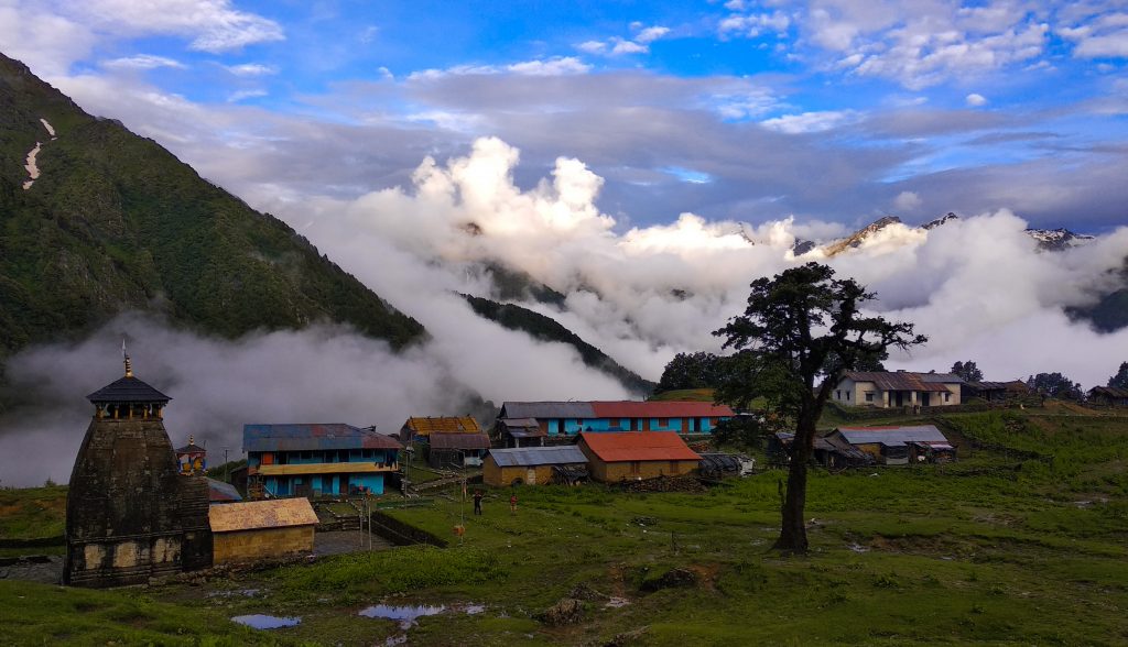
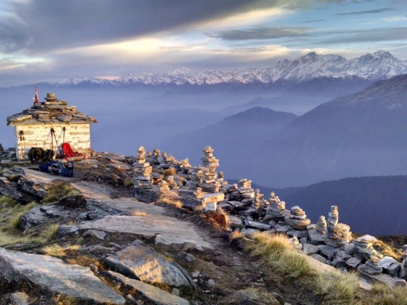
02 Madmaheshwar :
Madhmaheshwar is mystically covered by the snow-capped Himalayas on the right side, lush green alpine meadows on the left side and dense forest act as its backdrop.The shepherd huts, village houses, thousands of years old Madmaheshwar temple and picturesque views complete this town. The temple architecture is a classic north Indian style At a distance of 20 km from Ransi village, 36 km from Ukhimath, 89 km from Kedarnath, Madhyamaheshwar is an ancient Hindu temple located at the base of Chaukhamba peak in the Garhwal region of Rudraprag district in Uttarakhand. Madhyamaheshwar is a beautiful place among the Panch Kedars and is situated at an altitude of 3,497 m.
Madhyamaheshwar temple is dedicated to Lord Shiva. The temple architecture is a classic Nagara style. This is the fourth temple to be visited in the Panch Kedar Pilgrimage circuit; the other temples being Kedarnath, Tungnath, Rudranath and Kalpeshwar. The middle (madhya) or navel of the bull, considered a divine form of Shiva, is worshipped at this temple. There are two other smaller shrines, one for Shiva’s consort Parvati and the other dedicated to the Ardhanarishwara. Bhima, the second Pandava brother is believed to have built this temple and worshipped Shiva here. To the right of the main temple there is a small temple where the marble image of Saraswati is installed in the sanctum.
Madhyamaheshwar finds its mention in the Vedas and Mahabharata. As per historians, the land was ruled by the Khasa, Kshatriya and the rulers of Panwar dynasty. Madhyamaheshwar is associated with a legend of war between the Pandavas and Kauravas. In order to absolve from the sin of Gotra Hatya, the Pandavas decided to pay reverence to Lord Shiva. Lord Shiva wanted to avoid them as he was deeply incensed by the death and dishonesty at the Kurukshetra war. Therefore, he disguised in the form of a bull and disappeared into the ground with different parts of the body appearing at various places. Lord Shiva is worshipped in the form of navel – shaped lingam inMadhyamaheshwar.
There is also an old temple known as Vriddh-Madmaheshwar, located on the ridge which looks straight up at the commanding Chaukhamba peaks. Madhyamaheshwar is mystically covered by the snow-capped Himalayas on the right side, lush green alpine meadows on the left side and dense forest as backdrop. Buddha Madhyamaheshwar situated 2 km away from Madmaheshwar another interesting place. Trekking enthusiast can also visit Kanchani Tal situated at a distance of 6 km from Madmaheshwar. Trek to Kanchani Tal is of difficult level. Gaundhar and Kalimath are two important places on the route to Madhyamaheshwar.Uniana village is the last road point from where 19 km trek starts and ends up at Madmaheshwar. The trek is easy up to Bantoli, but from Bantoli to Madmaheshwar there is a steep ascent. After 3 km is Ransi village, a small chatti with a place to stay. The next stretch is 6 km long to Gaundhar where there are 3 lodges to stay. After 1 km, there is Bantoli, the point of confluence of Madhyamaheshwar Ganga and Martyenda Ganga. The trail continues to Khatara, Nanu, and then Madhyamaheshwar. Home stay accommodation options are available at Madmaheshwar.
The best season to visit Madhyamaheshwar is from May to October. The temple remains closed from November to April. During winters, the residing deity is shifted to Ukhimath for worship.
Day 1
Drive from Rishikesh to Ukhimath
You get picked-up with fellow trekkers from Rishikesh railway station or other designated spots by our staff in a cab or bus. After boarding, the drive to Ukhimath takes about 6 to 7 hours.
The drive is replete with serene forest stretches and stunning natural elegance and also passes through the banks of the Ganges River.
The Ukhimath town is a pristine village and also the holy winter home of the idols of Kedarnath and Madmaheshwar temples that are brought down here during winter by the annual Doli-Yatra procession. After reaching Ukhimath, stay overnight in a lodge/hotel or a tent.
Day 2
Ukhimath to Goundar
On the second day of the Madmaheshwar trek package, the trek starts early in the morning after having breakfast. The trek is easy from Ukhimath and you need to do some gradual hike through a few quaint villages like Ranshi.
This trail from Ukhimath to Goundar village is well-paved and passes through the forest full of rhododendrons, oaks, pines, and maple trees. The area houses several beautiful birds and a few wild animals as well. After a few hours of an easy hike, you reach your next halt and stay overnight in a hotel, or lodge, or tent.
Day 3
Goundar to Madhyamaheshwar
Today’s trek takes you to the summit of this Madmaheshwar trek package, which offers not only pristine views but has a spiritual connection as well. The trek starts from Goundar village that is gradual in the starting but becomes a bit steep yet moderate later on. This well-paved trail passes through dense forests to small villages and amazes you with the stunning elegance of lush greens and rustic lifestyle.
After trekking for 1 km from Gaundhar, you witness the unmatched beauty of the Madmaheshwar Ganga, dense forests, and reach the small Bantoli village. Here, you discover the confluence of Mourkhanda River coming from Chaukhamba, and River Madmaheshwari descending from Nandikund, known as the Madmaheshwar Ganga. The trail runs through this verdant Bantoli village and, afterward, a continuous ascent takes to upper-Bantoli. Now an arduous trek takes to the final destination of the Madmaheshwar Valley, where the famous holy shrine is on the left.
The mountain at the backdrop of the temple is the Buda-Madmaheshwar peak where you can reach after a difficult trek of 2 km in 2 hrs. The views of the surrounding mountains through this difficult terrain are extraordinary and enforce the trekkers to visit the place again and again. The Buda-Madmaheshwar has four stunning pools that reflect the unparalleled images of the surrounding mountain ranges. You get back to Madmaheshwar Valley before the dark and stay overnight in a tent or the temple’s Dharamshala.
Day 4
Madhyamaheshwar to Goundar
Wake up with an extraordinary sunrise and enjoy your healthy breakfast to start your return journey to Goundar. Endure the beauty and spiritual values of this pristine Madmaheshwar region, the summit of this Madmaheshwar trek package, and walk for 10 km to reach the basecamp. The trail for the descend is the same as above and is full of nature and wildlife.
Keep your camera ready and capture shots of some of the rare birds you spot and also click pictures of streams, falls, and lush landscapes that you spot through the trail. After a descent of 10 km, you reach Gaundar village, where you have plenty of time to interact with villagers and discover what’s nearby. After having dinner, stay overnight in a tent or a hotel.
Day 5
Goundar to Ukhimath
The fifth day of the Madmaheshwar trek package starts with breakfast and takes you back to the Ukhimath village. The trail is well-paved and easy to trek and is the same that was followed during the ascent. It takes almost three hours to reach back to the beautiful and quaint Ukhimath, which is a popular holy shrine.
After resting for a while and refueling yourself with lunch and tea, you can go for some sightseeing, a village tour, or visit the nearby holy temples. Interact with villagers to learn about their lifestyle or mythological significance that this town possesses. After dinner, rest in your cozy room or tent and enjoy an overnight relaxing sleep.
Day 6
Ukhimath to Rishikesh
Have your breakfast and get ready to bid farewell to this pristine destination. Our vehicle picks you from your hotel or tent and takes you to Rishikesh, the starting point of this Madmaheshwar trek package. Get dropped at the railway station or bus depot or the place of your choice and board your booked train or bus to your home destination.
Madmaheshwar Trek FAQs
1 .How do I get to Madmaheshwar?
Madmaheshwar lies in the Kedarnath Wildlife Sanctuary in Uttarakhand and to reach there, you have to first reach Ukhimath and then the starting point of the trek, Ransi.
The distance from Rishikesh to Ukhimath to Ransi village can be covered by road while from Ransi, the distance of 16 km to Madmaheshwar Valley requires trekking through well-paved trails or cover the distance on ponies. The Madmaheshwar trek follows a specified route that starts from Ukhimath and passes from Uniyana, Ransi Village (3 km), Gaundar (6 km), Bantoli (1 km), Khatara, Nanu, to Madhyamaheswar.
2. What are the must things to carry before going to Madmaheshwar for trekking?
Things to carry with you while going on for Madmaheshwar trekking are:
o Backpack with rain cover
o 2 bottles of water of 1 liter each
o Energy bars, dry fruits, and electoral/ORS
o Head Torch
o Personal medication, if any
o Comfortable cotton t-shirts and fleece t-shirt as well
o Track pants
o Waterproof jacket
o Sunscreen cream, Hand sanitizer, Moisturizer, Antibacterial Powder, Toilet Paper & Wipes, Toothbrush, Toothpaste, Lip
o Balm, and Quick-dry Towel
o Sunglasses, Cap, Gloves
o Trekking shoes
o A pair of floaters
o First Aid Kit
3. What is the best time to visit Madmaheshwar for trekking?
The best time to go for Madmaheshwar trekking falls in May, June, September, October for the best climatic conditions and serene ambiance. July and August months are avoided for the rainy season as the trek becomes slippery. However, during winters, the temple remains closed, and the temperature falls to sub-zero levels.
4. How long is the Madmaheshwar trek?
The total distance of Madmaheshwar trek from Ukhimath to Madmaheshwar Valley is about 32 km, which is complete with serene natural beauty, thick forests, exotic birds, and diverse wildlife. The trek also crosses several small villages and is full of excitement and thrills.
5. Is Madmaheshwar trek safe?
Yes, the Madmaheshwar Trek is safe as it lets you touch the altitude of 11,410 ft. while AMS like altitude sickness starts after reaching the altitude of 14,000 ft or more. The trails are also well-paved and offer easy to moderate difficulty levels. So, if you are fit enough, you can opt for the Madmaheshwar trek package and enjoy a remarkable experience.
6. What is Madmaheshwar famous for?
Madmaheshwar is famous for its Hindu holy shrine Madmaheshwar temple, which is also one of the Panch Kedar. The place is frequented by hindu devotees to offer prayer and seek blessings from Lord Shiva. The trek lies in the Kedarnath Wildlife Sanctuary, which is home to several wild animals like the endangered Himalayan Musk Deer and many beautiful birds. The trek offers diverse varieties of flowers, plants, and trees and also provides stunning views of Himalayan ranges.
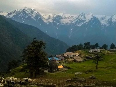
03 Tungnath:
Tungnath temple has been found be the highest Shiva temple of the World and is also the highest among the five Panch Kedar temples. It is located in the Indian State of Uttarakhand in the Mountain range of Tunganath in Rudraprayag district. The word Tunganath literally means the God of Mountain. This temple is the highest shrine of Hindus dedicated to Lord Shiva and is located just below Chandrashila’s peak. It is believed to be 1000 years old and in the order of Panch Krdars, it is the tritiya Kedar. The temple has a great connection with the Mahabharata heroes Pandavas.The Tunganatha temple has to offer something to everyone, be it an ardent devotee of the Lord Shiva or a nature lover or is somebody who loves adventurous things. The location of the temple is so that it fabulously adorns the scene of the nature. Scriptures reveal that it is the Tungnatha temple where Lord Shiva’s hands came into rest. And, also it is known that the temple was built by Pandvas to appease Lord Shiva.Along with having great spiritual value, the temple is so beautifully located that it has the power to fascinate the visitors with its idyllic beauty. This is a great place for the ardent trekkers and the place reveals the unmatched beauty of the Gharwal countryside. The pleasantly beautiful and gushing cascade looks as if; it had just appeared from the heaven directly.
Although, the trekking route of the temple is covered with brown stones, but the fantabulous view of the pasture makes trekking an awe-inspiring experience for peopleAs per the Hindu mythology, both Shiva and his better half Paravati resided in the Himalayas! The Tungnatha temple is actually associated with the Panch Kedar temples which were built by Pandavas. It is believed that Pandavas were advised by sage Vyas Rashi, that their sin of slaying their own cousins Kauravas during the war of Mahabharata in the Kurukshetra, can only be pardoned if they will worship Lord Shiva and make him happy. And, upon the advice they went on to searching for Lord Shiva who was trying to avoid Pandavas because of being convinced about the guilt of Pandavas. In order that, Panvas could not find them, Lord Shiva went on to take a shelter at Guptakashi and took the form of a bull. Nevertheless, Pandavas got catch of him and the body parts of Lord Shiva in the form of bull got rematerialized at five different locations and were later known as Panch Kedaras where the Pndvas built temple of Lord Shiva so as to seek his pardon for their sin to slay their own cousins. Tunganatha was the place where the hands were found! It was Kedarnatha where the hump was seen and the head, navel, stomach and his Jata appeared at Rudranath, Madhyamaheshwar and Kalpeshwara respectively. The facts also say that the chief character of Ramayana, Lord Rama, meditated at Chandrashil peak in the vicinity of Tunganatha. Also, it is believed that the Lanka King Ravana, did Penance to Lord Shivaat the time when he resided there.
Chopta Tungnath Trek Quick Facts:
Tungnath Trek Temperature: Day: 8°C to 15°C and Night: -5°C to 3°C
Maximum altitude: 11,154 ft.
Chopta to Tungnath Trek Distance: 5 Km
Base Camp: Sari Village (6-hour drive from Haridwar)
ATM: Last ATM is in Ukhimath, around 13 KM before Sari
Tungnath: Trek To The Highest Temple Of Lord Shiva
How about a peek-a-boo to one of the oldest and highest Shiva temples in the world?
The thought itself brings such a surge of overwhelming emotions, isn’t it?
Tungnath Temple has perched on the Chandrashila Parvat in the Tungnath mountain range, in the state of Uttarakhand. It sits atop an intimidating altitude of 12,073 feet.
Tungnath Temple is a heavenly abode that literally translates to “God of Mountain Before. Set amidst the most beautiful backdrop, it is not only the highest temple of Lord Shiva but also the highest of the PanchKedar temples.
We will discover more about this magnificent place of worship, first, let us quickly learn about the Panch Kedar temples.
These 5 temples (PanchKedar) are the holy places dedicated to Lord Shiva and therefore, held in high esteem by Hindus for pilgrimage.
The strict order that one should follow for a pilgrimage to these temples is Kedarnath, Tungnath, Rudranath, Madhyamaheshwar, and Kalpeshwar.
Tungnath is the Tritiya Kedar (3rd) among the PanchKedars.
Starting point of Tungnath: Chopta
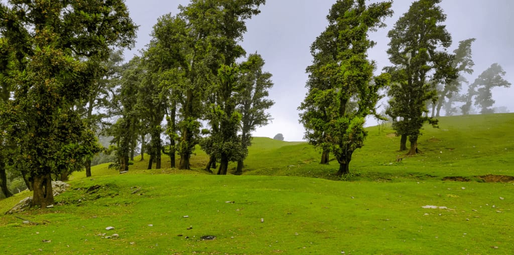
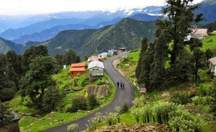
The beautiful meadow of Chopta is perched at an elevation of 8,556 ft in the lush evergreen forest area of the Kedarnath Wildlife Sanctuary. It is a small region that lays 29 km from Ukhimath. Chopta village, also famously known as the “Mini Switzerland of Uttarakhand” is the unspoiled hamlet in the Uttarakhand Himalayas with the mesmerizing view of the majestic peaks such as Trishul, Chaukhamba, and Nanda Devi that leave you awestruck.
Chopta village is blessed with the nature all around it, be it the forest of pine, deodar, and rhododendron or the chirping of the rare bird species to the animals from the wildlife sanctuary. Chopta will leave you mesmerized with its beauty.
Isn’t it ironic that the trek to the highest Shiva temple in the world is short and moderately easy? The trekking route starts at Panger village and journeys to Chopta, the base camp of the trek. This simple yet adventurous trek of 5 km (from Chopta to Tungnath) is dotted with a mixed terrain against the backdrop of distinct Himalayan peaks.
About Tungnath Temple
Tungnath temple, also known as Tunganth Mahadev is believed to be more than 1000 years old. It is said that the temple was discovered by Adi Shankaracharya. The temple is the abode of Lord Shiva and houses his beautiful idol. The idols of Goddess Parvati and many other Gods are also located in close proximity to this temple. Owning to harsh winters, the idol of Lord Shiva is moved to his nearby winter abode, Mukkumath Temple during the winter season.
The artistic architecture of Tungnath temple and its bewitching location attract hordes of tourists to this majestic abode of God.
Tungnath temple is best visited along with the Chopta-Chandrashila trek that also covers the high-altitude glacial lake called Deoria Tal.
Tungnath Summit: Chandrashila Peak
Chandrashila meaning the “moonrock” is the summit or the endpoint for the Tungnath Mahadev Trek. Chandrashila peak is at the alluring height of 13,000 ft above the sea level. Chandrashila has many legends associated with it. According to one legend, Lord Rama after defeating Ravana meditated at this peak. It is also believed that Lakshman, younger brother of Lord Rama meditated here at the Chandrashila Temple.
Another legend that makes Chandrashila peak such a unique destination is, Chandra, the god of the moon stayed here in self-abasement.
The trek route to Chopta Chandrashila trek journeys through lush meadows, quaint hamlets, and thickets of forests to reach the spellbinding temple. The trek moves further to Chandrashila Peak; it takes a steep hike of 1.5 km from Tungnath to reach Chandrashila peak.
The highlights are of the trek are Chopta village, Sari villages, Tungnath Temple, Chandarshila Peak, and Deoria Tal Lake.
While Chopta-Chandrashila trek can be an exciting all-year-round experience, it should be avoided in winters if you are not game for chilly weather. Also, the temple remains closed during the winter months.
Some quick facts about Tungnath-Chopta-Chandrashila trek
Region- Uttarakhand Himalayas, Rudraprayag District, Uttarakhand
Elevation- 13,500 feet
Trek difficulty level- Easy
Trek distance- 15 km
Trek duration- 4 days
Start point- Panger Village
Best time to visit- Winter months of December, January, February, and March
ATM- Last ATM is at Ukhimath, 30 km before Chopta.
Market- The last market is also at Ukhimath, 30 km before Chopta. It is recommended that you carry essential items with you as you may not find everything that you are looking for in this marketplace.
The mythology around Tungnath Temple
The mythology behind Tungnath Temple dates back to the times of Mahabharata. Legend has it that Pandavas after winning over Kauravas in the battle of Mahabharata seeks atonement of their sins. Rishi Vyas suggested Pandavas ask Lord Shiva for forgiveness.
Pandavas went in search of Lord Shiva in different directions. Lord Shiva was convinced of Pandavas’ guilt of killing their cousins, Kauravas. Therefore, he avoided Pandavas by taking the form of a bull and hiding underground at Guptakashi.
Later, when Lord Shiva took his original form, His body parts were discovered in five different spots. Pandavas constructed five temples at these spots in honor of Lord Shiva, which are called the Panch Kedar.
Each temple is associated with the body part of the bull (Lord Shiva’s body) that was discovered there. According to scriptures, at Tungnath Temple, Lord Shiva’s hands (bahu) were seen.
For this reason, Pandavas constructed Tungnath Temple to appease Lord Shiva.
How to reach Tungnath?
By Air
The best way to reach Tungnath by air is via Dehradun. Jolly Grant Airport is the nearest airport to Chopta, it lies in Dehradun. From the airport, it takes around 9 hours to cover the 220 km distance to reach Panger village, near Chopta.
By Rail
Dehradun, Haridwar, and Rishikesh are the nearest railway heads to Tungnath, at an approximate distance of 204, 184, and 162 km from Chopta respectively. Major trains like Shatabdi, Jan Shatabdi, Doon Express, and Rajdhani ply between these cities and other major cities of India. From Dehradun, Haridwar, or Rishikesh, there are taxis or buses till Panger village, near Chopta from where the trek commences. One can get many taxis/cabs just outside the railway station.
By Road
Delhi, Dehradun, Haridwar, and Rishikesh are well connected to major cities of India via State transport buses or private buses. Dehradun, Haridwar, and Rishikesh are at a distance of 204, 184, and 162 km from Chopta respectively. It takes approximately9 hours and 8 hours to reach Panger village from Dehradun and Haridwar respectively. From Rishikesh, it takes around 7 hours to reach Panger village.
Many taxis or cabs are also easily available that take you to Haridwar or Rishikesh from all the major cities of India.
The distance between Delhi and Chopta is 450 km. You can drive down in your own car or hire a taxi from Delhi to Panger village, it takes 10-12 hours.
Note:
Chopta has good motorable roads that connect it with all major towns in the Garhwal region of Uttarakhand state. Taxis/buses regularly ply between Chopta and Haridwar, Dehradun, Rishikesh, Rudraprayag, and Ukhimath.
Weather and temperature at Tungnath
The weather from April to October (barring July and August) is very inviting with bearable temperatures. It offers the most comfortable and opulent framework for visiting Tungnath.
But the best time to undertake the Tungnath-Chandrashila-Chopta trek is in the winters when the area witnesses snowfall.
The major flipside is that due to heavy snowfall, the Tungnath temple is closed for 5 to 6 months during winter.
Let’s look in detail what each month has to offer.
Spring-Summer months of April to June
The spring and summer months are ideal to embark on Tungnath trek as the climate is refreshing and extremely pleasant. The average temperature of the place shuttles around 16 degrees Celsius. Rhododendrons in tones of red, pink, and white adorn Chopta village in April and May. The spring-summer months offer the perfect ambiance for trekking and the beauty of the terrain is at its pinnacle.
Fall months of September to November
This beautiful region of Uttarakhand blazes with a variety of fall colors in autumn months. The region bathes in the sparkling beauty of fresh greens from the monsoon months gone by. The freshness in the landscape is palpable.
Winters months of December to March
The months of December, January, February, and early March impart a fairy tale look to the place. The pristine beauty of the region cannot be put into mere words.
There is no doubt that the winter trek to Tungnath Temple and ahead is a bit tricky because of the region witnesses abundant snowfall. The temperatures can range between 10 degrees in the daytime and drop to even minus 15 degrees in the night.
However, the beauty of the trek during winter time is ethereal. The crystal-clear skies and stark views of snow-capped Himalayas make your trek every bit worth it. The Tungnath Temple and Chandrashila Peak are blanketed under thick sheaths of snow.
Things to do in Tungnath
Tungnath is not an exclusive sightseeing locale. But it offers the most mesmerizing spiritual and adventurous experience to tourists. It is one of the ancient shrines snuggled amidst the picturesque backdrop that equals a picture postcard setting.
Pilgrimage- Out of the 5 PanchKedar shrines, Tungnath is the highest Shiva temple that holds deep reverence for Hindus. Pilgrims embarking on the Char Dham yatra usually visit Tungnath to seek blessings of Lord Shiva.
Trekking- The trekking route to Tungnath starts at Chopta. The trek of easy grade level takes you to the scintillating landscape of Garhwal Himalayas.
Birdwatching- The region in and around Tungnath, especially Chopta, is home to exotic species of birds. You can watch wild goat, Monal, Pika Mouse, and also musk deer, if lucky. The ideal months for bird watching are from February to April.
Enjoying nature- For nature lovers, the nearby Sari and Chopta villages, Deoria Tal, and spectacular Chandrashila summit offer a spellbinding vista and dreamy solitude.
The hushed hamlets of Sari and Chopta are the hidden gems of Uttarakhand. The sunrise view at Sari and Chopta is a once-in-a-lifetime experience. When the crimson rays of the sun paint the snow-laden mountains in hues of red and orange, the villages look paradisiacal.
Deoria Tal, the emerald water body set amidst the mammoth Chaukhamba peaks is a sparkling jewel that enamors tourists with its sheer beauty.
Chandrashila summit offers a spectacular 360 degrees view of the Garhwal Himalayas. Glimpses of Nanda Devi, Nanda Ghanti, Trishul, Dunagiri, Kamet, Thyalasagar, Chaukhambha, Kedar peak, and many Gangotri peaks mesmerize you with their imposing panorama from the top.
Frequently Asked Questions
How long is the Tungnath Trek?
Tungnath trek is only 5 km from Chopta. It is easily completed in 4 to 5 hours with frequent rests in between. Much of the time taken depends upon the physical and mental endurance of the trekker. Tungnath trek route is the shortest as compared to the other PanchKedar routes.
Is Tungnath Safe?

Tunganath is one of the safest trekking routes of the Uttarakhand region. However, one should avoid undertaking the Tungnath trek in the months of July and August. The region receives rainfall and is prone to landslides and road blockages. Tungnath is touted as a winter trek for adventure seekers and nature lovers. But winter months should be avoided if you don’t enjoy the cold weather. A point to note is that the wildlife in the Chopta region can be a little hostile. Therefore, tourists should not move around in the forest after dusk.
What is the difficulty level of Tungnath Trek?
The trek to Tungnath Temple takes you to an elevation of almost 12,000 feet above sea level. It is touted as a trek of moderately easy grade level. The trek journeys along with thick forests and expansive grasslands, and treats one with the breathtaking vista of snow drifted the Himalayas.
Is there snow in Tungnath trek?
In the winter months from December to early March, the temple of Tungnath is bedecked with a thick layer of snow. Snowfall is very common during this time of the year. The temperatures can go well below the freezing point. The air is crisp and the skies azure blue. If you are a winter buff who loves snow then winter is the season for you. It is recommended that you carry warm layered clothing to keep yourself comfortable. Trekking during these months is full of adventure but if you can take up the challenge then go for it.
In short, the Tungnath-Chandrashila peak trek is an upbeat mountain adventure soaked in spirituality and fun! This trek located in the heart of Uttarakhand makes for the most momentous excursions in the lap of nature. Just go for it!
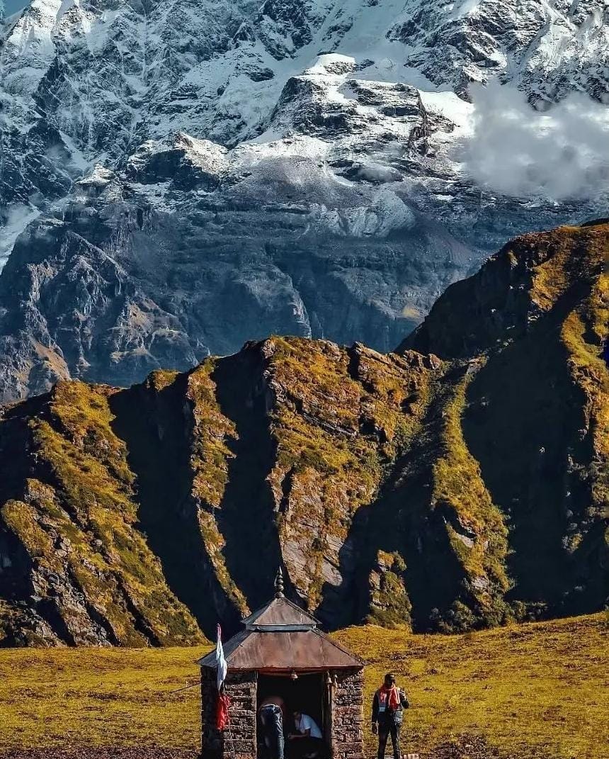
04 Rudranath:
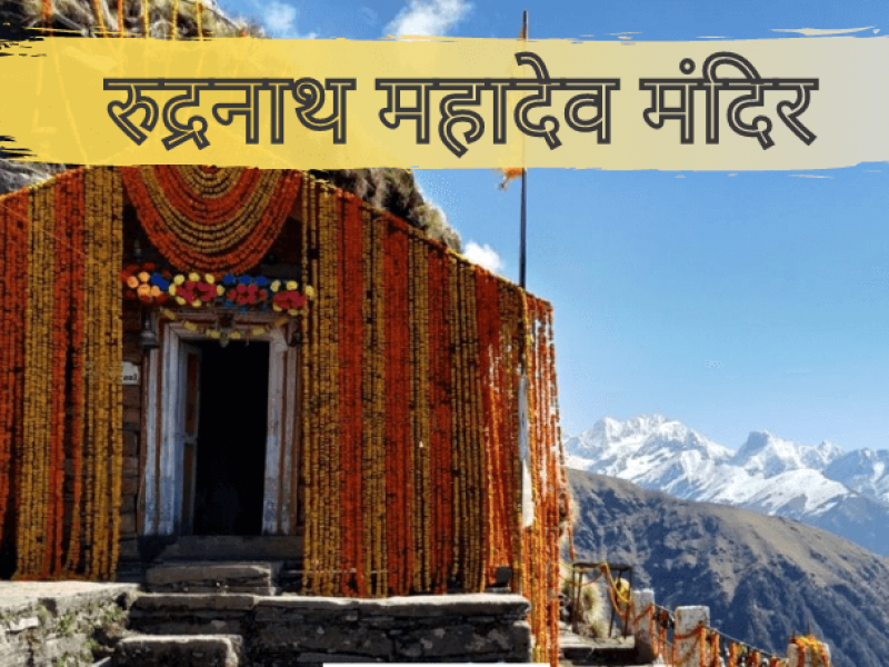
Toughest Kedar Rudranath is the highly revered temple of Lord Shiva is peacefully adorned in the Garhwal Himalayas. It is the fourth temple to visit in the circuit of Panch Kedar pilgrimage.
The celestial temple is snuggled inside the rhododendron forests and the alpine meadows. The exhilarating trek to Rudranath temple can be either commenced from Sagar village, Helang or Urgam village.
Rudranath temple is the toughest one to reach in comparison with other temples of Panch Kedar. The Himalayan peaks adding to the glory of Rudranath are Nanda Devi, Trishul and Nanda Ghunti.
Rudranath trk The journey begins from Rishikesh from where you can take a taxi till Gopeshwar which lies in the way to Rudranath. Take rest at the Sagar village which lies at a distance of 5 km from Gopeshwar. The next morning is when the trek starts from a gate situated there. You will reach Pun Bugyal after 2 hours and have breakfast there. You will be required to climb uphill from here all through the forest.
As you keep moving up, you will notice a change in the atmosphere and nature at its best in here with mushrooms, flowers, and insects. You will then reach Litti Bugyal after 4-6 km. The next stop is Pun Bugyal which takes nearly 3 hours to reach. You can then set up tents here and relax for a while.The next morning you will start for the Rudranath Temple which is 8 km from Panar. After travelling for 2 hours, you will come across Pitradhar which is decorated with flags and bells. You will reach Naola Pass 1 km downhill from here where you can have your breakfast. You will finally be able to see the Rudranath Temple after 4 km surrounded by clouds.
Rudranath| Rudranath Trek Complete Travel Guide | Rudranath Trek | Rudranath Tourism | Rudranath Travel Guide | Uttrakhand Tourism
Rudranath
Among the Panch Kedar temples of Lord Shiva in Uttarakhand, Rudranath Temple is worshipped as the fourth Kedar. This ancient temple of Lord Shiva is located in the Rudraprayag district of Uttarakhand. Apart from Rudranath temple, other Panch Kedar temples of Lord Shiva worship Kedarnath as First Kedar, Madhyamaheshwar as Second Kedar, Tungnath as Third Kedar and Kalpeshwar as Fifth Kedar.
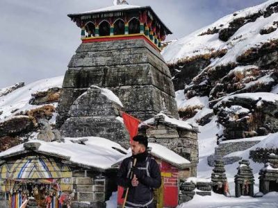
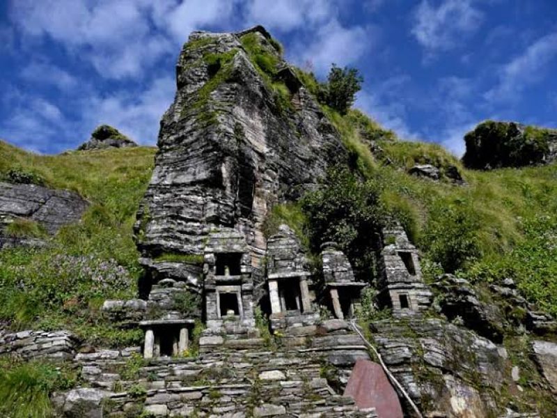
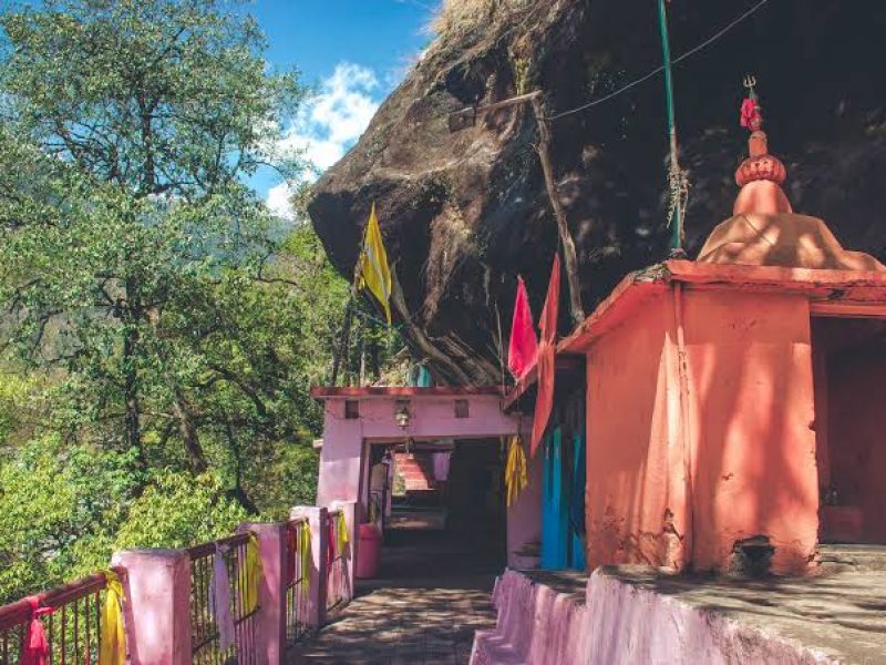
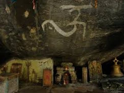
This temple of Lord Shiva is built in an ancient cave in which the face of Lord Shiva is worshipped. Due to the worship of the face of Lord Shiva here, that temple is called Rudranath. It is built amidst rhododendron and alpine meadows around the Shiva temple, which further enhances the natural beauty of this temple. Like the rest of the Kedar temples, the doors of the Rudranath temple are open only for six months a year.
(The Kalpeshwar temple is open for devotees throughout the year) The simple reason for this is that there are many snowfalls here in the winter season and for this reason, you can visit the Rudranath temple only for 06 months a year. The height of the Rudranath temple is only 2290 meters (7513 feet) above sea level, but out of all the Kedar temples, the most difficult and long walk is of this temple.
To reach the Rudranath Temple, you have to travel 20 kilometres (total 40 kilometres) on foot. You should have at least 4 – 5 days for the complete visit to Rudranath temple so that you can complete your walking tour of this temple without any hassle. Before starting the Rudranath temple walking tour or trek, there are some things that you should know before starting your journey to Rudranath like –
01 Where does the Rudranath Yatra start?
02 When does Rudranath Yatra start?
03 What to carry with you during the walking tour of Rudranath?
04 What facilities are available during Rudranath Yatra?
05 What are the precautions to be taken during the Rudranath Trek?
06 Travel route of Rudranath Trek?
So let us know what things we have to keep in mind during Rudranath Yatra.
Rudranath Trek
Situated in the Himalayan mountains, the Rudranath Temple is considered a moderate to difficult trek of 20 km long (total 40 km). Whenever you make an itinerary for Rudranath temple, make sure that you are physically fit and healthy. If you have respiratory or any other type of disease that causes difficulty in breathing, then you should not travel to Rudranath temple on foot.
The length of this trek and the steep steep climb make this trek even more difficult. During the trek to Rudranath temple, you reach the temple through alpine meadows, dense forests and deep valleys. And these dense forests and deep valleys make your Rudranath trek interesting and memorable.
The Rudranath trek is considered more difficult than all the other Kedar temple treks, but the more difficult this trek is, the more pleasure you get in completing this trek. From the Rudranath temple, there are very beautiful and eye-soothing views of the major mountain ranges of the Himalayas like Trishul, Nanda Devi and Nanda Ghunti etc. You are not provided with any kind of facility by the local administration during the Rudranath trek.
Yes, during the trek, there are some places on the way where you can rest for some time and you will also get the facility of breakfast and food. Apart from this, the residents have also made small eateries and restaurants during the trek, in which you can stay overnight by paying just some rent. Most of the facilities you get during the Rudranath trek are provided by the residents so that they can make your Rudranath Yatra easy and earn a living for your own family.
Three different treks are leading to the Rudranath temple. All these three treks present landscapes of different natural beauty. But most of the devotees and trekkers prefer to start their Rudranath trek from Sagar village. Now it depends on you how you want to trek Rudranath by road.
There is a very famous saying among the residents for Rudranath Trek, “The Ascent of Rudranath, Battle of the Germans”, you will know how true this saying is only when you do the Rudranath Trek.
Rudranath Temple Aarti Timings
The Prabhat Aarti in Rudranath Temple takes place at 08:00 in the morning and Sandhya Aarti at 06:30 in the evening. You should plan your trek in such a way that when you reach Rudranath after the trek, you can enjoy the evening aarti and the next day when you return from Rudranath, you can start your return trek by taking morning aarti.
Rudranath Temple opening date 2022
The doors of Rudranath temple will be opened for the general devotees on 19th May 2022, which will remain open for the devotees for the next six months.
Rudranath temple closing date 2022
So far no date has been fixed for the closure of the doors of the Rudranath temple. By the way, the doors of Rudranath temple are closed till the second week of November or even after Bhai Dooj, the doors of Rudranath temple are closed for the devotees.
Rudranath Trek Entry Fee
In Panch Kedar temples, no entry fee is charged for visiting the fourth Kedar Rudranath temple. But this temple is located in the area of Kedarnath Wildlife Sanctuary. Because of this, when you do the Rudranath trek and take any plastic packaging items with you such as water bottles, Maggi and biscuits etc.
Then the Forest Department will ask you for any plastic packaged items you have. Nos. charges Rs.100/-. In return for all the money you have deposited at the counter, you are given a slip, which you deposit at the forest department’s counter at the time of the return of your journey, then you get that money back.
But if you get less than one plastic packet out of the plastic packets you have written, then you can be fined Rs 5000/-. This decision on duty on plastic packets has been taken a while back so that plastic waste in forests and mountains is minimized.
Activities in Rudranath
Whenever you plan for the Rudranath trek and you have some spare time, you can also visit some ancient temples while doing the Rudranath trek. Apart from this, alpine meadows also come during the trek, which you can also take out. These grasslands are known as Luti Bugyal and Panar Bugyal.
Many mythological ponds like Chandra Kund, Manas Kund, Surya Kund and Tara Kund are also located around the Rudranath temple.
Rudranath Trek Route
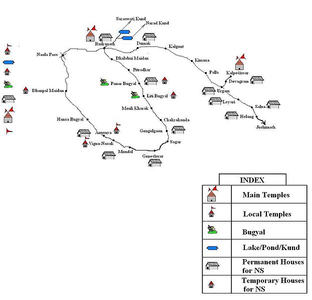
Rudranath Trek 01 – Sagar Village – Litti Bugyal – Panar Bugyal – Pitrudhar – Rudranath
Rudranath Trek 02 – Helang – Urgam – Kalpeshwar – Dumak – Bansi Narayan – Panar – Rudranath
Rudranath Trek 03 – Mandal Village – Anasuya Temple – Hansa Bugyal – Naula Pass – Rudranath
Rudranath Trekking Itinerary
By the way, it takes you 4-5 days to complete the Rudranath trek. Here it is the time of 4-5 days to complete the trek and not the time from starting the journey from your home to reaching back home. When you reach Rishikesh after starting your journey from your home and you reach back to your home from Rishikesh, this time will be considered as the additional time of your journey.
Therefore, you should also make the schedule of Rudranath Yatra in such a way that you do not face any kind of inconvenience related to time. I am going to tell you about the journey from Rishikesh to Rudranath here. Add extra to the time taken to reach Rishikesh from your home. Although there are 03 walks to Rudranath temple, among these three routes, the track from Sagar village to Rudranath is the most famous.
Day 1 –
Rishikesh to Sagar village (distance 215 km)
On the first day of your journey, you can reach Rishikesh by bus and taxi to Gopeshwar. From Gopeshwar you will get a taxi to reach Sagar. The distance of Sagar village from Gopeshwar is just 5 km. During the night you can stay at the homestay built-in Sagar village.
Day 2 –
Sagar-Pun Bugyal-Panar Bugyal (Total distance of the trek is 12 kms)
After resting overnight at Sagar village, you can start the trek the next morning at your convenience. When you start the trek from Sagar village, after trekking for about 02 hours, you reach Bugyal again, where you can rest for some time and have breakfast. After resting for some time in Pun Bugyal, you reach Luti Bugyal after trekking for about 4-6 km.
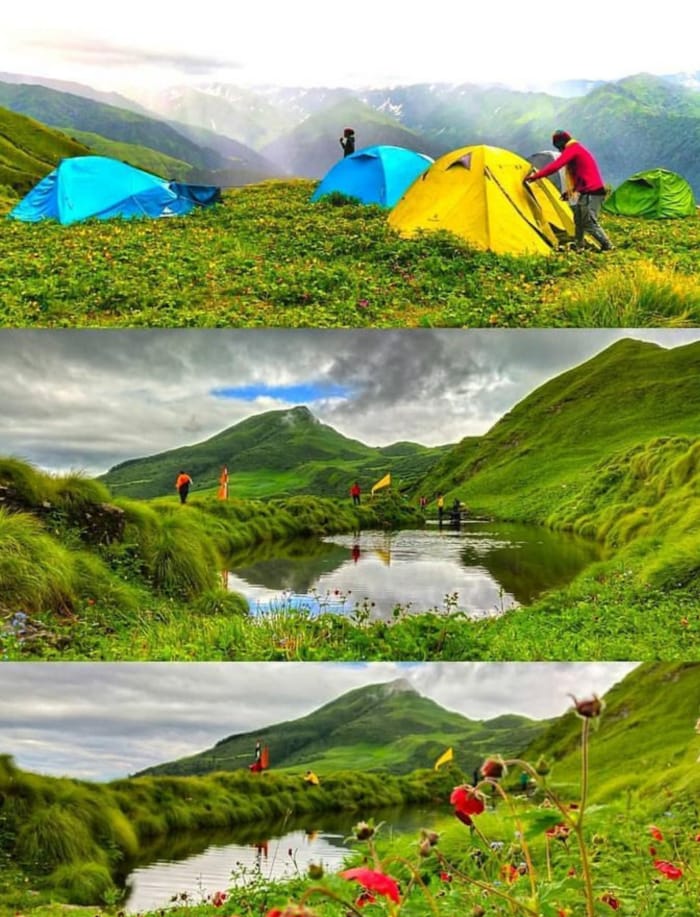
If you want, you can also enjoy food in Luti Bugyal. It may take another 3-4 hours to reach Panar Bugyal from Luti Bugyal. After reaching Panar Bugyal, you can stay in the homestay built here in the night time and if you have brought camping equipment then you can also do camping here.
Day 3 –
Panar Bugyal – Rudranath (Total distance of the trek is 08 km)
From Panar Bugyal, you can wake up early in the morning and after having some breakfast, you can start the onward journey to Rudranath. After starting the trek from Panar Bugyal your next stop is Pitrudhar. It will take you a total of 02-03 hours to reach Pitridhar from Panar. You can relax for some time by reaching Naola Pass, located at a distance of 01 km from Pitridhar.
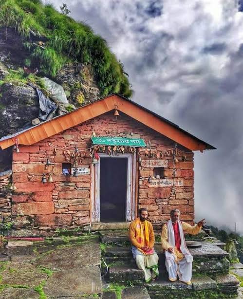
The total distance from Naola Pass to Rudranath Temple is 04 km. And this is also the last stop of your Rudranath Yatra. If you have reached Rudranath before Sandhya Aarti, then after Sandhya Aarti you can come back to Naola and go camping at night. But if you want to participate in Prabhat Aarti also, then you can stay in the accommodation built near the temple.
Note – Keep in mind that photography of any kind is not allowed inside the Rudranath temple.
Day 4 –
Rudranath to Sagar Gaon ( total trek distance of 20 km)
After seeing the Prabhat Aarti in Rudranath the next morning you can resume your journey to Sagar village. The more roads you cover today, the better. Otherwise, you can resume your journey to Sagar village early the next morning by stopping overnight at Luti Bugyal and Panar Bugyal.
Day 5 – Sagar village to Rishikesh
On the fifth day, after reaching Sagar village, you can travel to Rishikesh by bus and taxi via Gopeshwar.
Stay at Rundranath
There is no special arrangement made by the local administration for your stay or rest during the Rudranath trek. But during the trek, the facility of homestay is made available by the residents. In these homestays, you can stay comfortably in the nighttime by paying just a few rupees and apart from this, you also get the facility of local food here.
If you have camping equipment, you can also go camping in the alpine meadows during the night. If you are camping for the first time, then this activity also adds a different kind of memorable experience to your trip. An accommodation facility has also been provided for devotees and trekkers by the temple committee near the temple.
You will find the facility of homestay available in Sagar village, Luti Bugyal, Panar Bugyal and Urgam valley.
Food in Rudranath
During the Rudranath trek, you will find small eateries made by the residents at many places on the way where you can enjoy Maggi and local food. If you are travelling with your friends or with a trekking group, then you can also take your food items along with you.
You just have to make sure that if your food has any kind of plastic related packaging then you have to bring back all the plastic related items at the time of the return journey or else you may have to pay a very heavy fine.
Tips for Rudranath Trek
01 Identity Card
02 muffler
03 water bottles ( 3-5 litres)
04 Dry Fruits and Packet Food
05 Warm Clothes ( Sweater / Jacket / Pull Over )
06 Poncho / Rain Coat ( For Rainy Season )
07 Sunglasses
08 Extra Battery for Flashlight / Power Bank / Camera
09 Camping gear if possible. ( Mat / Sleeping Bag )
10 Waterproof bags to protect electronic items from rain.
11 lemon and salt or electrolyte powder/drink (Electrical/Gatorade/Glucon D)
12 Tracking Shoes / Tracking Paint / Quick Dry Tshirt / Cape
13 whistle (for emergency)
14 First Aid Kit:- Scissors, Sunscreen (SPF 50+), Band-Aids (Water Proof), Analgesic Spray (Relispray, Volini), Antiseptic Liquid (Sevlon, Dettol), Antiseptic Powder (Povidone-Iodine Based Powders like Cipladine, Savlon), bandage, cotton, crepe bandage etc.
15 medicines:- Fever, headache, motion sickness, loose motion, vomiting and acidity etc.
16 Must know about the weather before starting the Rudranath trek.
17 If you do not have experience in trekking in the mountains, then you can take a local guide with you.
(Note:- Before taking any kind of medicine, please consult your doctor.)
How to reach Rudranath
How to reach Rudranath by Air
Rudranath does not have any type of air service due to it being situated in the middle of the dense mountains of the Himalayas. The nearest airport to Rudranath is the Jolly Grant Airport of Dehradun. Dehradun is very well connected to major airports in the country.
The distance from Dehradun Airport to Rudranath (Gopeshwar) is 258 kilometres. To reach Rudranath, you have to reach Gopeshwar first. The 24-km trek to Rudranath starts from Sagar village, located at a distance of 05 km from Gopeshwar. From Dehradun, you will get a regular bus and taxi service to Gopeshwar.
From Gopeshwar you can start the track of Rudranath by reaching Sagar village.
How to reach Rudranath by Train
By the way, the nearest railway stations of Rudranath are Haridwar, Rishikesh and Dehradun railway stations. But the distance from Rishikesh railway station to Rudranath (Gopeshwar) is only 241 kilometres. From major cities of the country, you will get regular rail service to Rishikesh.
Bus and taxi services are available from Rishikesh to Gopeshwar regularly. From Sagar village, located at a distance of 05 km from Gopeshwar, you can start the track of Rudranath. Rudranath walk is 24 kilometres from Sagar village.
How to reach Rudranath by Road
Gopeshwar is very well connected by road with cities such as Haridwar, Rishikesh and Dehradun. Regular bus and taxi services are available from these three cities to Gopeshwar. If you are coming to Rudranath by your vehicle, then you can reach Sagar village located at a distance of 05 km from Gopeshwar with the help of your car. Rudranath’s walking tour starts from Sagar village itself.
(If you have reached here in this article, then I have a small request from you to share your suggestions related to this article in the comment box below, and if you see any deficiency or if you find any wrong information, then also definitely Tell me. I keep posting information related to travel on this website, if you like the information given by me, then you must subscribe to my website through my email, thank you)
naagisingh777@gmail.com/7060831895 website Ghoomouttarakhand.com
05 Kalpeshwar:
Kalpeshwar is the last and fifth temple in the list of Panch Kedar pilgrimage circuit and it is the only temple of the sacred Panch Kedars that remains open throughout the year. The matted hairs or Jata or Lord Shiva are worshipped inside this temple.
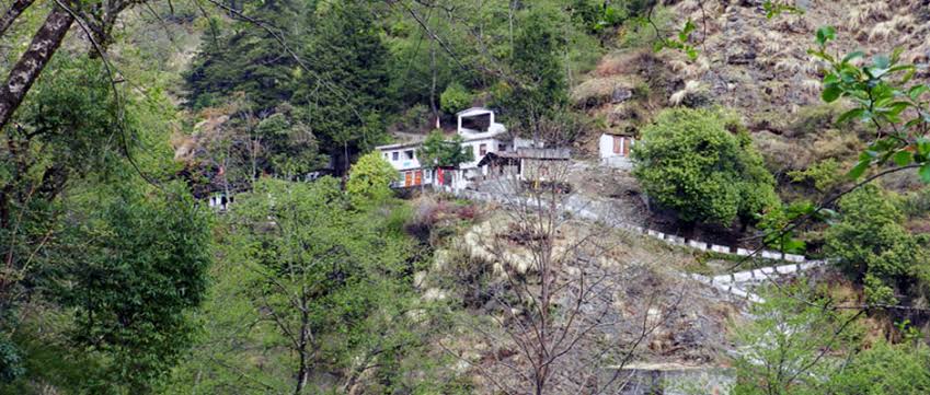
Lord Shiva is worshipped in the form of matted hairs at Kalpeshwar and the trail to this sacred shine goes through thick forests and lush green terrace fields. There is also an old Kalpvriksha tree here which is said to be the wish-granting tree in Hindu mythology Visitors need to trek only 2 km from Urgam to Kalpeshwar. This shrine is a delight for the tourists with striking views of valley with terraced fields and lush green forests. On the trek visitors can see Boodha Kedar temple, Dhyan Badri temple at Urgam village. Rudranath temple can be reached from kalpeshwar temple by trek.
Kalpeshwar temple is located at an height of 2200 mts, dedicated to Lord Shiva in the picturesque Urgam valley in the Garhwal region of Uttarakhand state in India. It is a part of the famous Panch Kedars.
At this small stone temple, approached through a cave passage, the matted tress (jata) of Lord Shiva is worshipped. Hence, Lord Shiva is also called as Jatadhar or Jateshwar. It is approachable only by 12 km trekking from the nearest road head of Helong on the Rishikesh-Badrinath road.
Kalpeshwar History and Legend
Kalpeshwar temple legend linked to the Pandavas, heroes of epic Mahabharata eminence is the fifth temple of the Panch Kedars (five temples) of Shiva’s five anatomical divine forms; the other four temples in the order of their worship are Kedarnath, Rudranath, Tungnath and Madhyamaheshwar temples.
The epic legend narrated on the creation of the Panch Kedar temples is that Pandavas of Mahabharata epic history, while chasing Lord Shiva to seek his pardon for the fratricidal sins committed by them during the Kurukshetra war, realized that Shiva, in order to distance himself from the Pandavas, took the incognito form of a bull. But when this form of Shiva was discerned by Bhima, the second of the Pandava brothers, tried to hold on to the bull’s tail and hind legs. But the bull vanished underground at Guptakashi. Subsequently it reappeared in five different forms: His hump appeared at Kedarnath, his bahu (arm) was spotted at Tungnath, his head surfaced at Rudranath, the stomach and navel were traced at Madhyamaheswar and his jata (tress) was divined at Kalpeshwar.
Another legend states that this place was much preferred by sages of folklore for meditation. Particular mention is made of sage Arghya who through his austere penance created Urvashi, the famous apsara (nymph) at this place. Durvasa, an ancient sage, son of Atri and Anasuya, considered an incarnation of Shiva, known for his short temper did penance and meditated under the Kalpavriksha, the wish fulfilling divine tree in the precincts of the temple.
Pooja in Kalpeshwar Temple
The temple priests at this temple also are the Dasnamis and Gossains, desciples of Adi Shankara, hail from South India. The Namboodiri brahmin sect who worship at Badrinath and Kedarnath from Kerala, the Jangamas are lingayats from Mysore and the Dasnami Gossains belong to Adi Shankara’s group.
Kalpeshwar Opening and Closing Timings
Kalpeshwar is the only Panch Kedar temple accessible and open throughout the year. All other Kedar are closed during winters.
Kalpeshwar as Trekking Destination
This temple is located in Urgam valley. This shrine is a delight for the tourists with striking views of valley with terraced fields and lush green forests. The temple is reached after a trek of 12 km from Helang which is the motor head on Rishikesh – Badarinath route. Trekking in this rocky terrain is a favorite where the trekkers are provided with the some of the hardest trekking routes.
Best Time to Visit Kalpeshwar
Best Months: May, June, September, October
Kalpeshwar in Summers (April to August): are very pleasant with moderate climate, with average around 15°C. Summers is ideal for all sight seeing, temple visit and also for visiting nearby attractions.
Kalpeshwar in Monsoons (September to November): are accompanied with scanty rains. This period is good for sight seeing as the hilly panoramic views are very attractive in rains.
Kalpeshwar in Winters (December to March): are chilly days with average minimum touching near 4°C. Minimum can touch sub zero levels.
How To Reach Kalpeshwar

By Road: Kalpeshwar can be reashed up to Helang, 243 kms. on the Rishikesh – Badrinath road by bus and taxis. From Helang, the 12 kms. trek is off the main road.
Boodha Kedar temple surrounded by potato fields is seen on the trek route. Also seen is the Dhyan Badri temple at Urgam Village, one of the Sapt Badri (seven Badri) temples.
By Air: Nearest airport is Jolly Grant, Dehradun 272 kms
By Rail: The nearest railhead, Rishikesh is 255 kms
What is the motorable route?
Haridwar – Rishikesh – Devprayag – Srinagar – Rudraprayag – Karnaprayag – Nandprayag – Chamoli – Pipalkoti – Helang – Lyari – Devgram
Total Distance – 275 kilometres, approximately
Earlier, the trek to Kalpeshwar started from Lyari as the road till Devgram was still under construction. Now, I’m told, the road has been completed although it’s not a firm one and not always open.
The road from Haridwar to Helang is more or less well-maintained except for a few patches that fall under the landslide zone.
But it is not going to be a cakewalk driving from Helang to Devgram. It is not a road but a trail of loose (mostly) soil and rocks that is prone to breaking apart. It is advised that you keep driving till Joshimath (14 kilometres from Helang), park your vehicle there and then take a shared jeep to Devgram via Helang. Unless you are a pro at off-roading!
This more than sorts it out in case you are driving your own vehicle or a self-drive vehicle.
In case I want to opt for public transport?
Take a bus or shared taxi (Max) from Haridwar/Rishikesh to Joshimath
Get down at Helang and take a shared taxi (Max) to Lyari/Devgram
Please note that almost all of the taxis to Devgram ply from Joshimath and aren’t as frequent as to other popular places. You might have to wait it out at Helang. Alternatively, you can get down at Joshimath and stay there for the night. Next morning, take a shared taxi from Joshimath to Devgram. If you don’t like to wait it out and have money to spare, you can book the entire vehicle (from Joshimath) at around INR 500-600 for one way.
Buses, both local and of Uttarakhand State Transport, and shared taxis start plying from Haridwar/Rishikesh to Rudraprayag and further as early as 4 am.
How long is the trek? How is the trek route like? Do I need a guide?
The trek from Lyari to Kalpeshwar is barely 2 km, whereas from Devgram to Kalpeshwar it is less than 500 m and pretty straight forward, passing through the gorgeous Urgam Valley. Most of the route is paved with little to no ascent. Reach till the end of the village, a curve from where the path descends towards the river. You will see a short ascent on the other side of the river, left to the waterfall, and leading up to Kalpeshwar temple, neatly hidden between the rocks. Walk down and take the little wooden bridge to reach to the other side.
If you start early, you can make it back to Joshimath by afternoon quite easily.
You do not need a guide.
Where to stay and how much will it cost?
There are a decent number of guest houses and lodges in Devgram where you can get a room for about INR 300-400 for two. The vibe here is inherently different than rest of the four Kedar combined. Even though the trek is short-lived, Urgam Valley makes it up with its chilled-out demeanour and ever-so-smiling locals.
If you wish to come back to Joshimath the same day, there are plenty of options, the cheapest one being the dormitory beds at GMVN, available for INR 300 per person. And if budget is not a constraint, you can also go for luxury cottages, and a few small guest houses and resorts at Auli, 25 km from Devgram.
This is the gist of it. If you have any further queries, feel free to leave a comment below. I’ll get back to you as soon as I can. Stay safe, travel responsibly!
*Panch Badri*
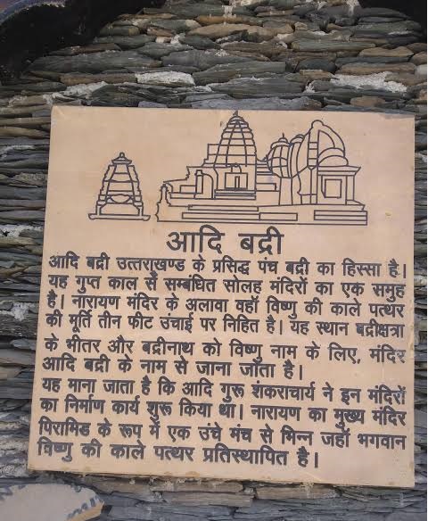
Adi Badri:
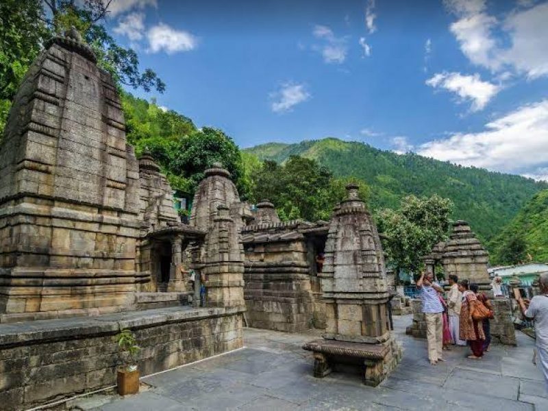
Adi Badri is part of famous Panch Badri of Uttarakhand. It is a group of sixteen temples, belonging to the Gupta period. Among them is the Narayan temple, where a black stone idol of Vishnu, three feet high is enshrined. This place is within the Badrikshetra, and Badrinath being the name for Vishnu, the temple is known as the Adi Badri Adbadri ,also known in revenue records as Helisera, is set in beautiful surroundings and the road from Lohba to Adbadri passes through scenic terrain. Just above Adbadri is the small Lake of Benital. At Adbadri are the remains of Sixteen temples similar to those found at dwarahat ( in district Almora) and the one dedicated to Badrinarayan is still used for worship as are the others but to a lesser degree. The local people have a superstitious belief that in a few year the road from Joshimath to Badrinath will be closed by the meeting of the hill near the temple that stand opposite each other and that then this temple will become a place for pilgrimage. There are remains of sixteen small temples, of which seven are more ancient with flat roofs belonging to the late Guptas period. Local tradition assigned the building of the temples to the the Shankracharya, the celebrated reformer and philosopher of the eighth century. All the temples are crowded together into a small space( 12.5 mts X 25 mts.) and vary in height from 2 to 6 mts.The Main temple of Narayan is distinguished by a raised platform in the front, roofed in and leading to the small enclosure of the pyramidal form, where the idol is enshrined. The idol of Vishnu is a metre high, sculpted out of black stone. Vishnu is of course, another name of Bdrinath and so this temple is also known as adibadri. It is one of the five Badris ( Panch Badris) the others being Vishal Badri, Yog-Dhyan Badri, Vriddha Badri and Bhavishya Badri. All five shrines are situated in close proximity.
Adi Badri is a famous temple dedicated to Lord Vishnu. The temple is located on the confluence of the Pindar river and Alaknanda river in Chamoli district, 17 kilometers beyond the Karnprayag. It is the second temple complex among the “Sapta Badri” temples. It’s part of the famous ‘Sapta Badri’ pilgrimage circuit. It is a part of the Char Dham Yatra Package within Uttarakhand.
This place is within the Badrikshetra, and Badrinath being the name for Vishnu, the temple is known as the Adi Badri. In ancient times, the path to the temple went through the Badri van (Forest of berries). Hence, the suffix ‘Badri‘ is added to the seven holy shrines of Lord Vishnu.
Adi Badri – Facts
Deity Lord Vishnu
Location Adi Badri Road, Karna Prayag, Uttarakhand
Best Time to Visit May to June and September to October
Darshan Timings 5 AM to 12 PM
2 PM to 9 PM
Entry Fees Free
Dress Code Traditional Wear
Festivals Krishna Janmashtmi, Makar Sankranti
Exploration Time 2 hr.
Adi Badri is a group of 16 temples. The main temple is dedicated to Narayan (Lord Vishnu). It’s part of the famous Sapta Badri pilgrimage circuit. It is also believed that the temple was built during the Gupta period (5th -8th century).
The temple is located 3 kilometers (1.9 min) from Chandpur fort or Garhi located on the hilltop. The fort was built by the Parmar kings of Garhwal. On shifting of Badrinath (also known as Raj Badri) to Bhavishya Badri, Adi Badri will be called the Yog Badri.
What are the timings of Adi Badri?
The timings of the temple are:-
Timings From To
Morning 5 AM 12 PM
Evening 2 PM 9 PM
What is the significance of Adi Badri?
The significance of the temple is that whenever Badrinath temple remains closed due to extremities in weather, devotees worship Lord Vishnu in Adi Badri temple. Moreover, the sanctum of the temple has an image of Lord Vishnu which is 1 meter high and has been carved out of black stone.
What is the history of Adi Badri?

According to history, Adi Shankaracharya built Sapta Badri temples, including Adi Badri during the Gupta period. As per beliefs, he did so to promote and spread Hinduism to all parts of the country, however remotely accessible. As per ancient texts, it is believed that Vishnu resided in Adi Badri during Satyug, Treta, and Dwapar. It is moved to Badrinath in Kalyug.
Adi Shankaracharya built Sapta Badri temples to promote and spread Hinduism.
Another historical significance of the temple lies in the fact that Maharishi Ved Vyas divided the Vedas into Rigveda, Samveda, Yajurveda, and Atharvaveda in this temple.
Maharishi Ved Vyas wrote the holy text of Bhagwat Gita in this temple.
People beleive that pandavas came here after giving up their kingdom Hastinapur to King Parikshit.
According to prophecy, it is believed that the Lord Vishnu will shift to Bhavishya Badri with the end of Kalyug and Satyug begins thereafter. After the lord Vishnu shall shift to Bhavisya Badri, Adi Badri shall be known as Yog Badri as per the religious texts.
The architecture of Adi Badri Temple
Festivals celebrated at Adi Badri
Some of the festivals celebrated at Adi Badri are:
How to reach Adi Badri?
Here’s how to reach Adi Badri:
Where to stay near Adi Badri?
Some of the places where one can stay near Adi Badri while undertaking the Char Dham Yatra are:
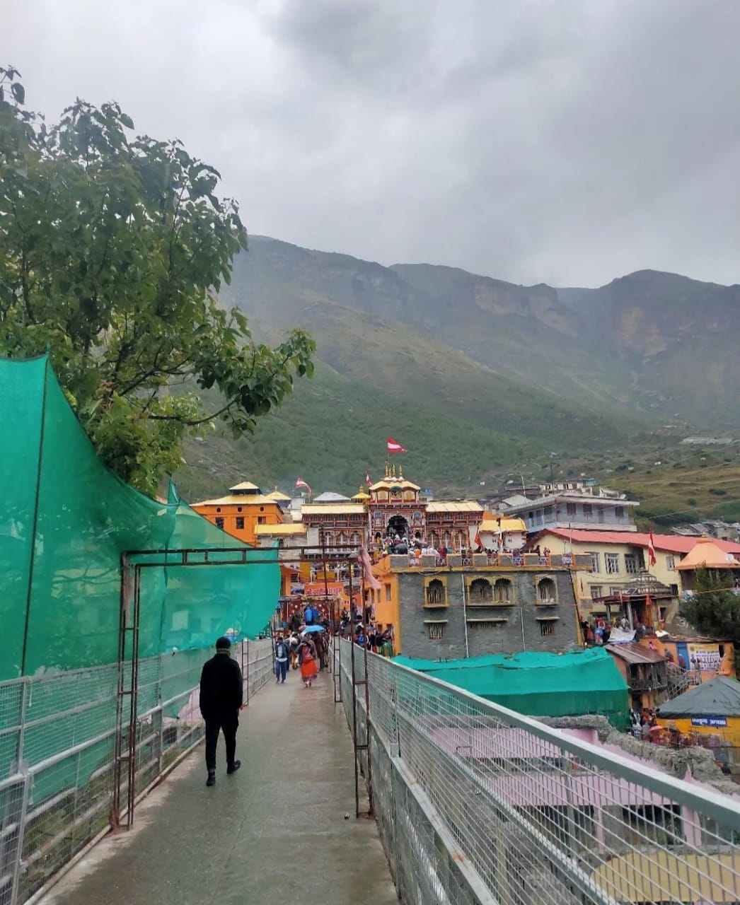
Badrinath:

The famed town of Badrinath is among the four dominant Char Dham pilgrimage sites of India as well as the Chota Char Dham. It is perched at an average elevation of 3,300 metres (10827 feet) above sea level on the banks of Alaknanda RiverThis holy town is named after the Badrinath temple dedicated to the preserver, Lord Vishnu. Many Hindu devotees are smitten by the charm of this holy shrine as it showcases the traditional Garhwali wooden architecture.Badrinath is well-known in the famous Char Dhams of India. Badrinath Dham is a religious place where both Nar and Narayan meet. According to the beliefs of the scriptures, it is also called Vishalpuri. Lord Vishnu is worshiped in Badrinath Dham. That is why it is also called Vishnudham. This Dham is one of the oldest pilgrims of the Himalayas. The main entrance of the temple is decorated with beautiful paintings. The main gate is named as Singhdwar. Badrinath Temple has very small statues of black stone with four arms. Here Lord Vishnu sits in the currency of Padmasana.According to the belief related to Badrinath Dham, this Dham was established in Satyuga. This is the reason here, that the Greatness of this Dham has been found in all major scriptures. The idol of Lord Vishnu established in this Dharam has a diamond on the head. The idol is decorated with the crown of gold. The main idol here has many other idols. The idols of Narayana, Udvavji, Kuber and Narada are prominent among them. A trunk near the temple, whose water is always hot
Located between the two mountains Nar and Narayan, Badrinath Dham is a majestic sight as well as the the most important of all the Char Dhams. Lakhs of tourist come every year to this sacred Badrinath town to seek blessings and to get a glimpse of the famous temple of Shri Badrinathji.
Badrinath is the only Shrine which is part of both Chota Char Dham and India Char Dham. Badrinath is one among four pilgrimage centres in four corners of India. Among them were Badrikashram (Badrinath Temple) in the North, Rameshwaram in South, Dwarkapuri in west and Jagannathpuri in east.
Bhagvat Puran Describes: There in Badrikashram the Supreme being (Vishnu), in his incarnation as the sages Nar & Narayan, had been undergoing great penance since time immemorial for the welfare of all living entities.
The Badrinath tirtha derives its name from the native word Badri, which refers to a variety of wild berry. Badrinath temple history has its own uniqueness and Legendaryness. There are a lot of tales about Badrinath temple. It is stated that when Lord Vishnu sat in penance in these mountains, His spouse Goddess Laxmi took the appearance of a berry tree and shielded Him from the fierce sun. It is not only the Lord’s dwelling place, but also the abode of countless pilgrims, saints, and sages who come to meditate in search of enlightenment.
According to SkandPuran the idol of Lord Badrinath was recovered by Adiguru Shankaracharya from NaradKund and was re-enshrined in the 8th century A.D. in this temple. Skanda Purana describes more about the place and says: “There are several sacred shrines in heaven, on earth, and in hell; but there is no shrine like Badrinath.”
In the history of Badrinath, the sages Nara and Narayana, the ‘fifth avatar of Lord Vishnu’, practised penance in the temple, according to the Vamana Purana. The religious narratives from several ancient Hindu scriptures abound in Badrinath. According to mythic, Badrinath is often called as Badri Vishal, and was a place of pilgrimage for Hindus.
About Badrinath Temple
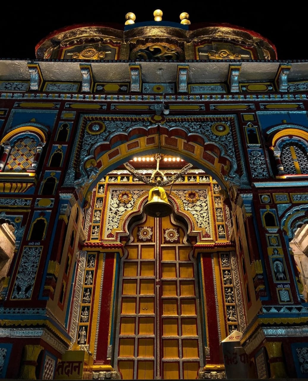
Badrinath Temple, also known as Badrinarayan Temple, is a well-known Char Dham Temple. It is dedicated to Lord Vishnu and is located in Badrinath town. Along with the Badrinath temple, the Town of Badrinath has the Panch Badri temples including Yog Dhyan Badri, Bhavishya Badri, Adi Badri, and Vriddha Badri.The temple has North Indian style architecture with stone walls and carvings, as well as a colourful and powerful entrance gate.
Shree Badrinath Temple is divided into three sections
The Garbha Griha portion of the Badrinath shrine has its canopy covered with a sheet of gold. The complex has 15 idols especially attractive is the one-metre-high image of lord Badrinarayan, finely sculpted in black stone. It represents Lord Vishnu seated in meditative pose called padmasan. The Darshan Mandap is a place in the Temple complex where devotees and pilgrims gather to pray for good fortune. Every puja must be preceded by a holy dip in the Tapta Kund. Unlike most Hindu temples, they are performed in the presence of the devotees.
Every year, the Badrinath Temple opening dates are determined in the month of April-May & closes for winters in the third week of November. As a result, the temple is closed for 6 months every year, during which time prayers to Badri Vishal are held in the Narsimha temple in Joshimath. This year Badrinath Temple has been closed for winter and will reopen on May 8 at 6.15 a.m.
Generally, the priests announce the dates for the opening of Badrinath Temple on Basant Panchami.Badrinath remains open for pilgrims from April-May till October-November and remain closed for winter months. Lord Badri Vishal worship continues to takes place at Winter Abode of Lord Badrinath, Narsimha Temple in Joshimath.
Before the closing date of Badrinath temple doors, the priests light a lamp in front of the idol in the sanctum. It is stated that throughout the winter months, Narad Muni, who obtained salvation here, continues with the prayer rituals. This notion is reinforced by the fact that when the temple is reopened after six months in spring, the lamp is still seen to be flickering

Weather in Badrinath is quite pleasant and cheerful all year. But the best time to visit Badrinath is between May and November. Visitors may have trouble visiting the temple during the monsoon season (late June to August) because to severe rain. March to June is very pleasant with moderate climate, with average around 18°C. Summers is ideal for all sightseeing and pilgrimage.July to mid-September is accompanied with scanty rains and also temperature drops down to 15°C. The region is prone to occasional landslides and travelling can be difficult.
November to April are chilly days with average minimum touching near 5°C. Minimum can touch sub-zero levels and snow falling seen very often during winters. Because of the Badrinath weather in winters, temple is closed during this time for 6 months.
The best season to visit Badrinath is undoubtedly during the summer months of May to June, followed by September and October. Summers are mild and attracts a large number of visitors.
Devotees can now book online pooja in advance for Badrinath Puja / Bhog/ Paath/ Aarti at a fair price. All pujas in Badrinath are done with immense mantrocharans and in a holy way by devoted priests.
It is a fairly simple procedure to book online puja in Badrinath temple. First, register at the Badri-Kedar website, log in to the website, then choose Puja/Bhog/Paath /Aarti. Enter your information correctly and make an online payment. Pujas of various kinds are performed in Badrinath.
There are separate rates for online Puja and advance Puja slots at the temple. You can select and book it accordingly. While sitting at your home, you can easily book the Puja slots with these simple steps.
Badrinath is a Hindu holy town and a Nagar panchayat in Chamoli district in the state of Uttarakhand, India. Where is Badrinath located? It is located at an elevation of 11204 feet (3415 m), in the shadow of Nilkanth Peak. This town is well-served by all major forms of transportation, including air, rail, and road. The quickest way to go to Badrinath is by car or train.
There is no direct bus or train service to Badrinath. To get to Badrinath, you must first travel to Haridwar/Rishikesh. Once in Haridwar or Rishikesh, you may easily catch a direct bus or taxi to Badrinath.
The location of Badrinath is easily accessible by road as compared to airways and railways. It is located at a distance of 525 Km from Delhi & 296 Km from Rishikesh.
Now the question is how to reach Badrinath. There are regular buses operating to Badrinath from Delhi, Haridwar and Rishikesh.Well connected to Haridwar, Rishikesh, Dehradun, Dev Prayag, Rudra Prayag, Kotdwar, Joshi Math and other hill stations of Garhwal and Kumaon region.
Tourist Places Near Badrinath
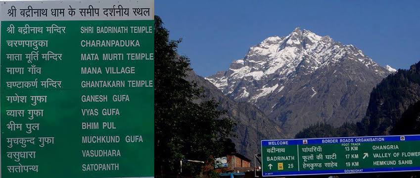
There are many pilgrimage and tourist places to visit near Badrinath Temple, some of them are trekking and skiing destinations as well. In Badrinath, there is so much to discover. Here is the list of sites, which pilgrimages can visit during their 4 dham yatar or Badrinath Tour.
Include all of the following locations in your itinerary to fully appreciate the magnificence of the Garhwal Himalayas. Pandukeshwar, Govindghat, BhimPul, Valley of Flowers, Hemkund Sahib and Lokpal Temple, Joshimath, Auli, Adi Badri etc.
The national route NH58 connects Delhi to Mana Pass in Uttarakhand, near the Indo-Tibet border, and from there to Badrinath. There is no direct route by Air and Railways between New Delhi and Badrinath. If you are travelling to Badrinath from Delhi, you will need to change modes of transportation either once or several times. However, if you have your own vehicle, you can drive directly to the venue.
The overall distance between Delhi and Badrinath is 528 kilometres. And the distance can be covered in almost 12 hours. The best and cheapest way to travel from Delhi is in the pilgrim season of summer months. At that time, buses carry pilgrims from New Delhi to Badrinath via Haridwar and Rishikesh.
How to Reach Badrinath?
Detailed Introduction of Panch Badri
Panch Badri are the Hindu shrines dedicated to Lord Vishnu. These temples, namely, Vishal Badri (Badrinath), Vridha Badri, Adi Badri, Yogdhan Badri, and Bhavishya Badri, are believed to be the abode of Vishnu. Lord Badrinath is worshipped under five different names at these five temples. A prominent pilgrimage destination for Hindus, the area commencing from Satopanth till Nandprayag is also known as Badri-Kshetra.

Temperature
Clothing
Languages/Dialects
Badrinath is a Hindu holy town and a nagar panchayat in Chamoli district in the state of Uttarakhand, India. It is located at an elevation of 11204 feet (3415 mts), in the shadow of Nilkanth Peak and between Nar-Narayana Hills, Badrinath is a holy hindu pilgrimage situated on the banks of Alaknanda river.
Kedarnath Popular Route : Delhi → Haridwar (206 km) → Rishikeh (24 km) →) Deoprayag (71 km) → Kirtinagar (30 km) → Shrinagar (4 km) → Rudraprayag (34 km) → Gauchar (20 km) → Karnaprayag (12 km) → Nandprayag (20 km) → Chamoli (11 km) → Birahi (8 km) → Pipalkoti (9 km) → Garur Ganga (5 km) → Helang (15 km) → Joshinath (14 km) → Vishnuprayag (13 km) → Govindghat (8 km) → Pandukeshwar (3 km) → Hanumanchatti (10 km) → Shri Badarinath Ji (11 km).
Bhavishya Badri:
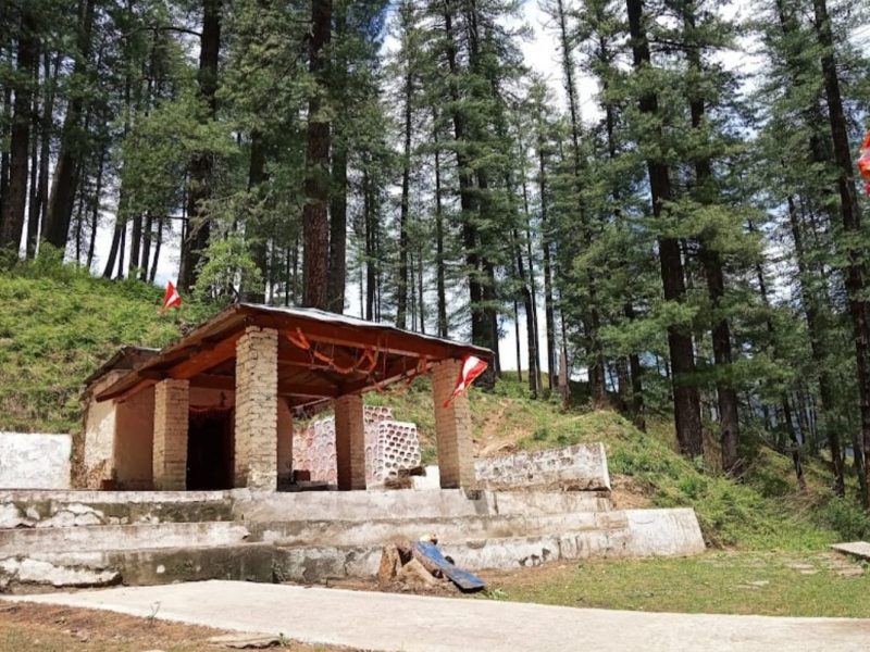
Bhavishya Badri is one of Panch Badri temples, located at an height of 2744 mtrs near Joshimath. Beyond the Tapovan, Bhavishya Badri is situated at 17 kms from Joshimath in Subhain Village This small temple deity is Lord Vishnu and known to be the future seat of Badrinath. There is a beautiful water spring in Bhavishya Badri and the place has many Cedar trees,Literally, the Badrinath of the future, the temple of Bhavishya Badri is at Subain, about 17 Kms from Joshimath to the east toward Lata. It is beyond Tapovan, up the Dhauliganga river and involves a track of about 3 Kms. from the motor road. It has an altitude of 2744 mts. and is located within dense forest. The approach along the Dhauli river is stimulating. The name Dhauliganga means (white water) and truly it is roaring torrent almost every where upstream from Tapovan and passes through almost perpendicular cliffs on either side, several 100 mts. high and wild in the extreme.It is believed that on the onset of Kalyug , the ever-withering arm of the Narasingha idol at Joshimath will finally fall off and the mountains of Jay and Vijay at Patmila near Vishnuprayag will collapse making the present shrine of Badrinath inaccessible, resulting in Badrinath’s reappearance and consequent worship at Bhavishya Badri. After Vishnu, in his incarnation as Kalki, destroys the world bringing Kalyug to an end satyug will begin again and Badrinath Dham will be reestablish at Bhavishya Badri.
Being a part of Panch Badri temples, Bhavishya Badri is located at an elevation of 2744 meters from the sea level. Bhavishya Badri, one of the most sacred places for Hindus, is only 17 Km away from Joshimath and, according to the folk tale, is the future adobe of Badrinath, Lord Vishnu.
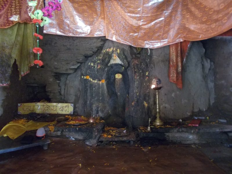
Significance of Bhavishya Badri
The panch Badri, Badrinath, Yogdhyan Badri, Adi Badri, Vridha Badri, and Bhavishya Badri are put together by the Adi Shankaracharya to foster Hindu culture in the country. If we go with the legends, then at the end of this Kali Yuga, Nara and Narayana mountains near Badrinath Dham will obstruct the route to the temple. Then the Lord Vishnu will appear in Bhavishya Badri temple.
At present, you will find the Narasimha Avatar of Lord Vishnu along with a rock adjacent to the temple that features the shape of God. The surrounding of Bhavishya Badri is a treat to your eye, thousands of cedar trees enfold this blessed place along with a beautiful water spring. On the other hand, the approach to Bhavishya Badri alongside the Dhauliganga river is just incredibly beautiful.
Best Time to Visit
The Best time to visit Bhavishya Badri is from March to May and again September to November. The temple usually opens at 7 AM and closes sharp at 6 PM.
How To Reach
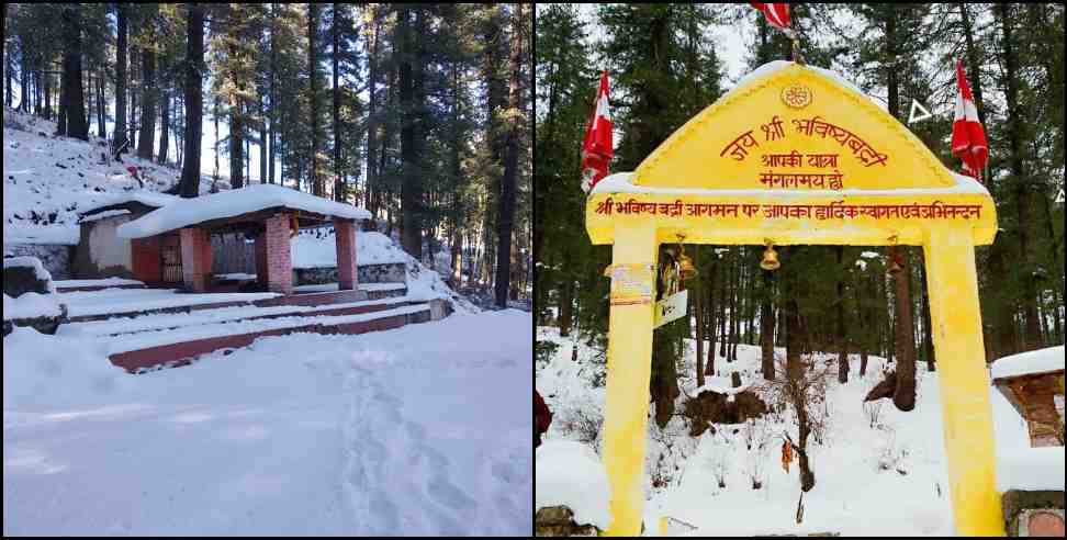
For Bhavishya Badri temple, you should start your journey from Haridwar and pass Rishikesh, Devprayag, Rudraprayag, Karnaprayag, Joshimath, and Saldhar. You can easily reach Bhavishya Badri temple by train and using roadways by starting your journey from Haridwar as well as Rishikesh and reach at Joshimath until Subhai village. Then you have to trek for around three-kilo meters.
Find More: Badrinath Yatra Packages
The nearest rail connectivity for Bhavishya Badri is Dehradun and Rishikesh. Furthermore, for air connectivity, you should reach Jolly Grant Airport, Dehradun, which is around 290 km away from Joshimath.
On the other hand, if you prefer roadways, you can also reach Saldhar, which is only 19 kilometers away from Joshimath and a good motorable road.

By Air
Jolly Grant airport Dehradun is the nearest airport 268Km from Joshimath through Rishikesh. Taxi and bus services are available from Dehradun airport to joshimath.
By Train
Rishikesh railway station is the nearest rail-head 251Km from Joshimath. Taxi or jeeps are available to Joshimath from Rishikesh railway station.
By Road
Saldhar is connected to Joshimath, 19Km away, by motorable road. Bhavishya Badri temple is 6 Km trek from Saldhar. Joshimath is well connected to most parts of Uttarakhand state through motorable road.
Vridha Badri:
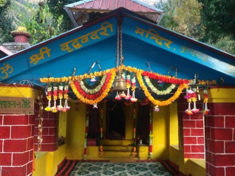
Virdha Badri is located at Animath in Chamoli district of Uttarakhand. The Vridha Badri temple dates back to the times when it India was ruled by the Gupta Dynasty. The Vridha Badri is one amongst the “Sapt Badri” temples in the Badrikshetra The Vridha Badri holds a very high significance in the Hindu mythology. The name of Vridha Badri is derived from the form of an old man in which Lord Vishnu is worshiped here. It is situated ahead of the Kalpeshwar Mahadev Temple, ahead of Helang. The elevation of Vridha Badri is of 1,380m in Animath.
Legend of Vridha Badri
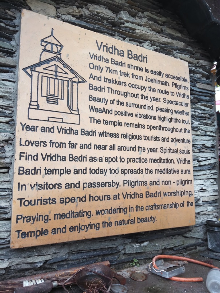
Legend states that sage Narada performed penance at this spot to please lord Vishnu. Pleased by Narada’s penance, lord Vishnu appeared at Animath in the form of an old man and answered to Narada’s prayer. Vishwakarma, the architect of gods and goddesses, crafted the statue of Badri as an old man and the statue was established in Animath. Lord Badrinath lived at Animath for years during ancient times. Later, the statue of Badrinath at Animath was flodded and fell down in the nearby lake Narad Kund.
In 8th Century, Aadi Shankaracharya found the broken statue of lord Vishnu in the form of Vridha (old) man and reestablished it. Aadi Shankaracharya established Badrinath at the present place. It is also said that the original statue crafted by Vishwakarma is now established at Badrinath.
Vridha Badri Tourism
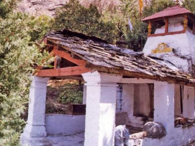
Vridha Badri shrine is easily accessible, only 7Km trek from Joshimath. Pilgrims and trekkers occupy the route to Vridha Badri throughout the year. Spectacular beauty of the surrounding, pleasing weather and positive vibrations highlight the tour. The temple remains open throughout the year and Vridha Badri witness religious tourists and adventure lovers from far and near all around the year. Spiritual souls find Vridha Badri as a spot to practice meditation. Vridha Badri temple keeps its age old image of being the old Badrinath temple and today too spreads the meditative aura in visitors and passersby. Pilgrims and non-pilgrim tourists spend hours at Vridha Badri worshiping, praying, meditating, wondering in the craftsmanship of the temple and enjoying the natural beauty.
Vridha Badri | Best Time to Visit
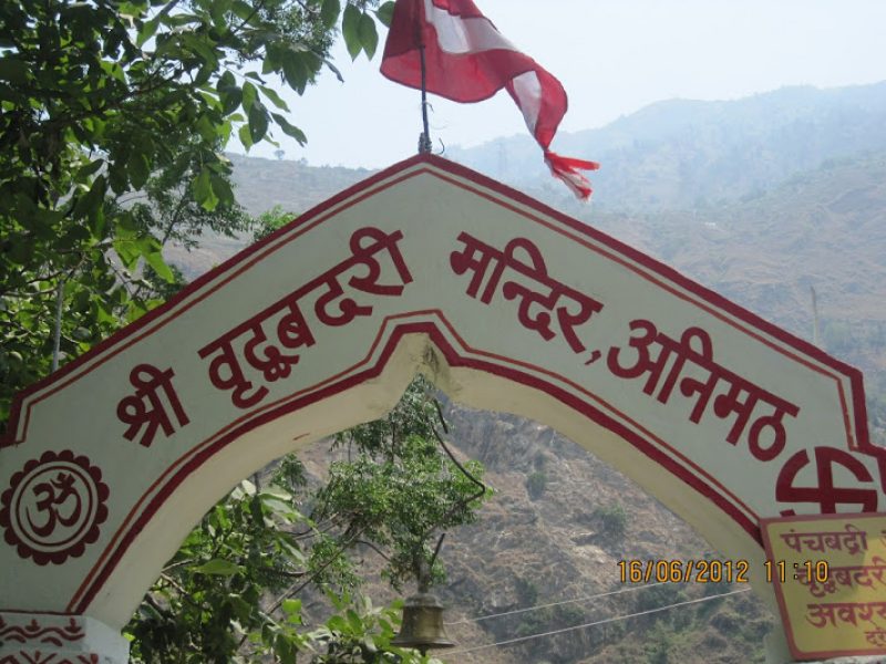
Vridha Badri | How to Reach ?
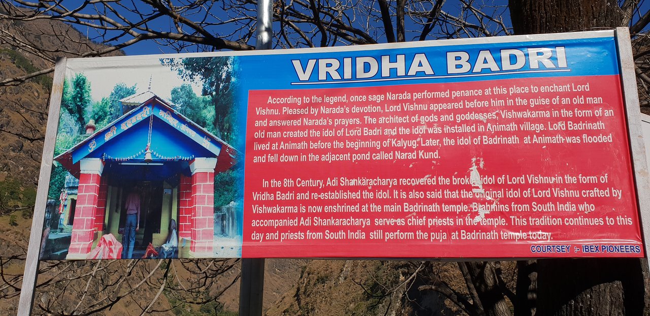
Vridha Badri is only 7Km easy trek from Joshimath. Vridha Badri lies before Helang on the route to Kalpeshwar. Here we discuss on how to reach Joshimath from other parts of Dev Bhoomi Uttarakhand:
Route to Vridha Badri
Yogdhyan Badri:
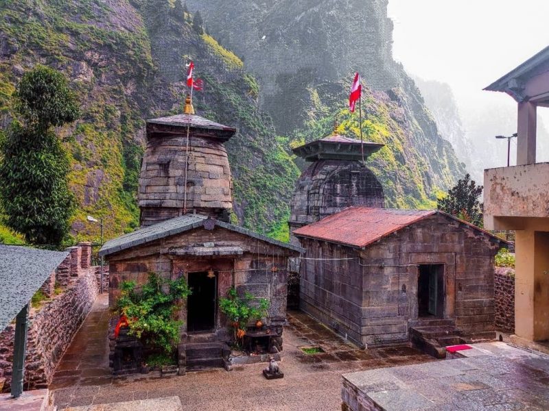
Yogdhyan Badri Temple is one of holy ‘Sapta Badri’ or seven Badri’s located at Pandukeshwar, Badrinath. Abode of Utsava-murti (festival-image) or Lord Udhava and Lord Kuber in winters, Yogadhyan Badri Temple is the place of worshipping Lord Vishnu meditative posture idol. Legends believed that King Pandu installed the bronze idol of Lord Vishnu in Yogdhyan Badri shrine The Yogdhyan Badri Temple is as old as the temple of Badrinath. Pandukeshwar is 24 kms from Joshimath , it has the Yogdhyan Badri temple one of the panch badri . The image here, in a meditative posture, is worshiped as at Badrinath.According to the myth, the Pandavas made over Hastinapur to Raja Parikshit and retired here. Also king Pandu, the father of Pandavas had spent his last days doing penance here before his Nirvana, and hence the name. Some famous copper plate carrying old inscriptions,providing valuable information on the history of the temple and early Katyuri Rajas have been found here. The surrounding region is Panchal Desh better known as UttarKhand. Suryakund , which is on the top of Milam glacier, is a hot water spring. Here Kunti is said to have given birth to Karna, fathered by Surya. Pandu married Kunti at Pandukeshwar near Sri Badrinath.
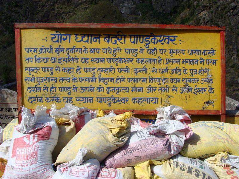
Important information
Stay Near Yogdhyan Badri
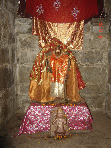
A portion of the spots where one can remain close to Yogadhyan Badri while undertaking the Char Dham Yatra are:
Hotel Sudarshan Palace: Hotel Sudarshan Palace has offices, for example, a 24-hour front work area, garden region, and stopping office inside its premises. Conveniences, for example, bed, packaged drinking water, admittance to the normal gallery, and joined washroom are accessible.
Hotel Kuber Annex: The offices presented here are the front work area, room administration, power reinforcement, STD PCO office, specialists available for any emergencies. Knead administration is likewise accessible here with the goal that visitors can unwind in the wake of traveling. A helicopter booking office is additionally accessible at the inn.
Hotel Heaven: The lodging offers offices suchlike stopping and phone. With a group of talented experts, the property guarantees the satisfaction of all requirements of visitors. Also, if there should be an occurrence of health-related crises, one can benefit from the specialist available to come into the work office at the inn.
What are the timings of Yogadhyan Badri?
Here are the timings of the temple:
Timings From To
Morning 5 AM 12 PM
Evening 2 PM 9 PM
Kartik Swami Temple :

Dedicated to Lord Shiva’s elder son, Kartikeya, Kartik Swami is a temple of mystic ambiance and exquisite views. The popular Hindu temple is perched on a hilltop at an elevation of 3050 m and situated near Kanak Chauri Village on Rudraprayag-Pokhari route in the district of Rudraprayag of the state Uttarakhand. In order to reach the temple, one has to undergo a 3 km thrilling trek that starts from Kanak Chauri Village. The route of the trek is rugged but it assures astonishing verdure to relish the exquisiteness of nature. The religious site in the Garhwal Himalayas that is dedicated to Lord Kartikeya has a strong history behind it. As per Hindu Mythology, Lord Shiva challenged his sons Lord Ganesha and Lord Kartikeya that whoever will first take seven rounds of the universe will have the honor to be worshiped first. Hearing that, Lord Kartikeya headed off to circle the universe on his vehicle, whereas, Lord Ganesha took seven round of his parents, Lord Shiva and Goddess Parvati. Impressed by Ganesha, Lord Shiva gave him the privilege of being worshipped first. Resultant, Lord Kartikeya showed his anger on the decision and sacrificed his body and bones to his father as reverence.It is believed that this whole incident took place here, and thus, the temple is named as Kartik Swami. Lord Kartikeya is also known as Lord Kartik Murugan in South India, where he is believed to have settled later. Apart from being a prominent tourist attraction, Kartik Swami is also renowned for offering the magnificent sunrise and heart-melting sunset views. Evening prayers, chanting of mantras, and maha bhandaras are the major attractions of the temple for tourists. Moreover, the shrine houses an idol of Lord Kartikeya and here few festivals and events like Kartik Poornima and 11-days-long Kailash Yatra are observed with much zeal. Once here, one has the chance to view some top attractions standing in the form of snow-clad Himalayan peaks of Bandarpoonch, Kedarnath Dome, Meru & Sumeru, Chaukhamba Peak, Neelkanth, Dronagiri, Nanda Ghunti, Trishul, and Nanda Devi group of peaks. Apart from the breathtaking views and indescribable feeling, the trek to the temple also offers an opportunity for bird watching, camping, and village tourism.
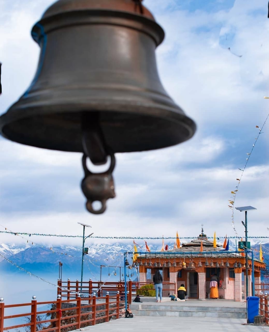
Best Time to Visit Kartik Swami Temple
Since the temple remains open throughout the year, one can visit it in any season. Despite this fact, summer and winter are considered the ideal time to visit the temple as the monsoon rain disrupts the trek and damage the roads as well.
The summer season here begins in April and continues till June. The average temperature of the peak in summer varies from 15°C to 20°C. During March and April, the entire witnesses abundance of rhododendron which one can easily get to see on the trekking route. As the months pass
The district of Rudraprayag along with the entire state, experience heavy rainfall during the months of July to September. Heavy rainfall makes trekking very difficult along with the chances of road blockage. In August and September there you will notice rich vegetation. Thus, it is advisable to check the weather conditions before heading out for Kartik Swami temple in monsoon.
The month of October is the commencement of winter season here which lasts till March. November to January offers the clear and majestic view of snow-clad Himalayan ranges. Moreover, the temperature during these months ranges from 0°C to 10°C. Make sure to wear warm woollen clothes when you visit the temple during winter.
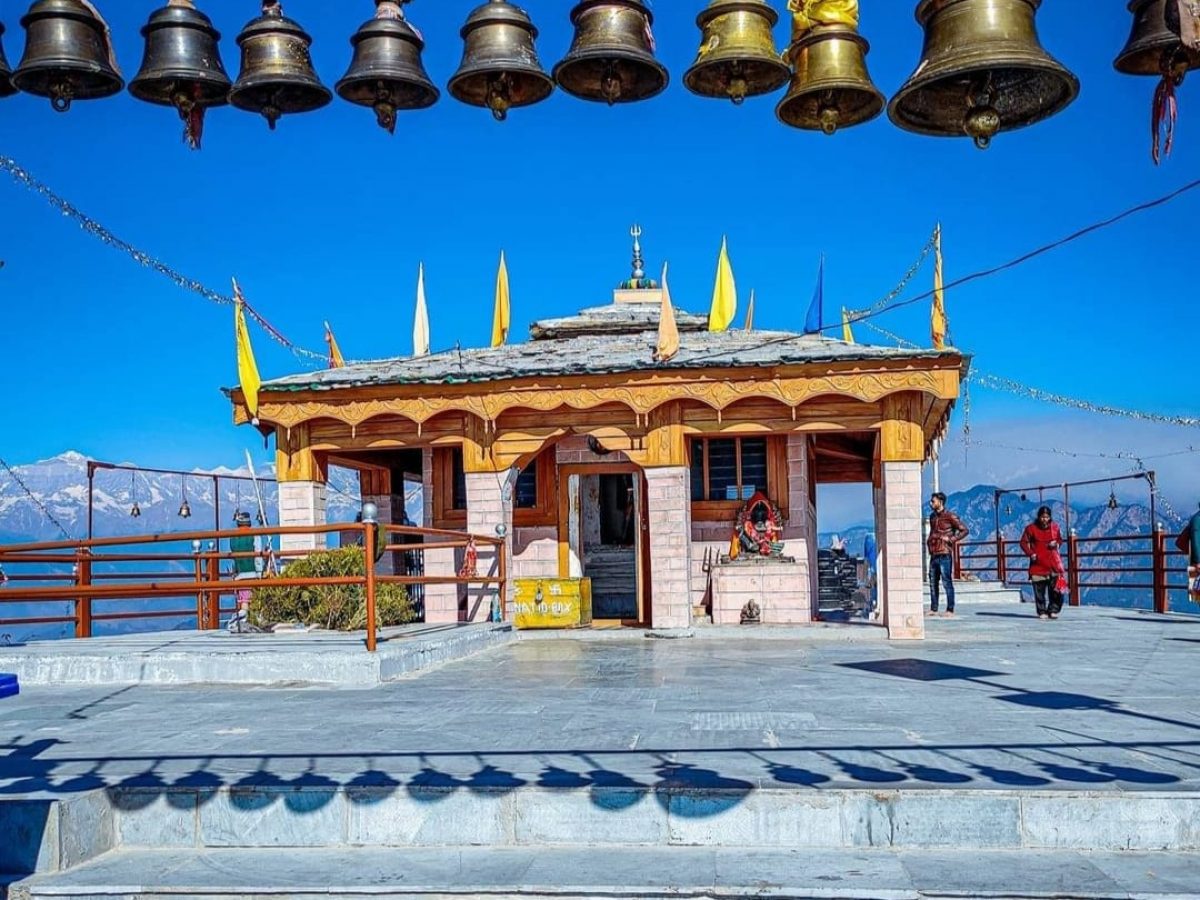
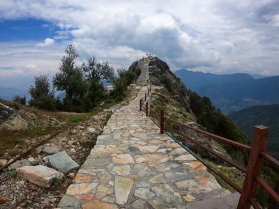
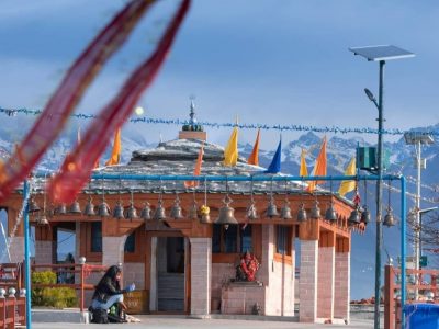
Where to Stay near Kartik Swami Temple?
Vishnuprayag being a small destination have fewer accommodations. Thus, a better place to find a variety of hotels near Vishnuprayag would be in Joshimath. The town offers a plethora of best staying places that range from budget to mid-range and ensures a comfortable and memorable experience.
How to Reach Kartik Swami Temple?
One can access the Kartik Swami Temple through a 3 km trek from Kanak Chauri Village which is at a distance of just 40 km. The Kanak Chauri village is situated on Rudraprayag-Pokhari route for which cabs on hire are available from different parts of the state and Delhi as well. Therefore, roadways are the best way to reach Kanak Chauri from where one has to trek to Kartik Swami Temple.
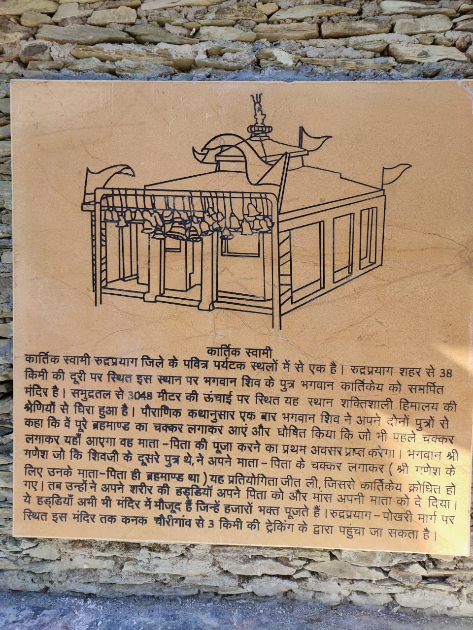
The nearest airport from the place is Jolly Grant Airport, Dehradun which is around 192 km away from the place. One can board a taxi or cab from the airport to reach Rudraprayag. Thereafter, shared jeep from Rudraprayag to Kanak Chauri and finally 3 km trek to the temple.
In order to reach the temple through railway network, one has to take a train to either Haridwar or Rishikesh railway station which are the nearest railway stations to Rudraprayag and located at a distance of around 140 km and 165 km respectively. Haridwar Railway Station has better connectivity with major cities in India, and thus, it is advisable to book train tickets for Haridwar. Once you reach the station, hire a cab/taxi to Rudraprayag or directly to Kanak Chauri. After reaching Kanak Chauri, there is a 3 km trek to the temple.
The temple of Kartik Swami is very well-connected to roads. Thus, one can hire a cab or taxi to Kanak Chauri. Interstate buses from ISBT Anand Vihar, Delhi to Rudraprayag, Rishikesh and Srinagar are also available. Once you reach Kanak Chauri, you’ll have to undergo a 3 km trek in order to reach Kartik Swami Temple.
For that Amazing Trekking Opportunity
Apart from the pilgrims, the temple is also often visited by oodles of nature lovers and adventure buffs. The 3-4 km trekking trail that passes through a thick rhododendron forest not only allows pro-trekkers but amateur ones as well to visit the temple, which also makes it a prominent destination for adventure seekers. From Kanakchauri, there is a 3 km trek to the temple which is an easy one, and hence, one doesn’t have to worry much about it. The best of this enthralling trek is that the most of the trail passes through the forest of Rhododendron and sight of the route will be as exquisite as you are imagining. On the way, the sights of waving mountains, stretching to the horizon, will surely blow your mind away.
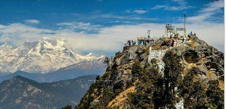
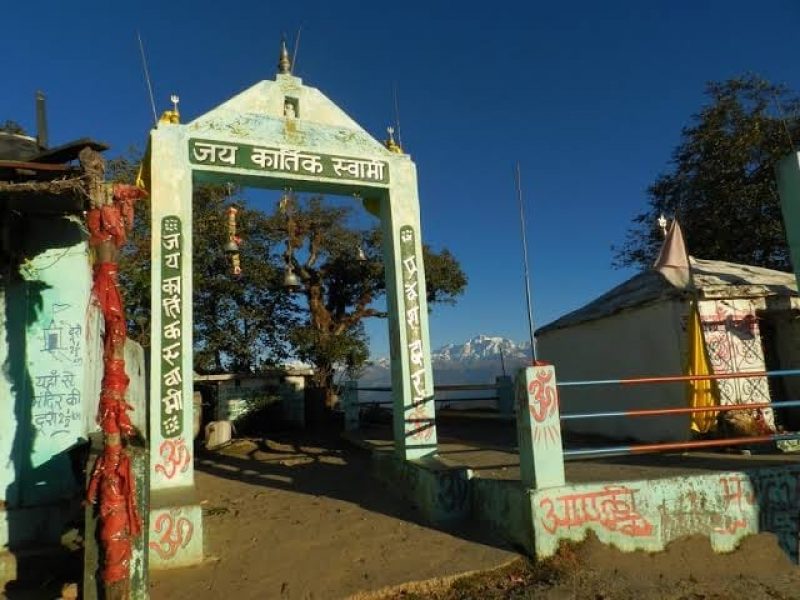
Tips for Backpackers or Solo Travellers
For all those travelling to Uttarakhand solo, it would be wise to board a bus from Rudraprayag to Kanakchauri as it is the most economical way to reach there as compared to taxi/cab. This whole journey from Rudraprayag to Kanakchauri will take around 2 hours. The moment you leave from Rudraprayag, the pristine and mesmerizing beauty of the region will make you fall in love with it. The road is well-paved and starts gaining height after Rudraprayag. On your expedition, you can see the villages and houses that almost look-like matchboxes.
Note:
After 2 pm buses do not run from Rudraprayag, and hence, make sure to reach here early in the morning, in case you have reached late here, you can either choose to stay in Rudraprayag at night or hire a cab instead.
Dhari Devi Temple
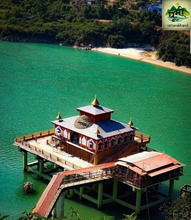
The temple dedicated to goddess Kali is a much worshiped Goddess of the region. People are of the opinion that the stone carved deity changes face of a girl, woman, and of old lady as the day progresses. A mythological account says that once a severe flood washed away a temple and Dhari Devi’s idol was trapped against a rock near the village Dharo. Villagers heard the wail of the idol and a devine voice directed them to install the idol there.Every year on the occasion of Navratras special worship is offered to Goddess Kaliasaur. People from far & near visit this sacred haunt in great number to get the blessings of Goddess Kali. An ancient cave is also present near the temple. The temple is 15km from Srinagar on Delhi- Niti National Highway 55 leading to Badrinath. A 1 km-cement pathway leads one to the temple on the bank of river Alaknanda.Dhari Devi temple is a popular Shrine of Maa Dhari Devi. The temple is located almost 15 km from Srinagar Garhwal, on the banks of the Alaknanda River between Srinagar and Rudraprayag in Kalyasaur village. Dhari Devi temple is one of the most important worship places in Garhwal Region of Uttarakhand, India. Goddess Dhari Devi is considered as the guardian and the protector of the Char Dhams in Uttarakhand.
Dhari Devi Temple Overview
State Uttarakhand
Village Kalyasaur
Deity Goddess Kali
Best Time to Visit October to June
Darshan Timings 6:00 am to 12:00 pm
2:00 pm to 7:00 pm
Entry Fee Free
Summer Temperature Max 36°C & Min 20°C
Winter Temperature Max 28°C & Min 9°C
Nearest Town Srinagar, Uttarakhand (15 Km)
Nearest Airport Jolly Grant Airport, Dehradun
Importance of Dhari Devi Temple
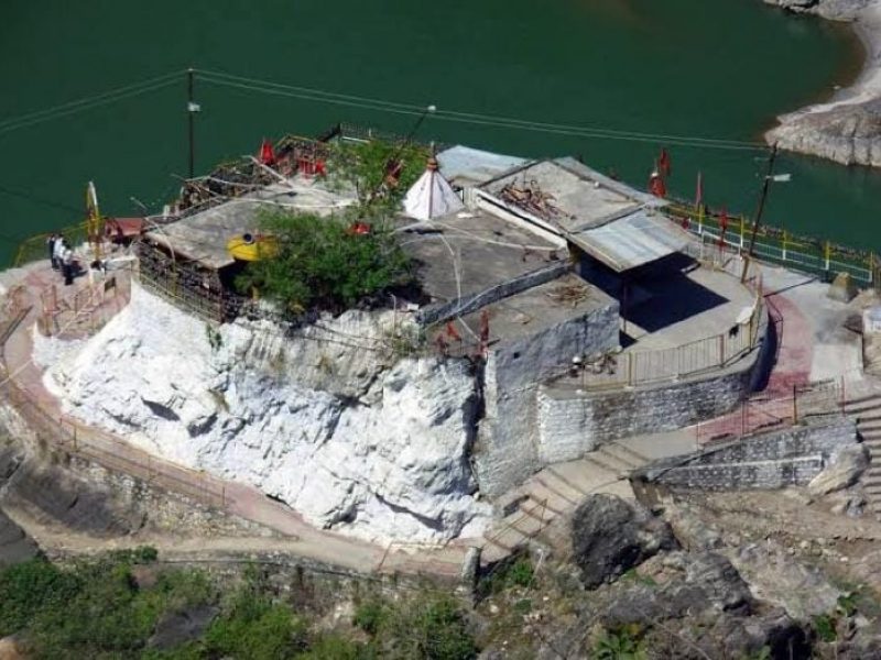
The shrine is one of 108 Shakti Sthals in India as numbered by Srimad Devi Bhagwat. The idol of Maa Dhari Devi has two parts, upper half and lower half. This shrine of Dhari Devi is home to the upper half of the idol of the goddess. On the other hand, Kalimath temple is the shrine where the lower half of the idol of the goddess is kept. In Kalimath temple the goddess is worshiped as a manifestation of the Maa Kali, the other half of Lord Shiva.
Goddess Dhari Devi is worshiped in an open space, there is no rooftop where the idol is kept. The reason behind this is that people believe that Dhari Devi likes to sit in the open space. Dhari Devi is considered as an Avatar of Kali Mata.
A large number of devotees come to visit the temple throughout the whole year. Some of the important festivals celebrated in the temple are Durga Puja and Navratra. During these festivals, the temple is decorated with beautiful flowers and lights.
Dhari Devi Temple Timings
Morning Darshan Timing 6 AM to 12 PM
Evening Darshan Timing 2 PM to 7 PM
Myths and History of Dhari Devi Mandir
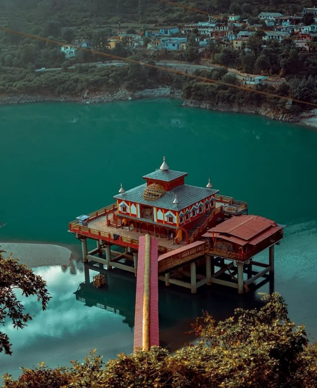
According to the local people the appearance of the idol of goddess changes with time from a girl to a woman and then to an old woman. People say that the idol of the goddess should not be put under the roof. So there is an open sky above idols in the temple. Taking photographs of Dhari Devi idol is strictly prohibited in the temple.
15th June 2013 has become an important day in the history of the temple. On this day the idol of Maa Dhari Devi was removed from the original location. It was shifted to another location to facilitate the construction of a dam. Many leads, residents of the state and locals were opposing the construction of this dam since the inception of the of the project.
The devotees of the goddess have the belief that the moving of the would somehow agitate Kali it would not be good for the region. And the ugly truth is, exactly on the next day of this incident a massive cloudburst and flash flood started in Uttarakhand. this massive disaster ruined the Kedarnath Dham, washing away many people, houses, trees, and vehicles.
To some people, it may sound like just a coincidence but the results of the disaster were shocking and unforgettable. According to official government records, 197 people were killed, 236 got injured and 4,021 went missing in the flash floods. The flood destroyed five districts of Uttarakhand. A total of 2,119 houses were fully damaged, 3,001 severely damaged and 11,759 partially damaged.
Legends
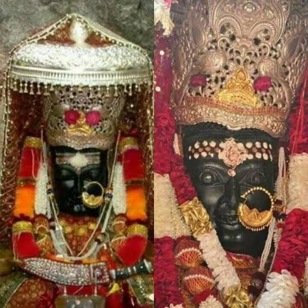
There is a popular legend which stated that once because of the flood in Alaknanda river the idol of Goddess Kali got struck against a big rock. Then the people of the Dharo village heard the divine voice of the Goddess and they fixed the idol of Goddess Kali at this spot, where the temple is present. After this incident, the temple is known as Dhari Devi temple.
Another legend states that when Adi Guru Shankaracharya went out in the excursion, he took some time to rest in this area and worshiped here. IF this is true then it is the possibility that this temple belongs to Dwaparyug era.
Relocation of Dhari Devi Temple
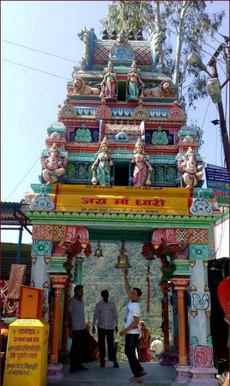
Because of the Srinagar Hydel Project in the Alaknanda river, Dhari Devi Temple was relocated from its original site. During Navratras the number of visitors significantly increases but devotees from all around the country visit Dhari Devi Mandir throughout the year.
Before the partition of Uttar Pradesh state, the whole region of Uttarakhand was a part of Uttar Pradesh. The Chief Minister of Uttar Pradesh was Mulayam Singh Yadav at that time. The government proposed a plan to build a dam on the Alaknanda river and did a survey. Local residents and many other leaders opposed this construction.
But the plan got finalized and later the construction of the dam started. When there was no dam on the river, devotees had to walk almost 600 meters from the road to the temple. But after the construction of the dam, the government had to lift the temple few meters. Now the devotees have to walk only 200 meters from the road to reach the temple.
How to Reach Dhari Devi Temple
Maa Dhari Devi Temple is located at Kalyasaur village between Srinagar and Rudraprayag. The distance between Srinagar to Dhari Devi is 16 km. And Rudraprayag is 20 km away from the temple.
One can reach here easily by bus or taxi from Srinagar or Rudraprayag. The nearest railway station is Rishikesh railway station, which is 119 km away. The nearest airport at Jolly Grant airport, which is 136 km away.
By Road
The temple is well connected to all the major cities of Uttarakhand. It is 124 km away from Rishikesh and 165 km from the capital Dehradun.
By Train
The nearest railway stations are in Rishikesh and Haridwar. Rishikesh is almost 124 km and Haridwar is 142 km away. After that, there are many buses and taxis to Srinagar and Rudraprayag.
By Air
The nearest airport to the temple is Jolly Grant airport Dehradun. It is almost 136 km away. There are many buses and taxis which are regularly active to reach Srinagar, which is almost 15 km from Dhari Devi temple.
FAQs
What is the temperature in winter and summer at Dhari Devi Temple?
The temperature in Dhari Devi Temple ranges from 9°C to 28°C in winter and 20°C to 36°C in summer.
What is the best time to visit Dhari Devi Temple?
The best time to visit Dhari Devi Temple is in summer and winter, as you may face road blockage during the rainy season. But then, if you want, you can come to the temple for darshan anytime.
What is the distance between Srinagar Garhwal to Dhari Devi Mandir?
The distance between Dhari Devi Mandir to Srinagar Garhwal is about 15 km.
What is the distance between Rishikesh to Dhari Devi Mandir?
The distance between Rishikesh to Dhari Devi Mandir is about 123 km.
What is the distance between Dhari Devi Mandir to Kedarnath?
The distance between Dhari Devi Mandir to Kedarnath is about 110 km.
More Places To Visit
NARSINGH DEVTA TEMPLE JOSHIMATH
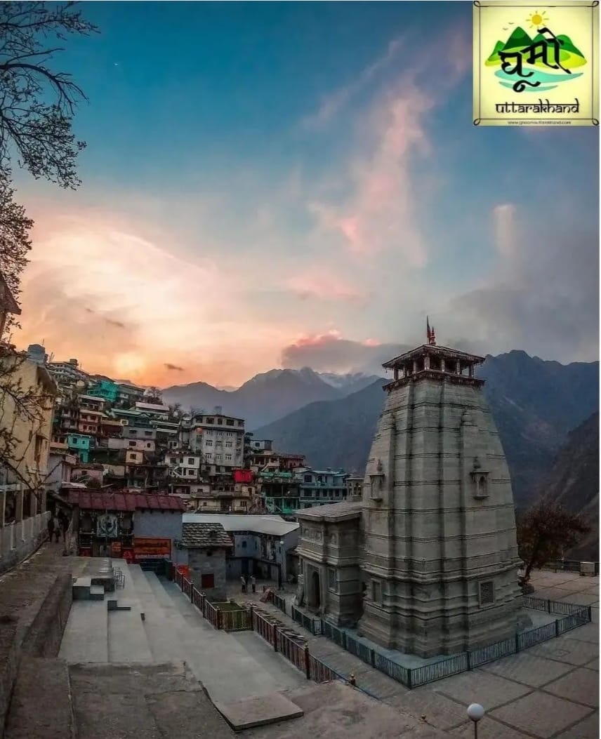
This is a very ancient temple of Lord Vishnu of Narasimha avatar and with it, this temple is also the main temple of Joshimath. It is believed that the idol of Lord Vishnu’s Narasimha avatar in this temple was installed by Shankaracharya himself with his own hands,According to some beliefs, it is believed that the idol is installed in this temple. His right hand is getting thinner which is as thin as a hair and the day this hand breaks it is believed that on that day Jai Vijay who comes on the way to Badrinath will unite both the mountains and the God of Badrinath temple.
Narsingh Devta Temple Joshimath Uttarakhand Timings, History
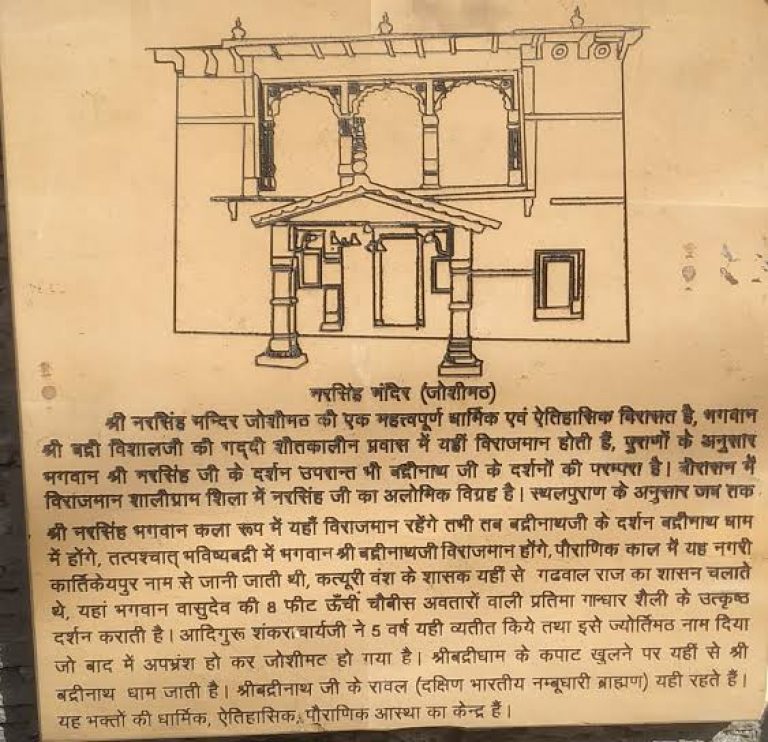
Narsingh Devta Temple is also known as Jyotirmath, Joshimath, Narasimha Badri and Narsingh Badri Temple is a famous hindu temple dedicated to Lord Narasimha. He is the fourth Avatar of Sri Maha Vishnu. This temple is located in the Joshimath, Chamoli district in Uttarakhand. Narasimha Temple is one of the most popular temples in Joshimath. This temple is one of the Pilgrimage of the Sapta temples. Lord Narasimha is known to protect his devotee Prahlad who killed the demon Hiranyakashipu.
Narsingh Badri Temple Timings: 6:00 AM to 7:30 PM
Narsingh Badri Temple History:
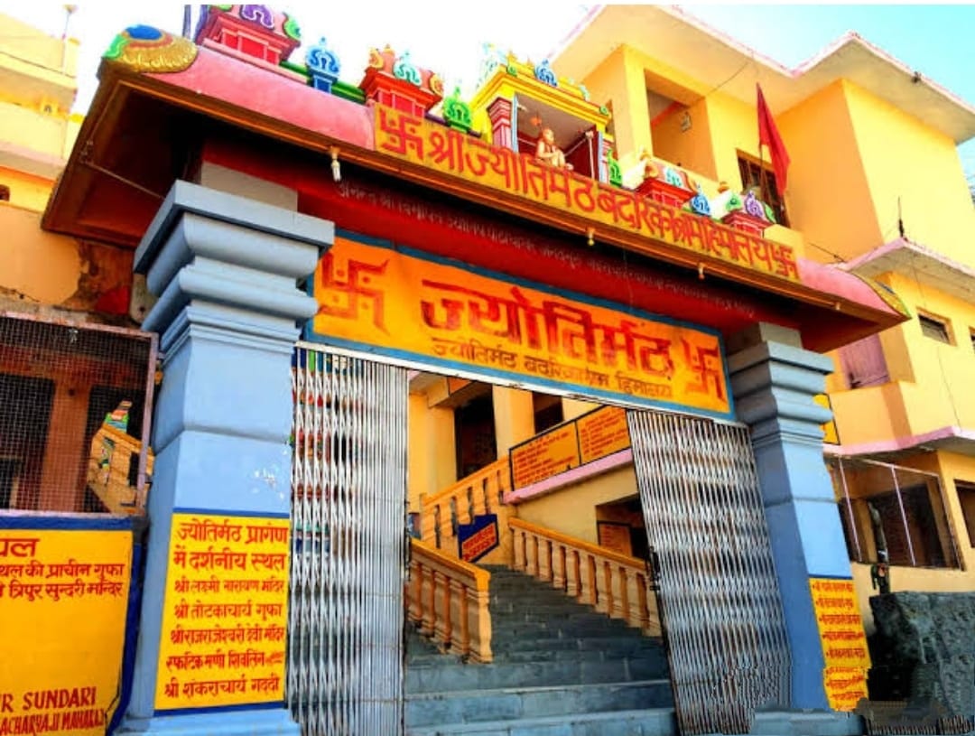
It is believed that the construction of this temple was done by by Sri Shankaracharya. The idol of God Narasimha established in the temple, is made of Shaligram stone. This statue was built during the reign of King Lalitaditya Yukta Pida of Kashmir in the 8th century. This idol of the deity of Narasimha is also believed to manifest. The stuatue measures 10 inches (25 cm) and represents God seated in the lotus position.
The history of Narasimha Badri temple is closely linked to the legend of Bhavishya Badri temple. It is believed that the statue’s left arm will decrease over time and eventually disappear. The main temple of Badrinath and the sanctuary of Badrinath will be blocked and inaccessible. Lord Badrinath will then appear in this temple of Bhavishya Badri. Instead of the Badrinath temple, there will be worshipped here.
When the main temple of Badrinath is closed in winter, the priests of Badrinath go to this temple and continue to worship Badrinath here. There is a statue of Badrinath in the temple, along with the main statue of Narasimha.
How to Reach Narsingh Devta Temple:
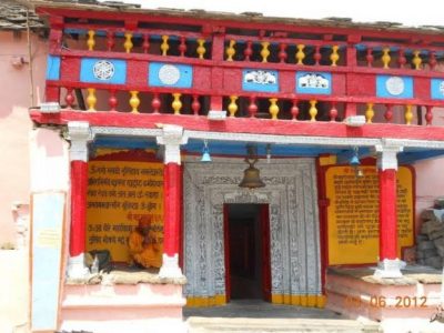
By Air:
Jolly Grant Airport at Dehradun is the Nearest Airport which is at a distance of 269 kilometres from Narsingh Temple.
By Rail:
Rishikesh railway station is the Nearest Railway Station which is 252 kilometres from Narsingh Temple.
By Road:
There are buses available for Rishikesh/Badrinath from ISBT Kashmere Gate. The temple is at walking distance from the Joshimath bus stop.
Narsingh Badri Temple Address:
Narsingh Mandir,
NH 58,
Joshimath,
Uttarakhand – 246443.
Kedarnath Popular Route : Delhi → Haridwar (206 km) → Rishikeh (24 km) →) Deoprayag (71 km) → Kirtinagar (30 km) → Shrinagar (4 km) → Rudraprayag (34 km) → Gauchar (20 km) → Karnaprayag (12 km) → Nandprayag (20 km) → Chamoli (11 km) → Birahi (8 km) → Pipalkoti (9 km) → Garur Ganga (5 km) → Helang (15 km) → Joshinath → NARSINGH DEVTA TEMPLE
Mussoorie:
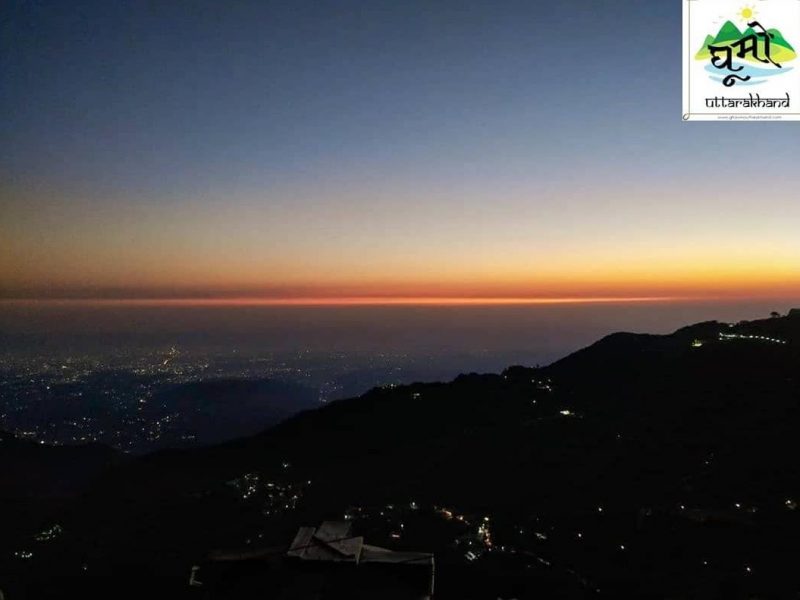
The Mall road
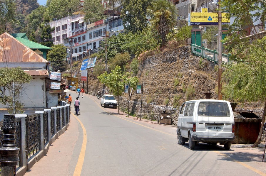
The Mall road is the central hub of the Mussoorie and is definitely a must visit on your trip to the city. It has a bunch of places, couple of things and plenty of activities to do when on a vacation to the Mall Road.
Location: The Mall road is located at a distance of some 15 km from the Kempty Falls.
Highlights: The visit to the Mall road is enough to give you greater insight to the city. There are a bunch of restaurants, shops and other establishments located here. Some of the hotels found here include Hotel Silver Rock, Hotel Hamers, Honeymoon Inn, Hotel Drive Inn, Tulip Inn Green Castle, Hotel Mall palace, Howard International and more. The restaurants that you can try include the Kalsang, The Rice Bowl, Udupi restaurant. You can try out a range of dishes from all parts of the country here.
Lal Tibba
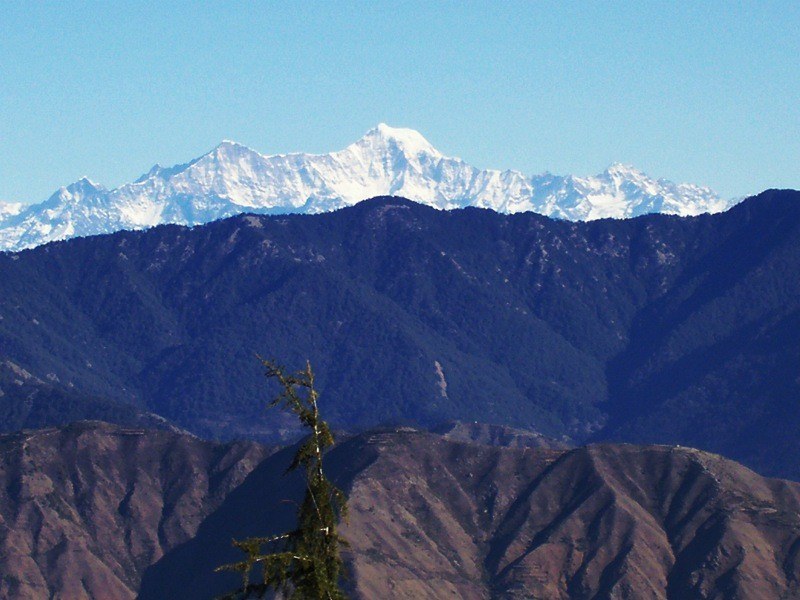
In the local language, Lal Tibba means the Red Hill. This is said to be the oldest and the most populated place in Mussoorie. The place is known for its scenic beauty courtesy the pleasant sunrise and sunset that leave the visitors spell bound. Do carry woolens irrespective of the month of the visit.
Location: It is situated in the Landour area and lies at an altitude of 8000 metre above the sea level.
Highlights: Lal Tibba is even famous as the Depot Hill because of the presence of a depot here. Besides this there is camp of the Indian Military services, All India Radio and Doordarshan. Hills of the Lal Tibba are also popular amongst the shoppers as there are a number of markets in the nearby areas.
Best Time: The best and the most ideal time to visit Lal Tibba is the summer months of March and June. Avoid travel during the monsoon months as there maybe leeches here.
Kempty Falls
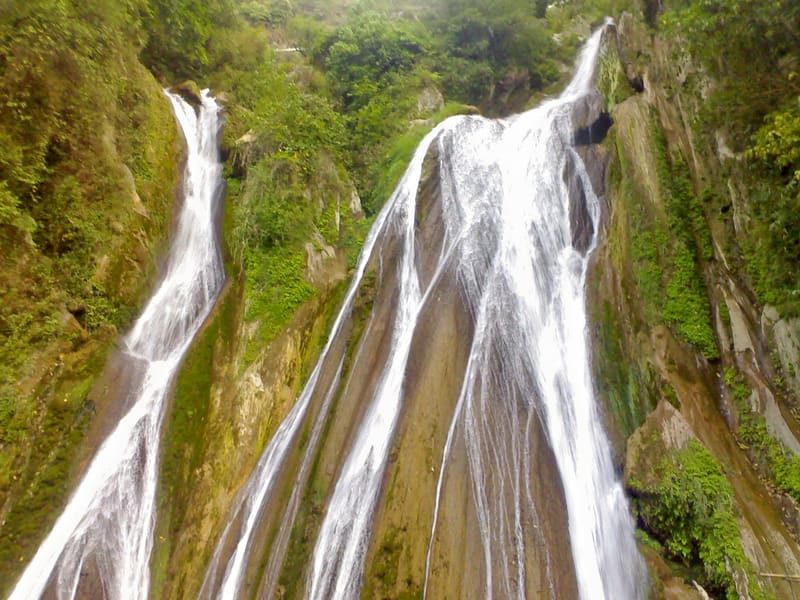
Kempty Falls is said to be one of the most prominent waterfalls in Uttarakhand. The falls are encircled by high mountain cliff. Since the water falls from a great height, it is believed that this water further divides in 5 different streams. Being present on the Mussoorie-Dehradun Highway, the Kempty Falls attracts a number of tourists from across the country.
Location: Kempty Falls is located about 15 km from Mussoorie and lies at an altitude of about 4500 feet above the sea level. The sacred River Yamuna is about 12 kms from here.
Highlights: Kempty Falls was initiated as a picnic spot in 1835 by the British officer John Mekinan. It has a perennial waterfall making it an interesting picnic spot for all. You can even take a bath under the fresh waters of the waterfall.
Best Time to Visit: Summer months of March and June are ideal since the weather is pleasant.
Benog Wildlife Sanctuary
Benog Wildlife Sanctuary is part of the much popular Rajaji National Park. The park is a home to a couple of rare and common fauna such as the Himalayan goat, panther, leopard, deer and bear. This is today the most visited tourist destinations in the hill station of Mussoorie. You can spot several exotic and indigenous birds here including the red-billed blue magpie, mountain quails and White Capped Water Redstart that make this place a paradise for bird watchers.
Location: The Benog Wildlife Sanctuary is located about 11 km from Library Point.
Highlights: Besides the huge pine and fir trees, this wildlife sanctuary is filled with a number of medicinal plants. From this sanctuary one can catch spectacular views of the ice caped Chaukhamba and Bandarpunch peaks. Greenery, rate avifauna and the rich fauna make this place a must visit.
Best Time: The park is open on all days between 07:00 am – 05:00 pm.
Library Bazaar
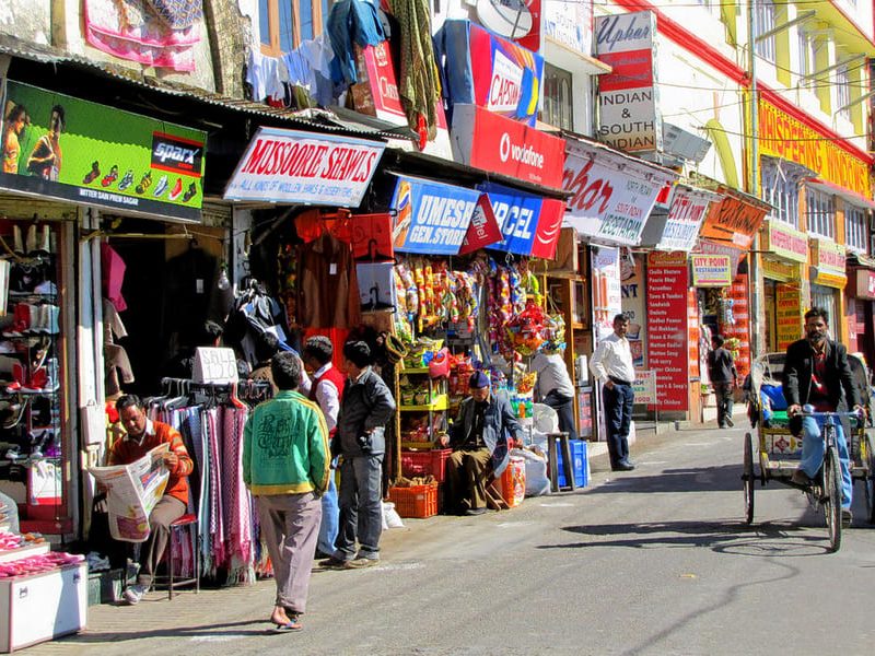
Library Bazaar is the focal taxi and the bus terminal points to enter the township of Mussoorie. Popularly known as the KitaabGhar, the Library Bazaar is so called library found in the 1843 that is present on the first floor of the fantastic building. This is also one of the few libraries found in India.
Location: The Library Bazaar is beautifully tucked between the Laxmi Narayan Temple, the Gurudwara Singh Sabha, the Amania mosque and the Christ church. It stretches up to the Mall road and is popular for its vegetarian and non-vegetarian serving restaurant, luxury and budget hotels, fancy showrooms, gift shops, dhabas, and the small shops to cater to the daily needs of the consumers.
Highlights: The architecture of the library bazaar speaks volumes about the colonial association of the building.
Best Time: The library is open on all days between 09:00 am – 08:00 pm.
Benog Mountan
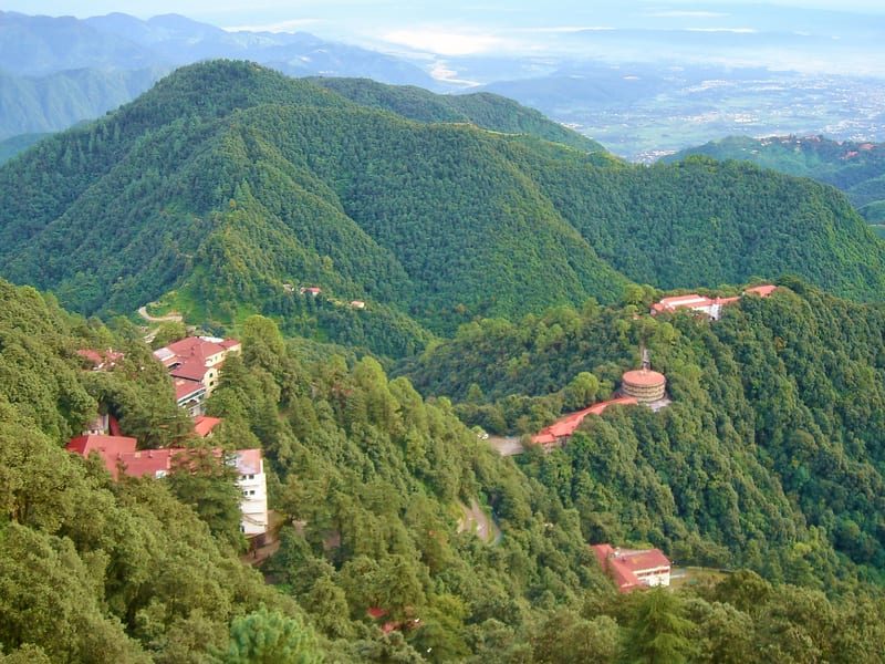
Price: There is no entry fee.
Housed inside the Benog Mountan
Quail Sanctuary in Mussoorie, the trek on Benog Hill is off the beaten track.
Ridden with steep slopes, the mountainous terrain is also dotted with camping
sites. So, if bonfire with friends is on your mind, the Benog Tibba trek will
leave you spellbound. The adventure trail also passes in the vicinity of Kempty
Falls, one of Mussoorie’s better-known waterfalls. The northern face of Benog
Tibba is home to ‘Ghoral’—a rare mountain goat on the verge of extinction. The
forest grows denser with ascent, and offers stunning panoramic vistas. The
trails running across pose sufficient challenges, with difficulty levels
ranging from easy to moderate. The months between October and April are
pleasant, with the snowfall over pines adding a mystical touch.
Distance from Delhi: 300 Kilometers
approximately
Nearest Railhead: Balawala Railway Station Junction
At a distance of 10.5 km from Mussoorie Library Bus Stand, Bhatta Falls is situated on Mussoorie – Dehradun Road near Bhatta Village. This fall is one of the major tourist attractions and also among the best waterfall to include in Mussoorie tour.
Bhatta Falls
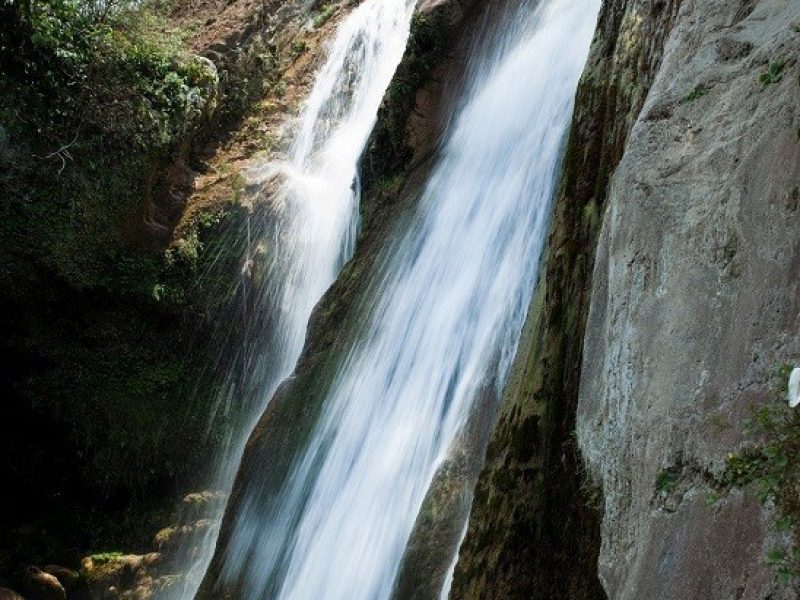
Bhatta Falls is a natural waterfall cascading down from a height of 30 feet into a naturally encircled pool. This waterfall is relatively untouched by commercialization and a good place to spend some time. Visitors can see several picturesque locations ideal for photographer to catch nature at its best. The pond at bottom of the falls provides some opportunity for swimming. There is also a children’s park, slopes and swings are provided for playing purpose.
Bhatta Falls is easily accessible by car or bus from Mussoorie and Dehradun. The falls about 100 meters from parking area and can be reached through well laid steps.
Timings: 8 AM to 5 PM
Mussoorie Lake
Located at a distance of 6 kms on the Mussoorie- Dehradun highway, Mussoorie Lake is an artificial lake developed and maintained by the City Board and the Mussoorie Dehradun Development Authority. Surrounded by a mesmerising natural charm and some surreal views of the charming Doon Valley, this lake offers a rejuvenating retreat in nature’s lap.
The scenic Mussoorie Lake is a newly developed picnic spot originating from a natural waterfall. Other than the umpteen outdoor activities available at the site, paddle boating is the most popular one. For a nominal fee, you can paddle your way across the lake to enjoy scenic views of the valley and a serene boating experience. Mussoorie Lake also has a hoard of eateries and refreshment stores to help you stay hydrated and full. Besides, the striking road leading to the lake is bound to give you some picture perfect moments and some memorable memories for life.
Read More on Mussoorie Lake
Activities to Do at Mussoorie Lake
Boating: A trip to this gorgeous lake is perhaps incomplete without taking a ride on the boat. The gentle breeze caressing your face while you relish a tour in the sparkling waters surrounded by the majestic scenic mountains is an out of the world experience.
Picnic: A picnic by the lakeside is the best and the most loved activity for some. Just get your favourite food, a few glasses of wine and a bedsheet to snuggle up and soak in the serenity of the tranquil atmosphere. In addition to this, the many street shops on the pavement will bring out the compulsive shoppers in you with their world-class quality products, and you can pick up some to take back home.
Best Time to Visit
It is recommended to visit Mussoorie Lake in the monsoon to have a splendid view of the fascinating lake in all its glory.
How To Reach Mussoorie Lake
Mussoorie Lake is located in Dhobi Ghat, which is just 6 kms away from the main town. It can be reached by hiring a taxi-cab or through a personal vehicle. If not, there are buses running from the city bus stop which can drop you at Dhobi Ghat itself.
Harsil Valley :

Harsil Valley is one of the best-kept secrets of Uttarakhand. Situated on the banks of the Bhagirathi River, this little hamlet is part of the equally gorgeous Uttarkashi district. The beautiful village nestled in the lap of Garhwal Himalayas is seated at a height of 2620 meters above sea level. It is a place for nature lovers and adventure seekers in the state of Uttarakhand.
With activities like hiking, trekking, and cycling, there is no dearth of things to do in Harsil Valley. The valley is surrounded by dense Oak and Deodar forests and is a place where nature greets with a warm embrace. The shimmering and gurgling streams, the apple orchards, and the chirping of birds make this off-beat location a prized possession of Uttarakhand.
Best Time To Visit Harsil Valley
The best time to visit Harsil Valley is during the summer season. During this time of the year, the weather is moderate the beauty of the valley is at its peak. The valley should be avoided during monsoon it always remains ins danger of landslide. Winter is also a good season to explore this valley and it is a perfect time for adventure seekers to pump up the adrenaline in their veins.
History Of Harsil Valley
According to a local legend, Harsil got its name from the Bhagirathi and the Jalandhari rivers as once they argued over their significance. Lord Hari, also known as Vishnu, was asked to intervene. He turned himself into a great stone and absorbed their anger. Even today, the waters of the two rivers have become a little less turbulent.
Major Attractions Of Harsil Valley
1. Dharali
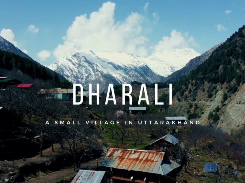
Located just 6 kilometers outside of Harsil Valley, Dharali is known for its apple orchards. The place surrounded by pine trees and is situated on the bank of the River Ganga. The Shiva Temple in Dharali is the chief attraction there.
2. Mukhwas
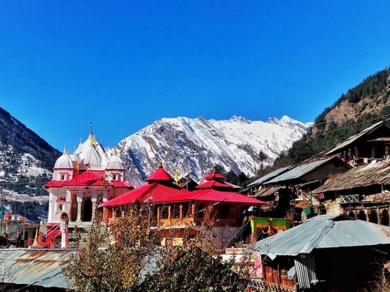
Known as the home of the Goddess Ganga, the village is situated just 1 km away from Harsil Valley. This region experiences heavy precipitation during winters. During this time the devotees worship the village as the gates of Gangotri when it remains temporarily closed due to heavy rainfall.
3. Kedar Tal
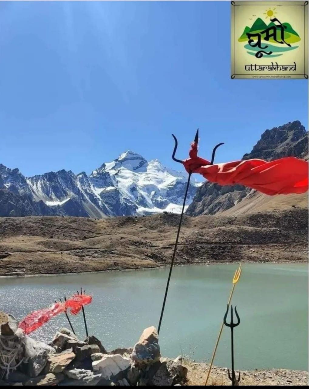
Situated at an elevation of 4750 meters above sea level, Kedar Tal is surrounded by Thalay Sagar, Jogin 1, Jogin 2, Bhrigupanth, and other major Himalayan peaks. It is one of the highest lakes in the state that dress numerous travelers. The place offers some of the best treks around Harsil Valley.
4. Dodital Lake
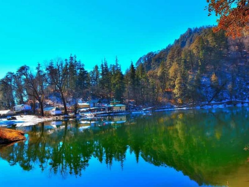
The Dodital Trek is one of the most picturesque treks in Uttarakhand’s Himalayan region. This region near Harsil Valley is blessed with elevated landscapes that are bedded with snow during colder months of the year. The trek starts from the Bhagirathi valley, which is situated at an altitude of 1,350 meters and passes through a mysterious forest, and ascends to a lofty height of 4,150 meters to Darwa Top.
5. Gangotri Glacier
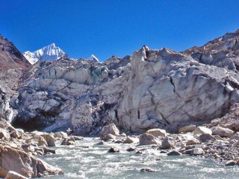
Situated in the Uttarkashi district of Uttarakhand, Gangotri is considered one of the most pious glaciers. Being the source of the sacred River Ganges, Gangotri Glacier is a significant site for Hindus. The glacier is around 4 kilometers in width and 30 kilometers in length. The glacier is a tourist hotspot and a paradise for trekkers and adventure enthusiasts.
How To Reach Harsil Valley
Harsil Valley is easily accessible from Gangotri and Uttarkashi and is connected well with roads. Reaching here is not that difficult. One can also choose rail and air services to reach at least halfway to the place.
• Nearest Metropolitan City – New Delhi
• Distance From Dehradun – 258 kilometers
• Distance From Uttarkashi – 100 kilometers
• Distance From Jolly Grant Airport – 271 kilometers
• Distance From New Delhi – 534 kilometers
By Road
Harsil is well-connected with other cities and towns of the state of Uttarakhand via roads. The nearest bus station from Harsil Valley is Uttarkashi which is easily accessible from major cities. There are government buses to Uttarkashi, and cab service from there for Harsil.
By Air
The nearest airport from Harsil is Jolly Grant Airport of Dehradun which is at a distance of 232 kilometers from Harsil Valley. The airport offers daily flights to and fro important cities like; Delhi, Mumbai, Chennai, and Kolkata. From the airport, cab services are available by which one can reach Harsil without any hassle.
By Train
Rishikesh and Haridwar railheads are the nearest to Harsil Valley. Trains to both the stations are available but, Haridwar seems to have better connectivity which is at a distance of 262 km. Private cabs are available from here to reach Harsil.
Travel Tip
Harsil being an offbeat destination does not have many options for accommodation. A handful of homestays and budget guesthouses can be found in the village which can only offer to cater for the basic needs of the travelers. Tourists can find a decent number of places to stay in Gangotri and Uttarkashi, which are 25 km and 74 km away from Harsil Valley respectively. Out of the two places, Uttarkashi has more options to offer.
Nainital :
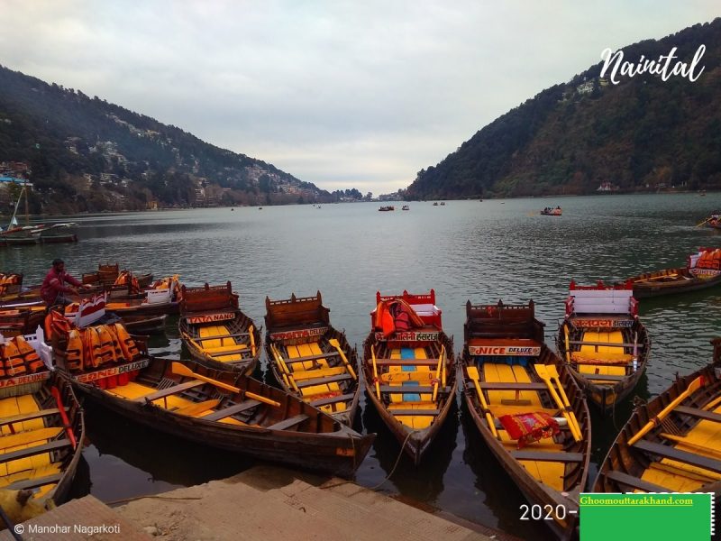
Nainital is a charming hill station located at the foothills of the Kumaon ranges in Uttarakhand. Located close to Dehradun and Delhi, it is the most visited hill station in North India. Nainital is a perfect weekend getaway from Delhi and the nearby places.
Nainital experiences a pleasant climate throughout the year, making it a popular hill station for families, couples and even solo travellers. It is easily accessible from nearby major cities by road and is ideal for a 2-day visit. The Naina Lake is the centre of Nainital with Mall Road on one side, Thandi Sadak on the other side, and the bus stand opposite it.
Founded by the British due to its resemblance to the Cumbrian Lake District, Nainital brims with elegant colonial structures that amplify the beauty of this place. There are some small hill towns near Nainital like Pangot, Ranikhet, Almora, which remain comparatively unexplored. Nainital also has some small trekking trails.
Whether you want to go boating in the beautiful Naini Lake, relish some Garhwali and Kumaoni delicacies, shop for mementoes, or take a ropeway ride to soak in the beauty of the Himalayas from Snow View Point, Nainital is sure to leave an imprint on you.
Nainital Lake, Nainital Overview
Situated in the centre of Nainital, Naini Lake (short for Nainital Lake) is a beautiful natural fresh body lake. The lake is in crescent or kidney shape and is one of the most famous lakes of the Kumaon region. Bounded by Naini Peak on North West, Tiffin Point on the South West and snow-capped peaks on the north, the Nainital Lake offers a breathtaking view, especially during early morning and sunset. It is most famous for boating, picnic and evening walk.
The Nainital Lake is a charming beauty that is surrounded by seven different peaks namely Ayarpata, Deopata, Handi Bandi, Cheena Peak, Alma, Laria Kanta and Sher Ka Danda. The lake itself can be divided into two distinct sections, the northern part called Mallital and southern region called Tallital. Coniferous trees that cover the hillside add charm to the raw beauty of the place. You can also visit Naina Devi Temple on the shores of the lake. A pretty lake that once a European man fell in love with, Naini Lake today serves as a major tourist spot for people from all over the country.
Best Time To Visit
You can best enjoy the serenity of Naini Lake during the months of March, June, November and December when the weather is perfect for a boat ride.
01 Carry heavy woollens if you are planning a visit during winter months as the weather is quite chilly.
02 Nainital’s Mall Road, which is a major shopping hub of the city, runs parallel to the Naini Lake and is a must-visit for every shopping buff. You can take your pick from a variety of candles, handicrafts, wooden artefacts, handlooms and shawls.
How to Reach Naini Lake
Once you have reached Nainital, the best way to explore the Naini Lake and surrounding areas is on foot. The Naini Lake is situated close to the Nainital Bus stand from where you can walk your way here. However, for convenience, there are cycle rickshaws and taxis area available that can take you from one place to another.
Boating at Naini Lake
A trip to the Naini Lake is perhaps incomplete if one doesn’t indulge in boating here. The serene beauty of the lake surrounded by gently rolling mountains presents a tranquil scenery. With gentle winds blowing as you pedal your way through the waters, the quaint atmosphere of Naini Lake will surely transport you into a world of your own. Yatching and kayaking are available here as well. The charges and timings of various boats here includes:-
Timings: 06:00 AM – 06:00 PM (March to June)
Cost for Boating in Naini Lake:
Brightly painted Gondola-like boats: INR 430 per hour
Boat ride through Nainital Boat Club: INR 700 per hour
Pedal boat: INR 230 per hour
Historical Significance of Naini Lake
Hindu scriptures such as the Skanda Purana mention a lake called the ‘Tririshi Sarovar’, which is believed to be the Nainital Lake. This name was derived from the names of three great sages who used to meditate here, namely Atri, Pulastya and Pulaha. A hole was dug by the three of them which soon got filled with water and came to be known as the Naini Lake or Tririshi Sarovar. According to the historical records, in 1839, a European businessman P. Barron while on a hunting expedition, accidentally found the Naini Lake and was captivated by its beauty. He then decided to build a European colony on the shores of the lake as a summer retreat for Englishmen.
Har Ki Dun:

About The Trek:
Nestled cozily on the hinges of the Gharwal Himalayas, Har ki dun trek is one of the most popular treks among a lot of trekkers and nature enthusiasts. This exhilarating trek is also known as a hanging valley because of its cradle-shaped mountains.
It is also known as the winter-wonderland as in winter the trails are totally covered with snow and the sun throw its rays within the clouds. The Har ki Dun trekking is embraced with soothing sights of deodar trees that will definitely enchant your soul with the pine smell.
Har Ki Doon Trek Quick facts:
Duration: 7D/6N
Maximum altitude: 11,675 ft
Har Ki Dun Trek Difficulty Level: Easy to Moderate
Har Ki Dun Trek Distance: 47 KM
Temperature: 10℃ to 15℃ during the day and 2℃ to -5℃ during the night
Best Time to do Har ki Dun Trek: April to Mid-June and October to Mid-November
ATM: Purola has the last ATM before your trek begins
Start/End Point of the trek: Sankri Village
Har Ki Doon Trek Package Inclusions:
1. Accommodation – You will be staying in a Guesthouse/camps in Sankri and in camp on the remaining days of the trek (3 people/tent). Room/tent is separate for the male and female participants.
2. Meals – (Breakfast, lunch, snacks, and dinner). We provide simple, nutritious veg/Jain food on all days of the trek
3. Trekking equipment – High-quality tents and sleeping bags in all the camps. Sleeping bags can withstand temperatures as low as -10 ºC.
4 Safety equipment– First aid kit, oxygen cylinders, oximeter, etc. will be with guide/trek leader and at the campsite as well to deal with emergencies.
5 Expert trek Leaders– All our trek leaders are at least qualified in basic/advanced mountaineering and first aid course.
6 Expert Trek support team– The mountain staff on Har Ki Dun trekking consists of certified guides, cooks, helpers, and porters.
How to Reach Dehradun:
You can reach Dehradun by Air/ Railways and Road. The nearest railway station is the Dehradun junction, which is well connected to major cities in northern India, primarily New Delhi. Jolly Grant Airport serves Dehradun domestically, with regular flights coming in from many major cities in India. Regular bus services also prevail to and fro Dehradun through an excellent roadways network.
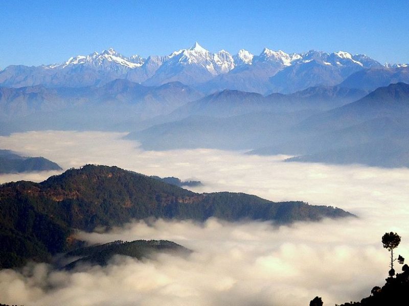
By Flight
Nearest Airport is Pant Nagar, at a distance of 119 km.
By Train
Kathgodam (86 km.) is the nearest railhead.
By Road
Ranikhet is well connected via roads. Roads run through Haldwani, Bhowali, and Khairna during all seasons. Ranikhet has direct bus links with Nainital (60 km), Kathgodam (86 kms), Ramnagar (96 km), and Delhi (366kms).
Mukteshwar :
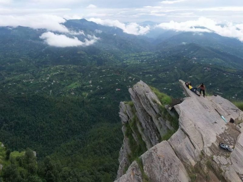
Imagine a place that could even make Jim Corbett fall in love with its ethereal beauty. Mukteshwar, which sits in the Kumaon Hills in the Nainital District is that place that mesmerized Corbett when he came here to hunt down a tiger. Today, a lot of people come here and feel the same way as this great conservationist once did. Surrounded by the sky-kissing rolling hills, Mukteshwar is a place to plan your honeymoon as well as family vacation. What adds to the grace of this place is the sacred Hindu temple located on top of the hill from which the town has got its name. Dedicated to Lord Shiva, the Mukteshwar Dham temple is the main attraction in this hill station in Kumaon Region of Uttarakhand.
This must-see place is about the beauty of nature, quietude and the chirping of birds. For those who want to explore more can head out on short treks and reward themselves with the 180° view of the mighty Himalayan Peaks.
Our Mukteshwar travel guide is overflowing with information on best places to visit and amazing things to do, which makes it quite essential for the travellers looking for an impeccable travelling experience. Also, handcrafted for you are the varied holiday packages by Tour My India that ensure a vacation unlike any other.
Best Time to Visit Mukteshwar
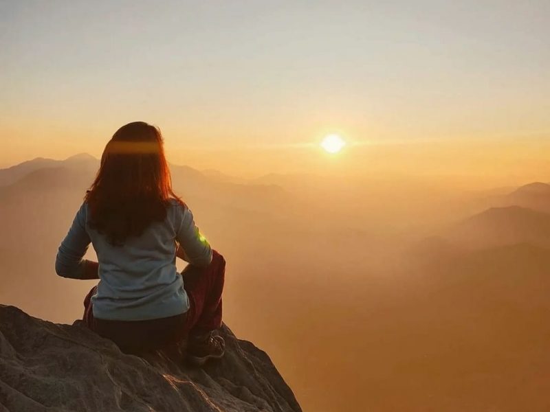
You won’t be surprised to know that Mukteshwar stays as beautiful in summers as it is in winters and monsoon. This untouched beauty in the Nainital district can be on your bucket list all through the year for its scenic view and pleasant atmosphere.
As the month of March approaches in Mukteshwar, the land dons a different kind of charm where the temperature rises up to 27°C only. The summers prevail till the nearing end of May making the town a must visit in this season.
Heavy rainfall is the perfect description of monsoon in Mukteshwar. The town encounters downpour in the months of July to September and there are chances of roadblocks in the area. Therefore it is preferred to check the weather forecast or give the destination a miss in monsoons.
Pack some extra soft woolen clothes if you are planning a visit to Mukteshwar in winters. The temperature varies between 17°C and 3°C, what makes the town look more mesmerizing is the view of the snow capped mountains while travelling from one tourist attractions to the other. As the town is covered with snow in winters hence it is advised to check the weather forecast beforehand.
Where to Stay in Mukteshwar ?
One of the best thing about Mukteshwar is that it has a rich number of accommodation options for every type of traveller. Whether it be solo traveller looking for economic hotels like 1 star to 3 star or the people travelling with their family on the lookout for 4 stars rated luxury hotels, Mukteshwar has it all. The range of hotel goes on and on where they offer comfortable and modern facilities and amenities for one of a kind experience. Besides, Mukteshwar also houses government guest houses if you are looking for more pocket-friendly alternatives.
How to Reach Mukteshwar ?
This town of Nainital district can be reached out to with ease from Uttarakhand and other parts of the country by the below-listed modes of transport.
Pantnagar Airport situated 98 km away, is the nearest airport to Mukteshwar. Taxis are available from the airport to Mukteshwar.
Kathgodam is the nearest railhead to Mukteshwar, situated 64 km away. One can hire a cab from the railway station to reach Mukteshwar.
Mukteshwar is well connected with major travel destinations of Uttarakhand. Buses are available from Delhi to Kathgodam/Haldwani and Mussoorie and taxis are easily accessible from Garhwal and Kumaon region.
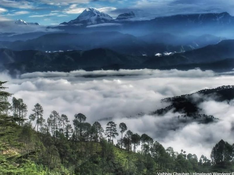
Located about 50 km from Almora in the Kumaon region of Uttarakhand, Kausani is a picturesque hill station that is famous for its stunning views of the Himalayas. At a height of 1890 meters above sea level, there are very few other places that offer the spectacular 300 km-wide panoramic view of the majestic Himalayan peaks of Trisul, Nanda Devi and Panchchuli. Dubbed as the “Switzerland of India”, Kausani is synonymous with lush green landscapes, dense coniferous trees and silent valleys which make it a very popular hill station. It is also a great weekend getaway from Delhi.
Best time to visit: April to June are the ideal months to visit Kausani. The months of December to mid February has Kausani covered with sheets of snow.
Photo courtesy: Rashmi Rao
Getting to Kausani
The nearest airport is Pantnagar airport, about 170 km away. The nearest railway station is Kathgodam which is about 140 km away. Kathgodam is well connected with major cities like Delhi, Kolkata and Lucknow. Buses as well as taxis are easily available to Kausani from both the airport as well as railway station. Kausani is well connected by road and is easily accessible from destinations like Delhi (419 km), Almora (52 km) and Nainital (117 km). State owned as well as private bus operators run their services from Kausani.
Anasakti Ashram or Gandhi Ashram
This serene place is located just about a kilometer from Kausani bus stand and accessible by a small walk uphill. It has been built as a tribute to the Mahatma who visited this place for about two weeks in 1929. Impressed by the pristine beauty of Kausani, Gandhiji described it as the “Switzerland of India” and was also inspired to write his treatise “Anasakti Yoga” here.
The place now serves as a research cum study center and has a small museum that is well stocked with books and photos of Gandhiji. There are also about 24 rooms on offer for accommodation with library facility for visitors. The place is peaceful and also houses a small prayer room where prayer sessions take place each morning and evening. Lined by deodar and pine trees and weather permitting, the view of the Himalayas from the Ashram is breathtaking.
Kausani Shawl factory
The shawl factory was started in 2002 and happens to be a place where you can witness local weavers manufacture woollen shawls using traditional methods. Established to promote the traditional Kumaoni artwork, this industry now serves as a major source of employment for the local people, shepherds and weavers. Shawls and handicrafts are available in myriad colors and designs and hence make the place popular with tourists. Most shawls also have embroidery work on them. The price of the woolen shawls depends upon the type of wool used and the detail of the embroidery. It is a great place to gain an insight into the local culture, manufacturing process as well as the perfect one to pick up a souvenir or gift from the shop located above the factory.
Baijnath Temple
Less than 20 km from Kausani is the Baijnath temple complex that dates back to the 12th century and is located on the banks of the river Gomti. The place holds special religious and historical significance in that, according to Hindu mythology, Lord Shiva and Parvati were married at the confluence of River Gomati and Garur Ganga.
The temple complex was built by the Katyuri kings and the temples are constructed in stone. There are idols dedicated to Lord Shiva, Ganesh, Parvati, Chandika, Kuber, Surya and Brahma. The town of Baijnath draws its name from the temple. The main temple is dedicated to Goddess Parvati and is accessible from the riverside by a flight of steps made of stones. The temple is popular with locals and tourists alike and attracts great crowds on special days like Mahasivaratri. Outside the temple complex is a lake full of fish and it is a ritual for pilgrims to offer food in the form of ‘channa’ after they visit the temple.
Photo courtesy: Rashmi Rao
Nature walks, trekking and bird watching
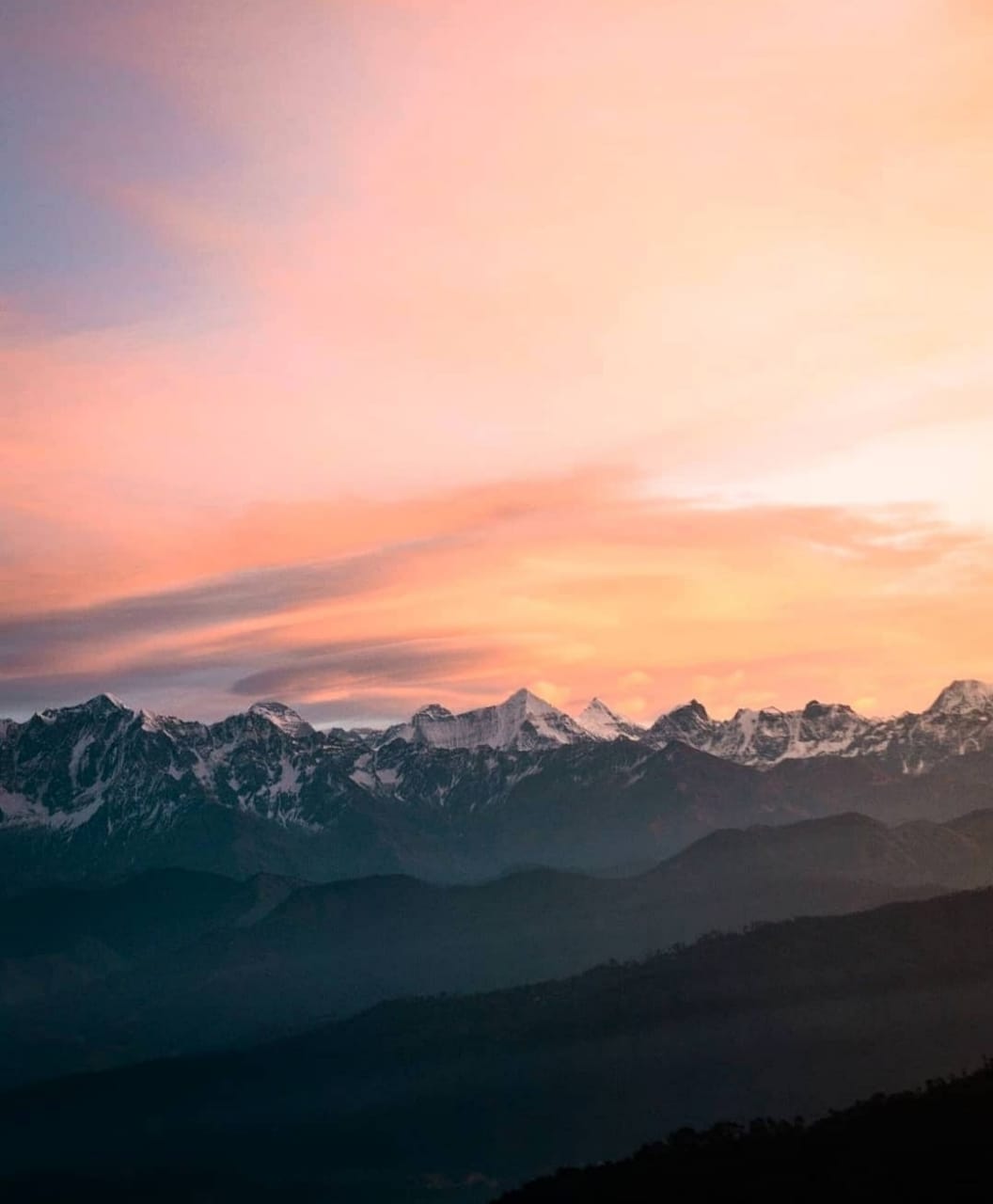
To say that Uttarkhand is one of India’s most picturesque states is no understatement. While you are in Kausani one of the best ways to explore the local sights and sounds is by taking a walk. The natural beauty of this place makes these walks even more meaningful. The beauty of the water flowing through the white pebbles is a sight that is hard to describe but if one word has to be used, it is ‘stunning’. You can watch several native birds here so make sure you are carrying a good pair of binoculars with you. Another must do while you are here is to go through the village to get a first hand experience of the way of life for the locals here. The villagers are warm and friendly and are always happy to talk to you about their daily occupations. It is a wonderful way to get up close with the rural lifestyles as well.
Like any hill station, Kausani is also famous for trekking and camping. The area has got some of the best treks in the country with the slopes of the Himalayas forming a good base for camping. Kausani serves as the starting point for many treks like Adi Kailash Trek, Base Kausani Trek etc. and weather permitting you can also trek to Kafni Glacier, which is situated at an altitude of 3853 m.
Photo courtesy: Rashmi Rao
Adventure Sports
If you love an adrenalin rush, Kausani is the place to head to. However, make sure that you get professional help before you indulge in activities such as rappelling and rock climbing. These activities are intense and need you to exhibit some resilience before you can get a bird’s eye view of the scenic beauty of this place. Some resorts in this area also offer activities like the Burma Bridge which is an unstable bridge walk with only ropes to hold on to. Likewise you can also indulge in some form of water sports on the river Kosi by battling the downstream by crossing the river or bouldering. What you need to ensure is that you have adequate professional help and are wearing the right safety equipment to ensure that the experience is memorable.
Lansdowne:
Several destinations come to mind when you talk about either a weekend trip or a short vacation from Delhi. Places like Shimla, Mussoorie, and Rishikesh tend to become the preferred choice but another place that not many people consider is the small town of Lansdowne. It is a highly scenic and much easier to reach hill station in the state of Uttarakhand that makes up for a perfect weekend getaway.
Please note that I am using Delhi just as a reference. A trip to Lansdowne can easily be planned from any other nearby city, like Meerut, Dehradun, or even Chandigarh.
The short distance and easier climb make it a great place for a short trip but the long list of tourist attractions it offers can keep you in this charming little hamlet for days as well. In this article, I will provide a complete travel guide on how a trip can be planned to Lansdowne.
About Lansdowne
For a brief introduction, located at a height of 1,700 meters, Lansdowne is a small hill-station in the Pauri Garhwal region of Uttarakhand. The town is named such after Lord Lansdowne, the then Viceroy of India, who visited the place in 1884. It is in fact a cantonment and much thanks to the Indian Army, is also a place that is not yet spoilt by tourist mania.
It still retains its quiet and serenity, unlike the other popular hill stations of our country. The entire town is administered by the cantonment board and hence is much cleaner, less commercialized, and well connected by super smooth roads. The place offers stunning views and is perfect to escape the scorching heat of the plains for a few days.
Fun fact to know is that the real name of Lansdowne in old days was actually Kaludanda, literally meaning the Black Forest in Garhwali; “Kalu” meaning Black and “Danda” meaning Forest. It then changed to Lansdowne in 1887 and developed by the British for catering for the Recruits Training center of the Garhwal Rifles. Even to date, the famous Garhwal Rifles of the Indian Army has its command office here at Lansdowne.
Why Visit Lansdowne ?
Let me begin by first writing about why you should plan on visiting Lansdowne. The biggest reason is that the place is not too hard to reach. Most of the journey in fact is through plains, and it is only the last 35 to 40 kilometers that involve driving in the hills. Roads are mostly all good except for a few bad patches in between. A drive to Lansdowne will not be too long and too tiring.
The second reason is that it is very well connected which can be a great assurance to a lot of people. There are a lot of hotels here and the phone reception is excellent. No matter which network you are on, you will have both calls and data connectivity.
The entire region is very clean due to the Army presence here and well maintained. You won’t find it dirty anywhere here nor does it get too crowded either. Yes, on weekends it tends to get filled with tourists but not in the manner of Shimla and Manali where it becomes annoying in fact.
It is quiet, less crowded, not overdeveloped, a bit undiscovered, and one of the most tranquil hill stations of India. Away from the hustle-bustle associated with other tourist spots, the calm environment enriched with the natural beauty of Lansdowne will enthrall you for sure. It still has several old buildings of British Colonial architecture and military history and its close proximity to the Delhi NCR region makes it a perfect weekend getaway.
How to reach Lansdowne ?
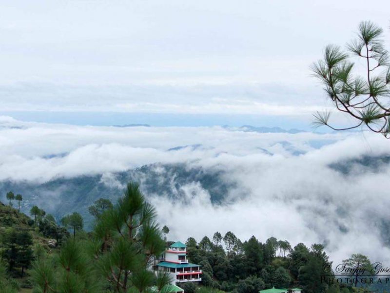
Due to its location in the Himalayas, the only way to reach Lansdowne of course is by road. You can either drive all the way from your home if you were living somewhere close. If not then you can reach the nearest rail station or airport and drive to Lansdowne from there.
Further details are provided in the article below. For explaining this part, I will assume Delhi as the starting point.
How to reach Lansdowne from Delhi
If you were driving to Lansdowne from Delhi, then the route of the journey will be as mentioned below. There can of course be a few other alternate ways but I will explain the easiest and the best one.
Delhi – Ghaziabad – Modinagar – Meerut – Khatauli – Mirapur – Bijnor – Najibabad – Kotdwar – Lansdowne
The entire journey by this route will be about 250 kilometers, doable in 6 to 7 hours depending upon your speed and breaks. From Delhi till Khatauli, the road is awesome and a national highway via Meerut.
At Khatauli, leave the highway and take the road towards Bijnor via Mirapur. From here, the road is a two-lane highway but mostly in good condition till Kotdwar. There are a few bad patches though as you get closer to Najibabad but you should still be able to make it to Kotdwar in about 6 hours from Delhi.
After Kotdwar, you start climbing up and the entire 40 kilometers till Lansdowne is a steep climb. The good part, however, is that the traffic is very less and the road is all smooth.
Alternate Route
I will explain one more route so that you can actually avoid it. From Meerut, a lot of people enter the city and then take the road via Mawana, Jhunjhuni, Behsuma, and Ramraj. They will then exit at Mirapur and take the road towards Bijnor but this entire stretch will eat up a lot of your time.
You will first get stuck in traffic in Meerut, and then the progress will remain slow until Mirapur. A better way for the journey is to not enter Meerut, stay on the highway till Khatauli, and then take the road towards Bijnor via Mirapur from there.
I explained the route from Delhi but if you were coming from any other city, then the idea is to first reach Meerut or Khatauli. Then you can just follow the route I explained above via Mirapur, Bijnor, Najibabad, and Kotdwar. If you were coming city like Chandigarh or Jaipur, then you can first arrive at Meerut and continue to Khatauli. If you were coming from Dehradun, Rishikesh, or Haridwar side, then Khatauli will arrive first from where you can continue to Bijnor.
Almora:
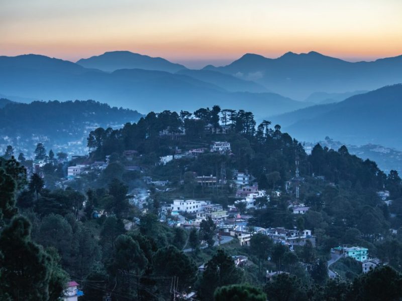
. Almora is believed to have gotten its name from Kilmora, a kind of sorrel, a short plant commonly found here, which was said to be used for washing the utensils of the sun temple at Katarmal. Situated on a 5-km-long ridge at the southern edge on the Kashyap hills in the shape of a horse saddle, Almora is a picturesque town set against the backdrop of the snow-capped Himalayas. Once the capital of the Chand dynasty rulers. Almora is known for its rich cultural heritage, unique handicraft and delicious cuisines. Almora has attracted several eminent people through the ages, including Swami Vivekananda, Rabindranath Tagore, Uday Shankar and his troupe, including Guru Dutt and Zora Sehgal came here for a performance, and Ravi Shankar, who contributed to the cultural enrichment of the town. Govind Ballabh Pant, noted freedom fighter, first chief minister of Uttar Pradesh and later Home Minister of India, was born in Almora. Sir Ronald Ross, who received the Nobel Prize for Physiology (or Medicine) for his path-breaking discovery of the malaria parasite, was born here in 1857. The town also serves as the starting point for many treks like Jageshwar, Pindari, Mornaula, Mukteshwar, Binsar, and Ranikhet among others.
Besides the museum and temples, Almora also has the Binsar Wildlife Sanctuary for the wildlife enthusiasts. Cave paintings dating back to the Stone Age can be found on the outskirts of Almora at Phulaseema (4 km), Pharkanauli and Lakhuudiyar (20 km). Humans doing daily chores and dancing and animals and reptiles form the theme of the paintings.
Almora is also a cantonment town and serves as the home to the Gorkha Rifles.
BEST PLACES TO STAY IN ALMORA
Almora has a decent range of budget and mid-range hotels along the Mall Road and Link Road. It also has a few resorts. During September, hotels rooms tend to get booked fast since tourists throng the town to attend the Nanda Devi fair and so it is advisable to make your travel plans in advance.
BEST PLACES TO EAT IN ALMORA
Bal Mithai is a popular sweet made of milk, found in Almora Options to eat in Almora are limited. Most of the restaurants are situated on Mall Road. The restaurants generally offer north Indian and Kumaoni cuisines. In-house restaurants in hotels are usually good options to eat. Most of them offer multiple cuisines like Indian, Chinese and Continental. A few cafes are also located on Mall Road.
BEST TIME TO VISIT ALMORA
The average minimum and maximum temperature of Almora is as given below. The best time to visit Almora is also specified.
The nearest airport for Almora is Pantnagar. Pantnagar Airport is situated 115kms from Almora. Taxis are available to Nainital, Haldwani and Almora from Pant Nagar Airport. Buses are available from Haldwani, Kathgodam and Nainital to Almora.
By Train
The nearest railway station is at Kathgodam that is situated around 90 km away from Almora. Kathgodam has railway connectivity with major cities like Delhi, Lucknow, Kolkata, and Dehradun. Frequent bus and taxi services are readily available from Kathgodam to Almora.
By Road
Almora is well-connected by motorable roads to all the major cities of northern India. The city is also connected with NH87 and NH87E.
Chakrata :
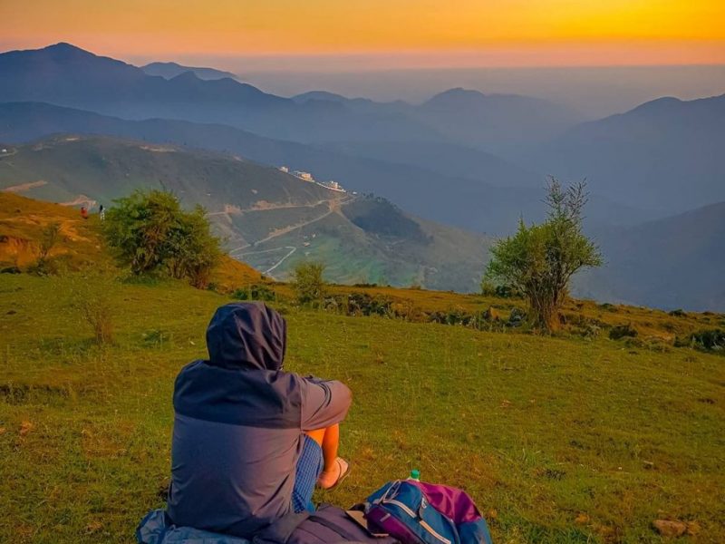
Chakrata is a small hill station in the state Uttarakhand. It lies 95 Kms from state capital Dehradoon. It is a quiet yet amazing place to relax and be up close with nature.
It is at a height of 2100M with beautiful waterfalls and short treks leading to 360 degree views of mountain ranges.
Temperature varies from 15-30 degrees in summers while in winters it varies between -3 to 15 degrees. It receives a moderate rainfall and the roads leading to Chakrata can b dangerous if planning a trip during Monsoon season.
The best part is the route to Chakrata. The drive has scenic green hills and amazing roads and that is why it is also called Mini Switzerland.
Chakrata Road
Chakrata has very few lodges and Hotels, most of which are on the outskirts of Chakrata. Kindly note there will be 1-2 luxurious resorts and usually they are booked in advance. Being a fairy less visited by tourist adds to the charm of this beautiful place.
PLACES OF ATTRACTION
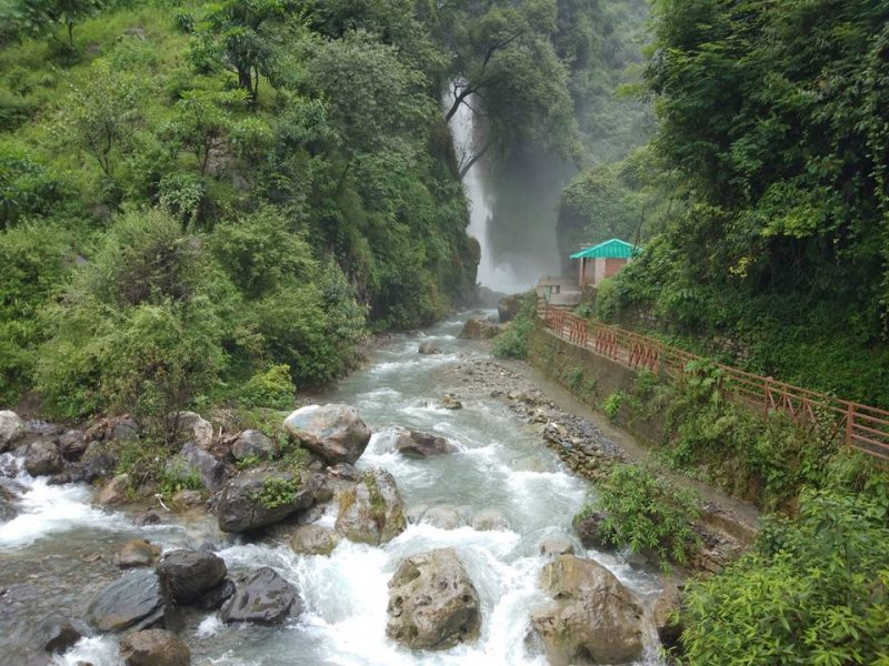
Important Points
How to reach Chakrata from Delhi
The total distance between Delhi and Chakrata is 321 kms that can be covered in a variety of travel mediums. You can take a flight or a train or a bus But all of these options are only available till Dehradun which is the nearest big city. From Dehradun, there are local city buses that can take you to Chakrata. Or you can also hire a taxi or cab to cover this distance. Alternatively, you can book a cab or drive down on your own, to cover the entire distance from Delhi to Chakrata. We have compiled an elaborate account of transport mediums from Delhi to Chakrata. Read on to find out more.
01 . Delhi to Chakrata in Flight and Bus
One way to travel from Delhi to Chakrata is in a flight. Of course there is no airport in Chakrata and the nearest one is in Dehradun which is around 88 kms from Chakrata. Several flights run regularly on the route from Delhi to Dehradun. The aerial distance of 202 kms can be covered in around 30- 40 minutes in a flight. Major flight operators on the route include Air India, Indigo and Spicejet. Have a look at the flight details-
Departure Airport: Indira Gandhi International Airport
Arrival Airport: Jolly Grant Airport
Starting Ticket Fares: INR 2399
Approx. Time Taken: 40 minutes
Once you land in Dehradun, there are several local buses, cabs and shared taxis available that can take you to Chakrata. The total distance from Dehradun to Chakrata is covered in 3 – 4 hours.
02. Delhi to Chakrata in Train and Bus
Another way is to travel from Delhi to Dehradun in a train and then take a public transport bus from Dehradun to Chakrata. A number of buses run between Delhi and Dehradun on a weekly basis. Some of these are DDN Jan Shatabdi, Nanda Devi Exp, Dehradun Shatabdi, Dehradun Exp, Ujjaini Exp, Mussoorie Exp, Uttaranchal Exp and more.
Starting Ticket Fares: INR 225
Approx. Time Taken: 6 hours to 10 hours
One you deboard at Dehradun, Chakrata is just 88 kms that can be covered in 3 to 4 hours. A number of buses, shared taxis and other public vehicles run from Dehradun to Chakrata on a daily basis.
03 . Delhi to Chakrata in Bus
There are also no direct buses running between Delhi and Chakrata so again, you will have to take a bus from Delhi to Dehradun first. Several buses run between Delhi and Dehradun on a weekly basis. Have a look at the details-
Boarding Points: Majnu ka Tila, Kashmere Gate, Dilshad Garden Metro Station
Deboarding Points: Near ISBT, Dekyiling Sahastrasha Road
Starting Ticket Fares: INR 500
Approx. Time Taken: 6 hours to 8 hours
04. Delhi to Chakrata in Car
You can also take a car to reach Chakrata from Delhi. You can either book a private taxi or a cab to reach here. Or you can also drive down on your own if you’re looking for a pleasant trip. The total distance can be covered in 7 to 8 hours. The cab fares for the same begin from INR 5000 and go up depending on the timings and the type of vehicle you choose to travel in.
Valley of Flowers:
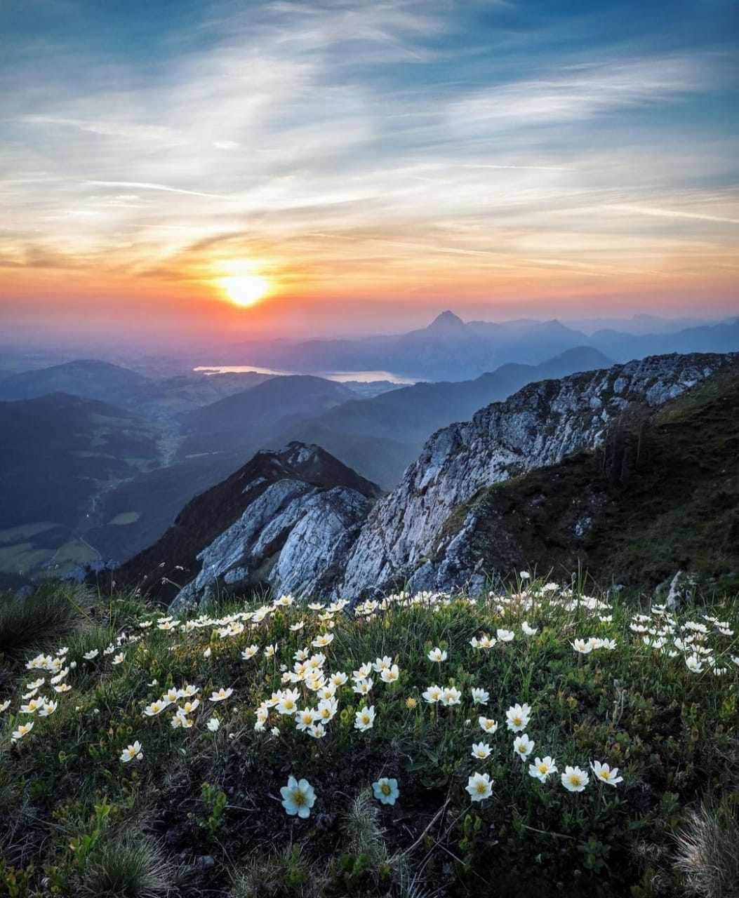
Who in this world would not want to go to a place that looks and feels like heaven. Dwelling in the lap of the Himalayas, walking towards the beauty of nature, you will want to spend time and refresh their minds in the misty winds and authentic sceneries. The Valley of Flowers Tours in India is one of the most exotic places to visit for you if you have a deep interest in nature and the views and feels that encompasses it. It is a real beauty that makes the viewer spellbound and helps them perceive the notion of eternal beauty. It has its situation in the Himalayan region of Uttarakhand. People and tourists from all over the world come to see its exotic creation of flora and fauna. With the most relaxing and peaceful environment, you are sure to enjoy the space to the fullest!
Famous for the charming meadows and alpine flowers, the Valley of Flowers places itself near Badrinath in the Garhwal region of Uttarakhand. Being a famous National park since 1982 and achieving a title of UNESCO World Heritage site since July 14, 2005, it is one of the most welcoming space for not just the residents but also the tourists. It is a space that blossoms up with a wide range of flowers and a room for several rare and exotic birds. Very commonly known amongst trekkers around the world, it is a common attraction for an adventure.
Valley of Flowers from Dehradun
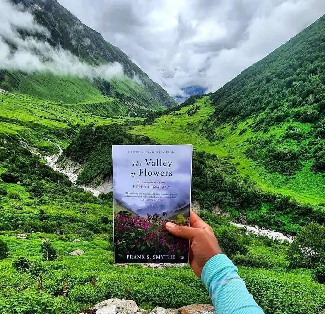
Valley of Flowers from Dehradun opens up in June for everyone till the first week of October. It brings forth the best monsoon beauty that you will ever come across. It caters to the best vacation commitments that you make for a trip. Despite the break from the routine, it renders to mental and emotional satisfaction. Just as it comes with a magnetizing name Valley of Flowers , it smells refreshing and is the best to visit during the monsoon months of July and August. It also has several tourist locations that are a must-visit if one comes to this flower basket.
Important facts about Valley of flowers national park.
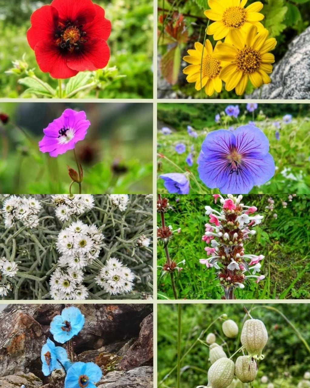
Why should you visit the Valley of Flowers ?
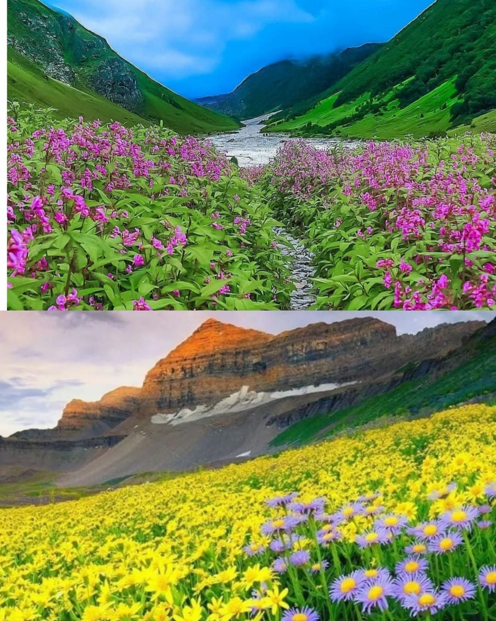
Visitors often come to a place with a motive to satisfy themselves. They either come up for recreation, but most importantly, come up to quench the thirst. The following are the reasons why you should visit the Valley of Flowers :
Blue Poppy Holidays was formally incorporated in 2012 by Devkant Sangwan and Seema Sangwan. They are eminent nature lovers and came here as tourist in 2004 for the first time. They kept coming here as tourist every year and later in 2011 they decided to start this business and turned their hobby as profession. They organize trek to this place for many years now. They own two resorts for the trip to valley of flowers. The resorts are at Auli and Ghangaria
About Nanda Devi Biosphere Reserve
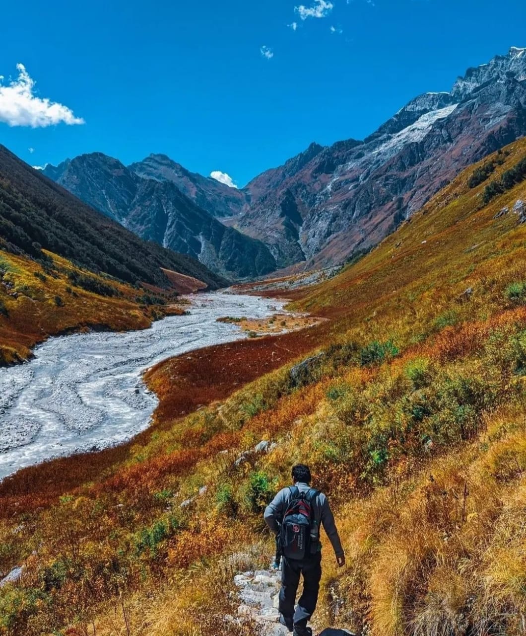
Discovered around 1931 and established in 1982, it is a colorfully painted landscape that spread over 87.5 square kilometers. It consists of Nanda Devi and Valley of Flowers National park. It finds itself in the peak of Nanda Devi at an altitude of about 3658 above sea level. It has within itself an inner and outer sanctuary that comes in its region. It offers layers of surprises as you move within. It has an exotic species of birds, animals, and flowers that are a tourist attraction and are an asset to the country.
We offer the most beautiful trip to the lap of nature and render services that are the best. It helps to have a view of the space and also helps with getting the knowledge. We place forth an opportunity of visiting the Valley of Flowers that one would never want to miss. We also cater to trips around the Valley to the regions of Badrinath, Hemkund Sahib, Auli, and several other never to miss places. With so much to look around and explore, you are sure to feel great!
Location of Valley of Flowers national park
Valley of flowers national park is located in Chamoli district in the state of Uttarakhand India. This is remotely located and it takes minimum 3 days to reach from Haridwar. The last motor-able point is Govindghat. Check our trek itinerary page for more day wise information. It is around 500 km from New Delhi and 300 km from Haridwar. Our page on how to reach, we have given distances between important points and time required between them, different modes of transportation available to reach here.
It is located 300 Kms North of Rishikesh, near Badrinath. You need to Travel by Road till Govindghat and from there the trek to Valley of Flowers starts. Govindghat is 20 Kms before Badrinath. Till Govidghat there is a motor-able Road, now you can drive upto Pulna village. Rishikesh is 6 Hours Drive from New Delhi, India.
Valley of flowers was declared as world heritage on July 14, 2005 under nature category by UNESCO.

Trekking itineraries and other essentials are a must carry for a smooth trip. You can look forward to situations that will give one the joy of being in the midst of the mountain. There will also be times when one will wish to stay back no matter what. With a charming environment with flora and fauna, the Valley of Flowers offers an exotic trek that none will ever forget!
You can check our Trek itinerary page for detailed itinerary of the tour.
Trekking in Valley of Flowers
Trekking is one of the most adventurous activities that one can ever indulge in for a tourist. It does not just cater to physical fitness but also upholds and promotes mental health. A trek in the Valley of Flowers is the most satisfying but is on the bucket list of several trekking lovers. It accounts for a blend of scenery when one moves along, and the climate and the soothing environment keep washing the tiredness. With so much to explore in just a trek, one can smoothly grab and keep in hand several memories that come in handy to the people who choose it.
Base camp Ghangaria
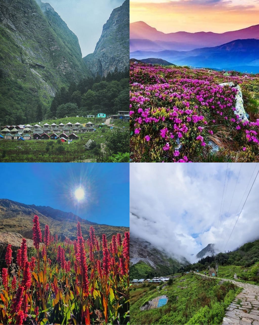
A day’s trek is never enough to satisfy the people who are into the world of adventure. Base camp Gangaria is the halt location for all the trekkers to fresh up, stay, and get ready for a new day. It has lodges and hotels that allow for privacy. At the same time, it caters to the needs of a day’s trek. It comes in between the venture to the Valley of Flowers . It is a property under the forest department that is well maintained and has plenty to look around and perceive. With the perks of being able to stay amid nature, it allows for interaction with the real world.
We offer various trekking packages that are good to go and are equally interesting to have in hand. With smart packages that do not drain the pockets, you can rest assure and enjoy the trek wholeheartedly. We cater to an essential part of rendering entertainment and enjoyment to everyone who comes to the place. With a place centric to the Valley of Flowers and the region that blooms every monsoon, one can have a trekking experience that none can have! You can go for pre-booking space and before coming to a trek. It eases up the process and caters to a hassle-free service. With beauty brimming from every nook and corner of the place, one should never miss visiting it.
Blue poppy holidays owns the best property in Ghangaria i.e. Blue Poppy Swiss Cottage camps. You can see the TripAdvisor reviews. The camps are located in most beautiful location of Ghangaria near Helipad.
Opening and Closing dates of Valley of Flowers in 2022.
Valley of flowers opened on 1st July 2022 and will close on 4th October, 2022. It remained closed for public in 2013 after the floods in June 2013 till 4th October, 2014 as the trek between Ghangaria and the valley was damaged. It was reconstructed by September, 2014 and valley was opened for public for 6 days from 4th October to 9th October, 2014. You can visit out best time to visit to know what will be best time among these four months of accessibility of the valley. Read our full post on Valley of flowers opening date 2022
Opening and Closing dates of Valley of Flowers in 2022
Valley of flowers is scheduled to open on 1st June 2022, and it will close on 4th October 2022. But the final decision is taken by the forest department, Government of India.
Opening and closing time for visitors
The usual and the most official time for visiting starts at 7 am till 2 pm in the noon. It requires you to start trekking back to the camp by 1:30 pm and touch the place safely by 5 pm. It is advisable to reach the entry gate by 6:45 am to get the first-hand ticket into the Valley and enjoy it to the maximum time. Trekking from the entry to the place you have to go takes time as everyone has their pace. It is hence better to keep a margin to avoid bad experiences.
Route map of the Valley of Flowers trek
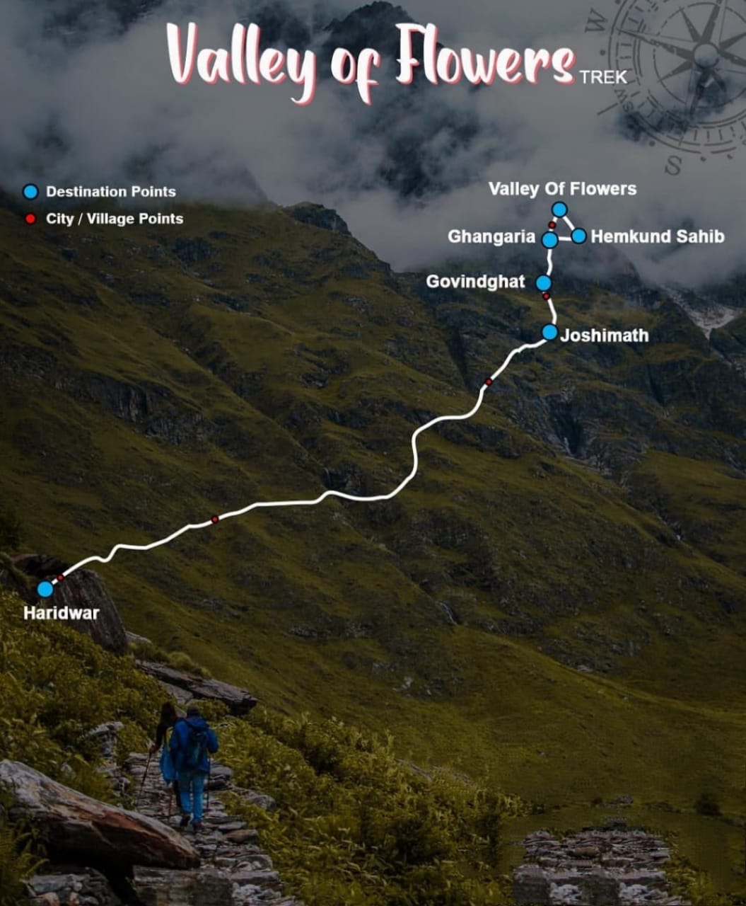
Several routes are available for trekking. You can have a picture of where you will travel during the trip. The following is the pathway that helps a person know about the region and prepare accordingly. We tend to cover most of the place to help give an insight. The following are the benchmarks for the trekking:
Temperature and Climate
The entire temperature of the region is pleasant and excellent to go for most of the tourists. It is not very cold as it is open during the post-summer season. The trek is usually in the monsoon season after summers and hence is relaxing. The places to stay at Ghangaria is also the best fit space as it goes moderately cold at night and stays fair during the days. It goes to around 3-5 degrees at night while staying and maintaining 10-18 degrees throughout the day.
The entire visiting time of the Valley of Flowers sees different climates in different months. Starting with the rains in the mid of July, you can always enjoy the trek using rain gears. With increasing and continuous rains during August, one can see the showers going away by the August end. Entering the place by early July, you can see the snow melting off the bridges that cater to the scenic beauty. With a mixed climate around, you are sure to have the best experience!
Camping in Ghangaira
Camping in Ghangaria is allowed at helipad Ground, located 400 meters before main Ghangaria village. Blue Poppy Swiss cottage camps are also located there. Ghangaria is the base camp for the tour to valley of flowers and Hemkund Sahib.
Frequently asked Questions about Valley of Flowers.
This page explains about various questions about valley of flowers like what is the minimum age to visit, best time to visit type of shoes good for the trek to Valley of flowers.
The best time to visit !
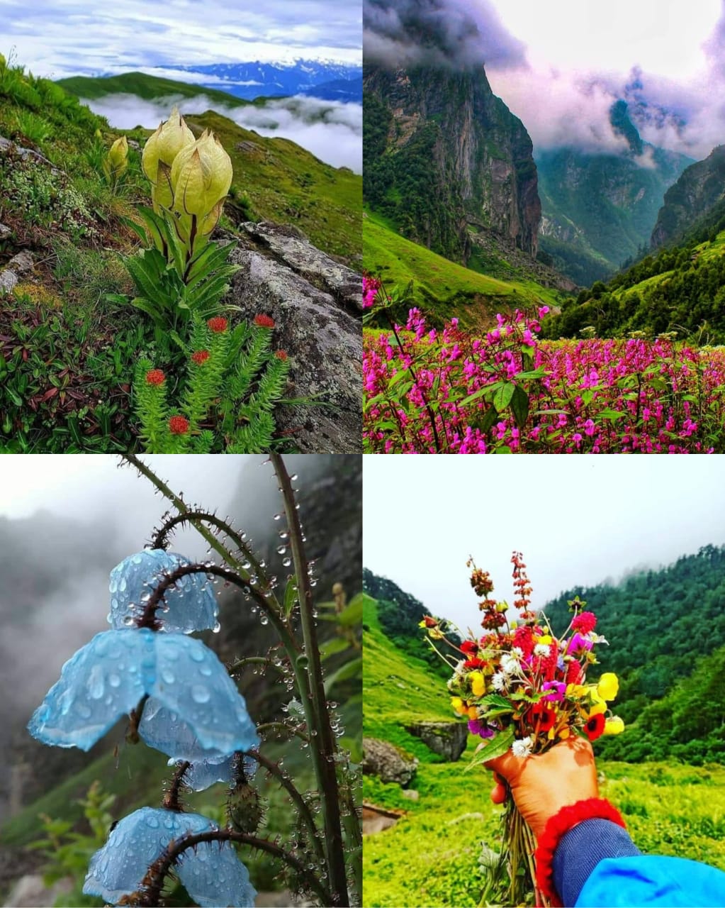
The most common UNESCO World Heritage site stays open for the people in the monsoon months. If you get to know the details, you can pick your dates and enjoy the time you love the most!
The valley in June month
June
June month often marks the melting glaciers in the region of Valley of Flowers . It is best for those who would love to see the germinating flowers at full bloom. So if you have been waiting to see the snow in the beautiful background of blooming flowers, June is the best time!
Filling itself with the rejuvenating environment, you will be able to see the lush green grass. You will also notice the Epilobium colony dominating the complete view by its magnificent pink color. So, if you would love the display of mountains with mist and pink shaded scene, go for a visit in July!The
The valley in July month
August
It is the month when one gets to see all kinds and varieties of flowers in the Valley of Flowers . One must either pre-book the tickets due to the National holiday or choose August end for the trip. If you are a photogenic person or a nature lover, then August is the most suitable month!
September
This is the picture taken in Last week of September in 2015. Flowers are all gone but the view is clear with different shade of the valley
It is the phase of the year where the place starts to get close to the tourists. The plants lose their leaves, and the fall season begins. It brings with itself seldom snowfalls, and everything starts to paint white. Regardless of the shedding plants, it is still a beautiful landscape.
October
October first week is the last visiting time for any visitors in the Valley of Flowers . Heavy snowfall begins during this period, and it often accompanies with itself a fall in temperature. It gets close for the visitors and general public from October 4.
The Valley in October
Visiting the Biosphere reserve does not often depend on the best months. It also depends on the season and the view that you love the most. Look around for the peak period when the region is at the peak of its beauty. Look around for the seasonal distribution and go for a season you enjoy. We often recommend coming in July and August as they display the best scenes!
Valley could not be opened every year since 2012.
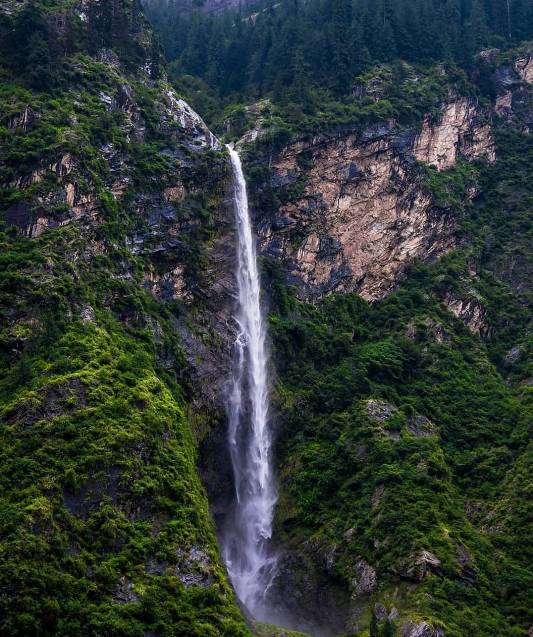
The region of the Valley of Flowers sees a lot of changes in the list of visitors. It keeps changing upon the year, the climate, and several other aspects. Lying in Uttarakhand, it experiences heavy rainfall. The most frequent rains lead to constant floods. It had heavy rains in 2013 that introduced floods in the region, and hence it was not welcoming. It was open in 2014 for just three days. Then it went back to its zone of no visitors. The pandemic starting in 2019 was a hindrance. The beautiful place was once again under the board of no visitors. After eight whole years, the Valley of Flowers is ready to bloom again despite the odds.
How much will you pay for the entry?
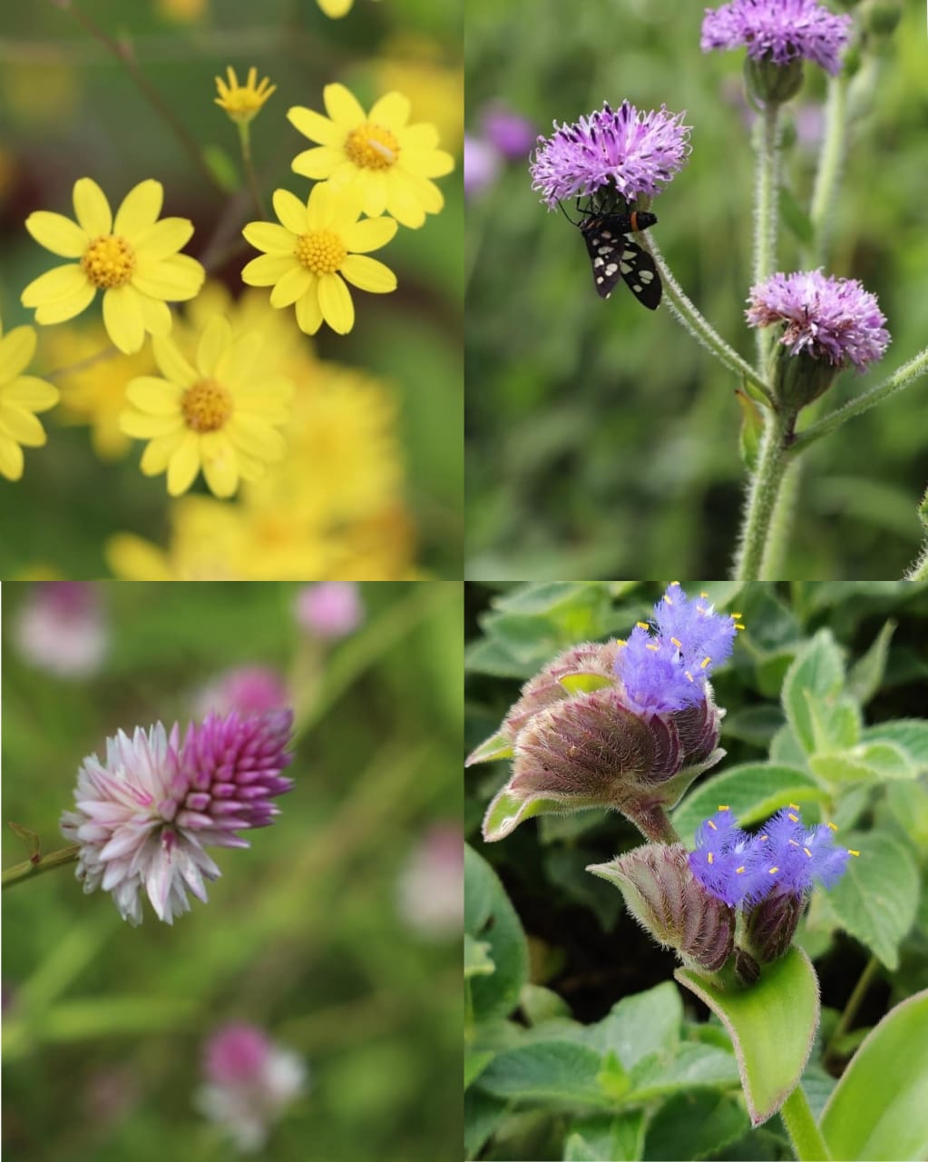
Entry ticket is a permit from the Forest department to anyone wanting to glance or get into to see the Valley of Flowers . The charge for Indian nationals and foreign tourists vary. The ticket lays valid for up to three days from the time of purchase, and an extra day, you will have to deposit more cash. The following are the payment amounts on various parameters:
Knowing about the cost structure helps to plan the trip accordingly and helps to prepare for the economy. Despite the charges you will have to pay to visit and view the mountains, valleys, and beauty, you will come out of the space refreshed and happy!
Entry fee for valley of flowers
Entry fee chart
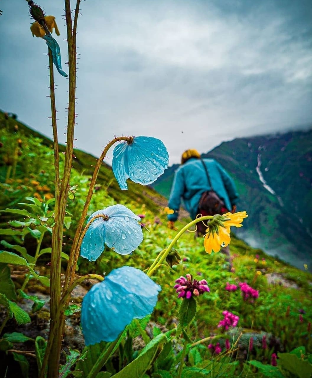
Vacations are the times to enjoy yourself and go to a place that offers not just recreation and break, but also an adventure. To everyone seeking the best place to visit, the Valley of Flowers can be the best option to pick. It does not render the best place for family and welcomes people of all ages. It instills a sense of happiness and calmness that no visitor can ever forget. It caters to inner beauty and helps fill the essence of beauty and scent to everyone visiting it!
Places to visit along with your trip to Valley of flowers.
A single visit brings along the chance to visit a lot of many must-visit places near itself. The following are the mesmerizing places that one must never miss:
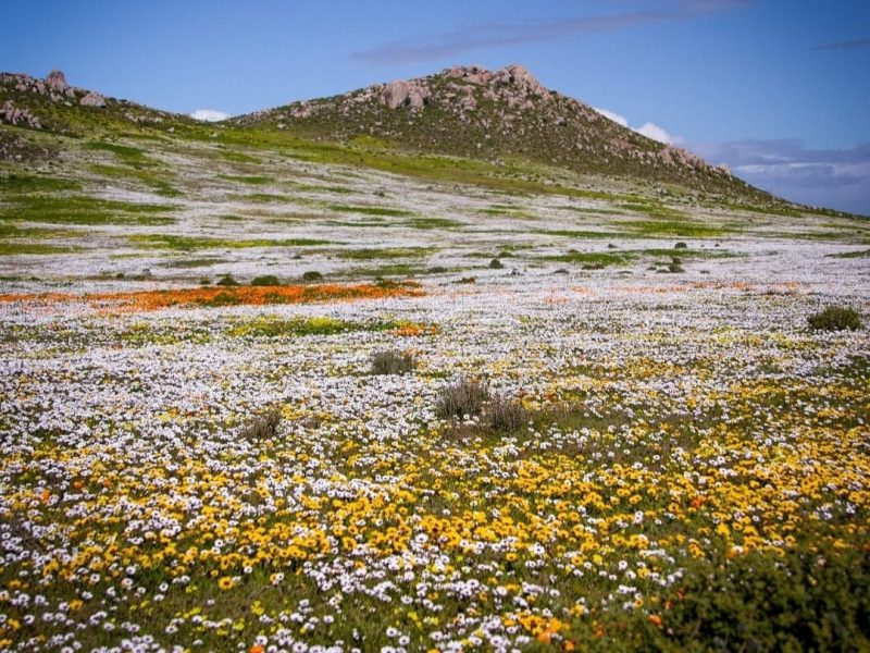
Valley could not be opened every year since 2012.
The region of the Valley of Flowers sees a lot of changes in the list of visitors. It keeps changing upon the year, the climate, and several other aspects. Lying in Uttarakhand, it experiences heavy rainfall. The most frequent rains lead to constant floods. It had heavy rains in 2013 that introduced floods in the region, and hence it was not welcoming. It was open in 2014 for just three days. Then it went back to its zone of no visitors. The pandemic starting in 2019 was a hindrance. The beautiful place was once again under the board of no visitors. After eight whole years, the Valley of Flowers is ready to bloom again despite the odds.
How much will you pay for the entry?
Entry ticket is a permit from the Forest department to anyone wanting to glance or get into to see the Valley of Flowers . The charge for Indian nationals and foreign tourists vary. The ticket lays valid for up to three days from the time of purchase, and an extra day, you will have to deposit more cash. The following are the payment amounts on various parameters:
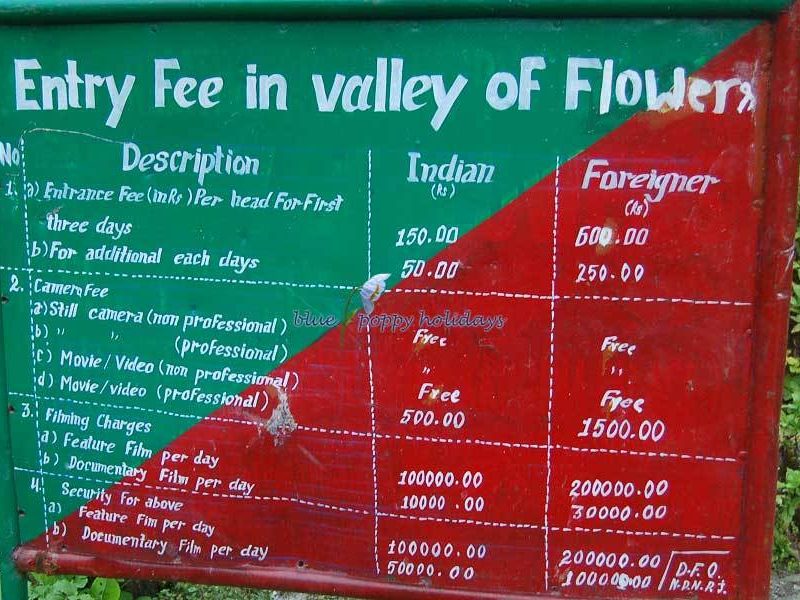
Knowing about the cost structure helps to plan the trip accordingly and helps to prepare for the economy. Despite the charges you will have to pay to visit and view the mountains, valleys, and beauty, you will come out of the space refreshed and happy!
Dhanaulti:
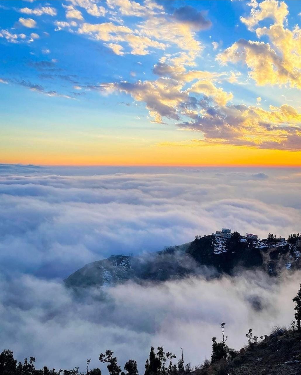
Tucked in between the snow-clad Himalayan ranges, Dhanaulti is a small hill station near the popular hill town of Uttarakhand, Mussoorie. Its proximity to the National Capital and several other popular places in Uttarakhand have made Dhanaulti one of the favourite winter destinations in recent times. The small hill town is home to beautiful rhododendrons, oak and deodar forests, which make it the perfect destination for tourists who love to witness nature at its best.
Located in the lap of Garhwal Himalayas, Dhanaulti is famous for its scenic beauty which is taken up by a notch by during the winter season after a heavy snowfall. Covered in sheets of pristine white snow, the town looks like a ‘postcard place’ and attracts tourists from all parts of Northernacross India and abroad.
Along with providing a panoramic view of snow-clad Himalayan peaks, the presence of alpine forests of Deodar, Rhododendron and Oak make Dhanaulti a pristine perfect location destination for a tranquil weekend getaway.
Climate
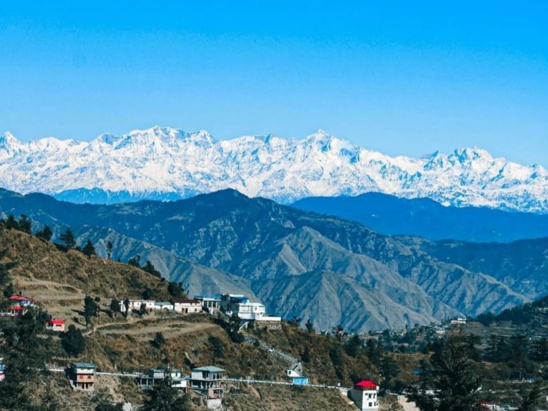
The climate in Dhanaulti remains pleasant throughout the year. During Summers, which last from April to June, the mercury does not go beyond 30 degrees. Ample sunlight makes the days pleasantly warm, but the nights can demand some layering of clothes. The Winter season lasts from November to February and the temperature ranges anywhere between 7 and 1 degrees. During the months of December and January, Dhanaulti witnesses harsh winters and the town remains under the blanket of snow during these two months.
Things to See & Do In Dhanaulti
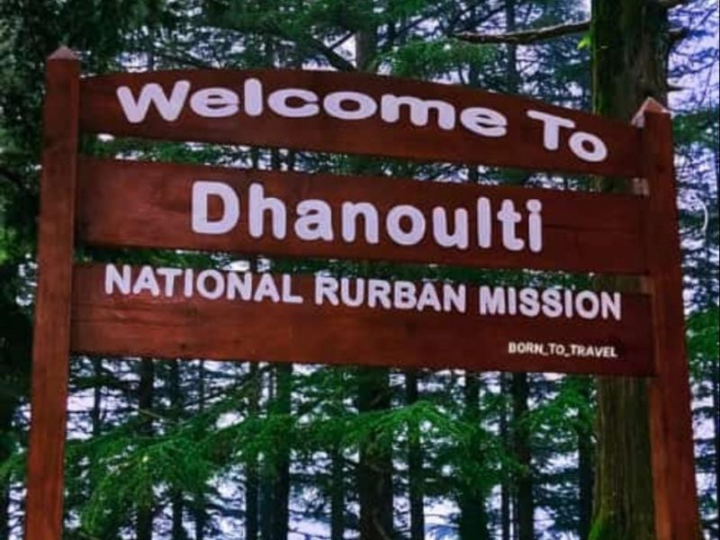
Dhanaulti still remains a less explored hill station as opposed to its counterparts in Uttarakhand, and this is the primary reason why it is still home to some of the most scenic and less-crowded tourist spots in the region.
Surkanda Devi Temple
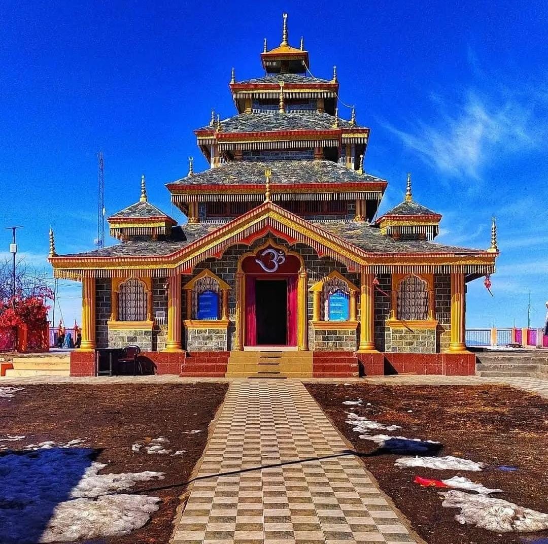
For people who love to explore the destination, Surkanda Devi temple, which is located at an elevation of 10,000 feet is a real treat. Also, the 1.5-km trek to the temple from Kaddukhal Village makes it a popular spot for trekkers.
Twin Eco Parks—Amber and Dhara
Dhanaulti is enveloped by tall Deodar and Cedar trees. As a result, the hill station is the perfect destination for peaceful walks in the parks. The two gardens—Amber and Dhara—are maintained by the forest department and offer rejuvenating walks, morning yoga sessions and day picnics. One can visit the park anytime between 6 am and 6 pm by paying a nominal entry fee of Rs. 15 per adult and Rs. 10 per child.
Camping
For camping enthusiasts, Dhanaulti has to offer a myriad of options to offer. The Kanatal Adventure camp, which is located on the Mussoorie-Chamba l road, is one of the most comfortable camping sights in Dhanaulti. The camps have attached washrooms and some of the most modern facilities which otherwise is are a rare sight at nature camps. Besides adventure activities such as rock climbing and valley crossing, tourists are treated with lip-smacking meals at Kanatal Adventure camp.
Best Time to Visit
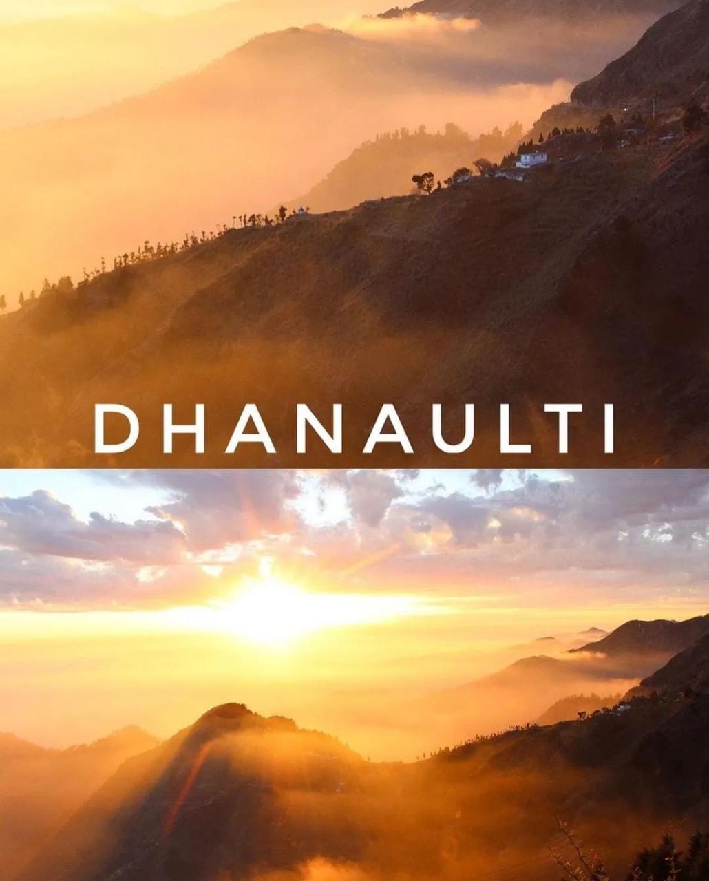
To experience the best of Dhanaulti, visit the hill station between the months of March and June. The climate during this time is pleasant and getting a clearer view of the scenic beauty of Dhanaulti is easier.
Adi Kailash Trek & Om Parvat:
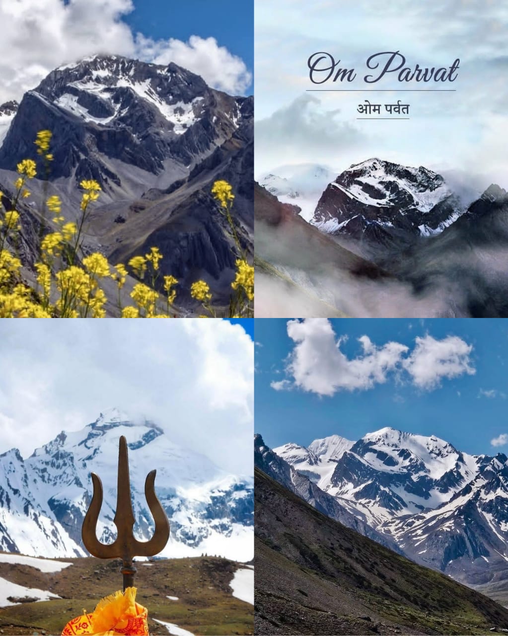
According to the legends, there are only eight mountains in India, which has an impression of OM symbol. Out of these eight, only one has been discovered, which is known as Om Parvat or Adi Kailash. This magical mountain, Adi Kailash, is standing tall at an elevation of 6191 m in the Dharchula district. It is quite known for its strong religious and adventure connect, also, it is believed that the mountain has a miraculous nature. One thing, which makes this mountain look apart from other Himalayan ranges is its OM shape, which is formed by the by deposition of snow on the black mountain. Also, the mountains bear a resemblance to the pious, Mount Kailash. Perhaps, this is the reason it is called Adi Kailash. To reach the base of the Om Parvat, trekkers need to walk the entire distance on foot, which will take approximately 12 days to complete. The pious Om Parvat is pristine or relatively undisturbed by human activity; however, many attempts by mountaineers were made to reach its summit. The trek is usually undertaken during the monsoon season, June to October, from the picturesque Dharchula.
Begin your spiritual journey escaping the chaos of life to the Chota Kailash of India, and resonate in the peaceful vibes of Uttarakhand. Snuggled up in the Pithoragarh district of Uttarakhand, Adi Kailash is one of the Hindu sacred sites which is the oldest resting place of the divine Lord Shiva. Another fact that adds more religious importance to the place is that Ravana, the great king of Lanka who was also a great devotee of Lord Shiva visited Adi Kailash. Set at an elevation of 6191 mts, it is an essential part of the Kailash trilogy nestled in the Himalayas which are Kailash Mansarovar, Adi Kailash and Kinnaur Kailash. As per Hindu mythology, these places are the abodes of Lord Shiva, Goddess Parvati, Lord Ganapati and Kartik Swami. Adi Kailash is set up close to Brahma Parvat and Sin La whereas the spiritually blessed Om Parvat near Nabidang. Talking about Om Parvat, it is till date the only one out of the 8 ‘OM’ emergence discovered in the Himalayas. Where a little detour from Adi Kailash can be just perfect to sight the prepossessing Om Parvat which is carved on the Indo-Nepal border, where the silhouette of ‘OM’ is facing India and the back in Nepal.
In this Adi Kailash and Om Parvat Yatra, you can experience the scenic beauty of Bhimtal which you can traverse while visiting Pithoragarh. On your way you may come across the Kumaon hamlets like Lakhanpur, Lamari which will be just perfect to acquaint you with the culture and traditions of the region. The main expedition to the serene environ finally lands you in the ideal spot of Nabidang from where you can sightsee the heartwarming mountain range of Om Parvat.At Tour My India, you can select one of our finest Adi Kailash and Om Parvat adventure package which comes with all the services like guided trekking tours and porter intact. In the adventure packages, not just our facilities but our itineraries are also curated with such care that you would be pleased to have a vacation in Spiritual Uttarakhand.Our itineraries also take care of your basic requirements and needs while touring with us which includes finest accommodation and quality meals. Through our 11D/12N trekking expedition you will get a chance to witness the beauty of the pristine pilgrimage site of Adi Kailash, Om Parvat, Parvati Lake, Shiva temple, Gaurikund along with the scenic vistas of various villages like Nabidang, Daniya on the route.
Where is the Adi Kailash Trek ?
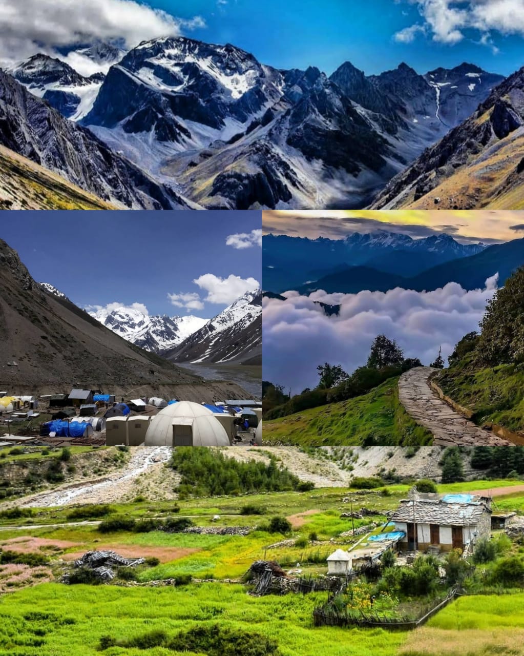
Because of a very close resemblance with Mount Kailash, Adi Kailash is also called the ‘Chotta Kailash’ or ‘Little Kailash’. Adi Kailash stands at a great height of 6,191 metres and is located in India, close to the Indo-Tibetan border. The region around the peak is peaceful, soothing and incredibly beautiful. At the bottom of the mighty peak quietly exists a lake, known as Gaurikund, which beautifully mirrors the Adi Kailash, Parvati Sarovar (also known as Manasarovar) is another lake near the peak. It is much smaller than its namesake (Manasarovar Lake, Tibet). Near the shoreline stands a shrine of Lord Shiva and Goddess Parvati. After the Chinese occupation of Tibet, Chotta Kailash has been looked up as the closest and most respected substitute of Mt. Kailash.
Through the Adi-Kailash Trek, one will witness the amazing snow-clad peaks of Annapurna, dense forest, several waterfalls, surging Kali River, lovely diversity of wild flowers and fruits at Narayan Ashram, and much more. Mount Adi Kailash and Parvati Sarovar are ancient holy places for Hindus in the Kumaon Himalayas.
Best Time to Visit Adi Kailash Trek
The weather best suits for Adi Kailash trek during June – September as the temperature is pleasing and monsoon yet remains to start blocking the route with landslides.
Weather in Adi Kailash Trek
Summer: Summer months June is the best time to trek to Adi Kailash. The sun warms up the cool region of Adi Kailash and trekkers find it easy to cope with the environment.
Monsoon: During monsoon season, the route gets slippery and trekkers find it very difficult to make through the route.
Spring: September is the charming spring favors trekkers to make way to Adi Kailash. Pleasing sun and calm weather.
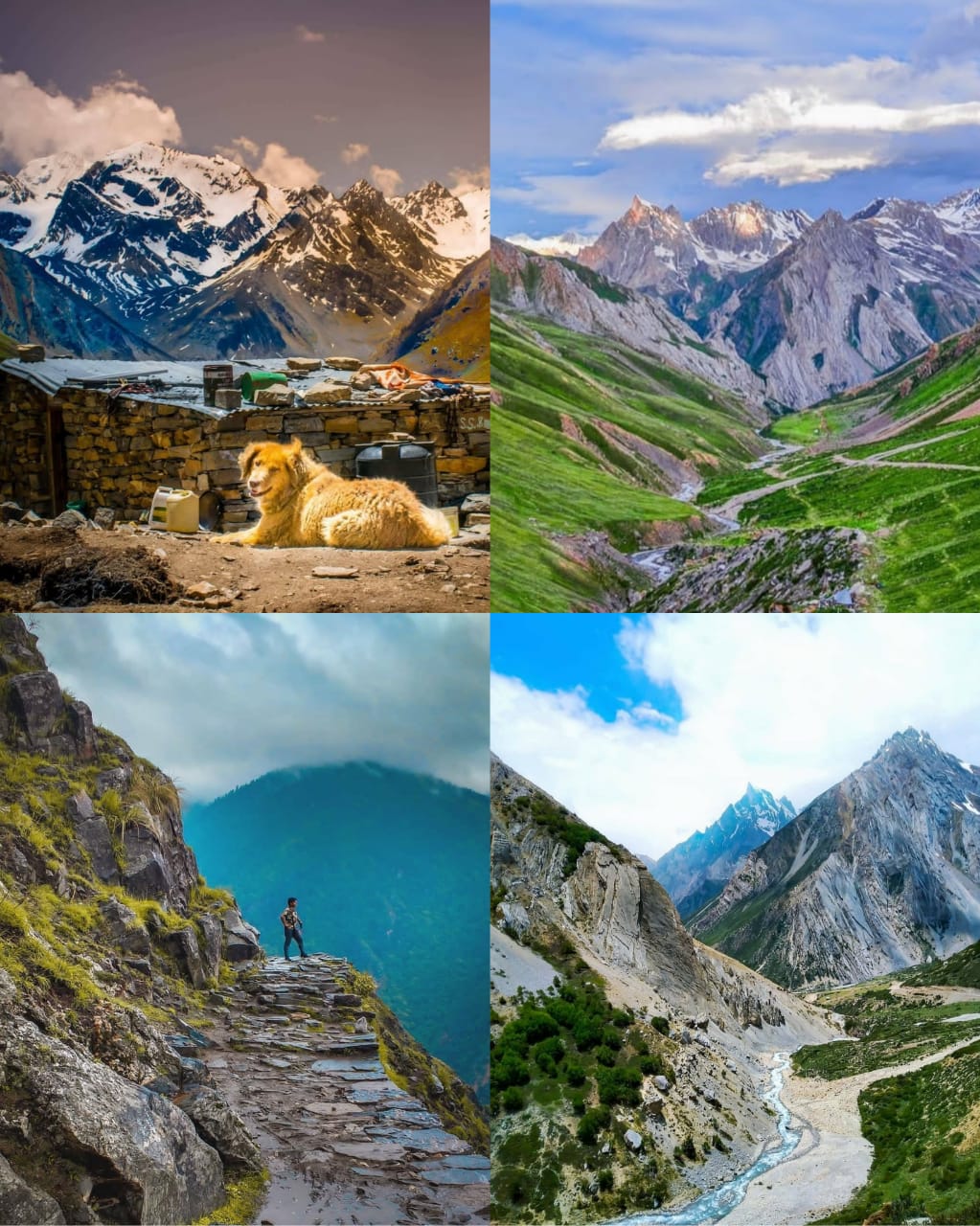
Adi Kailash Trekking Tour Highlights
Route Adi Kailash Trek & Om Parvat
Day 0: Delhi – Kathgodam (280 KMs / 7 Hrs) 554 m :
Departure from Delhi by Train/Bus, Overnight Journey in Train/Bus. Next morning, we arrive at Kathgodam railway station at around 6 Am. (Train ticket of 3A / CC/ Bus ticket fare in sleeper class is included for both ways)
Day 1: Kathgodam – Dhaulchina (115 KMs / 3-4 Hrs) 1828 m : We will start from Kathgodam/Haldwani. We will start early and visit Bhimtal first and then go for Neem Kiroli Baba temple at Kanchi Dham and Goluji Temple. After visiting Neem Kiroli Baba we will leave for Dhaulchina. Dinner and Overnight stay at Hotel. (3 Star Hotel on Twin / Triple sharing basis)
Day 2: Dhaulchina – Pithoragarh (95 KMs / 2-3 Hrs) 1627m :
Early morning, After Breakfast we will leave for Pithoragarh. En-route we visit Jageshwar Dham Mandir. After then we continue proceed to the Pithoragarh. When we reach check in at Hotel. Dinner and night stay in Pithoragarh. (3 Star Hotel on Twin / Triple sharing basis)
Day 3: Pithoragarh – Baling (160 KMs/ 4/5 Hrs) 2743 m :
After Morning breakfast, we will drive to Baling. On the way to Baling we will spend some time at Dharchula. we will get paperwork for Inner line permit done. We may probably go to Nepal. (It is to be noted that we have entered the international borders of both Nepal & China and need to get your inner line permit.) Dinner and Overnight stay at Huts/Tents. (Twin / Triple sharing basis)
Day 4: Baling – Panchachuli – Baling (15 KMs/ 1 Hrs) 2743 m :
We will start early morning from Baling to Panchachuli. Today we will get darshan of Panchachuli Parvat. We will trek 3 Km on Panchachuli Glacier today. After trek later in evening we will back Baling for dinner and night stay in Baling. Overnight stay at Baling in Huts/ Tents. (Twin / Triple sharing basis)
Day 5: Baling – Nabi (120 KMs/ 3-4 Hrs) 3048 m :
Today morning after having breakfast we will move to Nabi the area that we are visiting is simply beautiful village. En-route We will also visit natural beautiful villages like Chialekh ,Garbyang ,Gunji and Napalchu on the way to Nabi. Dinner and overnight stay at Home Stay with (Common Washroom) in Nabi Village.
Day 6: Nabi (35 KMs) 3048 m :
Today we start early morning from Nabi for Om Parvat. It will take approx. 45 minutes by vehicle to reach Om Parvat. Where you can see a “Miracle of Nature” ! Where Snow lies on the mountain in the shape of Om. We will do darshan and some meditation at Om Parvat. After darshan we move to Kalapani and if Government allows, we can go for Darshan of Mount Kailash (Subjected to permission by authorities) from Old Lipu Pass and keep in your Mind this is not a part of our itinerary, but we are in talks and yes there is a possibility to do darshan. Dinner and overnight stay at Home Stay with (Common Washroom) in Nabi Village. (Total 1-1.5 KMs one way trek if we get opportunity to see Mt Kailash)
Day 7: Nabi – Jyolingkong (35 Kms / 1 Hrs approx.) 4572 m :
Today we will stay in Jyolingkong for acclimatisation. When we reach Jyolingkong, we acclimatize our body for the cold weather & higher altitude condition. Guests can take a walk around the village and Probably we visit Gauri kund which is near to the foot of Adi Kailash. In evening we return to our Camp site for Dinner and night stay at Camps with (Open Toilet or Portable common Toilet) in Jyolingkong
Day 8: Jyolingkong – Kuti (14 KMs / 1 Hrs) 3700 m :
Today early in the morning you get a chance to see the beauty of the divine pilgrimage site Adi Kailash. Here you can perform religious activities like 2 Km parikrama of Parvati Sarovar, devotee perform prayer at Lord Shiva & Goddess Parvati Temple, which is around 2.5 Km by trekking from our camp site. After Darshan we will move to Kuti for Dinner and Night stay will be at Old Heritage Homes in Kuti (4-5 people sharing rooms in Old Heritage Homes with common Toilet).
Day 9: Kuti – Dharchula (100 KMs / 3 Hrs) 915 m :
After morning breakfast, we will return to Dharchula. When we reach, Dinner and Overnight stay at Basic Hotel (Washroom available).
Day 10: Dharchula – Chokori (115 KMs/ 3-4 Hrs) 2010 m :
After breakfast we will depart from Dharchula to Chokori. You will get to see Himalayas during your journey. Today you can explore Chokori on your own. Overnight stay at Guest house in Chokori.
Day 11: Chokori – Kathgodam – Delhi :
Today morning after breakfast, we will leave for Kathgodam from Chakori. It takes around 180 km. Enroute we will go to Patal Bhawaneshwar. After Patal Bhawaneshwar sightseeing our executive will drop you at Kathgodam Railway Station/Bus Stand. Overnight journey in Train/ Sleeper Class Bus.
Gaumukh Tapovan Trek:
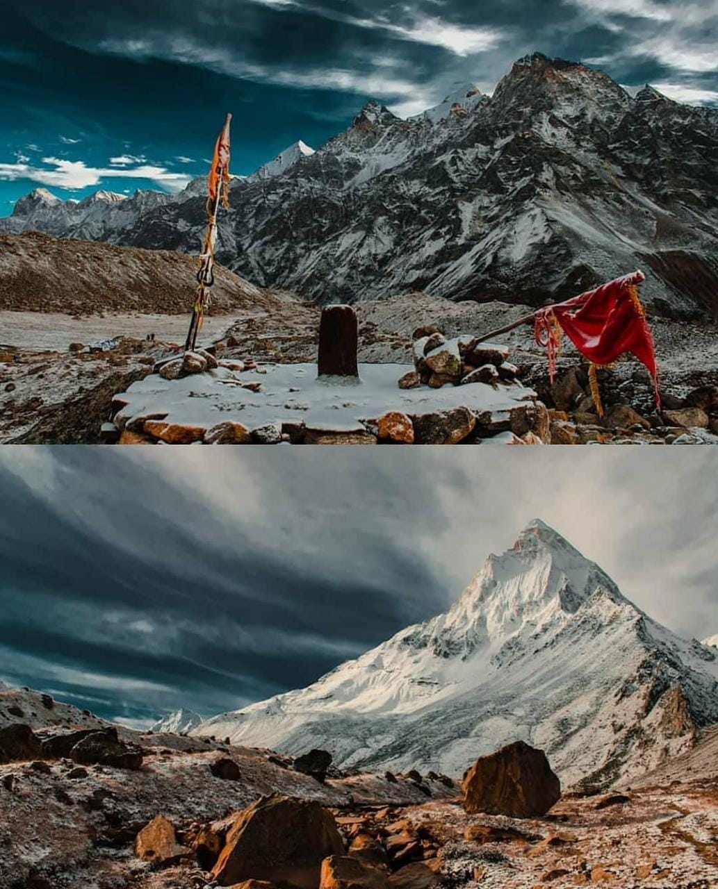
Tapovan trek group departure on 1st and 15th May 2022 as per the itinerary from Dehradun.
Tapovan trek is a strikingly different type of trail inside Bhagirathi river valley to high up at the base of majestic Mt. Shivling. Tapovan (4,270 m/14,270 ft) a patch of green, situated on the west bank of Gangotri glacier amidst glacial moraine and debris. This is among few known trails which takes you to a the core of the Himalayas inside a glacial valley.
The word ‘Tapovan’ means a sacred and serene place, where the sages meditate for spiritual bliss. According to Hindu mythology, King Bhagiratha (Lord Rama’s ancestor) of the Ikshvaku dynasty, meditated here to Shiva for Ganga’s descent to the earth. From time unknown, Hindu sadhus or spiritualists come here to pay tribute to Lord Shiva and River Ganges. Tapovan, lush green in summer, blooming with wild flowers, turns golden in post-monsoon season.
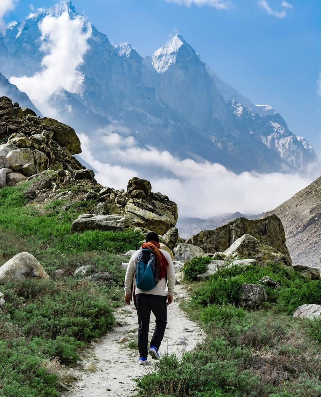
The valley, flanked by majestic Himalayan peaks like Mt. Shivling (6543 m), Mt. Meru (6630 m) and Kedar Dome (6808 m) is a favourite destination for trekking enthusiastic, both Indians and foreigners. The Bhagirathi Group of peaks – I (6,856 m), II (6,512 m) and III (6,454 m) are visible on the eastern bank of Gangotri glacier. The trail from Gangotri to Tapovan via, Bhujbasa and Gomukh, is only 24 km and two days trek but it covers a vast array of Geo-morphological features, like the ‘I’ shaped river gorge of Ganges, then the snout of the glacier from where the river originates, followed by the glacier itself with lateral moraine and ice covered glacial debris and finally the steep edge of the glacier. Initially the trail runs amidst pine and birch forest, but crosses the tree line to reach this Alpine meadow where only perennial grasses, sedges, and forbs can survive. Sighting of Bharals (Blue Mountain Sheep) on nearby mountain slopes is common. The high altitude, rarity of oxygen, average 6-7 km walk in the difficult terrain and the erratic weather make this a short but challenging trek.

Day 1 – Dehradun to Gangotri (10,055 feet)
Assemble at the Dehradun Railway station by 6.30 AM. Our journey begins as soon as we hit the road from Dehradun. The Chinyali Saur nearby Tehri Dam with a capacity to generate 2400 MW of electricity and the massive Tehri Lake is seen during the journey. Then we drive to Gangotri along the river bank of river Ganga (Bhagirathi) and in the mid-way visit Hot spring teak sulfur bath in Gangnani. On the way to our base camp, we will see the beautiful view of Grater Himalayas, Harshil and green forest.
On arrival check in the respective hotel in the evening as we visit the holy city Gangotri. By 7 pm we will see nice Siromani (Arti) of Goddess GANGA. Dinner and overnight at the hotel.
Day 2 – Gangotri to Chirbasa (11,761 feet)
Morning you fill yourself with food needed for the trek to Chirbasa that will take about 6 hours to cover. The scenery is just magnificent, and you cannot stop to admire beauties of the forests and the valleys down below, especially Chirbasa or the abode of pine trees. The entire trek today is along the roaring Bhagirathi River. Trek above the Bhagirathi River on a relatively groomed path to Chirbasa. Though there are trees, we are walking on the side of the mountain, and there is little shade most of the time. Finally, you arrive at Chirbasa tired but happy with the delightful views as we stay the night in a tent.
In the morning we meet our trekking crew and start your trek towards Chirbasa (3600mt). From Gangotri, we move along the beaten track towards Chirbasa, which is on the tree line. Camp in a small, forested area next to the river.
Day 3 – Chirbasa to Bhojbasa (12,450 feet)
Above Chirbasa, the valley widens and offers views of snow-clad peaks in the south. It is a gentle walk to Bhojbasa (3,800m). Running virtually due south-east along the river, the Bhagirathi peaks over a beacon to the source of the river. Bhojbasa is the widest point in the upper valley, and camping here at night offers magnificent moonlit views of the Bhagirathi peaks. The trek further to Bhojbasa is along the path that slowly flattens out and dips suddenly to reveal Bhojbasa with a small temple and a potential campsite near the river. The camp is set up near the river.
The afternoon we are free to explore the area and to enjoy excellent sunset on Bhagirathi group of peaks. Dinner and overnight stay in tents. Enjoy incredible scenery and sight of Shiv Ling Mountain, dinner and rest under the tent.
Day 4 – Bhojbasa to Tapovan via Gaumukh (14,250 feet)
The first four kilometers upstream from Bhojbasa are surprising though the narrow valley. The path runs smoothly above the river and is fringed by a grassy meadow. With about a kilometer to go, the terrain turns rocky, and one has to pick one’s way through the rocks and boulders, down to a sandy beach sheltered by enormous piles of granite. Incidentally, the beach is an excellent place to camp. Scour the water’s edge for shards of ice, or follow the broken path along the river’s edge to the very foot of Gaumukh (3,969m), and look up at the Shivling Peak (6543m) almost vertically above. Once you have reached the southern (left) bank of the river valley, the path is marked with a steep climb of nearly a thousand feet to the meadows at the base of Shivling Peak. This is Tapovan, an exquisitely watered spot from which the fabled peak of Shivling appears to sweep up in a wave of screen, granite, and snow. It is an idyllic camping spot; alternatively, a couple of Babas have establishments.
Day 5 – Explore Tapovan
Tapovan is a high-altitude alpine meadow below Mt. Shivling, which dominates the landscape. Tapovan is over 2 km in length. Although it’s considerable level ground, not all the land is suitable for camping. The area close to Mt. Shivling is wet during early summer due to melting snow and glacial water. These grounds have been used by many sages to meditate over the centuries. Many such holy men are living permanently at Tapovan. A 1.5 km trek from Tapovan to the adjoining peak that connects to Neelatal brings you to a vantage point from where you get great views of Meru. Meru takes about 2 hours to reach from the campsite. From here, you can either walk on the ridge ahead to reach Neelatal or step back on the same trail to Tapovan. Neelatal seldom has any water now. Manage your time such that you’re back at the campsite by 1:30 PM.
Day 6 – Tapovan to Bhojbasa (12,450 feet)
It’s time to trace the trail back. It’s downhill all the way till Gaumukh and the next 4 km. If you’re feeling fit, walk another 5 km till Chirbasa, to spend a night exploring the banks of the Ganga. If you manage to reach Chirbasa, the next day will be accessible from here, it is a short hop of under 2hrs to Gangotri, allowing plenty of time for a drive to Uttarkashi, and the dubious charms of civilization.
Day 7 – Bhojbasa to Gangotri (10,055 feet)
From Bhojbasa, start early to reach Gangotri by noon. Overnight stay in a hotel.
Day 8 – Gangotri to Dehradun
Morning Breakfast and then we start our Drive from Gangotri to Uttarkashi at lunch and then drive to Dehradun 170km. At evening trek tours service ends as we reach the station.
Note:
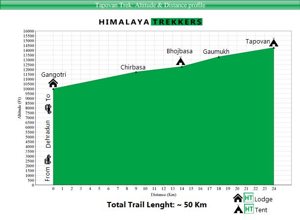
Like all high altitude treks you can do Tapovan trek in following two seasons:
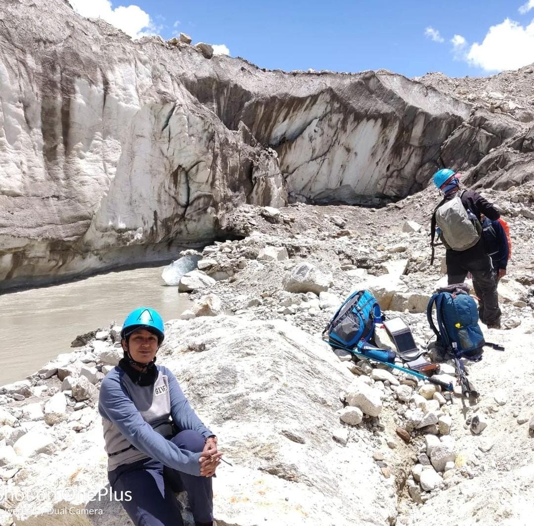
There are quite a few Moderate grade treks which we suggest in planning of your first time trek on the Himalayas. However Tapovan being also graded as “Moderate” but NOT really a trail which we recommend as your first trek. It isn’t the highest altitude of this trail which is too high, rather the trail reaches relatively lower highest altitude.
The trail till Bhojbasa is relatively easy on wide track. Things start changing as you approach towards the Gangotri glacier’s famous snout Gaumukh. On popular “Moderate” treks like Roopkund, Rupin, Goecha La and others you don’t need to negotiate a glacier, more specifically on deposited moraine. Moraine is rocks, boulders, scree and debris carried down by the glacier. One Km hopping on this terrain can be physically demanding as twice the distance. It takes 3/4 hours to cross Gangotri glacier breath-wise and the the final climb to Tapovan, for a reasonable fit and well acclimatised person. Prior trekking experience(s) will prepare you both physically and mentally for this challenge.
Furthermore this glacier valley lacks oxygen, resulting in more challenges from acclimatisation perspective. Our itinerary has a full rest and acclimatisation day at Gangotri, still a considerable number of trekkers struggle to cope with rarefied oxygen on difficult terrain. Acclimatisation problem can happen to anyone, but people with prior acclimatisation problem will face problem on this trail for certain.
We recommend Tapovan trek to trekkers who have at least twice been on high altitude treks (on or above ~4000 m/13000 ft) with good physical fitness and no prior acclimatisation issues reported.
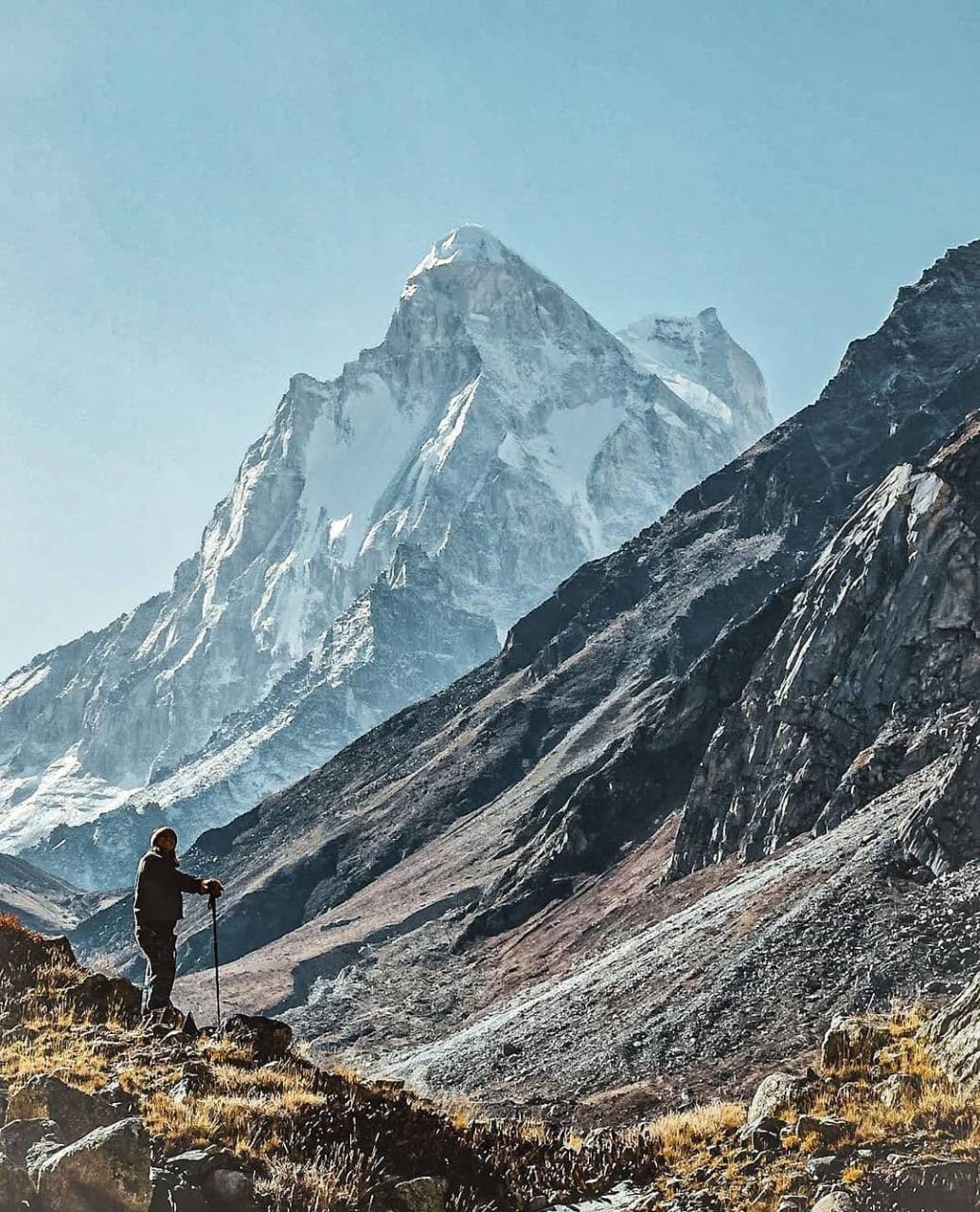
There is no debate now on that the “Climatic change” is affecting the Himalayas in general. Increase of receding glaciers are alarming for quite sometime. Gangotri glacier is a prominent example. The glacier retreated more than a kilometre in last 30 years or so. We organised our first trek to Tapovan back in 2011 and since then observed the trail course. On glacier and moraine trekking groups keep changing their path suitable up to Tapovan almost every year. A study of NASA in the beginning of millennia can be found here
Depending upon the number of trekkers we may arrange a car pickup from Dehradun to Gangotri and back. This will get equally divided amongst the trekkers opting. You pay directly to the driver. At present a Tata Sumo/Bolero type vehicles charge ₹ 8000 for drop from Dehradun to Gangotri. This can accommodate 5-8 persons.
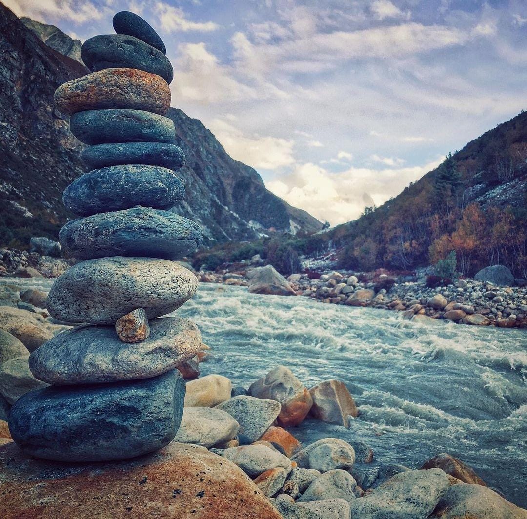
Alternatively if you wish to reach Gangotri on your own by public transportation then:
Dehradun is the nearest location for our trek basecamp is connected with most of the state and city within India.
By Air:
Jolly Grant Airport is the airport serving Dehradun, located about 25 km from the city. There is a daily flight from Delhi to Dehradun.
By Train:
Take the overnight train to Dehradun from Delhi
By Road:
There is regular bus service from Delhi for Dehradun from Delhi ISBT Kashmere Gate. Usually, buses drop you at Dehradun ISBT. From there you have to come to Dehradun Railway Station.
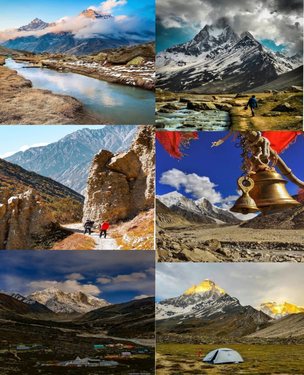
Best time to go for Gaumukh Tapovan Trek is during May to June and mid-Aug to Oct.
Gaumukh Tapovan Trek in comparison is moderate to difficult difficulty with another high altitude trek.
On an average, we cover roughly 6-20kms between our camping stations.
Beyond our controllable reasons when the trek is extended, then additional charges tend to be applied.
Lead guide person is certified & experienced personnel. These guides are locally sourced and have other team members including local guides, cook, helpers, and porters.
Our treks are planned with a male: female ratio. As an organizer, we make sure that their tents are shared only with other female trekkers.
Our tents are all three person tents.
Good physical and mental fitness is expected to complete the Trek.
We make sure that wholesome and nutritious breakfast, lunch and evening snacks are served. We believe and serve only vegetarian food as it is easy to digest and preferable in high altitudes.
We are trained to manage emergencies in high altitudes. Our lead guide is professional and experienced. Our team do carry emergency first aid kits and oxygen cylinder.
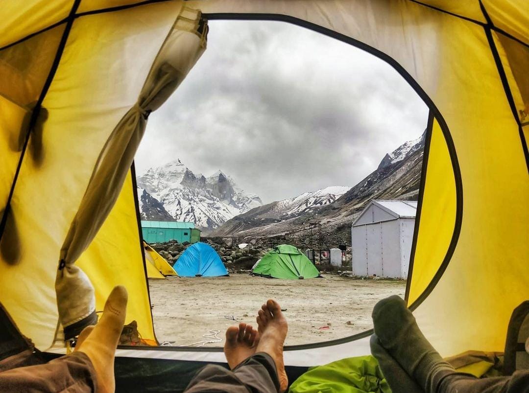
THINGS TO CARRY
Things to Carry

Medicines to carry
INCLUSIONS/EXCLUSIONS
What we’ll give/What we won’t
Uttarakhand
Rishikesh
Uttarakhand
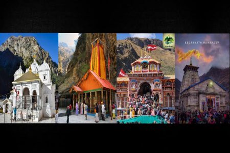
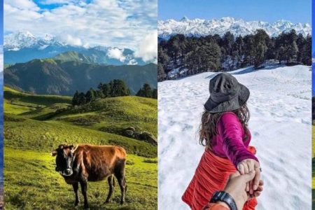
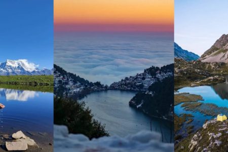
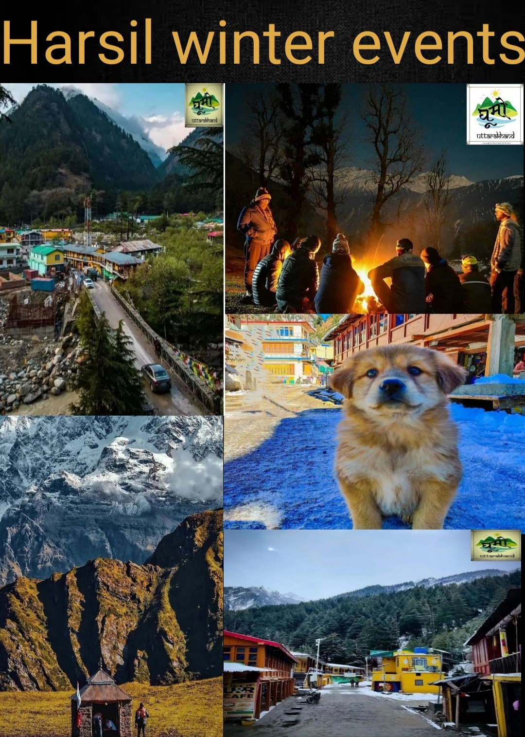
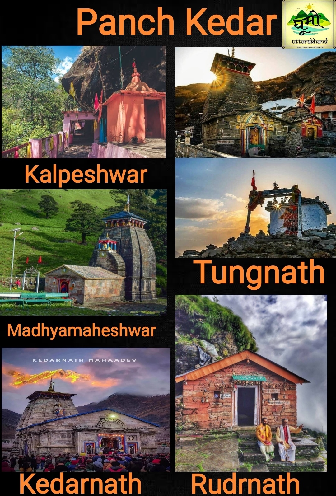
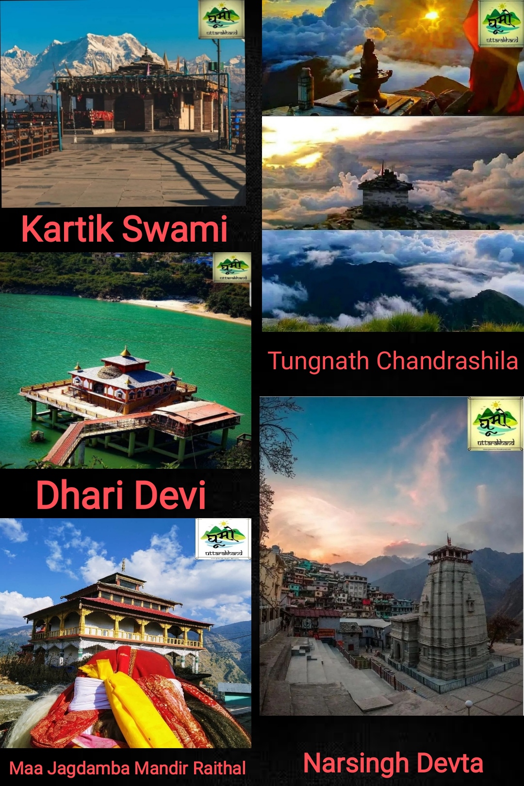
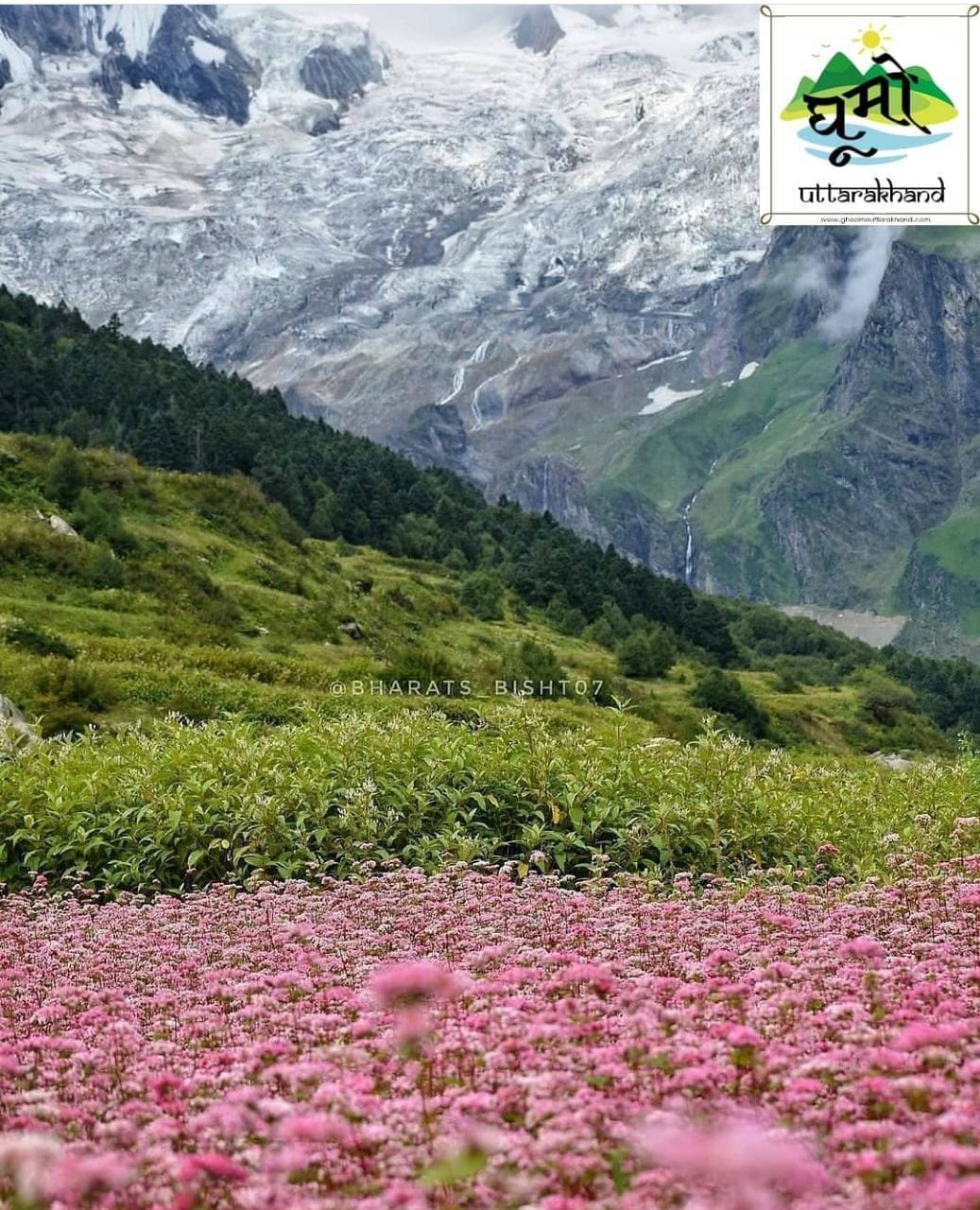
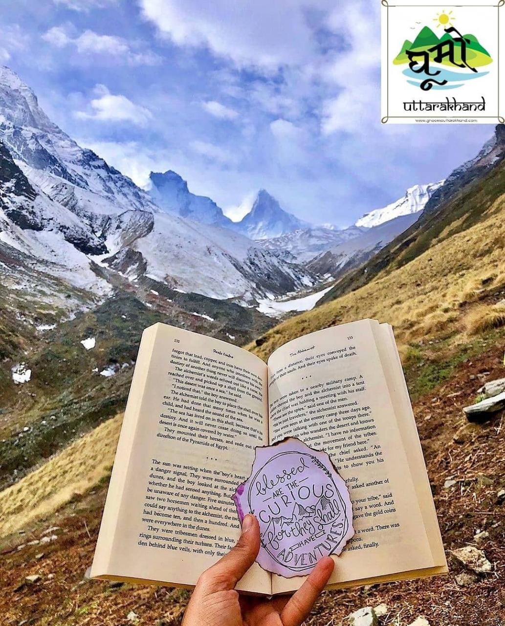
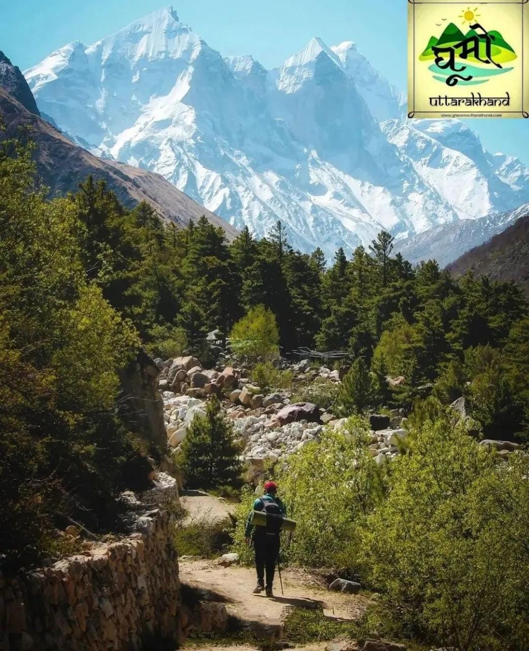
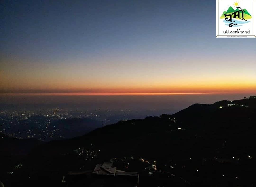
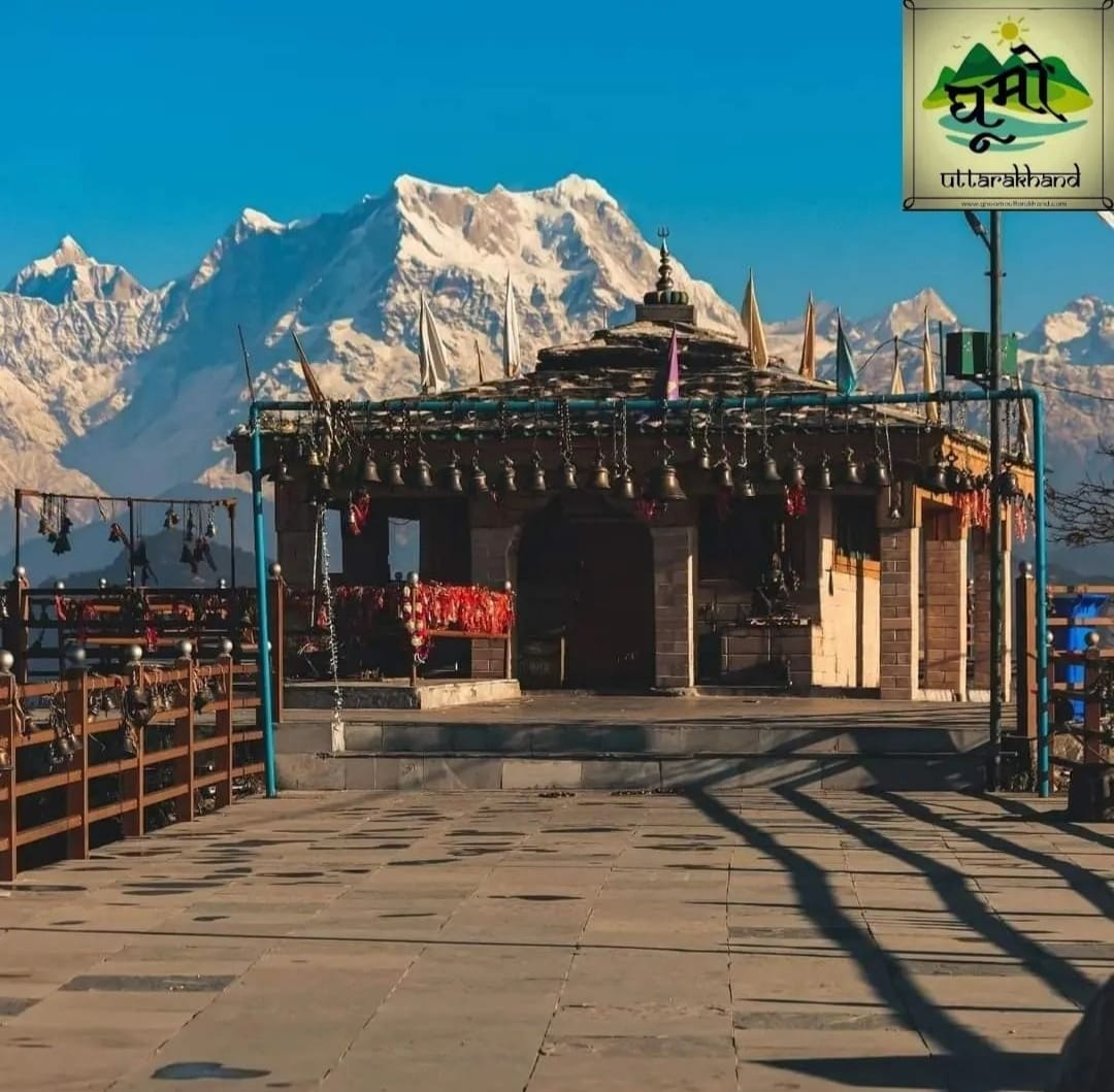
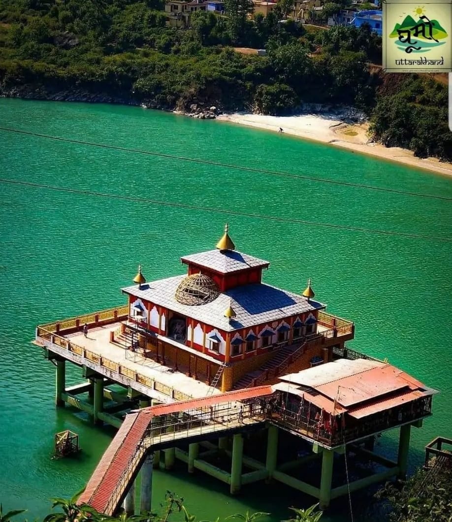
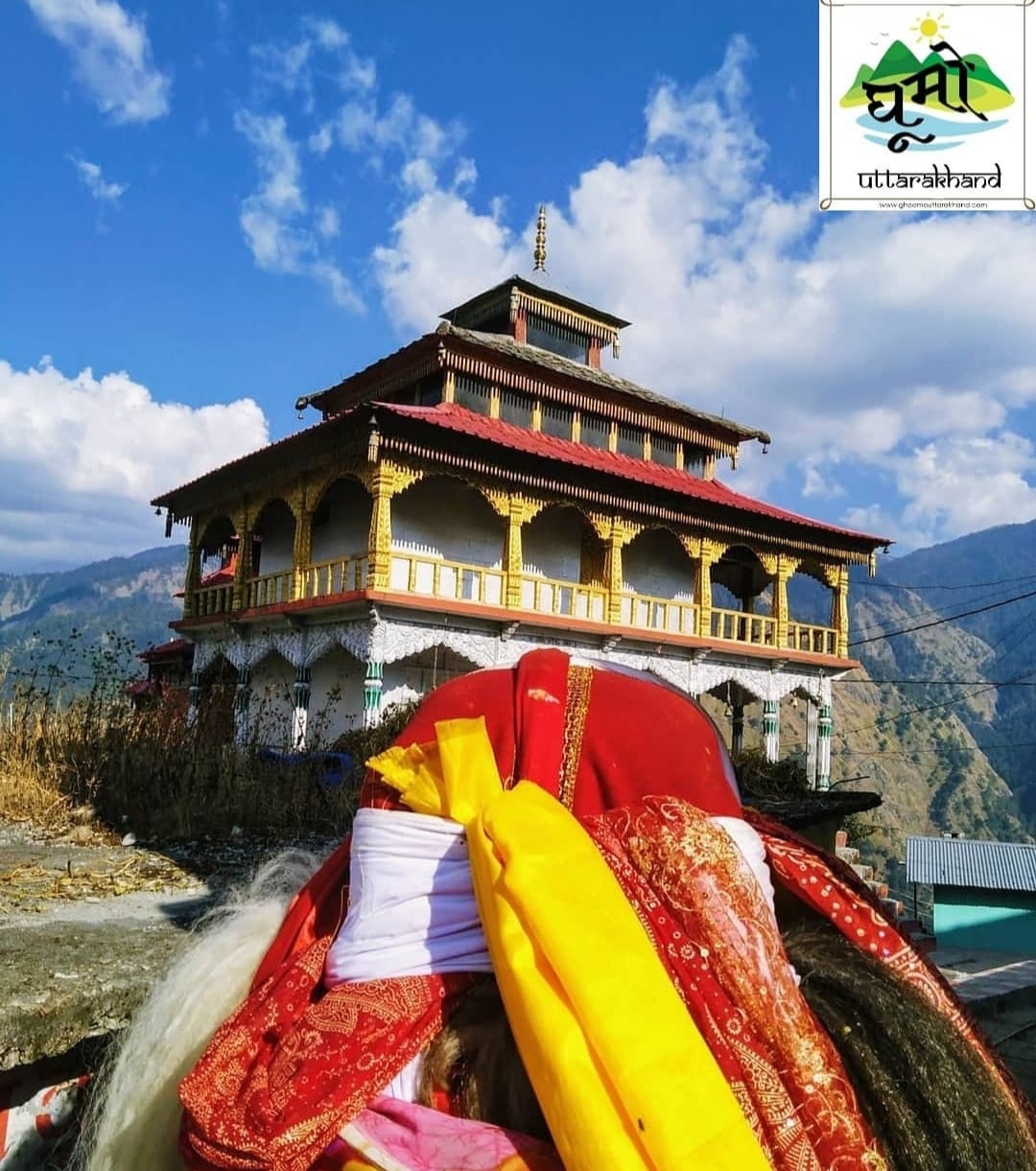
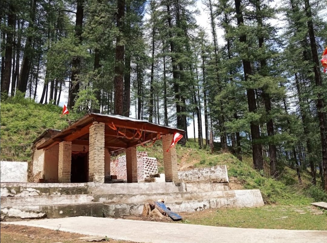
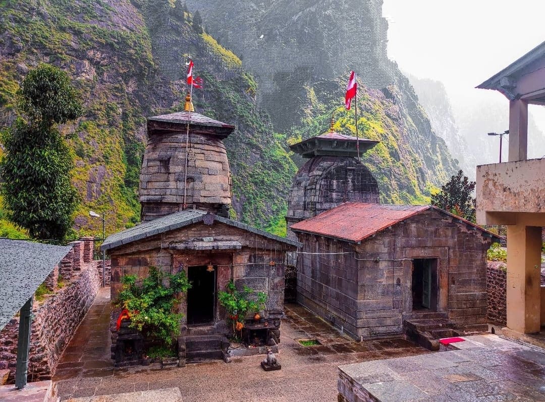
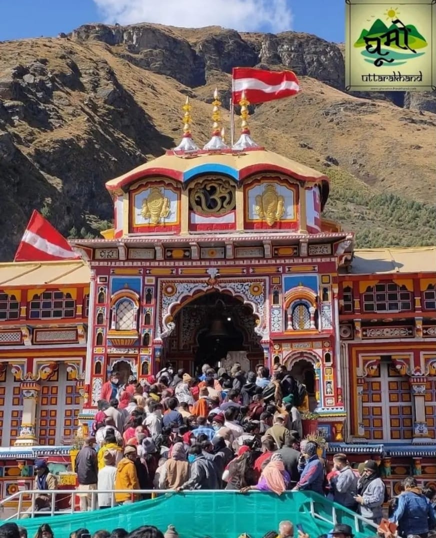
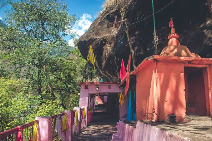
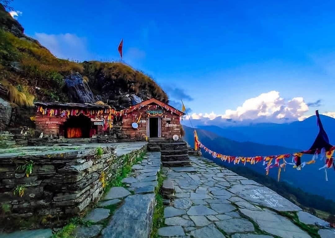
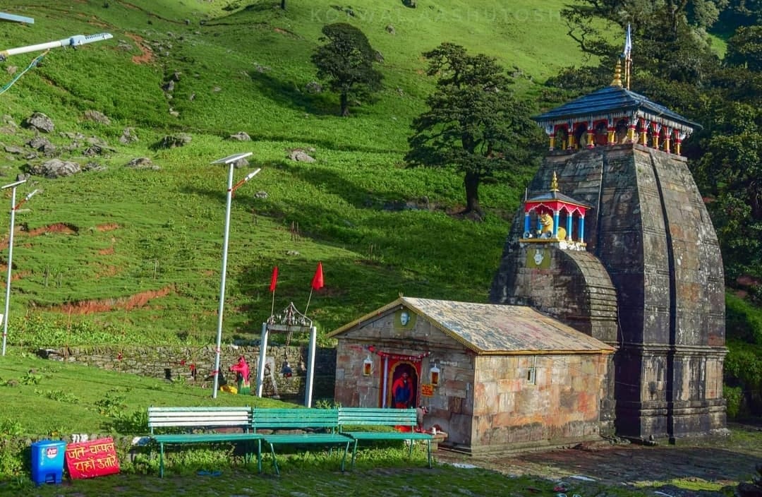
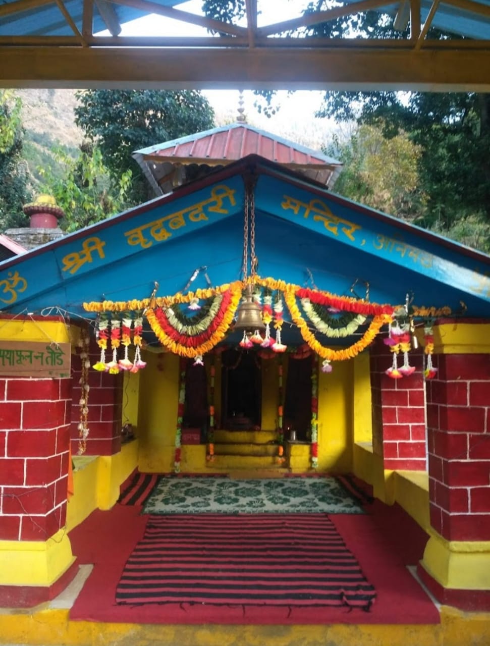
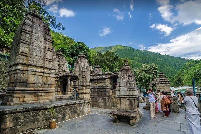
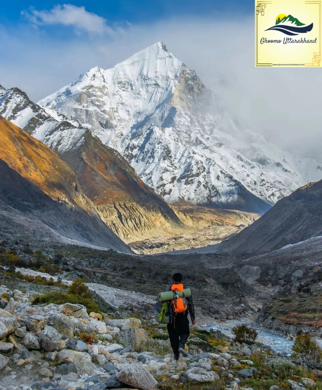
EugeneRhipt
Полностью актуальные новости индустрии.